More From Contributor
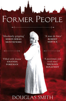
£2.95
Formby in 1906 in a fascinating series of reproductions of old Ordnance Survey plans in the Alan Godfrey Editions, ideal for anyone interested in the history of their neighbourhood or family. Selected towns in Great Britain & Ireland are covered by maps showing the extent of urban development in the last decades of the 19th & early 20th century. In this title: the map covers the centre & north of Formby & continues northward to Freshfield. Coverage stretches from Formby station northward to Freshfield station, & from the railway eastward to Altcar Lane. Features include St Peter's RC College, Freshfield Hall, St Peter's church, Holy Trinity church, Formby RC church, Duke's Farm, White House Farm, Formby Fields, Formby Moss, Downholland Brook, Moss Side, Norris's Farm & many villas from these expanding villages. A directory of Formby is included on the reverse. About the Alan Godfrey Editions of the 25 ...
Archived Product
£3.50
Formby in 1906 in a fascinating series of reproductions of old Ordnance Survey plans in the Alan Godfrey Editions, ideal for anyone interested in the history of their neighbourhood or family. The map covers the centre & north of Formby & continues northward to Freshfield. Coverage stretches from Formby station northward to Freshfield station, & from the railway eastward to Altcar Lane. Features include St Peter`s RC College, Freshfield Hall, St Peter`s church, Holy Trinity church, Formby RC church, Duke`s Farm, White House Farm, Formby Fields, Formby Moss, Downholland Brook, Moss Side, Norris`s Farm & many villas from these expanding villages. A directory of Formby is on the reverse. About the Alan Godfrey Editions of the 25” OS Series: Selected towns in Great Britain & Ireland are covered by maps showing the extent of urban development in the last decades of the 19th & early 20th century. The plans have been taken from the Ordnance Survey mapping & reprinted at about 15 inches to one mile (1:4, 340). On the reverse most maps have historical notes & many also include extracts from contemporary directories. Most maps cover about one mile (1.6kms) north/south, one & a half miles (2.4kms) across; adjoining sheets can be combined to provide wider coverage.FOR MORE INFORMATION & A COMPLETE LIST OF ALL AVAILABLE TITLES PLEASE CLICK ON THE SERIES LINK. ...
Archived Product
£3.50
Formby, Crosby & District in 1896 in a series of reproductions of Ordnance Survey’s famous ” Inch to the Mile” maps published in the Alan Godfrey Editions to provide a historical record of England & Wales in the second half of 19th & early 20th century. The map covers the coastal area from Bootle northward to Ainsdale, & inland as far as Maghull. The northern part of Bootle itself is included, & interesting features include the long closed Cheshire Lines Railways. Other locations covered include Aintree, Blundellsands, Fazakerley, Freshfield, Great Altcar, Great Crosby, Halsall, Ince Blundell, Litherl&, Lydiate, Lunt, Melling, Scarisbrick, Seaforth, Sefton, Thornton & Waterloo. A detailed map of the village of Little Crosby is on the reverse. About the Alan Godfrey Editions of the OS Inch to the Mile Maps: the maps provide an invaluable overview of a wider area, typically 18 x 12 miles (29 x 19 kms approx.), & offer historical mapping for small towns & villages not covered by the more detailed series for which the Godfrey Editions are better known. On the reverse all the maps have historical notes & most titles also include a more detailed, large scale map of a small town or a village in the area. To see other titles in this series please click on the series link. ...
Archived Product
£6.95
Topographic coverage of the Balearic Islands at 1:50, 000 in the MTN50 (Mapa Topográfico Nacional) series from the Instituto Geográfico Nacional – Centro Nacional de Información Geografica, the country’s civilian survey organization. The maps have contours at 20m intervals, enhanced by relief shading, plus colouring and/or graphics to show different types of terrain, vegetation or land use. Boundaries of national parks & other protected areas are marked. In addition to all the usual information featured on topographic mapping at this scale: detailed presentation of the road & rail networks, rural tracks & paths, etc, the maps also show campsites & mountain refuges. On more recent editions some GRs, the official long-distance hiking routes, are also marked (although not as clearly as on hiking maps from other publishers). The MTN50 series was begun in late 1990s. Each map covers 28.5x 18.5 km (with adjustments in the coastal areas). The maps have a 1-km UTM grid, plus margin ticks for latitude & longitude at 1` intervals. Map legend is in Spanish only. To see other titles in this series please click on the series link. ...
Archived Product
£8.99
Water-proof, split-proof, tear-proof, adventure-proof. Formentera Tour & Trail Super-Durable Map is simply the toughest, most accurate, easy to read, easy to use map of the island you can buy at any price. David & Ros Brawn surveyed this beautiful island in October 2015 carrying out their `gps ground survey` pinpointing all the details needed to produce the definitive map of Formentera. Large, 25k scale, easy to read map sheet

Includes::
a wealth of useful details. 20 metre & 100 metre contours combined with altitude shading bring the Formentera landscape to life. All of the legendary Tour & Trail attention to detail is included so that you will find those petrol stations, mirador viewpoints with parking, refreshment stops with parking & accurate road numbering that are so essential when adventuring by hire car; `watts` new & unique to Formentera we have included the ` Electric hire car` recharging points making sure you never run out of go. ` Off-Tarmac` Formentera Tour & Trail Map is in a league of its own thanks to all the gps information for the cycling & walking trails plus all of the island`s famous beaches are shown & named. Printed on a large 840mm by 620mm super-durable map sheet the island of Formentera at 25, 000 scale is on the facing page of the map sheet which folds back to a pocketable 235mm by 120mm when folded. On the reverse side of the map sheet you will find large scale street plans along with a host of useful information to make the most of your time on the isl&. ` Super-Durable` means a waterproof, tear-proof, map that can take the roughest treatment & still folds up like new after your adventures. Printed on Polyart using specialist 100% oxygenation inks produces a lightweight map that feels like silk but is a tough as old boots as it shrugs off water, resists tearing & damage better than any other map. ` Super-Durable` combined with our special concertina map fold means this `near indestructible` Tour & Trail Map unfolds easily for use, & more importantly folds back up easily to its compact pocket size even after the toughest use. Custom Map digital edition for Garmin users is available from Discovery Walking Guides website dwgwalking.co.uk plus digital editions are available for 3/4G gps apps from Viewranger & My Trails. Tour & Trail Super-Durable Maps are printed on Polyart using 100% oxygenation inks which produces a lighweight map that feels like silk while being both water-proof & incredibly tough so that after even the toughest of adventures your Tour & Trail Super-Durable Map will fold up like new. Polyart is made from high-density polyethylene (HDPE) & is therefore 100% recyclable in category 2 HDPE. For more information see the Polyart website.

...
Archived Product
£11.50
Topographic survey of France at 1:25, 000 in IGN`s excellent TOP25 / Série Bleue series. All the maps are GPS compatible, with a 1km UTM grid plus latitude & longitude lines at 5’ intervals. Contours are at 5m intervals except for mountainous areas where the maps have contours at 10m intervals, vividly enhanced by hill shading & graphics for rocky terrain. Colouring with graphics indicates different types of vegetation or land use (deciduous or coniferous forests, moors, orchards, vineyards, etc). PLEASE NOTE: coverage of France at this scale is currently being revised – the format & the presentation of each title are indicated by the letters at the end of its Sheet Reference number (e.g. 0416ET, 3531ETR, 1923SB, etc.)MAPS WITH FULL TOURIST OVERPRINT & AN ENGLISH MAP LEGEND: all TOP25 maps & the SB editions of Série Bleue have an overprint highlighting waymarked walking trails including long-distance GR routes &, where appropriate, ski routes. Symbols indicate campsites, gîtes d’etape, refuges, equestrian centres & other recreational facilities or sites, tourist information centres, cultural heritage, etc. Towns & locations of particular interest are highlighted.- ET or OT = single-sided TOP25 map covering approx. 29x 21 km / 18x 13 miles.- ETR or OTR = waterproof & tear resistant TOP25 map covering the same area as the corresponding ET or OT number, but double-sided, printed on a smaller size sheet with a good overlap between the sides.- SB = Série Bleue map with full tourist overprint; these maps, first introduced in summer 2014, each cover approx. 29x 24km / 18x 15 miles.SÉRIE BLEUE maps with numbers ending in E (Est) or O (Ouest): most editions now indicate the GR routes, but do not show any other tourist information. Map legend is in French only. Each map covers approx. 14x 20km / 9x 12 miles. ...
Archived Product
£6.50
Topographic coverage of the Balearic Islands at 1:25, 000 published by the Instituto Geográfico Nacional – Centro Nacional de Información Geografica, the country’s civilian survey organization. The maps have contours at 10m intervals & colouring and/or graphics to show different types of vegetation or land use. Boundaries of national parks & other protected areas are marked. In addition to all the usual information shown on topographic mapping at this scale: detailed presentation of the road & rail networks, rural tracks & paths, etc, the maps also show campsites. The maps have a 1-km UTM grid, plus margin ticks for latitude & longitude at 1` intervals. The majority of the titles have been published since late 1990s. Map legend is in Spanish only.COVERAGE: each 25K map covers one quarter of the corresponding 1:50, 000 map, with the numbering system: I = NW quarter, II = NE quarter, III = SW quarter, & IV = SE quarter. To see other titles in this series please click on the series link. ...
Archived Product
£10.99
Forni di Sopra
- Ampezzo
- Sàuris
- Alta Val Taglimento area in a series of Tabacco maps at 1:25, 000 covering the Dolomites


...
Archived Product
£17.99
Topographic survey of Portugal at 1:50, 000 from the Instituto Geográfico do Exército, the country’s military survey organisation. The maps have contours at 20m intervals & in addition to the standard features shown on topographic mapping at this scale also indicate various types of terrain or vegetation (s&, terraces, rocks, woodlands, vineyards, etc). Each sheet covers an area of 32 x 20km (20 x 12.5 miles approx). The maps have a 1-km UTM grid plus latitude & longitude coordinates for the map corners. Map legend & a glossary of terms used on the maps include English.EDITION DATES: most titles in this series date from 1990s or later. To see all the titles in this series please click on the series link. ...
Archived Product
£17.99
Topographic survey of Portugal at 1:50, 000 from the Instituto Geográfico Português, the country’s civilian survey organisation. The maps have contours at 25m intervals & in addition to the standard features shown on topographic mapping at this scale also indicate various types of vegetation (vineyards, olive groves, etc). Each sheet covers an area of 32 x 20km (20 x 12.5miles approx). The maps have latitude & longitude margin ticks at 1’ intervals & UTM coordinates for the map corners – each sheet also shows conversion details from BBLx (Bessel-Bonnie system, Datum Lisbon) to UTM. Map legend is in Portuguese only.EDITION DATES: most titles in this series have now been updated in the 1990s or later. To see all the titles in this series please click on the series link. ...
Archived Product

Former People

Epic in scope, intimate in detail, heartbreaking in its human drama, this is the first book to recount the history of the nobility caught up the maelstrom of the Bolshevik Revolution and the creation of Stalin`s Russia. It is a book filled with chilling tales of looted palaces, burning estates, of desperate flights from marauding thugs and Red Army soldiers, of imprisonment, exile, and execution. It is the story of how a centuries`-old elite famous for its glittering wealth, its service to the Tsar and Empire, was dispossessed and destroyed along with the rest of old Russia. Drawing on the private archives of two great families -- the Sheremetovs and the Golitsyns -- Former People is also a story of survival, of how many of the tsarist ruling class, so-called ”former
people” and ”class enemies, ” abandoned, displaced, and repressed, overcame the loss of their world and struggled to find a place for themselves and their families in the new, hostile world of the Soviet Union. It reveals how even at the darkest depths of the terror, daily life went on--men and women fell in love, children were born and educated, friends gathered, simple pleasures were cherished.Ultimately, Former People is a testament to the resilience of the human spirit.
RIP - This product is no longer available on our network. It was last seen on 25.09.2019

This page now acts as a permanent archive for this product. Add more information using the comments box below to ensure it can still be found by future generations.

Use our search facility to see if it is available from an alternative contributor.
  • External links may include paid for promotion
  • Availability: Out Of Stock
  • Supplier: Stanfords
  • SKU: 9780330520294
Availability: In Stock
£10.99

Product Description

Epic in scope, intimate in detail, heartbreaking in its human drama, this is the first book to recount the history of the nobility caught up the maelstrom of the Bolshevik Revolution & the creation of Stalin`s Russia. It is a book filled with chilling tales of looted palaces, burning estates, of desperate flights from marauding thugs & Red Army soldiers, of imprisonment, exile, & execution. It is the story of how a centuries`-old elite famous for its glittering wealth, its service to the Tsar & Empire, was dispossessed & destroyed along with the rest of old Russia. Drawing on the private archives of two great families -- the Sheremetovs & the Golitsyns -- Former People is also a story of survival, of how many of the tsarist ruling class, so-called ”former people” & ”class enemies, ” abandoned, displaced, & repressed, overcame the loss of their world & struggled to find a place for themselves & their families in the new, hostile world of the Soviet Union. It reveals how even at the darkest depths of the terror, daily life went on--men & women fell in love, children were born & educated, friends gathered, simple pleasures were cherished. Ultimately, Former People is a testament to the resilience of the human spirit.

Reviews/Comments

Add New

Intelligent Comparison

Oooops!
We couldn't find anything!
Perhaps this product's unique.... Or perhaps we are still looking for comparisons!
Click to bump this page and we'll hurry up.

Price History

Vouchers

No voucher codes found.
Do you know a voucher code for this product or supplier? Add it to Insights for others to use.

Facebook

Jargon Buster

Friends - A close associate or a popular US based sitcom about a group of friends
Red - One of the three primary colours
Human - A highly developed and adapted mamal and deminant species on earth
History - Anything that happens in the past. An acedemic subject.
World - A physical grouping, commonly used to describe earth and everything associated with ti
Love - Someone who shows deep affection for someone else.
Simple - Basic, easy no difficulty in understanding.
Children - A young life form within the early stages of physical development,

Supplier Information

Stanfords
Stanfords was established in 1853 and opened their iconic Covent Garden flagship store in 1901. They have become the top retailer of maps, travel books and accessories in the UK and arguably offer the largest selection of maps and travel books worldwide. Famous names such as Captain Robert Falcon Scott, Ranulph Fiennes and Michael Palin have purchased from Stanfords. They now have a shop in Bristol and both stores together with other venues operate a calendar of events including talks, book signings and exhibitions. As a specialist map retailer, the map selection is comprehensive and includes road maps, street maps and walking maps from worldwide destinations, as well as a selection of world atlases and wall maps. Books include travel guides and travel literature. Stanfords also stock globes, from miniatures made of blue marble to magnificent floor-standing globes. The website features a selection of interesting articles on travel topics.
Page Updated: 2023-11-12 20:15:36

Community Generated Product Tags

Oh No! The productWIKI community hasn't generated any tags for this product yet!
Menu