More From Contributor
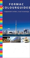
£14.99
East Prussia is no longer on any map, though it was once a thriving l&, famously military, deeply forested, artistically fertile, & the birthplace of Immanuel Kant. As the scene of Stalin`s `terrible revenge` it came to embody the turbulence of the twentieth century, was carved up between Poland & the USSR after World War II -- & passed abruptly into history. Embarking on a remarkable journey through landscape & memory, Max Egremont has woven the stories of ghosts & survivors into an evocative & deeply moving meditation on identity & the passing of time. ` East Prussia`s successful evocation demands both the mind of a poet who can delineate the scale of human loss, & the imagination of an historian who knows how to count the cost. Forgotten L&, a work of consummate artistry, blends both capacities to rare effect` Spectator ` Changing frontiers, blurred racial identities, shifting allegiances & the mass movement of people -- this a story for our time` New Statesman ` Illuminating.A literary map to a beguiling hidden enclave of Europe` Metro ` Egremont`s compelling tale exploits his boundless intellectual curiosity, mastery of German & eye for whimsy as well as tragedy. The book`s canvas is remarkable. Fascinating reading` Max Hastings, Sunday Times ...
Archived Product
£14.99
With over 250 stunning photographs of people & places all over London in the 1920s, Forgotten London charts a decade of great ...
Archived Product
£20.00
The chance discovery of the log of a slave ship
- the Daniel & Henry which set sail from Dartmouth in 1700, bound for the Guinea
...
Archived Product
£9.99
6 June 1944: the day Allied forces crossed the Channel & began fighting their way into Nazi-occupied Northwest Europe. Initiated by airborne units & covered by air & naval bombardment, the Normandy landings were the most ambitious combined airborne & amphibious assault ever attempted. Their success marked the beginning of the end for Nazi Germany. Drawing on thousands of hours of eyewitness testimony recorded by the Imperial War Museum, Forgotten Voices of D-Day tells the compelling story of this turning point in World War 2. Hearing from paratroopers & commandos, glider pilots & landing craft crewmen, airmen & naval personnel, we learn first-hand what it was like as men waited to go in, as they neared the beaches & drop zones, & as they landed & met the enemy. Accounts range from memories of the daring capture of ` Pegasus` bridge by British glider-bourn troops to recollections of brutal fighting as the assault forces stormed the beaches. Featuring a mass of previously unpublished material, Forgotten Voices of D-Day is a powerful & important new record of a defining moment in modern history. ...
Archived Product
£12.99
Forli & Rimini Provinces at 1:150, 000 in a series of handy size provincial road maps from Litografia Artistica Cartografica (LAC) with more minor local roads & country tracks than can be found on most regional maps from other publishers. This title is published with the traditional style LAC cartography.LAC’s provincial series is gradually being changed to a new style of digitally derived cartography, so presentation of adjoining titles may vary. All the maps have hill shading to represent the general relief with spot heights for selected peaks, & show a few more local roads & rough tracks than the other road map series. Intermediate road distances are indicated. Regional, provincial & communal borders are marked, & railways, funiculars, airports, sea ferry links & campsites are shown. The legend is in Italian only. The new, digitally produced editions are indexed & have enhanced, more finely drawn cartography: the hill-shading is less bold, motorway service areas are marked, natural parks are highlighted & an expanded range of symbols indicates various landmarks & sites, e.g. antiquities, churches, etc. Two styles of the new cartography are produced, differing only in the colour of the predominant background shading: grey or yellow/green. Some of the new editions include geographical coordinates for the map corners. The index of localities is on the reverse. To see all the titles in this series please click on the series link. ...
Archived Product
£20.00
We are able to source a wide range flags in many sizes, sewn or printed on 100% Ministry Of Defence Standard Woven & Knitted Polyester. Flags are supplied with rope & toggle. If you would like more information, have a custom size request or cannot find a desired product, please email us at maritime@stanfords.co.uk. We will be glad to help! ...
Archived Product
£2.95
Formby in 1906 in a fascinating series of reproductions of old Ordnance Survey plans in the Alan Godfrey Editions, ideal for anyone interested in the history of their neighbourhood or family. Selected towns in Great Britain & Ireland are covered by maps showing the extent of urban development in the last decades of the 19th & early 20th century. In this title: the map covers the centre & north of Formby & continues northward to Freshfield. Coverage stretches from Formby station northward to Freshfield station, & from the railway eastward to Altcar Lane. Features include St Peter's RC College, Freshfield Hall, St Peter's church, Holy Trinity church, Formby RC church, Duke's Farm, White House Farm, Formby Fields, Formby Moss, Downholland Brook, Moss Side, Norris's Farm & many villas from these expanding villages. A directory of Formby is included on the reverse. About the Alan Godfrey Editions of the 25 ...
Archived Product
£3.50
Formby in 1906 in a fascinating series of reproductions of old Ordnance Survey plans in the Alan Godfrey Editions, ideal for anyone interested in the history of their neighbourhood or family. The map covers the centre & north of Formby & continues northward to Freshfield. Coverage stretches from Formby station northward to Freshfield station, & from the railway eastward to Altcar Lane. Features include St Peter`s RC College, Freshfield Hall, St Peter`s church, Holy Trinity church, Formby RC church, Duke`s Farm, White House Farm, Formby Fields, Formby Moss, Downholland Brook, Moss Side, Norris`s Farm & many villas from these expanding villages. A directory of Formby is on the reverse. About the Alan Godfrey Editions of the 25” OS Series: Selected towns in Great Britain & Ireland are covered by maps showing the extent of urban development in the last decades of the 19th & early 20th century. The plans have been taken from the Ordnance Survey mapping & reprinted at about 15 inches to one mile (1:4, 340). On the reverse most maps have historical notes & many also include extracts from contemporary directories. Most maps cover about one mile (1.6kms) north/south, one & a half miles (2.4kms) across; adjoining sheets can be combined to provide wider coverage.FOR MORE INFORMATION & A COMPLETE LIST OF ALL AVAILABLE TITLES PLEASE CLICK ON THE SERIES LINK. ...
Archived Product
£3.50
Formby, Crosby & District in 1896 in a series of reproductions of Ordnance Survey’s famous ” Inch to the Mile” maps published in the Alan Godfrey Editions to provide a historical record of England & Wales in the second half of 19th & early 20th century. The map covers the coastal area from Bootle northward to Ainsdale, & inland as far as Maghull. The northern part of Bootle itself is included, & interesting features include the long closed Cheshire Lines Railways. Other locations covered include Aintree, Blundellsands, Fazakerley, Freshfield, Great Altcar, Great Crosby, Halsall, Ince Blundell, Litherl&, Lydiate, Lunt, Melling, Scarisbrick, Seaforth, Sefton, Thornton & Waterloo. A detailed map of the village of Little Crosby is on the reverse. About the Alan Godfrey Editions of the OS Inch to the Mile Maps: the maps provide an invaluable overview of a wider area, typically 18 x 12 miles (29 x 19 kms approx.), & offer historical mapping for small towns & villages not covered by the more detailed series for which the Godfrey Editions are better known. On the reverse all the maps have historical notes & most titles also include a more detailed, large scale map of a small town or a village in the area. To see other titles in this series please click on the series link. ...
Archived Product
£6.95
Topographic coverage of the Balearic Islands at 1:50, 000 in the MTN50 (Mapa Topográfico Nacional) series from the Instituto Geográfico Nacional – Centro Nacional de Información Geografica, the country’s civilian survey organization. The maps have contours at 20m intervals, enhanced by relief shading, plus colouring and/or graphics to show different types of terrain, vegetation or land use. Boundaries of national parks & other protected areas are marked. In addition to all the usual information featured on topographic mapping at this scale: detailed presentation of the road & rail networks, rural tracks & paths, etc, the maps also show campsites & mountain refuges. On more recent editions some GRs, the official long-distance hiking routes, are also marked (although not as clearly as on hiking maps from other publishers). The MTN50 series was begun in late 1990s. Each map covers 28.5x 18.5 km (with adjustments in the coastal areas). The maps have a 1-km UTM grid, plus margin ticks for latitude & longitude at 1` intervals. Map legend is in Spanish only. To see other titles in this series please click on the series link. ...
Archived Product

Formac Colorguides

Formac Colorguides are a series of guide books to parts of Canada that have been both written by locals and printed in Canada. It’s this first hand knowledge that give these little guides the edge for Canadian destinations.Colourguides offer detailed information on museums, galleries, and heritage sites as well as shopping, dining nightlife and more; the guides reflect the local knowledge and independent recommendations of the guide`s contributors.Listings come complete with contact information for accommodations, events, places to eat, shop and relax. Maps and full-colour photography illustrate an entertaining and informative text.
RIP - This product is no longer available on our network. It was last seen on 25.09.2019

This page now acts as a permanent archive for this product. Add more information using the comments box below to ensure it can still be found by future generations.

Use our search facility to see if it is available from an alternative contributor.
  • External links may include paid for promotion
  • Availability: Out Of Stock
  • Supplier: Stanfords
  • SKU: SI00001077
Availability: In Stock
£10.99

Product Description

Formac Colorguides are a series of guide books to parts of Canada that have been both written by locals & printed in Canada. It’s this first hand knowledge that give these little guides the edge for Canadian destinations. Colourguides offer detailed information on museums, galleries, & heritage sites as well as shopping, dining nightlife & more; the guides reflect the local knowledge & independent recommendations of the guide`s contributors. Listings come complete with contact information for accommodations, events, places to eat, shop & relax. Maps & full-colour photography illustrate an entertaining & informative text.

Reviews/Comments

Add New

Intelligent Comparison

Oooops!
We couldn't find anything!
Perhaps this product's unique.... Or perhaps we are still looking for comparisons!
Click to bump this page and we'll hurry up.

Price History

Vouchers

No voucher codes found.
Do you know a voucher code for this product or supplier? Add it to Insights for others to use.

Facebook

Jargon Buster

Hand - A part of the body at the end of the arm
Hand - A pointer which indicates time on a clock face
Colour - The categorised spectrum of light visable to humans
edge - Enhanced data rates for GSM evolution also known as enhanced GPRS. A mobile phone technology with improved data transmission rates.
edge - The point at which two surfaces meet

Supplier Information

Stanfords
Stanfords was established in 1853 and opened their iconic Covent Garden flagship store in 1901. They have become the top retailer of maps, travel books and accessories in the UK and arguably offer the largest selection of maps and travel books worldwide. Famous names such as Captain Robert Falcon Scott, Ranulph Fiennes and Michael Palin have purchased from Stanfords. They now have a shop in Bristol and both stores together with other venues operate a calendar of events including talks, book signings and exhibitions. As a specialist map retailer, the map selection is comprehensive and includes road maps, street maps and walking maps from worldwide destinations, as well as a selection of world atlases and wall maps. Books include travel guides and travel literature. Stanfords also stock globes, from miniatures made of blue marble to magnificent floor-standing globes. The website features a selection of interesting articles on travel topics.
Page Updated: 2023-11-12 20:15:36

Community Generated Product Tags

Oh No! The productWIKI community hasn't generated any tags for this product yet!
Menu