
 United Kingdom
 France
 Germany
 Netherlands
 Sweden
 USA
USA
 Italy
Italy
 Spain
Spain
More From Contributor


Forfar 1901
Forfar in 1901 in a fascinating series of reproductions of old Ordnance Survey plans in the Alan Godfrey Editions, ideal for anyone interested in the history of their neighbourhood or family. The map is double-sided. The main map covers the centre and western half of the town, stretching from East High Street westward to the Loch of Forfar. Features include town centre, Reid Park, Jute & Linen Works, Common Myre, Canmore Works, bleaching green, Manor Works, Westfield, Benholme Lodge, Town Hall, West and East High Street, Castle Street, Teuchatcroft, Dundee Loan, etc. On the reverse is a section of the adjacent sheet 38.08 extending coverage east to include Newmont Hill, cemetery, Forfar Works, Haugh Works, Poorhouse, Infirmary, Lillybank, Gowanbank, etc.About the
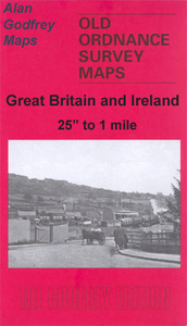
Alan Godfrey Editions of the 25” OS Series:Selected towns in Great Britain and Ireland are covered by maps showing the extent of urban development in the last decades of the 19th and early 20th century. The plans have been taken from the Ordnance Survey mapping and reprinted at about 15 inches to one mile (1:4, 340). On the reverse most maps have historical notes and many also include extracts from contemporary directories. Most maps cover about one mile (1.6kms) north/south, one and a half miles (2.4kms) across; adjoining sheets can be combined to provide wider coverage.FOR MORE INFORMATION AND A COMPLETE LIST OF ALL AVAILABLE TITLES PLEASE CLICK ON THE SERIES LINK.
Alan Godfrey Editions of the 25” OS Series:Selected towns in Great Britain and Ireland are covered by maps showing the extent of urban development in the last decades of the 19th and early 20th century. The plans have been taken from the Ordnance Survey mapping and reprinted at about 15 inches to one mile (1:4, 340). On the reverse most maps have historical notes and many also include extracts from contemporary directories. Most maps cover about one mile (1.6kms) north/south, one and a half miles (2.4kms) across; adjoining sheets can be combined to provide wider coverage.FOR MORE INFORMATION AND A COMPLETE LIST OF ALL AVAILABLE TITLES PLEASE CLICK ON THE SERIES LINK.

Product Description
Reviews/Comments
Add New
Intelligent Comparison
Archived Product
Moira 1901 Stanfords
£2.95
Archived Product

Moira 1901 Stanfords
£3.50
Vouchers
No voucher codes found.
Do you know a voucher code for this product or supplier? Add it to Insights for others to use.
Do you know a voucher code for this product or supplier? Add it to Insights for others to use.
 Denmark