More From Contributor
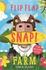
£12.99
Flinders Ranges in South Australia on a waterproof & tear-resistant map at 1:400, 000 from Hema showing locations with tourist accommodation & other facilities, plus on the reverse enlargements of the three most visited areas, a table of facilities in national parks, etc. On one side a map at 1:400, 000 covers the Flinders Ranges, including Gammon Ranges & Mount Remarkable. Topography is shown by relief shading, with colours & graphics indicating various types of terrain & highlighting national parks, protected areas, aboriginal lands, etc. A special feature of Hema’s mapping of the Outback is the presentation of roads & tracks, distinguishing between those plotted by the publishers themselves & others taken from the country’s topographic survey data. A wide range of symbols highlight various facilities including accommodation, campsites, different types of fuel supplies, general stores & meals, medical facilities, etc, many shown with opening hours and/or phone numbers. Latitude & longitude lines are drawn at 15’ intervals. An index of localities is next to the map. On the reverse there are enlargements fshowing in greater detail the three main national parks in the area: Mt Remarkable NP at 1:125, 000, Gammon Ranges NP at 1:250, 000 & Flinders Ranges NP at 1:200, 000, indicating main hiking tracks, ranger stations & tourist facilities. The map also provides descriptions of principal places of interest, a table of facilities in all the national parks, & lists of useful contact addresses. To see other titles in Hema’s series of regional maps of Australia please click on the series grid. ...
Archived Product
£14.99
Discover the gruesome armoury of siege warfare & set up your own exciting castle siege. Learn where to position your archers, how to load your catapult, & exactly where to aim-then catapult your way to victory! In the Middle Ages, castles controlled the land around them & provided bases from which knights could ride out to attack the enemy. With detailed information on the armour & weapons used by medieval knights & soldiers, this essential work explains how opposing armies attacked on foot & on horseback
- with a terrifying range of siege engines invented to break down a castle`s defences. Each spread is introduced with a diary entry, alternately from the attackers & defenders, as the siege progresses. The book also details the deadly array of weapons & armour used in medieval warfare. What`s more, there are a mangonel catapult & three targets to build! The tuck box contains push-out model sheets for a complete mangonel catapult & targets.
...
Archived Product
£3.50
Flint in 1909 in a fascinating series of reproductions of old Ordnance Survey plans in the Alan Godfrey Editions, ideal for anyone interested in the history of their neighbourhood or family. The map is double-sided. The main map covers the town & area to the south, stretching south-east to Pentre Ffwrndan. Features include the town centre, railway with the station, British Glanzstoff Works, Mount Pleasant area, Castle, St Mary`s RC church, Ancient Ditch, St Mary`s church, Castle Villa, Pen Goch Hill, Mercerising Works, Pentre Farm, St David`s church, ancient remains around Pentre Ffwrndan, etc. On the reverse is most of the adjacent sheet 6.16 extending coverage north to include Chemical Works, numerous sidings, Flint Marsh, Coleshill Farm, etc. About the Alan Godfrey Editions of the 25” OS Series: Selected towns in Great Britain & Ireland are covered by maps showing the extent of urban development in the last decades of the 19th & early 20th century. The plans have been taken from the Ordnance Survey mapping & reprinted at about 15 inches to one mile (1:4, 340). On the reverse most maps have historical notes & many also include extracts from contemporary directories. Most maps cover about one mile (1.6kms) north/south, one & a half miles (2.4kms) across; adjoining sheets can be combined to provide wider coverage.FOR MORE INFORMATION & A COMPLETE LIST OF ALL AVAILABLE TITLES PLEASE CLICK ON THE SERIES LINK. ...
Archived Product
£60.00
Flintshire, an original antique map by G. Cole / J. Roper, published in London, c. 1804 -1810. A copperplate engraving, original colour. Map size 23 x 17.5 cm with a mount size of 38.5 x 33 cm.A detailed nineteenth-century map of Flintshire that was published in the atlas, The British Atlas; Comprising A Complete Set Of County Maps, Of England & Wales; & Plans Of Cities & Principal Towns in 1810. The map was drawn by G. Cole & engraved by John Roper for publication in The Beauties Of England & Wales, that was published in parts, from c.1804. Such was the success of the publication that the maps were re-used in other publications, as here. The maps show accurate geographical detail, including the turnpike, mail coach & principal roads, sites of Roman & other historical remains, as well as the seats of the nobility & the gentry, & market towns with their distances from London. The maps also show the division of the counties into hundreds or wapontakes. They are representative of the functional nineteenth-century approach to cartography, yet are not unattractive. Antique maps from various original publishers are presented on the Stanford ...
Archived Product
£4.99
Flip the flap to discover what the busy pilots do at work in this look-&-find book for inquisitive toddlers. Each spread is packed with detail about airports & aeroplanes & there`s lots of things for little ones to find behind the big sturdy flaps. With wonderful, bright illustrations & funny, rhyming text, there`s heaps to explore & a bird to spot throughout too! ...
Archived Product
£8.99
Whoever heard of a fr-abbit? Or how about a ch-eep? Flip the flaps to come up with fun combinations that put a new twist on farm creatures
-
...
Archived Product
£8.99
Whoever heard of croco-phant? Or how about an orangu-pard? Flip the flaps to come up with fun combinations that put a new twist on jungle characters
- but watch out, these animals bite! With non-fiction rhyming text, fun facts, pop-ups & beautiful artwork from Carmen Saldana, these books are sure to raise a few giggles with little ones.
...
Archived Product
£9.99
William Alexander is not just a Francophile, he wants to be French. It`s not enough to explore the country, to enjoy the food & revel in the ambience, he wants to feel French from the inside. Among the things that stand in his way is the fact that he can`t actually speak the language. Setting out to conquer the language he loves (but which, amusingly, does not seem to love him back), Alexander devotes himself to learning French, going beyond grammar lessons & memory techniques to delve into the history of the language, the science of linguistics, & the art of translation. Along the way, during his travels in France or following his passion at home, he discovers that not learning a language may be its own reward. ...
Archived Product
£6.99
Bea Hogg is shy but fiery inside. When national dance competition Starwars comes to her school looking for talent, she wants to sign up. It`s just a shame her best friend agreed to enter with school super-cow Pearl Harris. Bea will fight back! But when school hottie, Ollie Matthews, who also happens to be Pearl`s boyfriend, decides to enter the competition with Bea, she will have more than a fight on her hands. This warm, nuanced, hilarious story about friendship, fortitude.. .and dancing is impossible not to fall in love with. Jenny`s voice is fresh & convincing, & she handles both darker & lighter elements of the story with equal panache. ...
Archived Product
£12.99
Topographic survey of Catalonia at 1:25, 000 from the Institut Cartogràfic i Geològic de Catalunya, an attractive alternative to Spain’s national topographic survey at this scale, offering a much larger area per sheet with extensive tourist information & vivid presentation of vegetation & land use. These large, detailed maps have contours at 10m intervals enhanced by hill shading & fine colouring and/or graphics to portray of vegetation or land use (different types of woodlands, marshl&, vineyards, crops, etc). An overprint highlights waymarked local & long-distance GR footpaths plus CT cycling routes. Also highlighted are picturesque locations such as villages, isolated buildings or natural features. A very wide range of symbols indicate various facilities, places of interest & recreational sites: tourist information centres, campsites & other rural accommodation, cultural heritage, vineries, wildlife observation areas, viewpoints & beauty spots, sites for recreational pursuits including horse riding, water sports, paragliding, etc The maps are divided by the publishers into three types: Administrative Units, Natural Protected Areas, & Geographical Areas, as shown on our grid for this series. Coverage by each sheet varies; most maps present an area of 30 x 23km (19 x 14km approx). The maps have a 1km UTM grid, with latitude & longitude values shown for the map corners. Excellently presented topographic map legend is in Catalan only but the legend for the tourist information & the road network

Includes::
English. To see the list of all the titles in this series please click on the series link.

...
Archived Product

Flip Flap FARM

Children can learn the mysteries of the farm with this wonderful and innovative new flap book. It is full of surprises to keep enquiring minds entertained, there are flaps beneath flaps, spinning wheels and miniature fold-out booklets. Children discover what it`s like in the day of the life of a cow, how a farm changes with the seasons and all about the different animals and machines that can be found on the farm. It includes a small pull-out fictional story at the end, set on a farm. This is the first in an exciting new series.
RIP - This product is no longer available on our network. It was last seen on 25.09.2019

This page now acts as a permanent archive for this product. Add more information using the comments box below to ensure it can still be found by future generations.

Use our search facility to see if it is available from an alternative contributor.
  • External links may include paid for promotion
  • Availability: Out Of Stock
  • Supplier: Stanfords
  • SKU: 9780746091135
Availability: In Stock
£9.99

Product Description

Children can learn the mysteries of the farm with this wonderful & innovative new flap book. It is full of surprises to keep enquiring minds entertained, there are flaps beneath flaps, spinning wheels & miniature fold-out booklets. Children discover what it`s like in the day of the life of a cow, how a farm changes with the seasons & all about the different animals & machines that can be found on the farm. It

Includes::
a small pull-out fictional story at the end, set on a farm. This is the first in an exciting new series.

Reviews/Comments

Add New

Intelligent Comparison

Oooops!
We couldn't find anything!
Perhaps this product's unique.... Or perhaps we are still looking for comparisons!
Click to bump this page and we'll hurry up.

Price History

Vouchers

No voucher codes found.
Do you know a voucher code for this product or supplier? Add it to Insights for others to use.

Facebook

Jargon Buster

Day - The time it takes a planet or other space objects to complete one rotation.
Set - a group of items usually related to one another. Some objects cannot function without the complete set of items.
Small - something that takes up less space than normal.
Innovative - An idea that shows new method and ways of thinking, an original design.
Children - A young life form within the early stages of physical development,
Wonderful - Another word for describing something that is extremely good, marvellous.

Supplier Information

Stanfords
Stanfords was established in 1853 and opened their iconic Covent Garden flagship store in 1901. They have become the top retailer of maps, travel books and accessories in the UK and arguably offer the largest selection of maps and travel books worldwide. Famous names such as Captain Robert Falcon Scott, Ranulph Fiennes and Michael Palin have purchased from Stanfords. They now have a shop in Bristol and both stores together with other venues operate a calendar of events including talks, book signings and exhibitions. As a specialist map retailer, the map selection is comprehensive and includes road maps, street maps and walking maps from worldwide destinations, as well as a selection of world atlases and wall maps. Books include travel guides and travel literature. Stanfords also stock globes, from miniatures made of blue marble to magnificent floor-standing globes. The website features a selection of interesting articles on travel topics.
Page Updated: 2023-11-12 20:15:36

Community Generated Product Tags

Oh No! The productWIKI community hasn't generated any tags for this product yet!
Menu