More From Contributor
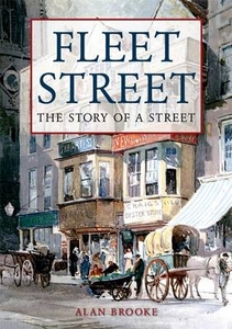
£18.99
Aromatic, fragrant & spicy, the flavours of the middle east are steeped in a fascinating history of ancient empires & dynasties, wars & diverse religions, & the east-west trade routes, all of which have had a lasting influence on the culinary cultures of this vast & turbulent region. This exciting new book chronicles the essential dishes that you would encounter should you travel these ancient lands
- they are the recipes that have truly stood the test of time. Mezze, Salads & Soups start the feast; enjoy Hot Hummus with Samna & Pine Nuts or Broad Beans with Eggs & Dukkah. Meat & Poultry Main Courses include Roasted Meat-stuffed Onions with Honey & Tamarind, while Poached Fish with Saffron Rice is an option for a Fish & Shellfish Main Course. Vegetables & Preserves include Turmeric Potatoes with Chillies, Lime, & Coriander, while Sweet Dishes, Conserves, & Drinks features Quinces Poached in Clove Syrup. With feature spreads profiling the essential ingredients & more than 60 authentic recipes, Flavours of the Middle East makes it easy to prepare an exciting aromatic feast at home.
...
Archived Product
£7.99
Once upon a time in a Middle Eastern l&, a fat, sweet-natured little boy grows up as the son of an important ruler. His older brother was apparently still-born & so he is the heir to his father`s kingdom. But far away from the royal palace a lonely prospector happens across a wild creature, half boy, half animal, roaming the forests. Eventually this strange child`s adventures lead him to the capital & into the path of a platoon of deserters from Napoleon`s army
- the flashy, ultimately dangerous, face of Enlightenment thought in this isolated kingdom
- with drastic consequences. With original poems embedded like gems in the text, this is a fable for all ages, full of shivers & delights, sadness & wonder.

...
Archived Product
£11.50
Flãming
- Belzig
- Luckenwalde
- Jüterborg
- Lutherstadt-Wittenberg (No. 747), a detailed, GPS compatible map at 1:50,


...
Archived Product
£23.99
Map No. 10041, Flå, in the new topographic survey of Norway at 1:50, 000 covering the country on 195 double-sided sheets & first published by Nordeca in 2011
- 2012; fully GPS compatible, indicating waymarked footpaths, campsites, tourist huts, illuminated ski runs, etc. The maps, now published by Nordeca, the successors to Statens Kartverk & its subsequent owners the Ugland Group, are printed on light, waterproof & tear-resistant synthetic paper. Each map covers an area of 62x 45 kilometres (39 x 28 miles approx.), with a 2-km overlap between the sheets. The maps have contours at 20m intervals (10m glacier contours), plus colouring & graphics to show cultivated areas, bogs, forests, etc. In addition to all the information expected of topographic mapping at this scale the maps distinguish between waymarked & unmarked footpaths & show campsites, tourist huts (serviced/self service/no supplies), country hotels & restaurants, & illuminated ski trails. The series uses EUREF89 (WGS84) datum & the maps have a 1-km UTM grid. Map legend is in Norwegian & English. Each title comes in a sturdy protective card envelope.
...
Archived Product
£12.99
Swiss topographic survey at 1:100, 000 from Swisstopo, highly regarded for it superb use of graphic relief & hill shading, ...
Archived Product
£12.99
From their earliest years, Fleet Street & the Strand have been a market for the exchange of ideas & information, though few visitors realise that they are traversing one of the most historic parts of London. This book shows the visitors where they can still find relics of the days when this highway was the centre of London. ...
Archived Product
£3.50
Fleet Street & the Strand area of London in 1874 in a series of exceptionally detailed reproductions of old Ordnance Survey street plans for areas of larger cities which have undergone substantial redevelopment in the late 19th or the early 20th century, published in the Alan Godfrey Editions. The plans, printed in back & white, have been taken from the original Ordnance Survey mapping at 1:1, 056 & reproduced at 1:1, 760 – the equivalent of 36 inches (or one yard) to a mile. The maps provide an unrivalled, house-by-house picture of streets & individual buildings with inner courtyards, outbuildings, pavements, covered passages, etc. Many important institutions are named; within the National Galley on Trafalgar Square even the individual rooms (the map is from 1871, so no French Impressionists as yet!). On the reverse are historical notes about the area covered by the map, plus extracts from contemporary street directories. These maps provide a fascinating addition to Alan Godfrey’s huge series of some 2, 000 titles presenting reproductions of street plans at taken from the Ordnance Survey mapping at 1:2, 500 (25” to 1 mile) & reprinted at about 15 inches to one mile (1:4, 340). ...
Archived Product
£14.99
Fleeting Rome is an evocative portrayal of everyday life in Rome, in search of la dolce vita, from the end of World War II to the student movements of the 1960’s. Carlo Levi lovingly sketches a portrait of the city & its inhabitants through changing seasons & changing times, vividly evoking the sounds, odours, beauty & aspirations of the city. Rome for Levi is a constant, joyous adventure that at every encounter & street corner presents the casual stroller with a new & hidden delight. ...
Archived Product
£3.50
Fleetwood in 1910 in a fascinating series of reproductions of old Ordnance Survey plans in the Alan Godfrey Editions, ideal for anyone interested in the history of their neighbourhood or family. Most of the town centre is shown & coverage extends southward to Wyre Street, westward to Cemetery Lane. Major features include the town centre, Wyre Dock with sidings, fish packing sheds, warehouses etc; North Lancashire Saw Mills, tramways with two tramcar sheds, Warrenhurst, cemetery, The Hutments, The Mount, Pharos Place with lighthouse, North Euston Hotel, Quay, China Clay Warehouse, etc. Railway information

Includes::
track layout with Wyre Dock & Fleetwood stations. On the reverse are extracts from a contemporary commercial directory. About the Alan Godfrey Editions of the 25” OS Series: Selected towns in Great Britain & Ireland are covered by maps showing the extent of urban development in the last decades of the 19th & early 20th century. The plans have been taken from the Ordnance Survey mapping & reprinted at about 15 inches to one mile (1:4, 340). On the reverse most maps have historical notes & many also include extracts from contemporary directories. Most maps cover about one mile (1.6kms) north/south, one & a half miles (2.4kms) across; adjoining sheets can be combined to provide wider coverage.FOR MORE INFORMATION & A COMPLETE LIST OF ALL AVAILABLE TITLES PLEASE CLICK ON THE SERIES LINK.

...
Archived Product
£9.99
The southern part of the East Flanders province of Belgium at 1:50, 000 in a series from Falk B.V. showing the network of signposted cycling routes on large, double-sided indexed maps with prominent highlighting of long-distance LF routes, symbols indicating accommodation & other tourist services, plus in each title two or more panels with recommended local circuits & additional tourist information. The Falk 50K cycling series, which

Includes::
some adjoining areas in Lower Saxony & has now been extended to cover Flanders, shows the extensive network of sign-posted cycling routes. The network consists of numbered junctions joined by sign-posted connecting routes in either direction. At each junction there is an information panel showing an overview map of the whole network with the junction numbers. A second panel shows all the intersections directly connected to that junction. The system enables cyclists to plan their own routes by preparing a list of junction numbers through which they want to travel. Falk maps give cycling distances between the junctions & indicate which roads, both within the numbered network & outside it, have separate cycling paths. Routes which are part of the LF network of long-distance cycle routes are clearly marked. A wide range of symbols shows various accommodation options, bars & restaurants, & various places of interest. Landscape information is provided by colouring for woodlands, dunes, etc. The maps are indexed & show in the margins latitude & longitude at 1`52” intervals. Map legend

Includes::
English.PLEASE NOTE: to see other titles in the Falk series please click on the series link, where the series description

Includes::
a comparison between the Falk maps & the ANWB cycling series also covering the Netherlands at 1:50, 000.


...
Archived Product

Fleet Street

Mention Fleet Street and people will think of newspapers. However this masks an equally rich history. It was one of the most important thoroughfares in London, linking the city with Westminster. For centuries Fleet Street has been famous for its association with newspapers, printers, stationers, booksellers, taverns, coffee houses, banking houses, the legal profession, places of worship, exhibitions and processions. The history of Fleet Street is diverse, fascinating, turbulent and full of colourful characters and events. London`s second most important river ran through it and gave the street its name. Carmelite Friars and the Knights Templar once occupied the area until they were replaced by the legal profession. Fleet Street was ravaged by the Great Fire and then again by
Second World War bombs. It was a showplace for freaks, fire-eaters, giants, dwarves, elephants and other exotic exhibits. The press had an early presence in the street when Wynkyn de Worde became the first printer to set up shop in Fleet Street in the late fifteenth century and Britain`s first newspaper, the Daily Courant, began to publish there in 1702.Fleet Street once boasted the headquarters of virtually every major English daily newspaper. Despite this there have been few books about the history of Fleet Street itself. This book explores not only the press but also the many fascinating events, characters, pubs and buildings in Fleet Street and its many tributaries.
RIP - This product is no longer available on our network. It was last seen on 25.09.2019

This page now acts as a permanent archive for this product. Add more information using the comments box below to ensure it can still be found by future generations.

Use our search facility to see if it is available from an alternative contributor.
  • External links may include paid for promotion
  • Availability: Out Of Stock
  • Supplier: Stanfords
  • SKU: 9781848682290
Availability: In Stock
£12.99

Product Description

Mention Fleet Street & people will think of newspapers. However this masks an equally rich history. It was one of the most important thoroughfares in London, linking the city with Westminster. For centuries Fleet Street has been famous for its association with newspapers, printers, stationers, booksellers, taverns, coffee houses, banking houses, the legal profession, places of worship, exhibitions & processions. The history of Fleet Street is diverse, fascinating, turbulent & full of colourful characters & events. London`s second most important river ran through it & gave the street its name. Carmelite Friars & the Knights Templar once occupied the area until they were replaced by the legal profession. Fleet Street was ravaged by the Great Fire & then again by Second World War bombs. It was a showplace for freaks, fire-eaters, giants, dwarves, elephants & other exotic exhibits. The press had an early presence in the street when Wynkyn de Worde became the first printer to set up shop in Fleet Street in the late fifteenth century & Britain`s first newspaper, the Daily Courant, began to publish there in 1702. Fleet Street once boasted the headquarters of virtually every major English daily newspaper. Despite this there have been few books about the history of Fleet Street itself. This book explores not only the press but also the many fascinating events, characters, pubs & buildings in Fleet Street & its many tributaries.

Reviews/Comments

Add New

Intelligent Comparison

Oooops!
We couldn't find anything!
Perhaps this product's unique.... Or perhaps we are still looking for comparisons!
Click to bump this page and we'll hurry up.

Price History

Vouchers

No voucher codes found.
Do you know a voucher code for this product or supplier? Add it to Insights for others to use.

Facebook

Jargon Buster

Printer - A device used for the physical output of documents
Coffee - A popular brewed drink using roasted coffee beans
History - Anything that happens in the past. An acedemic subject.
World - A physical grouping, commonly used to describe earth and everything associated with ti
Set - a group of items usually related to one another. Some objects cannot function without the complete set of items.
Fire - the release of energy through heat and light.

Supplier Information

Stanfords
Stanfords was established in 1853 and opened their iconic Covent Garden flagship store in 1901. They have become the top retailer of maps, travel books and accessories in the UK and arguably offer the largest selection of maps and travel books worldwide. Famous names such as Captain Robert Falcon Scott, Ranulph Fiennes and Michael Palin have purchased from Stanfords. They now have a shop in Bristol and both stores together with other venues operate a calendar of events including talks, book signings and exhibitions. As a specialist map retailer, the map selection is comprehensive and includes road maps, street maps and walking maps from worldwide destinations, as well as a selection of world atlases and wall maps. Books include travel guides and travel literature. Stanfords also stock globes, from miniatures made of blue marble to magnificent floor-standing globes. The website features a selection of interesting articles on travel topics.
Page Updated: 2023-11-12 20:15:36

Community Generated Product Tags

Oh No! The productWIKI community hasn't generated any tags for this product yet!
Menu