More From Contributor

£7.99
A box of 50 cards showing the flag of every country in the world. Each flag is accompanied by country fact data, from capital cities to currencies. Feature panels tell more about flag designs, symbols & traditions & internet links provide lots more flag information. ...
Archived Product
£7.99
An excellent sticker & colouring book bursting with interesting information about the flags of the world. Children can enjoy colouring the patterns of the flags & matching the stickers while learning something about each country & its heritage. ...
Archived Product
£14.99
Flags of the World is a fun & educational card game that

Includes::
all the independent countries in the world.

...
Archived Product
£7.99
Which national flag

Includes::
an image of a vicuña (cousin to the llama)? Which displays a blue chakra wheel?

...
Archived Product
£4.99
Flags of the World Sticker Book contains over 350 easy to peel flag stickers & is a fun filled introduction to the continents & countries of the world. The sticker book is arranged by continent, with up-to-date maps & nation sticker flags. Match the sticker with its place on each continent introduction page, which provides you with facts, statistics & a map for each world region. Also included is a giant fold out map of the world, featuring the world’s flags. ...
Archived Product
£9.99
Map No. 856, Coconino National Forest: Flagstaff & Sedona, AZ, in an extensive series of GPS compatible, contoured hiking maps of USA’s national & state parks or forests & other popular recreational areas. Cartography based on the national topographic survey, with additional tourist information. The maps, with most titles now printed on light, waterproof & tear-resistant plastic paper, highlight walking trails along with campsites & other accommodation, picnic sites, areas for various recreational pursuits such as horse riding or skiing, drinking water sources, & many other facilities of interest to the outdoor enthusiast. Cartography is based on information from the USGS (United States Geological Survey
- the country’s national survey organization), revised by the National Geographic Maps in cooperation with the National Park Service, USDA Forest Service, etc. Topography is excellently presented by contours (interval varies according to scale), enhanced by relief shading & colouring/graphics for wood cover, glaciers, etc. All heights are given in feet. The maps have a UTM grid plus latitude & longitude margin ticks & GPS waypoints for selected important locations. Each map is double-sided to give either maximum coverage of the chosen area or additional enlargements of its important sections. Accompanying notes provide useful information on relevant regulations, safety precautions, contact addresses, etc.* *IMPORTANT
- PLEASE NOTE: the series is very extensive, ranging in scale from 1:400, 000 for the vast national parks of Alaska to 1:25, 000 for local map in several states. We recommend, therefore, viewing the series by state rather than the whole list.*

...
Archived Product
£6.50
Flagstaff
- Sedona
- Grand Canyon, AZ in a series of indexed street plans of US cities from G.M. Johnson & Associates. The

...
Archived Product
£6.50
Flagstaff
- Sedona
- Grand Canyon, AZ in a series of indexed street plans of US cities from G.M. Johnson & Associates. The

...
Archived Product
£9.99
Simon Yates, author of Against the Wall, takes us back to his early years as a climber
- the escapades & excitement of a young
...
Archived Product
£9.99
Map No. 704, Flaming Gorge
- East Uintas, UT/WY, in an extensive series of GPS compatible, contoured hiking maps of USA’s national
...
Archived Product

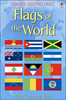
Flags Of The World To Colour

Discover the national flag of every independent country in the world in this fascinating colouring book. Grouped by continent, there are maps matching each flag to its country, information on flag colours and symbols and black and white flags and coats of arms to colour. With internet links to carefully selected websites to find out more.
RIP - This product is no longer available on our network. It was last seen on 25.09.2019

This page now acts as a permanent archive for this product. Add more information using the comments box below to ensure it can still be found by future generations.

Use our search facility to see if it is available from an alternative contributor.
  • External links may include paid for promotion
  • Availability: Out Of Stock
  • Supplier: Stanfords
  • SKU: 9781474922609
Availability: In Stock
£5.99

Product Description

Discover the national flag of every independent country in the world in this fascinating colouring book. Grouped by continent, there are maps matching each flag to its country, information on flag colours & symbols & black & white flags & coats of arms to colour. With internet links to carefully selected websites to find out more.

Reviews/Comments

Add New

Intelligent Comparison

Oooops!
We couldn't find anything!
Perhaps this product's unique.... Or perhaps we are still looking for comparisons!
Click to bump this page and we'll hurry up.

Price History

Vouchers

No voucher codes found.
Do you know a voucher code for this product or supplier? Add it to Insights for others to use.

Facebook

Jargon Buster

Black - A colour which does not emit any colour of the spectrum. Black absorbs all frequencies of the spectrum.
White - A colour combining all colours
flag - A piece of material flown from a mast used symbolically for identification.
World - A physical grouping, commonly used to describe earth and everything associated with ti
Colour - The categorised spectrum of light visable to humans

Supplier Information

Stanfords
Stanfords was established in 1853 and opened their iconic Covent Garden flagship store in 1901. They have become the top retailer of maps, travel books and accessories in the UK and arguably offer the largest selection of maps and travel books worldwide. Famous names such as Captain Robert Falcon Scott, Ranulph Fiennes and Michael Palin have purchased from Stanfords. They now have a shop in Bristol and both stores together with other venues operate a calendar of events including talks, book signings and exhibitions. As a specialist map retailer, the map selection is comprehensive and includes road maps, street maps and walking maps from worldwide destinations, as well as a selection of world atlases and wall maps. Books include travel guides and travel literature. Stanfords also stock globes, from miniatures made of blue marble to magnificent floor-standing globes. The website features a selection of interesting articles on travel topics.
Page Updated: 2023-11-12 20:15:36

Community Generated Product Tags

Oh No! The productWIKI community hasn't generated any tags for this product yet!
Menu