More From Contributor
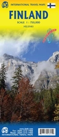
£10.99
Double-sided map dividing the country in two sections — north & south. It combines clear road details with subtle hillshading & peak heights. Eight different types of roads are shown, with road names, distances between junctions & gradients. Railways & cable railways, car-ferries, administrative boundaries, border crossings & military areas are also marked, alongside national parks & places of interest. Latitude & longitude lines are drawn at 30` intervals. The Legend is in 10 different languages including English. An index of place names is in an attached booklet. ...
Archived Product
£12.99
Indexed general road map of Finl&, extending across the Gulf of Bothnia to cover eastern & northern Sweden & northern Norway. The map shows seven different kind of roads plus foothpaths, with road names, intermediate driving distances in km, petrol stations, restaurants & motels along main roads. Railways, mountain/cable railways, ferry lines & airports are also marked alongside mountain passes, national boundaries & prohibited areas. A number of symbols also indicates places of interests, notable buildings & ruins, monuments & churches, campsites, lighthouses & detached houses. All texts are in six different European languages including English. ...
Archived Product
£15.99
Reproduction of a map of Finland published by the country’s survey organization in 1917, showing its border with Russia before Karelia was ceded to Russia. Road & rail networks are presented on a base with bold altitude colouring indicating the topography. ...
Archived Product
£15.99
Reproduction of a map of Finland published by the country’s survey organization in 1933, showing its border with Russia before Karelia, Salla & Patsamo were ceded to Russia in 1944 after the Continuation War. Road & rail networks are presented on a base with bold altitude colouring indicating the topography. Map legend is in Finnish & Swedish. ...
Archived Product
£4.99
Finland in the Compact Guide series from Insight is an accessible & handy reference guide, describing main sites & cultural highlights. Each illustrated guide

Includes::
an introductory chapter with a selection of the top ten things to do & gives visitors an insight into history, culture & geography. An extensive

...
Archived Product
£12.99
A double-sided map useful for picking out the national parks, which are shown fairly clearly
- as are restricted areas. Motorways
...
Archived Product
£39.99
Road Atlas of Finl&, 2017 edition in an A4 spiral-bound format covering the southern & central parts of the country at 1:200, 000, with the north at 1:250, 000, plus city maps of 50 towns, enlargements showing in more details the environs of Helsinki, Oulu, Tampere & Turku, examples of traffic signs, etc. Over 2800 places of interest & 2000 accommodation options are highlighted. The atlas covers the country at two scales: 1:200, 000 up to just north of Pudasjärvi, & 1:250, 000 for the north. Finely graded road network

Includes::
unsurfaced roads & privately maintained local roads, shows distances on main routes, locations of petrol stations, etc. Railway lines are shown with stations; local airports & coastal ferry are marked. Symbols show campsites, youth hostels, holiday villages, recreational facilities, cultural or nature places of interest, etc. Mapping at 250K for the northern part of Finland also has contours at 50m intervals plus colouring and/or graphics for marshl&, etc. National parks & other protected areas are highlighted. The maps have no geographical coordinates. Extensive index

Includes::
names of protected areas & topographic features. The atlas also provides: enlargements at 1:100, 000 showing in greater detail the environs of Helsinki, Oulu, Tampere & Turku; 50 city maps at 1:40, 000 annotated with tourist accommodation including hotels, places of interest, etc; four pages with examples of the country’s traffic signs; plus a comprehensive distance table. Map legend & the text include English.


...
Archived Product
£6.99
Marco Polo Finland: the Travel Guide with Insider Tips Experience all of Finland`s attractions with this up-to-date, authoritative guide, complete with ` Best Of` recommendations. You`ll discover excellent hotels, restaurants, trendy places to go, plus shopping tips, suggestions for those on a tight budget, details of all the sports & activities on offer & ideas for Travel with Kids. Also contains: the Perfect Route, Festival & Events, Travel Tips, Links, Blogs, Apps & more, Finnish phrasebook & a comprehensive index. Beware
- it could easily happen that you travel to Finland & end up not wanting to leave this stunning place. Suomi (that`s what Finns call Finland) has an extraordinary coastline with lots of rocky islands, a never ending blue-green patchwork of forest & water, vast expanses of moorland & tundra, silver midsummer nights & northern lights in winter. But a visit to the land of tango dancers, owners of summer cottages & the inventor of the mobile phone is more than just a trip to the countryside. With Marco Polo Finland you`ll embark on a journey of discovery. Immerse yourself in a very special lifestyle & discover the out-of-the-ordinary among its cultural variety & lively art scene, at its colourful festivals & while tasting Finnish specialities. Where else in the world can you pick berries & mushrooms in dense forests & dance tango in the streets at night? Or sweat in the typical smoke sauna & meet up to drink vodka afterwards? You`ll appreciate the tranquillity of the thousand lakes as much as the noisy evenings in karaoke bars. Celebrate the Finnish way
- you`ll love it. The Insider Tips reveal, amongst other things, where you can experience the variety of Finnish cuisine & how you can explore the fascinating world of Lapl&. Panels in each chapter suggest things to do if you`re on a tight budget & where to pick up some real bargains. Go cruising through the skerries, the most beautiful archipelago of the world, row around Lake Paijanne, & take a trip to the Arctic
- Trips & Tours showcase the country`s best destinations. Untouched, lonely & beautiful: Finland`s forests & lakes offer everything your heart desires. Go fishing, swimming in icy water & even dog sledding: you`ll find selected listings & tips in the Sports & Activities chapter. Finally, the Dos & Don`ts point out some of the things you need to be aware of & watch out for when visiting the country. Marco Polo Finland provides comprehensive coverage of the country. To help you get around there`s a detailed road atlas inside, a folding city map of Helsinki in the backcover, plus a handy pull-out map. Don`t go on holiday without a Marco Polo guide!


...
Archived Product
£6.99
Finland at 1:850, 000 from an indexed road map Marco Polo Travel Publishing with special features to aid route planning, plus street plans of central Helsinki, Lahti, Oulu, Rovaniemi, Tampere & Turku/ Abo. A fold-out extension of the map cover gives at-a-glance overview of the whole area covered by the map with the adjoining regions, highlighting main places of interest & making it much easier to find various localities on the main map and/or plan a route. A set of seven peel-on/peel-off stickers, removable without damaging the map, is provided to make routes or locations more prominent when navigating. Coverage

Includes::
large areas of Norwegian & Swedish Lapland &, along the eastern border, parts of Karelia with road & rail access St. Petersburg & road connections with Murmansk. Cartography is from the renowned German publishers Mair Dumont. Road network

Includes::
minor local roads & selected unsurfaced tracks, indicates motorway services, truck shops, toll stations, traffic or seasonal restrictions, etc. & gives driving distances on main & most secondary routes. Scenic routes & viewpoints are highlighted. Railway lines, ferry routes & local airports are included, as well as the country’s administrative divisions with names of the provinces. Locations of interest are prominently highlighted, with separate colouring for towns or villages & for natural sites. National parks & other protected areas are marked. Symbols highlight locations of campsites, youth hostels, isolated hotels, etc. Topography is shown by relief shading with spot heights, plus graphics for bogs & marshl&. Latitude & longitude lines are at 30’ intervals. Multilingual map legend

Includes::
English.A booklet attached to the map cover has an extensive index of place names with post codes, a distance/driving times table, & basic driving regulations. Also provided are street plans at 1:20, 000 of central areas of Helsinki, Lahti, Oulu, Rovaniemi, Tampere & Turku/ Abo.


...
Archived Product
£5.99
The Michelin National road map of Finland at 1:1, 250, 000 scale is ideal for route planning. The map gives comprehensive coverage of national road networks showing all major motorways, dual carriageways, national & regional main roads & some single-lane roads. Also shows unsurfaced roads. The map is divided by grid showing latitude & longitude. Distances between major locations are marked along roads, with total distance & several intermediate distances shown. A quick-reference chart of distances & driving times between major locations is also included. The map also

Includes::
a grid-referenced index of principal place names. Clear, easy-to read cartography shows roads in reds, yellows & white with black outlines. Major topography is indicated with relief shading. Woodland & forest is marked with green shading. Built-up urban areas are clearly marked in yellow. Airports, ferries, railways, bridges are also marked. National & administrative divisions are marked, as are areas of tourist interest such as rock carvings, national parks & scenic routes. Also

Includes::
a quick reference panel giving national driving regulations, including speed limits, equipment requirements (e.g. bulb kits, warning triangles) & seatbelt rules for all countries principally shown. Town plans & regional enlargements:- Helsinki at 1:250, 000 scale


...
Archived Product

Finland ITMB

Finland at 1:750, 000 on an indexed, double-sided map from ITMB with insets providing a street plan of central Helsinki plus more detailed mapping of the capital’s environs.The map is double-sided with an overlap between the sides. Road network shows driving distances on main and on selected local roads. Railway lines and ferry links are included and local airports are marked. The map highlights selected national parks and other protected areas, and symbols indicate various places of interest.
RIP - This product is no longer available on our network. It was last seen on 25.09.2019

This page now acts as a permanent archive for this product. Add more information using the comments box below to ensure it can still be found by future generations.

Use our search facility to see if it is available from an alternative contributor.
  • External links may include paid for promotion
  • Availability: Out Of Stock
  • Supplier: Stanfords
  • SKU: 9781771292825
Availability: In Stock
£9.99

Product Description

Finland at 1:750, 000 on an indexed, double-sided map from ITMB with insets providing a street plan of central Helsinki plus more detailed mapping of the capital’s environs. The map is double-sided with an overlap between the sides. Road network shows driving distances on main & on selected local roads. Railway lines & ferry links are included & local airports are marked. The map highlights selected national parks & other protected areas, & symbols indicate various places of interest.

Reviews/Comments

Add New

Intelligent Comparison

Oooops!
We couldn't find anything!
Perhaps this product's unique.... Or perhaps we are still looking for comparisons!
Click to bump this page and we'll hurry up.

Price History

Vouchers

No voucher codes found.
Do you know a voucher code for this product or supplier? Add it to Insights for others to use.

Facebook

Jargon Buster

Network - A link and communication between things. Often computers or people.
Road - a manmade lane or a path that is used to speed up travel.

Supplier Information

Stanfords
Stanfords was established in 1853 and opened their iconic Covent Garden flagship store in 1901. They have become the top retailer of maps, travel books and accessories in the UK and arguably offer the largest selection of maps and travel books worldwide. Famous names such as Captain Robert Falcon Scott, Ranulph Fiennes and Michael Palin have purchased from Stanfords. They now have a shop in Bristol and both stores together with other venues operate a calendar of events including talks, book signings and exhibitions. As a specialist map retailer, the map selection is comprehensive and includes road maps, street maps and walking maps from worldwide destinations, as well as a selection of world atlases and wall maps. Books include travel guides and travel literature. Stanfords also stock globes, from miniatures made of blue marble to magnificent floor-standing globes. The website features a selection of interesting articles on travel topics.
Page Updated: 2023-11-12 20:15:36

Community Generated Product Tags

Oh No! The productWIKI community hasn't generated any tags for this product yet!
Menu