More From Contributor
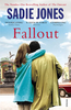
£8.99
It`s Tibet, 1954. The highest pass of the Himalayas is enveloped in silence save the flapping of prayer flags. Seven thousand feet below, two Americans travelling on foot arrive in the remote town of Shigatse, intending to make it their new home. Steeped in the Quaker tradition of non-violence & longing to live in a society that has embraced pacifism for centuries, Emma & Gerald Kittredge are soon happily adopted by their Tibetan neighbours, Dorje & Rinchen, & their small family. But the arrival of Maoist soldiers into their quiet life shatters everything. In the upheaval that follows, Gerald is captured, leaving a pregnant Emma facing an agonising decision: whether to flee Tibet with her friends or stay & risk capture herself. Dorje & Rinchen`s family is also torn apart as one son struggles to find a peaceful solution to an increasingly impossible situation, & the other chooses a path of violence, breaking his monastic vows. Set in a region so breathtakingly beautiful it is believed to be the ceiling of the world, ” Falling to Heaven” is an uplifting & extraordinary novel about faith: losing it & rediscovering it in places you`d never expect. ...
Archived Product
£9.99
In the first volume of ` Unreliable Memoirs`, we said farewell to our hero as he set sail from Sydney Harbour, bound for London, fame & fortune. Finding the first of these proved relatively simple; the second two less so. Undaunted, Clive moved into a bed & breakfast in a Swiss Cottage where he practised the Twist, anticipated poetical masterpieces & worried about his wardrobe.. .`A comic triumph, full of terrific jokes & brilliantly sustained setpieces` Ian Hamilton, London Review of Books ` James` wickedly funny jokes & jibes make you laugh out loud & feel warm to the man. No wonder women wanted to feed him greens, & men lend him money` The Times ...
Archived Product
£25.00
Falling Upwards tells the story of the enigmatic group of men & women who first risked their lives to take to the air, & so discovered a new dimension of human experience. Why they did it, what their contemporaries thought of them, & how their flights revealed the secrets of our planet in wholly unexpected ways is its subject. In this heart-lifting book, the Romantic biographer Richard Holmes floats across the world following the pioneer generation of balloon aeronauts, from the first heroic experiments of the Montgolfiers in 1780s to the tragic attempt to fly a balloon to the North Pole in the 1890s. It is a compelling adventure story of the kind that only Holmes could tell. Dramatic sequences move from the early Anglo-French balloon rivalries, the crazy firework flights of beautiful Sophie Blanchard; the revelatory ascents over the great Victorian cities & sprawling industrial towns of Northern Europe; & the astonishing long-distance voyages of the American entrepreneur John Wise, & the French photographer Felix Nadar. Later we find balloons used to observe the horrors of modern battle during the American Civil War (including a memorable flight by General Custer); the legendary tale of sixty balloons that escaped Paris during the Prussian siege of 1870; & the terrifying high-altitude flights of James Glaisher FRS who rose above seven miles without oxygen, helping to establish the new science of meteorology as well as the environmental notion
- so important to us today
- of a `fragile` planet. Besides the aeronauts themselves, readers will also discover the many writers & dreamers
- from Mary Shelley to Edgar Alan Poe, from Charles Dickens to Jules Verne
- who felt the imaginative impact of flight & allowed it to soar in their work. Through all these adventures, the narrative continually lifts off in unexpected literary & scientific directions, exploring the interplay between technology & science fiction, the understanding of the biosphere, & the metaphysics of flight itself. Most of all, through the strange allure of the great balloonists, Holmes offers another of his subtle portraits of human endeavour, recklessness & vision.


...
Archived Product
£10.99
` Nominally a history of the hot air balloon, ` Falling Upwards` is really a history of hope & fantasy
- & the quixotic characters
...
Archived Product
£7.99
This is the intoxicating new novel from the number one bestselling author of The Outcast London 1972. Luke is dazzled by the city. It seems a world away from the provincial town he has fled along with his own troubled past, & his new life is unrecognisable
- one of friendships forged in pubs, candlelit power cuts, & smoky late-night parties. When Nina, a fragile & damaged actress, strays into his path, Luke is immediately drawn to her & the delicate balance of his new life is threatened. Unable to stay away from her, Luke is torn between loyalty, desire & his own painful past, until everything he values, even the promise of the future, is in danger...
...
Archived Product
£3.50
Fallowfield in 1904 in a fascinating series of reproductions of old Ordnance Survey plans in the Alan Godfrey Editions, ideal for anyone interested in the history of their neighbourhood or family. The map covers the area of Manchester around Fallowfield, including the southern part of Rusholme. Coverage stretches from Brook Road northward to Dickenson Road. Features include a stretch of the GCR railway with Fallowfield station, Owen`s College Athletic Ground, Manchester Athletic Ground, Grangethorpe, Oakley & several other detached houses, Burnage Hall (in south-eastern corner), Slade Farm, Platt Bridge, Baptist College, Birch Hall, Demesne Farm, Holy Trinity church, tramway, etc. On the reverse are street directory entries for Albion Road, Braemar Road, Brailsford Road, Egerton Road, Furness Road, Lancaster Road, Wilbraham Road & Wilmslow Road. About the Alan Godfrey Editions of the 25” OS Series: Selected towns in Great Britain & Ireland are covered by maps showing the extent of urban development in the last decades of the 19th & early 20th century. The plans have been taken from the Ordnance Survey mapping & reprinted at about 15 inches to one mile (1:4, 340). On the reverse most maps have historical notes & many also include extracts from contemporary directories. Most maps cover about one mile (1.6kms) north/south, one & a half miles (2.4kms) across; adjoining sheets can be combined to provide wider coverage.FOR MORE INFORMATION & A COMPLETE LIST OF ALL AVAILABLE TITLES PLEASE CLICK ON THE SERIES LINK. ...
Archived Product
£6.39
A detailed topographic map from the Ordnance Survey Explorer series, covering Truro & St Mawes (showing part of the South West Coast Path). Edition B2; Publication date December 2009 About this series: These highly detailed maps show all the administrative boundaries, settlements as small as isolated farms, the road network down to unfenced roads & country tracks, & field boundaries (hedges & drystone walls) which make navigation across the countryside much easier. Steep gradients on roads are indicated. Various landmarks, e.g. powerlines, archaeological sites, windmills, churches & lighthouses are shown & additional graphics indicate natural terrain features such as cliffs, scree, mud & vegetation variations. The contour interval is 5 metres in the lower parts of the country & 10 metres in the uplands, & spot heights are marked. Each map covers an area of 30 x 20km (i.e. approx. 19 x 12 miles), with some double-sided maps covering more, as indicated in the individual descriptions. The maps are fully GPS compatible, with the National Grid shown at 1km intervals & latitude & longitude indicated by margin ticks at 1'. The Explorer series has replaced the earlier, green-cover Pathfinder maps. The Explorer series is now complete & covers all of Engl&, Wales & Scotl&. Some sheets for popular areas like the National Parks are still branded as Outdoor Leisure (OL) maps, but are now included in this series as the cartography is the same as that in the Explorer Maps. The Explorer maps offer a substantial improvement on the Pathfinder series, with greater use of colour, larger area per map, & stronger emphasis on information for ramblers & tourists. This series is ideal for walking & other outdoor pursuits & each map shows a large amount of information for ramblers & tourists. Public rights of way are shown (except in Scotland), together with other routes with public access: National Trails & Recreational Paths, permitted paths & bridleways, & selected cycle routes. Open access land created under the Countryside & Rights of Way Act 2000 is marked. Tourist information

Includes::
caravan & camp sites, Park & Ride locations, recreation/leisure/sport centres, museums, historic buildings, English Heritage & National Trust sites, rural pubs, etc. The map legend is in English only, except for the tourist information content which is also in French & German.

...
Archived Product
£14.99
Falmouth, Mevagissey, Truro & St Mawes area on a detailed topographic & GPS compatible map No. 105, waterproof version, from the Ordnance Survey’s 1:25, 000 Explorer series. MOBILE DOWNLOADS: this title & all the other OS Explorer maps include a code for downloading after purchase the digital version onto your smartphone or tablet for viewing on the OS smartphone app.OS EXPLORER SERIES: to see the list of all the titles in the OS Explorer series, both paper & waterproof versions, please click on the series link. The Explorer series, Ordnance Survey’s most detailed maps recommended for anyone enjoying outdoor activities, provides topographic coverage of Great Britain at 1:25, 000 on GPS compatible maps with hiking trails, cycling routes & extensive tourist information. Each printed map is available either on paper or as a waterproof & tear-resistant OS Active Map, as indicated in its title. Britain’s National Parks & other areas of particular tourist interest are presented on often double-sided OL (Outdoor Leisure) maps, whilst most standard format Explorers cover an area of 30 x 20km (approx. 19 x 12 miles). All three versions (paper, waterproof & digital) are the same & provide plenty of recreational & tourist information, indicating the traditional public right of way paths (except in Scotland where different laws apply), including bridleways & byways. National Trails & other long-distance paths are marked, as well as permissive footpaths or bridleways & on-road or traffic-free cycle routes with, where appropriate, their National/ Regional Cycle Network numbers. Boundaries of access land are clearly marked. A wide range of symbols provides additional tourist information, highlighting camping & caravanning sites, information offices & visitors’ centres, parking & picnicking places, country pubs, sport & recreational facilities including cycle hire locations & mountain biking trails, historic buildings & museums, etc. Exceptionally clear presentation of the landscape is provided by contours at 5m or in the uplands at 10m intervals, with additional spot heights plus colouring and/or graphics for different types of woodlands, orchards, heath, marshl&, scree or boulders, & other topographic features. For GPS users the maps have British National Grid lines at 1km intervals, with latitude & longitude given by margin ticks at 1`. Clearly laid out map legend

Includes::
French & German translations for the tourist information symbols.

...
Archived Product
£8.99
Falmouth, Mevagissey, Truro & St Mawes area on a detailed topographic & GPS compatible map No. 105, paper version, from the Ordnance Survey’s 1:25, 000 Explorer series.MOBILE DOWNLOADS: this title & all the other OS Explorer maps include a code for downloading after purchase the digital version onto your smartphone or tablet for viewing on the OS smartphone app.OS EXPLORER SERIES: to see the list of all the titles in the OS Explorer series, both paper & waterproof versions, please click on the series link. The Explorer series, Ordnance Survey’s most detailed maps recommended for anyone enjoying outdoor activities, provides topographic coverage of Great Britain at 1:25, 000 on GPS compatible maps with hiking trails, cycling routes & extensive tourist information. Each printed map is available either on paper or as a waterproof & tear-resistant OS Active Map, as indicated in its title. Britain’s National Parks & other areas of particular tourist interest are presented on often double-sided OL (Outdoor Leisure) maps, whilst most standard format Explorers cover an area of 30 x 20km (approx. 19 x 12 miles). All three versions (paper, waterproof & digital) are the same & provide plenty of recreational & tourist information, indicating the traditional public right of way paths (except in Scotland where different laws apply), including bridleways & byways. National Trails & other long-distance paths are marked, as well as permissive footpaths or bridleways & on-road or traffic-free cycle routes with, where appropriate, their National/ Regional Cycle Network numbers. Boundaries of access land are clearly marked. A wide range of symbols provides additional tourist information, highlighting camping & caravanning sites, information offices & visitors’ centres, parking & picnicking places, country pubs, sport & recreational facilities including cycle hire locations & mountain biking trails, historic buildings & museums, etc. Exceptionally clear presentation of the landscape is provided by contours at 5m or in the uplands at 10m intervals, with additional spot heights plus colouring and/or graphics for different types of woodlands, orchards, heath, marshl&, scree or boulders, & other topographic features. For GPS users the maps have British National Grid lines at 1km intervals, with latitude & longitude given by margin ticks at 1`. Clearly laid out map legend

Includes::
French & German translations for the tourist information symbols.

...
Archived Product
£11.19
Laminated waterproof edition of a detailed topographic map from the Ordnance Survey Explorer series, covering Truro & St Mawes (showing part of the South West Coast Path). Edition B2; Publication date December 2009 About this series: These highly detailed maps show all the administrative boundaries, settlements as small as isolated farms, the road network down to unfenced roads & country tracks, & field boundaries (hedges & drystone walls) which make navigation across the countryside much easier. Steep gradients on roads are indicated. Various landmarks, e.g. powerlines, archaeological sites, windmills, churches & lighthouses are shown & additional graphics indicate natural terrain features such as cliffs, scree, mud & vegetation variations. The contour interval is 5 metres in the lower parts of the country & 10 metres in the uplands, & spot heights are marked. Each map covers an area of 30 x 20km (i.e. approx. 19 x 12 miles), with some double-sided maps covering more, as indicated in the individual descriptions. The maps are fully GPS compatible, with the National Grid shown at 1km intervals & latitude & longitude indicated by margin ticks at 1'. The Explorer series has replaced the earlier, green-cover Pathfinder maps. The Explorer series is now complete & covers all of Engl&, Wales & Scotl&. Some sheets for popular areas like the National Parks are still branded as Outdoor Leisure (OL) maps, but are now included in this series as the cartography is the same as that in the Explorer Maps. The Explorer maps offer a substantial improvement on the Pathfinder series, with greater use of colour, larger area per map, & stronger emphasis on information for ramblers & tourists. This series is ideal for walking & other outdoor pursuits & each map shows a large amount of information for ramblers & tourists. Public rights of way are shown (except in Scotland), together with other routes with public access: National Trails & Recreational Paths, permitted paths & bridleways, & selected cycle routes. Open access land created under the Countryside & Rights of Way Act 2000 is marked. Tourist information

Includes::
caravan & camp sites, Park & Ride locations, recreation/leisure/sport centres, museums, historic buildings, English Heritage & National Trust sites, rural pubs, etc. The map legend is in English only, except for the tourist information content which is also in French & German.

...
Archived Product

Fallow

Fallow is a tense, thrilling literary novel combining elements of dark comedy and surrealism. At its heart is the relationship between two brothers bound by a terrible crime. Paul and Mikey are on the run, apparently from the press surrounding their house after Mikey`s release from prison. His crime, child murder, committed when he was a boy. As they travel, moving from one disturbing scenario to the next, they encounter a group of dishonest archaeologists, an unhinged born-again Christian, two American tourists researching their genealogy, the inhabitants of a peace camp and a religious cult headed by the powerful Brother Terry. Gradually, the brothers` relationship begins to change and we realise there is more to their history than Paul has allowed us to know.
RIP - This product is no longer available on our network. It was last seen on 25.09.2019

This page now acts as a permanent archive for this product. Add more information using the comments box below to ensure it can still be found by future generations.

Use our search facility to see if it is available from an alternative contributor.
  • Availability: Out Of Stock
  • Supplier: Stanfords
  • SKU: 9781910985342
Availability: In Stock
£8.99

Product Description

Fallow is a tense, thrilling literary novel combining elements of dark comedy & surrealism. At its heart is the relationship between two brothers bound by a terrible crime. Paul & Mikey are on the run, apparently from the press surrounding their house after Mikey`s release from prison. His crime, child murder, committed when he was a boy. As they travel, moving from one disturbing scenario to the next, they encounter a group of dishonest archaeologists, an unhinged born-again Christian, two American tourists researching their genealogy, the inhabitants of a peace camp & a religious cult headed by the powerful Brother Terry. Gradually, the brothers` relationship begins to change & we realise there is more to their history than Paul has allowed us to know.

Reviews/Comments

Add New

Intelligent Comparison

Oooops!
We couldn't find anything!
Perhaps this product's unique.... Or perhaps we are still looking for comparisons!
Click to bump this page and we'll hurry up.

Price History

Vouchers

No voucher codes found.
Do you know a voucher code for this product or supplier? Add it to Insights for others to use.

Facebook

Jargon Buster

Dark - A colour which absorbs visable ligt so apears less light than objects that reflect light
History - Anything that happens in the past. An acedemic subject.
Heart - An organ that pumps blood around the body. Usually related to love.

Supplier Information

Stanfords
Stanfords was established in 1853 and opened their iconic Covent Garden flagship store in 1901. They have become the top retailer of maps, travel books and accessories in the UK and arguably offer the largest selection of maps and travel books worldwide. Famous names such as Captain Robert Falcon Scott, Ranulph Fiennes and Michael Palin have purchased from Stanfords. They now have a shop in Bristol and both stores together with other venues operate a calendar of events including talks, book signings and exhibitions. As a specialist map retailer, the map selection is comprehensive and includes road maps, street maps and walking maps from worldwide destinations, as well as a selection of world atlases and wall maps. Books include travel guides and travel literature. Stanfords also stock globes, from miniatures made of blue marble to magnificent floor-standing globes. The website features a selection of interesting articles on travel topics.
Page Updated: 2023-11-12 20:15:36

Community Generated Product Tags

Oh No! The productWIKI community hasn't generated any tags for this product yet!
Menu