
 United Kingdom
 France
 Germany
 Netherlands
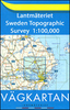
 Sweden
 USA
USA
 Italy
Italy
 Spain
Spain
More From Contributor


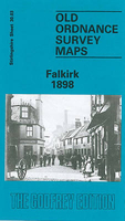
Falkirk 1898
Falkirk in 1898 in a fascinating series of reproductions of old Ordnance Survey plans in the Alan Godfrey Editions, ideal for anyone interested in the history of their neighbourhood or family. Coverage stretches from Kerse Lane and Callendar Road westward to Camelon Main Street, and from Grahamston Iron Works southward to Woodlands and High Station Road. Features include Camelon Iron Works, High Street area, Town Hall, Dalderse Goods Depot, NBR railway line with Grahamston station, mineral railways, swivel bridge, Parkhouse Iron Works, Brockville Park, Arnot Hill, Poorhouse, Woodlands area, part of the Antonine Wall, Forth & Clyde Canal with locks, Rosebank Distillery, Lock Sixteen, Falkirk Cemetery, Bantaskin House, Camelon Colliery Pit No.2, Callendar Iron Works,
Salton Iron Foundry, etc. On the reverse are extracts from a contemporary trade directory. About the Alan Godfrey Editions of the 25” OS Series:Selected towns in Great Britain and Ireland are covered by maps showing the extent of urban development in the last decades of the 19th and early 20th century. The plans have been taken from the Ordnance Survey mapping and reprinted at about 15 inches to one mile (1:4, 340). On the reverse most maps have historical notes and many also include extracts from contemporary directories. Most maps cover about one mile (1.6kms) north/south, one and a half miles (2.4kms) across; adjoining sheets can be combined to provide wider coverage.FOR MORE INFORMATION AND A COMPLETE LIST OF ALL AVAILABLE TITLES PLEASE CLICK ON THE SERIES LINK.
Salton Iron Foundry, etc. On the reverse are extracts from a contemporary trade directory. About the Alan Godfrey Editions of the 25” OS Series:Selected towns in Great Britain and Ireland are covered by maps showing the extent of urban development in the last decades of the 19th and early 20th century. The plans have been taken from the Ordnance Survey mapping and reprinted at about 15 inches to one mile (1:4, 340). On the reverse most maps have historical notes and many also include extracts from contemporary directories. Most maps cover about one mile (1.6kms) north/south, one and a half miles (2.4kms) across; adjoining sheets can be combined to provide wider coverage.FOR MORE INFORMATION AND A COMPLETE LIST OF ALL AVAILABLE TITLES PLEASE CLICK ON THE SERIES LINK.

Product Description
Reviews/Comments
Add New
Intelligent Comparison
Archived Product
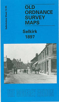
Selkirk 1897 Stanfords
£3.50
Vouchers
No voucher codes found.
Do you know a voucher code for this product or supplier? Add it to Insights for others to use.
Do you know a voucher code for this product or supplier? Add it to Insights for others to use.
 Denmark