More From Contributor

£12.50
Large, double-sided, indexed road map, published in association with the caravanning specialist Promobil, highlighting selected campsites, all listed in a 30-page booklet. A more general road map at 1:3, 000, 000 covers Europe south of Brussels
- Cologne
- Dresden
- Wroclaw, extending east to Budapest & Belgrade, with the whole of the Balkans south of Belgrade & Bucharest, including Greece (NB. campsites shown only on northern Dalmatian coast & in Greece). Surrounding the main map & on its reverse are larger scale insets at 1:1, 000, 000 showing countries & regions: the whole of Germany, Switzerl&, Austria, Hungary, & Slovenia, plus selected parts of France (Brittany, Atlantic coast between Nantes & Cap Breton, Dordogne, & the Mediterranean regions with the Cevennes), Italy (Tuscany, Lake Garda & its environs, & Adriatic coast south to Pescara), Spain (Costa Brava), & Croatia (Istria). Road information varies according to scale. At 1:3, 000, 000 the map shows the motorway networks & main roads. The more detailed maps show more roads, with toll routes & restricted access, with steep roads with gradients & opening months of the mountain passes, etc. Railways indicate car transportation routes. National parks are marked & symbols show a range of places of interest, recreational facilities, etc. There are no geographical coordinates. Map legend

Includes::
English. The map comes with two booklets attached to its cover: a 77-page place names index, plus a 30-page booklet listing all the campsites by location, with, where possible, their website addresses.


...
Archived Product
£13.95
Europe Supertouring Road Atlas from Freytag & Berndt at 1:2, 000, 000 in a handy 16 x 26cm, spiral-bound format, presenting the whole of the Continent, including most of European part of Russia & the whole of Turkey on 55 double-page maps. The atlas shows the network of main & secondary roads, indicating driving distances on many local routes & locations of border crossings. Main railway lines & ferry routes are also shown. Topography is indicated by bold relief shading. Within Russia, Ukraine & Belarus names of main cities are given in both Roman & Cyrillic alphabet. In Greece, Bulgaria & the Middle Eastern section all names are in Roman alphabet only. Map legend

Includes::
English. Extensive 100 page index groups all locations by country

...
Archived Product
£26.95
The most comprehensive road atlas of Europe: A4 hardback, 6 cm or nearly two & a half inches thick (and correspondingly heavy!), with street plans of over 60 cities. All the sections are colour coded for easy access. Multilingual map legends & all the text include English. The opening section of the atlas lists Europe ...
Archived Product
£11.99
Description of 2010 edition: Europe Touring & Motoring Atlas from Michelin in an A3, spiral-bound format, presenting Western & most of Central Europe at 1:1, 000, 000, with adjoining areas at various scales, plus the whole continent at 1:3, 000, 000. Road network is graded according to the number of lanes. Motorway junctions show full or limited interchanges. Driving distances are marked on many secondary routes & primary destinations shown on green signs along major routes are indicated. Scenic routes are highlighted. A range of small symbols mark various places of interest. Topography is shown by relief shading with peak heights & passes, plus colouring for forested areas. The maps have no geographical coordinates. Map legend & all explanatory text include English. The Continent is covered at the following scales: 1:1, 000, 000 for Western & Central Europe, extending to the eastern borders of Germany, Czech Republic, Austria, Croatia, Serbia, Macedonia & Albania. 1:1, 500, 000 for the Scandinavian countries, including Finland & Icel&. 1:500, 000 for the Baltic States (Latvia, Lithuania & Estonia). 1:700, 000 for Pol&, Greece & Cyprus. Coverage of the remaining countries of Eastern Europe (including most of Slovakia & Hungary) is provided only at 1:3, 000, 000, using more simplified presentation of the road network. The atlas also contains: 78 street plans of city centres highlighting main routes & indicating one way streets (only principal streets are named & listed in a small index) or enlargements highlighting road access from the outskirts & main cross-town routes. A chart showing basing driving regulations in each country. Information on climate, main motoring organizations, etc A comprehensive distance table. ...
Archived Product
£11.99
Europe Touring & Motoring Atlas from Michelin in an A4, spiral-bound format, presenting western & most of central Europe at 1:1, 000, 000, with adjoining areas at various scales, plus the whole continent at 1:3, 000, 000. Road network is graded according to the number of lanes. Motorway junctions show full or limited interchanges. Driving distances are marked on many secondary routes & primary destinations shown on green signs along major routes are indicated. Scenic routes are highlighted. A range of small symbols mark various places of interest. Topography is shown by relief shading with peak heights & passes, plus colouring for forested areas. The maps have no geographical coordinates. Map legend & all explanatory text include English. The continent is covered at the following scales: 1:1, 000, 000 for Western & Central Europe, extending to the eastern borders of Germany, Czech Republic, Austria, Croatia, Serbia, Macedonia & Albania. 1:1, 500, 000 for the Scandinavian countries, including Finland & Icel&. 1:500, 000 for the Baltic states (Latvia, Lithuania & Estonia). 1:700, 000 for Pol&, Greece & Cyprus. Coverage of the remaining countries of eastern Europe (including most of Slovakia & Hungary) is provided by a section showing the whole of Europe at 1:3, 000, 000, using more simplified presentation of the road network. The atlas also contains: 78 street plans of city centres highlighting main routes & indicating one way streets (only principal streets are named & listed in a small index) or enlargements highlighting road access from the outskirts & main cross-town routes. A chart showing basing driving regulations in each country. Information on climate, main motoring organizations, etc A comprehensive distance table. Please note: each section in this A4 format of the atlas is clearly colour coded, making it easier to distinguish mapping at different scales. ...
Archived Product
£4.99
Western Europe at 1:2, 000, 000 on a large, indexed, double-sided map from the AA, with cartography by Freytag & Berndt, providing an overview of the network of motorways & main roads. It splits Europe along Liege, Bonn & Dresden height with a narrow repeat. The map covers on one side the British Isles with northern Belgium, Netherlands, northern Germany & most of Scandinavia, with the northern part of Scandinavia shown as an inset. On the reverse the coverage extends eastwards beyond Prague/ Linz/ Ljubljana, with the southern part of Italy, Sicily, Sardinia & Corsica. Administrative & national boundaries are prominently highlighted. Lines of longitude & latitude are marked at 1 ...
Archived Product
£10.99
Western Europe at 1:2, 000, 000 from Freytag & Berndt, with coverage extending from the British Isles to Denmark, the western half of Germany, Switzerland & north-western Italy, with street plans of nine capitals in an index booklet. Relief shading shows the topography & names of many mountain ranges, particularly within the Alpine areas, are indicated. The map shows road & rail network at the level appropriate to its scale, clearly indicating on main routes their road numbers, including where appropriate the E-numbers. Also marked are ferry connections, local airports, & within larger countries internal administrative boundaries. Latitude/longitude grid is drawn at intervals of 1º. Map legend

Includes::
English. The index, arranged by country & for all except GB showing postcodes, is in a separate booklet attached to the map cover. The booklet also

Includes::
street plans of city centres in Amsterdam, Bern, Brussels, Copenhagen, Dublin, Lisbon, London, Luxembourg City & Madrid.


...
Archived Product
£7.50
Wine producing regions of western, central & southern Europe shown on a colourful map from Editions Benoit. A different colour is used for each country to highlight its wine growing regions & a table gives overall production figures. Information is provided only for the regions up the eastern border of Germany & the northern borders of the Czech Republic, Slovakia, Hungary & Romania. Areas outside that line, e.g. the vineyards of southern Ukraine are not included.A base with shading for mountain chains & main towns is overprinted with colours highlighting wine growing areas. Principal wine producing regions are named, although the degree of detail varies from country to country; more, inevitably, in France where regions such as Bordeaux or Burgundy are divided into sectors (Médoc, Graves, Côte de Nuits, Maconnais, etc.), whilst in Italy only names of administrative regions are given, i.e. Tuscany but not Chianti (no colouring within England although Sussex & Essex are designated as wine growing regions). Also included is a table showing various wine production figures both for the counties covered by the map & for the remaining European wine producers. All information is in French. ...
Archived Product
£14.99
Europe in Footprint’s ‘ With Kids’ series; covering a range of guides dedicated to travelling with children in Britain & Europe & incorporating child-friendly days out, activities, places to stay, accommodation & restaurants. Each of the guides in the series provides a comprehensive survey of the region &

Includes::
a large selection of recommendations for parents planning a trip away with their children. Footprint guides have an established reputation, publishing guides since 1921 & have an unrestrictive editorial style that gives authors the freedom to capture & explore the best of each region for children. All of the With Kids guides are arranged geographically by chapter, allowing readers to identify easily areas of interest. A Family Favourites section at the start of individual titles profile must-see attractions that are suitable for the whole family & a Kids’ Stuff section also

Includes::
ideas for beach & travel games, recommended children’s books, lists of things to spot & 10 things to try on holiday. Each regional section opens by describing the destination & giving a sample of the range of attractions & activities that are available. There is also information on accommodation, restaurants, & notable local towns or villages, all included with children in mind & designed to make planning easier for parents. A Grown-ups’ stuff section at the back of each guide also provides practical guidance on getting there, public transport, recommended maps, online resources, recommendations for accommodation based on children’s ages. Details of baby supplies, camping equipment, doctors & medical centres, hospitals, pharmacies, supermarkets, tourist information centres & toys & beach gear are also included.


...
Archived Product
£33.99
Europe Wooden Jigsaw has been handcrafted & cut, then primed & painted in bright child safe non toxic, bright colours. A small work of art in its own right, the jigsaw both entertains & educates, allowing children to appreciate geography by piecing it together with their own hands. The item is presented in an attractive box & supplied with its own natural cotton drawstring bag for transporting the pieces around. Suitable for ages 6 & up. Products meet & exceed required European Toy Safety Standard. ...
Archived Product

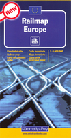
Europe Travellers` Railway Map

A Travellers` Railway Map of Europe from Carto Studio presenting the Continent in a series of six maps and their enlargements, including 12 city maps indicating locations of their main railway stations and a map of the high-speed network.On one side it an overview map of Europe at 1:3, 800, 000, with coverage extending north to Oslo and Stockholm and east to Warsaw/Budapest/Dubrovnik. Railway lines are classified as high-speed, main or secondary, narrow gauge, tourist and rack railways. Each line is shown stations as allowed by the scale of the map. Interesting towns are highlighted and national borders are clearly marked. The map also shows train-ferry and passenger ferry services and locations of international airports. City names are in the language of their country (Warszawa,
Roma, Firenze, etc).Two panels at a reduced scale extend coverage of the main map to the whole of Scandinavia and eastwards to Moscow and Ankara. Enlargements present in greater detail: Central Europe from London to Prague and north/south to Hamburg and Munich; Switzerland with the adjoining regions of the neighbouring countries; plus the Italian Lakes with Milan.Also provided is a map showing Europe’s High Speed network with connecting lines, plus street plans of Barcelona, Berlin, Brussels, Budapest and Dublin, London, Lyon, Milan, Paris, Prague, Rome and Vienna indicating locations of principal railway stations and main tourist sights. Map legend and all the text are in English.
RIP - This product is no longer available on our network. It was last seen on 25.09.2019

This page now acts as a permanent archive for this product. Add more information using the comments box below to ensure it can still be found by future generations.

Use our search facility to see if it is available from an alternative contributor.
  • Availability: Out Of Stock
  • Supplier: Stanfords
  • SKU: 9789077899090
Availability: In Stock
£14.50

Product Description

A Travellers` Railway Map of Europe from Carto Studio presenting the Continent in a series of six maps & their enlargements, including 12 city maps indicating locations of their main railway stations & a map of the high-speed network. On one side it an overview map of Europe at 1:3, 800, 000, with coverage extending north to Oslo & Stockholm & east to Warsaw/ Budapest/ Dubrovnik. Railway lines are classified as high-speed, main or secondary, narrow gauge, tourist & rack railways. Each line is shown stations as allowed by the scale of the map. Interesting towns are highlighted & national borders are clearly marked. The map also shows train-ferry & passenger ferry services & locations of international airports. City names are in the language of their country (Warszawa, Roma, Firenze, etc). Two panels at a reduced scale extend coverage of the main map to the whole of Scandinavia & eastwards to Moscow & Ankara. Enlargements present in greater detail: Central Europe from London to Prague & north/south to Hamburg & Munich; Switzerland with the adjoining regions of the neighbouring countries; plus the Italian Lakes with Milan. Also provided is a map showing Europe’s High Speed network with connecting lines, plus street plans of Barcelona, Berlin, Brussels, Budapest & Dublin, London, Lyon, Milan, Paris, Prague, Rome & Vienna indicating locations of principal railway stations & main tourist sights. Map legend & all the text are in English.

Reviews/Comments

Add New

Price History

Vouchers

No voucher codes found.
Do you know a voucher code for this product or supplier? Add it to Insights for others to use.

Facebook

Jargon Buster

Italian - A word used ot descibe something from Italy
Milan - A city in Italy
switzerland - A landlocked country in western Europe. One of the richest countries in the world
Railways - A set of tracks that have been laid for the purpose of trains to travel up and down them
speed - A measurement of how fast an object travels between two points
Network - A link and communication between things. Often computers or people.
Language - the method of communication used in different areas. Humans and computers have many different languages.
Borders - A line that sometimes can be built up separating off an area, e.g. countries "the welsh boarder"
Language - The way humans communicate either written and spoken.

Supplier Information

Stanfords
Stanfords was established in 1853 and opened their iconic Covent Garden flagship store in 1901. They have become the top retailer of maps, travel books and accessories in the UK and arguably offer the largest selection of maps and travel books worldwide. Famous names such as Captain Robert Falcon Scott, Ranulph Fiennes and Michael Palin have purchased from Stanfords. They now have a shop in Bristol and both stores together with other venues operate a calendar of events including talks, book signings and exhibitions. As a specialist map retailer, the map selection is comprehensive and includes road maps, street maps and walking maps from worldwide destinations, as well as a selection of world atlases and wall maps. Books include travel guides and travel literature. Stanfords also stock globes, from miniatures made of blue marble to magnificent floor-standing globes. The website features a selection of interesting articles on travel topics.
Page Updated: 2023-11-12 20:15:36

Community Generated Product Tags

"a travellers' railway map" (1 person tagged the product this way)
Menu