
 United Kingdom
 France
 Germany
 Netherlands
 Sweden
 USA
USA
 Italy
Italy
 Spain
Spain
More From Contributor


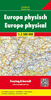


Europe Philip`s Multiscale Road Atlas 2019 A4
PHILIP`S: THE BEST-SELLING EUROPE ROAD ATLAS RANGE IN THE UK `The clearest and most detailed maps of Europe` David Williams MBE, CEO Gem Motoring Assist `The best of its kind with quick, easy-to-use information` Fleet Week Multiscale mapping - more details where you need it Special feature for 2019 `Driving Abroad - a cautionary tale` with dashcam examples Philip`s Multiscale Road Atlas of Europe 2019 has: - Every country in Europe and Western Europe - Practical A4 format and spiral-binding - easy to use in the car - Main scale super-clear 1:750, 000 (12 miles to 1 inch) - 22-page route planning map section with 1, 200 miles to a page - Three supplementary scales from 1:200, 000 to 1:3M - helps navigation in denser areas - 50 town and city plans - 31 urban area maps - Scenic routes
highlighted - Driving regulations country-by-country - Ski resorts feature - Distance chart - Fully indexed In fact, everything you need for your trip to Europe.
highlighted - Driving regulations country-by-country - Ski resorts feature - Distance chart - Fully indexed In fact, everything you need for your trip to Europe.

Product Description
Reviews/Comments
Add New
Vouchers
No voucher codes found.
Do you know a voucher code for this product or supplier? Add it to Insights for others to use.
Do you know a voucher code for this product or supplier? Add it to Insights for others to use.
 Denmark