More From Contributor
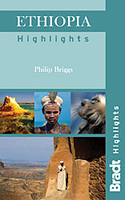
£9.50
Indexed, waterproof & tear-resistant road map Ethiopia with Eritrea, Somalia & Djibouti, providing both topographic & tourist information. The map, published by Reise Know-How as part of their highly acclaimed World Mapping Project, is double-sided to provide the best balance between a good scale & a convenient size sheet. Road & rail networks are easy to see on a clear base which presents topography by altitude colouring with contours, spot heights, mountain passes & names of mountain ranges. Salt pans, swamps, seasonal rivers & lakes, oases, caves, hot springs & coral reefs are indicated. Road network

Includes::
seasonal local tracks, gives driving distances on main roads, & shows locations of fuel supplies & border crossings. Local airfields are also marked. Internal administrative boundaries are shown with names of the provinces. National parks & protected areas are marked & symbols highlight various places of interest, including UNESCO world heritage sites, archaeological remains, churches & monasteries, mosques, viewpoints, beaches, etc. Campsites, particularly within Ethiopia, & locations of wells & water tanks are indicated. The map has a grid with latitude & longitude at intervals of 1

...
Archived Product
£11.50
Ethiopia with Eritrea, Somalia & Djibouti at 1:1, 800, 000 on a light, waterproof & tear-resistant, indexed road map, providing both topographic & tourist information. The map, published by Reise-Know-How as part of their highly acclaimed World Mapping Project, is double-sided, with a generous overlap between the sides, to provide the best balance between a good scale & a convenient size sheet. Road & rail networks are easy to see on a clear base which presents topography by altitude colouring with contours, spot heights, mountain passes & names of mountain ranges. Salt pans, swamps, seasonal rivers & lakes, oases, caves, hot springs & coral reefs are indicated. Road network

Includes::
seasonal local tracks, gives driving distances on main roads, & shows locations of fuel supplies & border crossings. Local airfields are also marked. Internal administrative boundaries are shown with names of the provinces. National parks & protected areas are marked & symbols highlight various places of interest, including UNESCO world heritage sites, archaeological remains, churches & monasteries, mosques, viewpoints, beaches, etc. Campsites, particularly within Ethiopia, & locations of wells & water tanks are indicated. The map has a grid with latitude & longitude at intervals of 1º, & a separate index of localities for each country, plus a list of national parks & reverse. Map legend

Includes::
English.


...
Archived Product
£17.99
Ethiopia
- Travellers` Handbook is a book conceived for the discerning traveller, the package tourist & those people wishing to
...
Archived Product
£59.99
Ethiopia at 1:1, 000, 000 on a set of three large, overlapping maps from the University of Bern, with the colouring indicating various areas of crop cultivation. The map is accompanied by numerous graphs. The map, produced as a joint project between the University of Bern, Soil Conservation Research Programme & the Ethiopian Mapping Authority, has vivid relief shading derived from satellite imagery, plus contours at 200m intervals & spot heights from the country’s topographic survey. Road network is classified as all-weather asphalt or gravel roads, dry-weather roads & motorable tracks, with, overall, more tracks & small settlements shown than on general road maps. The colouring indicates agroecological belts
- areas of cultivation of various crops according to the altitude of the terrain & the prevailing climate. Surrounding the main map are graphs & small maps providing additional information on the overall surface of each belt, length of growing periods, etc. The map carries no tourist information on archaeological sites, national parks & protected areas, etc. Latitude & longitude lines are at 1° intervals.* Map legend & all the text are in English.*
...
Archived Product
£13.59
Ethiopia & Eritrea in the Countries & Regions series from Lonely Planet, market-leading comprehensive guides aimed at independent travellers & serving a large range of international destinations. Frank & informal in style, the guides explore an extensive range of sights, activities, accommodation, restaurants & nightlife & are designed for practical use while travelling on the road. Written & researched by a team of experts, each book is independent in its recommendations & suggestions, often offering individual takes on individual destinations. Widely recognised for their reliability, each Lonely Planet country & region guide has the same layout. Introductory sections profile the destination with individual chapters on particular highlights, getting started, (including when to go) itineraries, history, culture, arts, food & drink & the environment. Each guide is organised geographically by region, with individual sections detailing an extensive range of sights, places of interest, attractions, restaurants, nightlife, accommodation & any local activities. The guides have detailed explanations of historical context where relevant. There is also practical guidance on ...
Archived Product
£55.00
Following on from ” Ethiopia Engraved”, an illustrated book of engraving by foreign travellers from 1681 to 1900, ” Ethiopia Photographed” covers the inception of photography in the country up until the Italian Fascist invasion in 1936. The people, terrain, buildings & rulers of Ethiopia
- such as the Emperor Menelik & the Emperor Haile Selassie
- make it a highly photogenic country, as this illustrated book reveals. Situated in lofty, often inaccessible mountains between the Red Sea & the Blue Nile, & extending far into the Horn of Africa, it is a complex & mysterious country which has always exercised an extraordinary fascination for the outside world. The book begins with an introduction which gives a brief history of Ethiopia in this period, & describes the role of photography in this time. Through the rich captured visuals in ” Ethiopia Photographed”, the reader may pay witness to many personalities & places not previously seen &, in many cases, now lost for all time but for the photographic memories compiled here.

...
Archived Product
£14.95
Map No. L-6A in the TPC series: military topographic survey mapping covering the world's land masses & significant islands at 1:500, 000. The maps are useful as general topographical coverage where nothing else is available, although they are designed primarily as flying charts for military aircraft. TPC stands for Tactical Pilotage Chart. Relief is portrayed by a combination of contours (basic interval 500ft, intermediate contours shown where appropriate), elevation tinting & relief shading, plus spot heights. Towns, villages, major roads, railways & airports are shown but please note that many of the smaller settlements are not named & the road information is not necessarily up to date, as compilation & revision dates vary. Some air navigation information also appears on the map, such as radio beacons & restricted flying zones. Each TPC chart has both UTM & latitude/longitude grids overprinted on it, with additional margin ticks. IMPORTANT
- PLEASE NOTE: The series is gradually being withdrawn from sale to the general public & some sheets may no longer be available when ordered by us. Due to the nature of the map projection assembling these sheets to make a larger map is not recommended. in addition, colours used for relief are not constant throughout the series. In some areas of central Africa & South America the maps have blank spaces, reflecting localized deficiencies or inconsistencies in the survey data.
...
Archived Product
£14.95
Map No. L-6B in the TPC series: military topographic survey mapping covering the world's land masses & significant islands at 1:500, 000. The maps are useful as general topographical coverage where nothing else is available, although they are designed primarily as flying charts for military aircraft. TPC stands for Tactical Pilotage Chart. Relief is portrayed by a combination of contours (basic interval 500ft, intermediate contours shown where appropriate), elevation tinting & relief shading, plus spot heights. Towns, villages, major roads, railways & airports are shown but please note that many of the smaller settlements are not named & the road information is not necessarily up to date, as compilation & revision dates vary. Some air navigation information also appears on the map, such as radio beacons & restricted flying zones. Each TPC chart has both UTM & latitude/longitude grids overprinted on it, with additional margin ticks. IMPORTANT
- PLEASE NOTE: The series is gradually being withdrawn from sale to the general public & some sheets may no longer be available when ordered by us. Due to the nature of the map projection assembling these sheets to make a larger map is not recommended. in addition, colours used for relief are not constant throughout the series. In some areas of central Africa & South America the maps have blank spaces, reflecting localized deficiencies or inconsistencies in the survey data.
...
Archived Product
£30.00
Travel photographer Julie Green first visited Ethiopia in the 1960s. Here, her breathtaking photographs from that period are joined by photographs of Ethiopia today. The result is a stunning panoply of images from across Ethiopia celebrating the beauties of this ancient l&, ranging from the castles & rock churches of the north to remote rural communities of the Omo Valley in the south.” ...
Archived Product
£30.00
Ethiopia stands as a land apart: never colonised, the country celebrates & preserves ancient traditions. The fascinating cuisine is enriched with the different religious influences of Judaism, Christianity & Islam
- a combination unique to Africa. The delicious dishes featured are Doro Wat, chicken slowly stewed with berbere spice, Yeassa Alichia, curried fish stew, & Siga Tibs, flashfried beef cubes, as well as a wealth of vegetarian dishes such as Gomen, minced collard greens with ginger & garlic & Azifa, green lentil salad. Chef Yohanis takes the reader on a journey through all the essential dishes of his native country, including the traditional Injera synonymous with an Ethiopia feast, along the way telling wondrous stories of the local communities & customs. Complete with photography of the country`s stunning landscapes & vibrant artisans, this book demonstrates why Ethiopian food should be considered as one of the world`s greatest, most enchanting cuisines.
...
Archived Product

Ethiopia Highlights

Ethiopia in Bradt’s new Highlights series exploring the country’s most popular places, routes and itineraries as selected by some of the world’s leading travel writers and tour operators. The guide includes the renowned northern historical circuit, the Rift Valley lakes, the citadel of Harar, the Omo Valley, the Afar region and the Simien and Bale National Parks.The guide is designed to present readers with the destination’s main highlights and must-see attractions to help travellers select the best route for an organised tour or plan an independent trip. It provides practical and useful guidance on making the most of their visit and colour photographs features throughout.Individual guides in this series have extensive introductory chapters on the local history, people and
culture; the geography of the region and its natural landscape, including wildlife. Chapters dealing with practicalities include Planning a Trip and life On the Ground, providing comprehensive information on when and where to go, getting there, red tape, health and safety, cultural etiquette etc. The ‘Highlights’ part of the guide focuses on the attractions, sites or experiences that are unique to the region or country. Detailed advice and recommendations from Brandt’s expert authors with a focus on things to see and do are provided, as well as concise listings on accommodation and eating out options.A couple of pages are dedicated to essential vocabulary and a list of recommended reading.
RIP - This product is no longer available on our network. It was last seen on 25.09.2019

This page now acts as a permanent archive for this product. Add more information using the comments box below to ensure it can still be found by future generations.

Use our search facility to see if it is available from an alternative contributor.
  • External links may include paid for promotion
  • Availability: Out Of Stock
  • Supplier: Stanfords
  • SKU: 9781841624341
Availability: In Stock
£15.99

Product Description

Ethiopia in Bradt’s new Highlights series exploring the country’s most popular places, routes & itineraries as selected by some of the world’s leading travel writers & tour operators. The guide

Includes::
the renowned northern historical circuit, the Rift Valley lakes, the citadel of Harar, the Omo Valley, the Afar region & the Simien & Bale National Parks. The guide is designed to present readers with the destination’s main highlights & must-see attractions to help travellers select the best route for an organised tour or plan an independent trip. It provides practical & useful guidance on making the most of their visit & colour photographs features throughout. Individual guides in this series have extensive introductory chapters on the local history, people & culture; the geography of the region & its natural landscape, including wildlife. Chapters dealing with practicalities include Planning a Trip & life On the Ground, providing comprehensive information on when & where to go, getting there, red tape, health & safety, cultural etiquette etc. The ‘ Highlights’ part of the guide focuses on the attractions, sites or experiences that are unique to the region or country. Detailed advice & recommendations from Brandt’s expert authors with a focus on things to see & do are provided, as well as concise listings on accommodation & eating out options.A couple of pages are dedicated to essential vocabulary & a list of recommended reading.

Reviews/Comments

Add New

Intelligent Comparison

Oooops!
We couldn't find anything!
Perhaps this product's unique.... Or perhaps we are still looking for comparisons!
Click to bump this page and we'll hurry up.

Price History

Vouchers

No voucher codes found.
Do you know a voucher code for this product or supplier? Add it to Insights for others to use.

Facebook

Jargon Buster

Red - One of the three primary colours
History - Anything that happens in the past. An acedemic subject.
World - A physical grouping, commonly used to describe earth and everything associated with ti
Colour - The categorised spectrum of light visable to humans
Safety - prevents damage being caused.
Natural - not manmade
Accommodation - A room in which someone can live in, for example in a hotel
Practical - Weather a task is easy to carry out and realistically succeed.
Popular - Something that is admired and liked by many people.
Individual - A single separate item or person.
Vocabulary - The collaboration of words used in a language.

Supplier Information

Stanfords
Stanfords was established in 1853 and opened their iconic Covent Garden flagship store in 1901. They have become the top retailer of maps, travel books and accessories in the UK and arguably offer the largest selection of maps and travel books worldwide. Famous names such as Captain Robert Falcon Scott, Ranulph Fiennes and Michael Palin have purchased from Stanfords. They now have a shop in Bristol and both stores together with other venues operate a calendar of events including talks, book signings and exhibitions. As a specialist map retailer, the map selection is comprehensive and includes road maps, street maps and walking maps from worldwide destinations, as well as a selection of world atlases and wall maps. Books include travel guides and travel literature. Stanfords also stock globes, from miniatures made of blue marble to magnificent floor-standing globes. The website features a selection of interesting articles on travel topics.
Page Updated: 2023-11-12 20:15:36

Community Generated Product Tags

Oh No! The productWIKI community hasn't generated any tags for this product yet!
Menu