More From Contributor

£17.99
Unexplored Equatorial Guinea finally gets a guidebook! This one-time Spanish colony is one of the smallest countries in continental Africa, both in terms of size & population, & is ranked by the United Nations among the ten least visited countries in the world. From the oil rich capital of Malabo on the volcanic island of Bioko, set out to explore the jungle interior via the Spanish colonial outpost of Bata, where you`ll find pristine national parks teeming with wildlife, incredible white sand beaches & a wealth of small, traditional communities. Travel here may not always be straightforward, but the rewards are worth it for such a unique experience in the heart of tropical Africa`s only Spanish speaking nation. This is the only in-depth English language guide to Equatorial Guinea, one of the last truly unexplored corners of sub-Saharan Africa. With first-hand descriptions of all seven provinces (including the islands & the mainland), accommodation, maps & itineraries, plus practical details, guides to security & getting a visa, this is all the information you need whether visiting Bioko on business or trekking Rio Muni in search of gorillas. ...
Archived Product
£8.99
It is the turn of the twentieth century & a British astronomer, Thayer, high on Darwin & other progressive scientists of the age, arrives in Egypt to embark on the project of a lifetime: the excavation of a triangle in the desert, with sides hundreds of miles long, to be filled with petrol & set alight. The purpose: to send out a signal to life on Mars (for which he has evidence) that humans exist. But as work progresses, the huge task force of Egyptian workers is struck by disease & rebellion, & the success of Thayer`s project looks increasingly uncertain. ...
Archived Product
£11.99
This journal features striking gold embellishment combined with the look of an old leather journal that has been lovingly used for at least a century. It is made from paper & thick cardboard & the back cover comes up to wrap itself on the front cover with the help of an invisible magnet, thus protecting the pages inside. It has 144 ruled pages, a memento pouch, & a grey ribbon marker. 13x 18cm. ...
Archived Product
£30.00
No animal has captured the human imagination quite like the horse, depicted in cave drawings thousands of years ago through countless renderings in paint, clay, ink, even film. In his first book, award-winning photographer Tim Flach`s quest to document the horse has resulted in ” Equus”, an intensely moving look at an animal
- as solitary subject & en masse, from the air & from underwater
- whose history is so powerfully linked to our own. From exquisite Arabians in the Royal Yards of the United Arab Emirates to purebred Icelandic horses in their glacial habitat; from the soulful gaze of a single horse`s lash-lined eye to the thundering majesty of thousands of Mustangs racing across the plains of Utah, ” Equus” provides an amazing & unique insight into the physical dynamics & spirit of the horse.

...
Archived Product
£10.00
Er Rachidia
- Central Ziz Valley in a series of GPS compatible maps at 1:160, 000 published by EWP & West Col Productions & covering
...
Archived Product
£11.50
Erding in a series of GPS compatible recreational editions of the Bavarian topographic survey at 1:25, 000, with waymarked hiking trails & cycling routes, campsites & youth hostels, etc. Coverage Isen, Sankt Wolfgang, Forstinning, Lengdorf, Hohenlinden, Forstern. Contours used in this map vary between 5 to 20m according to the terrain, with 20m interval predominantly used for hilly areas. Varied colouring show different types of landscape: woods, vineyards, fields etc. Maps in this series feature extensive overprint highlighting local & long-distance footpaths & cycle routes, including King Ludwig Way or different variants of the Way of St James, indicating their waymarking. Symbols highlight different types of accommodation (campsites, youth hostels, refuges, etc), sport & recreational facilities, various places of interest, etc. The maps have a 1-km UTM grid. Map legend & all the text are in German only. To see other titles in this series please click on the series link. ...
Archived Product
£2.95
Erdington Chester Road in 1913 in a fascinating series of reproductions of old Ordnance Survey plans in the Alan Godfrey Editions, ideal for anyone interested in the history of their neighbourhood or family. Selected towns in Great Britain & Ireland are covered by maps showing the extent of urban development in the last decades of the 19th & early 20th century. In this title: the map covers the northern part of Erdington, stretching from St Agnes Convent & Silver Birch Road northward to Wylde Green Hotel, & eastward to Penns Hall. Features include LNWR railway with Chester Road station, Penns Lane area, Destitute Orphans Home, Audley College, Chester Road area, tramway, mixture of terraced streets & villas in grounds, etc. The map

Includes::
the eastern part of Boldmere around Boldmere Road. On the reverse are directories for Chester Road & for Boldmere. About the Alan Godfrey Editions of the 25

...
Archived Product
£3.50
Erdington East in 1913 in a fascinating series of reproductions of old Ordnance Survey plans in the Alan Godfrey Editions, ideal for anyone interested in the history of their neighbourhood or family. The map covers the eastern part of Erdington, extending eastward to Pype Hayes Hall & southward to Birches Green & Kingsbury Road. Features include a stretch of the Birmingham & Fazeley Canal with Nickel Works, Pype Hayes Hall & grounds, St Thomas & St Edmund`s RC church, skating rink, Moor End Green, Rookery Park, Glenthorne, Birches Green Farm, Moat House, St Ethelreda`s Mission church, tramway along High Street & Sutton Road, etc. On the reverse is a selection of street directory entries, including Arthur Road, Church Road, Kingsbury Road, Mason Road, Orchard Road & Orphanage Road. About the Alan Godfrey Editions of the 25” OS Series: Selected towns in Great Britain & Ireland are covered by maps showing the extent of urban development in the last decades of the 19th & early 20th century. The plans have been taken from the Ordnance Survey mapping & reprinted at about 15 inches to one mile (1:4, 340). On the reverse most maps have historical notes & many also include extracts from contemporary directories. Most maps cover about one mile (1.6kms) north/south, one & a half miles (2.4kms) across; adjoining sheets can be combined to provide wider coverage.FOR MORE INFORMATION & A COMPLETE LIST OF ALL AVAILABLE TITLES PLEASE CLICK ON THE SERIES LINK. ...
Archived Product
£3.50
Erdington West & Stockland Green in 1913 in a fascinating series of reproductions of old Ordnance Survey plans in the Alan Godfrey Editions, ideal for anyone interested in the history of their neighbourhood or family. The map covers the western part of Erdington, stretching Newman Road & Trafalgar Road westward to Upper Witton, & from Gravelly Hill station northward to Station Road & Short Heath Road. Features include the LNWR railway with Gravelly Hill & Erdington stations, tramway along Gravelly Hill North & High Street, Jaffray Hospital, St John`s Home, Six Ways, St Barnabas church, Erdington Reservoir, Birmingham Union Workhouse, Cottage Homes, Stockland Green area, tramway along Slade Road, Brookvale Park, Witton Hall, Hare & Hounds pub, part of Upper Witton Reservoir, etc. On the reverse is a selection of street directory entries, including Fentham Road, George Road, Gravelly Hill, Gravelly Lane, Erdington High Street, Hunton Road, Slade Road, Summer Road & Wood End Road. About the Alan Godfrey Editions of the 25” OS Series: Selected towns in Great Britain & Ireland are covered by maps showing the extent of urban development in the last decades of the 19th & early 20th century. The plans have been taken from the Ordnance Survey mapping & reprinted at about 15 inches to one mile (1:4, 340). On the reverse most maps have historical notes & many also include extracts from contemporary directories. Most maps cover about one mile (1.6kms) north/south, one & a half miles (2.4kms) across; adjoining sheets can be combined to provide wider coverage.FOR MORE INFORMATION & A COMPLETE LIST OF ALL AVAILABLE TITLES PLEASE CLICK ON THE SERIES LINK. ...
Archived Product
£20.00
In September 2014 the wreck of a sailing vessel was discovered at the bottom of the sea in the frozen wastes of the Canadian Arctic. It was broken at the stern & covered in a woolly coat of underwater vegetation. Its whereabouts had been a mystery for over a century & a half. Its name was HMS Erebus. Now Michael Palin – former Monty Python stalwart & television globetrotter – brings this extraordinary ship back to life, following it from its launch in 1826 to the epic voyages of discovery that led to glory in the Antarctic & to ultimate catastrophe in the Arctic. He explores the intertwined careers of the men who shared its journeys: the dashing James Clark Ross & the troubled John Franklin. & he vividly recounts the experiences of the men who first stepped ashore on Antarctica’s Victoria L&, & those who, just a few years later, froze to death one by one in the Arctic wastes as rescue missions desperately tried to reach them. To help tell the story, he has travelled to various locations across the world – Tasmania, the Falklands, the Canadian Arctic – to search for local information, & to experience at first hand the terrain & the conditions that would have confronted the Erebus & her crew. Michael Palin has written & starred in numerous TV programmes & films, from Monty Python & Ripping Yarns to The Missionary & American Friends. He has also made several much-acclaimed travel documentaries, his journeys taking him to the North & South Poles, the Sahara Desert, the Himalayas, Eastern Europe & Brazil. His books include accounts of his journeys, novels (Hemingway’s Chair & The Truth) & several volumes of diaries. From 2009 to 2012 he was president of the Royal Geographical Society, & in 2013 he was made a BAFTA fellow. In 2018 he was awarded the Edward Stanford Travel Writing Award for Outstanding Contribution to Travel Writing. He lives in London. ...
Archived Product

Erd And Environs

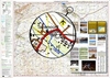
Erd and the surroundings settlements in a series of street plans of Hungary’s main towns from Cartographia in Budapest. The plans cover the whole town with its outer suburbs and, where appropriate, have an enlargement for the central area. All the plans have a street index.Map legend varies; in plans of larger towns or popular tourist destinations it usually includes English.Many plans also include additional features: insets with plans of larger satellite developments or villages, lists of sights and/or various municipal offices and facilities, etc. Some titles include on the reverse a road map of the town’s environs or the administrative province.
RIP - This product is no longer available on our network. It was last seen on 25.09.2019

This page now acts as a permanent archive for this product. Add more information using the comments box below to ensure it can still be found by future generations.

Use our search facility to see if it is available from an alternative contributor.
  • External links may include paid for promotion
  • Availability: Out Of Stock
  • Supplier: Stanfords
  • SKU: 9789633526835
Availability: In Stock
£4.99

Product Description

Erd & the surroundings settlements in a series of street plans of Hungary’s main towns from Cartographia in Budapest. The plans cover the whole town with its outer suburbs &, where appropriate, have an enlargement for the central area. All the plans have a street index. Map legend varies; in plans of larger towns or popular tourist destinations it usually

Includes::
English. Many plans also include additional

Features:
insets with plans of larger satellite developments or villages, lists of sights and/or various municipal offices & facilities, etc. Some titles include on the reverse a road map of the town’s environs or the administrative province.

Reviews/Comments

Add New

Intelligent Comparison

Oooops!
We couldn't find anything!
Perhaps this product's unique.... Or perhaps we are still looking for comparisons!
Click to bump this page and we'll hurry up.

Price History

Vouchers

No voucher codes found.
Do you know a voucher code for this product or supplier? Add it to Insights for others to use.

Facebook

Jargon Buster

Road - a manmade lane or a path that is used to speed up travel.
Popular - Something that is admired and liked by many people.

Supplier Information

Stanfords
Stanfords was established in 1853 and opened their iconic Covent Garden flagship store in 1901. They have become the top retailer of maps, travel books and accessories in the UK and arguably offer the largest selection of maps and travel books worldwide. Famous names such as Captain Robert Falcon Scott, Ranulph Fiennes and Michael Palin have purchased from Stanfords. They now have a shop in Bristol and both stores together with other venues operate a calendar of events including talks, book signings and exhibitions. As a specialist map retailer, the map selection is comprehensive and includes road maps, street maps and walking maps from worldwide destinations, as well as a selection of world atlases and wall maps. Books include travel guides and travel literature. Stanfords also stock globes, from miniatures made of blue marble to magnificent floor-standing globes. The website features a selection of interesting articles on travel topics.
Page Updated: 2023-11-12 20:15:36

Community Generated Product Tags

Oh No! The productWIKI community hasn't generated any tags for this product yet!
Menu