More From Contributor

£15.99
Enns Cycle Route, a 264-km long cycle trail along the river from its source to the Danube, presented by the Verlag Esterbauer in a guide with maps at 1:50, 000 showing the route & its variants. Extensive information is conveyed by symbols, indicating road surface, campsites & other accommodation, repair workshops, recreational facilities, places of interest, etc. A list of various types of accommodation facilities is included.IMPORTANT
- PLEASE NOTE BEFORE ORDERING:ALL THE TEXT IN THIS TITLE IS GERMAN ONLYMAP LEGEND

Includes::
ENGLISH (please see our sample image) & the information provided on the maps is sufficient to use this title without any knowledge of German.ABOUT THE BIKELINE SERIES: all the titles have been meticulously researched & are highly regarded in their native Germany. Most titles, as indicated in their individual descriptions, also include a separate section listing selected accommodation, from hotels to campsites, youth hostels & rooms in private houses, all with addresses, telephone numbers & price range. Information on towns along each route

Includes::
a list of places of interest, with opening hours, etc. Several of the guides also have street plans. To see the list of other titles in the Bikeline series please click on the series link.


...
Archived Product
£11.99
Ennstaler Alpen
- Gesause area of the Alps in a combined hiking & ski edition at 1:25, 000 from a series of detailed, GPS compatible
...
Archived Product
£17.99
The 1:50, 000 topographic map gives a more general picture of the ground features than a basic map. It shows settlements, houses, roads, cultivated areas, waterways, cutting areas, mires, rock exposures, & relief. One map sheet covers an area of 30 x 40 km & one centimetre corresponds to 500 metres on the ground. The 1:50, 000 topographic map is also an ideal complement to nautical charts as it provides useful information about the land areas adjacent to waterways. For example, all Finnish sea areas are covered by 1:50, 000 topographic map sheets. ...
Archived Product
£17.99
The 1:50 000 topographic map gives a more general picture of the ground features than a basic map. It shows settlements, houses, roads, cultivated areas, waterways, cutting areas, mires, rock exposures, & relief. One map sheet covers an area of 30 x 40 km & one centimetre corresponds to 500 metres on the ground. The 1:50, 000 topographic map is also an ideal complement to nautical charts as it provides useful information about the land areas adjacent to waterways. For example, all Finnish sea areas are covered by 1:50 000 topographic map sheets. ...
Archived Product
£12.99
The Republic of Irel&, which declared itself in 1949, allowed the Catholic Church to dominate its civil society & education system. Investment by American & European companies, & a welcoming tax regime, created the ' Celtic Tiger' of the 1990s. That brief burst of good fortune was destroyed by a corrupt political class which encouraged a wild property boom, leaving the country almost bankrupt. What Ireland needs now is a programme of real change. It needs to become a fully modern republic in fact as well as name. This disastrous economic collapse also allows us to think through the kind of multiculturalism that Ireland needs, & to build institutions that can accommodate the sudden influx of migrants who have come to Ireland in the past 15 years. The State should take over the entire education system, for which it pays already, & make it fit for the 21st century. The political system is dysfunctional & is one of the main causes of the debacle we have just experienced. Ireland needs constitutional reform. Politicians have been let get away with murder, & there is a fatalistic sense that nothing can change. The country needs to encourage participation in, & oversight & knowledge of politics, to make people feel that they have a right to challenge the old party machines & to make a difference. It is their country, after all. ...
Archived Product
£10.99
We’ve never had more information or more opportunity to debate the issues of the day. Yet the relationship between politicians, the media & the public is characterised by suspicion, mistrust & apathy. What has gone wrong? Enough Said reveals how political, social & technological change has transformed our political landscape – & how we talk about the issues that affect us all. Political rhetoric has become stale & the mistrust of politicians has made voters flock to populists who promise authenticity, honesty & truth instead of spin, evasiveness & lies. Featuring Ronald Reagan & Sarah Palin, Tony Blair & George Osborne, Silvio Berlusconi & many more star performers, Enough Said shows how public language is losing its power, & how an ominous gap is opening between the governed & those who govern. The result of decades of first-hand experience of politics & media, this is an essential, brilliant diagnosis of what we should stop doing & what we should start doing in order to reinvigorate Western democracy. ...
Archived Product
£17.99
Kadaster, Holland`s national survey organization, produces one of the most attractive topographic surveys in Europe. The maps are very colourful, with their characteristic patchwork of polders & an unusually large amount of land use information: meadows, arable l&, different types of forest, marshes, sand dunes, etc. Contours are shown at 5-metre intervals with numerous spot heights &, with such a large part of the country below the sea level, ”spot depths”. Each map covers an area of Approx. 25 x 20 km / 15 x 12 miles, with some sheets slightly larger. The maps have a 1-km Dutch national grid, plus latitude & longitude at intervals of 1`. Map legend

Includes::
English.IMPORTANT
- PLEASE NOTE BEFORE ORDERING: both the west (W) & the east (O) sheet of each number has the same name, although the town after which the two maps are named appears only on one of the sheets. For example: maps 41W & 41O are both called Arnhem, although the city of Arnhem appears only on sheet 40W, etc. To see the list of titles available in this series please click on the series link.


...
Archived Product
£17.99
Topographic mapping from Mexico’s national survey agency, Instituto Nacional de Estadística, Geografía e Informática. The maps have contours at 20m intervals with relief shading & indicate various types of terrain & vegetation, e.g. dense vegetation, cultivated areas, swamps, sand dunes, salt pans, etc. UTM grid is at 10km intervals, with latitude & longitude shown by margin ticks at intervals of 5`. Map legend is in Spanish only. To see the other titles in this series please click on the series link. ...
Archived Product
£5.99
Ensenada & Northern Baja in the Moon Spotlight guide series; covering a range of specific local cities, districts, areas & regions in North, Central & South America & targeted at those seeking to travel to a specific area within a country. Each of the guides has been extracted in full from the relevant country Moon Handbook & individual titles focus on a particular city, region or notable area of the destination. Many of the guides in the series are unique in their coverage, although are limited in putting the destination into its wider geographical context that a more comprehensive guide would provide. Stylistically, Moon ...
Archived Product

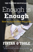
Enough Is Enough

The Republic of Ireland, which declared itself in 1949, allowed the Catholic Church to dominate its civil society and education system. Investment by American and European companies, and a welcoming tax regime, created the `Celtic Tiger` of the 1990s. That brief burst of good fortune was destroyed by a corrupt political class which encouraged a wild property boom, leaving the country almost bankrupt. What Ireland needs now is a programme of real change. It needs to become a fully modern republic in fact as well as name. Politicians have been let get away with murder, and there is a fatalistic sense that nothing can change. The country needs to encourage participation in, and oversight and knowledge of politics, to make people feel that they have a right to challenge the old party
machines and to make a difference. It is their country, after all.
RIP - This product is no longer available on our network. It was last seen on 25.09.2019

This page now acts as a permanent archive for this product. Add more information using the comments box below to ensure it can still be found by future generations.

Use our search facility to see if it is available from an alternative contributor.
  • Availability: Out Of Stock
  • Supplier: Stanfords
  • SKU: 9780571270095
Availability: In Stock
£8.99

Product Description

The Republic of Irel&, which declared itself in 1949, allowed the Catholic Church to dominate its civil society & education system. Investment by American & European companies, & a welcoming tax regime, created the ` Celtic Tiger` of the 1990s. That brief burst of good fortune was destroyed by a corrupt political class which encouraged a wild property boom, leaving the country almost bankrupt. What Ireland needs now is a programme of real change. It needs to become a fully modern republic in fact as well as name. Politicians have been let get away with murder, & there is a fatalistic sense that nothing can change. The country needs to encourage participation in, & oversight & knowledge of politics, to make people feel that they have a right to challenge the old party machines & to make a difference. It is their country, after all.

Reviews/Comments

Add New

Intelligent Comparison

Oooops!
We couldn't find anything!
Perhaps this product's unique.... Or perhaps we are still looking for comparisons!
Click to bump this page and we'll hurry up.

Price History

Vouchers

No voucher codes found.
Do you know a voucher code for this product or supplier? Add it to Insights for others to use.

Facebook

Jargon Buster

Education - A term used to describe the act of learning a new skill or information

Supplier Information

Stanfords
Stanfords was established in 1853 and opened their iconic Covent Garden flagship store in 1901. They have become the top retailer of maps, travel books and accessories in the UK and arguably offer the largest selection of maps and travel books worldwide. Famous names such as Captain Robert Falcon Scott, Ranulph Fiennes and Michael Palin have purchased from Stanfords. They now have a shop in Bristol and both stores together with other venues operate a calendar of events including talks, book signings and exhibitions. As a specialist map retailer, the map selection is comprehensive and includes road maps, street maps and walking maps from worldwide destinations, as well as a selection of world atlases and wall maps. Books include travel guides and travel literature. Stanfords also stock globes, from miniatures made of blue marble to magnificent floor-standing globes. The website features a selection of interesting articles on travel topics.
Page Updated: 2023-11-12 20:15:36

Community Generated Product Tags

Oh No! The productWIKI community hasn't generated any tags for this product yet!
Menu