More From Contributor

£24.99
This title features striking, unique aerial photography of the largest truly-deserted expanses of land on Earth. Aerial photographer George Steinmetz, shooting from a motorized paraglider, has created an unparalleled portrait of Rub`al-Khali, or `the Empty Quarter`, one of the largest
- & harshest
- sand deserts in the world. Although only a fraction of the size of its giant neighbour, the Sahara, the Empty Quarter`s punishing terrain has rarely been captured on film & never from such a striking perspective. Old maps, satellite images & a dose of Arabic hospitality enabled Steinmetz to venture where few had ever been before, revealing through his photographs a true wilderness, without a single permanent human habitation or known point of water & preserved by its harsh climate & extreme remoteness, as well as a fascinating tradition of a hardy people living at its edges. For experienced travellers or explorers who have heard of Rub`al-Khali, entering the heart of the Arabian Desert is truly the ultimate experience.

...
Archived Product
£13.95
A 379km long cycle route along the Ems, with additional 100kms along the Dortmund
- Ems canal. Detailed maps show the route &
...
Archived Product
£17.50
Ems Cycle Route, a 380-km long route from the source of the Ems to the North Sea, presented by Verlag Esterbauer in a German language guide with maps at 1:50, 000 showing the route & its variants including an alternative starting point in Dortmund reaching the Ems along the Dortmund – Ems Canal. Extensive information is conveyed by symbols, indicating road surface, campsites & other accommodation, repair workshops, recreational facilities, places of interest, etc. A list of various types of accommodation facilities is included. NB. This section of the Baltic Coast Route is also covered in the Bikeline series by an English language guide “ Iron Curtain Cycle Route Part 2: Usedom to the German/ Czech Border” with mapping at 1:85, 000.IMPORTANT
- PLEASE NOTE BEFORE ORDERING
- ALL THE TEXT IN THIS TITLE IS GERMAN ONLY. MAP LEGEND

Includes::
ENGLISH (please see our sample image) & the information provided on the maps is sufficient to use this title without any knowledge of German.ABOUT THE BIKELINE SERIES: all the titles have been meticulously researched & are highly regarded in their native Germany. Most titles, as indicated in their individual descriptions, also include a separate section listing selected accommodation, from hotels to campsites, youth hostels & rooms in private houses, all with addresses, telephone numbers & price range. Information on towns along each route

Includes::
a list of places of interest, with opening hours, etc. Several of the guides also have street plans. To see the list of other titles in the Bikeline series please click on the series link.


...
Archived Product
£10.99
East Frisia on a waterproof, tear-resistant, GPS compatible cycling map at 1:75, 000 from the ADFC (Allgemeiner Deutscher Fahrrad-Club
-
...
Archived Product
£13.99
Emsland Cycle Tour, a 297km cycle route between Papenburg & Rheine presented by the Verlag Esterbauer in guide with maps at 1:50, 000 showing the route & its variants. Extensive information is conveyed by symbols, indicating road surface, campsites & other accommodation, repair workshops, recreational facilities, places of interest, etc. A list of various types of accommodation facilities is included.IMPORTANT
- PLEASE NOTE BEFORE ORDERING
- ALL THE TEXT IN THIS TITLE IS GERMAN ONLY. MAP LEGEND

Includes::
ENGLISH (please see our sample image) & the information provided on the maps is sufficient to use this title without any knowledge of German.ABOUT THE BIKELINE SERIES: all the titles have been meticulously researched & are highly regarded in their native Germany. Most titles, as indicated in their individual descriptions, also include a separate section listing selected accommodation, from hotels to campsites, youth hostels & rooms in private houses, all with addresses, telephone numbers & price range. Information on towns along each route

Includes::
a list of places of interest, with opening hours, etc. Several of the guides also have street plans. To see the list of other titles in the Bikeline series please click on the series link.


...
Archived Product
£11.95
Following on from the success of the bestselling colouring books Secret Garden & Enchanted Forest by Johanna Basford, this set of notecards enables you to share some inky magic & will suit a variety of occasions. There are 12 notecards with 12 different designs for you or the lucky recipient to colour in. Each card is left blank inside for your message, & comes with an illustrated envelope. ...
Archived Product
£8.95
This book

Includes::
20 detachable postcards to decorate, colour in & send to your friends. That`s if you

...
Archived Product
£9.95
This stunning colouring book by Johanna Basford takes readers on a inky quest through an enchanted forest to discover what ...
Archived Product
£2.99
From deserts to rainforests, coral reefs to mountains, the empty Outback to the busy cities, mainland Australia, the world`s largest isl&, is a land of fascinating contrasts. Facts about Australia contain many superlatives: there are an estimated 27, 700 plant species, including living fossils such as the cycad palm, & brilliant wildflowers, such as the waratah, Sturt`s desert pea & kangaroo paws; & more than 80 per cent of the 378 mammal species, 828 bird species, 4, 000 fish species, 442 species of lizard, snake & crocodile, & 50 types of marine mammal are unique to Australia. Perfect for nature-lovers, the country also offers fantastic opportunities for sporting enthusiasts from diving to surfing, hiking to climbing. The great outdoors is a perfect description of this vibrant country. For relaxation, apart from the glorious beaches, there is also a wealth of wine, food & culture to be sampled. Australia has more than 60 designated wine regions & has developed a worldwide reputation for its award-winning wines. Among its many home-grown products, there are local cheeses & olive oils direct from the producers & there`s a range of dining options from world-class restaurants to Outback barbecues. Enchanting Australia describes & illustrates the spectacular natural world, the bustling cities & the adventurous pursuits just waiting to be explored. ...
Archived Product
£2.99
Though one of the smallest islands of the Indonesian archipelago, Bali has miles of world-famous beaches, perfect for sunbathers & surfers alike. But Bali also has extraordinary inland attractions, including picturesque rice terraces, the towering Kintamani volcano, the holy forest with its wild monkeys & the romantically sited water temple of Ulun Danu. The island has a rich cultural heritage with over 20, 000 temples & numerous colourful festivals & ceremonies. A drive through the small country roads will take you through many artisan villages specialising in stone & wood carving; jewellery making & ikat weaving. Bali is also an ideal destination for families with its many child-friendly attractions, such as rafting, cycling, elephant rides & the Bali Bird Park. ...
Archived Product

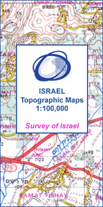
En Yahav

One of the titles in a series of maps from the Israeli Survey, in Hebrew - with some Roman alphabet equivalents, providing coverage of the whole of the West Bank and the Gaza Strip (pre-1967 boundaries are not shown). Most sheets were revised in the late 1990s - early 2000s, and although the areas of Palestinian Autonomy or shared responsibility are indicated, the political information and the effect of barrier on the road network may not necessarily be up to date.Relief is shown by contours at 25m intervals (20m on some sheets) and spot heights, with various types of terrain and land-use indicated by colours and symbols e.g. cliffs, sand, mudflats, orchards, olive groves, scrub, forest, nature reserves. Hydrographic information includes wadis, springs and wells. The maps show
various grades of roads, tracks and paths, as well as the country’s rail, indicating standard or narrow gauge lines. Symbols mark archaeological sites, ruins, synagogues and other places of worship, etc. The Israeli grid is shown at 1km intervals, with latitude and longitude given for the sheet corners. Map legend is in Hebrew and English. Some of the place names in Hebrew are printed in very small letters.
RIP - This product is no longer available on our network. It was last seen on 25.09.2019

This page now acts as a permanent archive for this product. Add more information using the comments box below to ensure it can still be found by future generations.

Use our search facility to see if it is available from an alternative contributor.
  • Availability: Out Of Stock
  • Supplier: Stanfords
  • SKU: XL00000025895
Availability: In Stock
£17.99

Product Description

One of the titles in a series of maps from the Israeli Survey, in Hebrew
- with some Roman alphabet equivalents, providing coverage of the whole of the West Bank & the Gaza Strip (pre-1967 boundaries are not shown). Most sheets were revised in the late 1990s
- early 2000s, & although the areas of Palestinian Autonomy or shared responsibility are indicated, the political information & the effect of barrier on the road network may not necessarily be up to date. Relief is shown by contours at 25m intervals (20m on some sheets) & spot heights, with various types of terrain & l&-use indicated by colours & symbols e.g. cliffs, s&, mudflats, orchards, olive groves, scrub, forest, nature reserves. Hydrographic information

Includes::
wadis, springs & wells. The maps show various grades of roads, tracks & paths, as well as the country’s rail, indicating standard or narrow gauge lines. Symbols mark archaeological sites, ruins, synagogues & other places of worship, etc. The Israeli grid is shown at 1km intervals, with latitude & longitude given for the sheet corners. Map legend is in Hebrew & English. Some of the place names in Hebrew are printed in very small letters.

Reviews/Comments

Add New

Intelligent Comparison

Oooops!
We couldn't find anything!
Perhaps this product's unique.... Or perhaps we are still looking for comparisons!
Click to bump this page and we'll hurry up.

Price History

Vouchers

No voucher codes found.
Do you know a voucher code for this product or supplier? Add it to Insights for others to use.

Facebook

Jargon Buster

Forest - A area with a high density of trees
Date - A day on a calendar
Date - A social activity whith a current or potential partner
Network - A link and communication between things. Often computers or people.
Small - something that takes up less space than normal.
Road - a manmade lane or a path that is used to speed up travel.

Supplier Information

Stanfords
Stanfords was established in 1853 and opened their iconic Covent Garden flagship store in 1901. They have become the top retailer of maps, travel books and accessories in the UK and arguably offer the largest selection of maps and travel books worldwide. Famous names such as Captain Robert Falcon Scott, Ranulph Fiennes and Michael Palin have purchased from Stanfords. They now have a shop in Bristol and both stores together with other venues operate a calendar of events including talks, book signings and exhibitions. As a specialist map retailer, the map selection is comprehensive and includes road maps, street maps and walking maps from worldwide destinations, as well as a selection of world atlases and wall maps. Books include travel guides and travel literature. Stanfords also stock globes, from miniatures made of blue marble to magnificent floor-standing globes. The website features a selection of interesting articles on travel topics.
Page Updated: 2023-11-12 20:15:36

Community Generated Product Tags

Oh No! The productWIKI community hasn't generated any tags for this product yet!
Menu