-
Home
-
Contributors
-
International
-
Account
-
Information
More From Contributor
Includes:: notes on the development of Ordnance Survey & the various series produced by them. For those interested in maps & cartography in general, the Cassini series also provides a fascinating insight into how Ordnance Survey cartographic style has developed over a period of over 100 years. Coverage in this title
Includes:: present day Downham Market, March, Chatteris, Wisbech St Mary, Murrow, Emneth, Stowbridge, St John’s Fen End, Narborough, Marham, Watlington, Shouldham, Oxborough, Fincham, Outwell, Upwell, Friday Bridge, Guyhirn, Westry, Nordelph, Christchurch, Welney, Hilgay, Stoke Ferry, Northwold, Southery, Methwold, Feltwell, Hockwold cum Wilton, Lakenheath, Beck Row, Mildenhall, Isleham, Littleport, Wimblington, Little Downham, Coveney, Witchford, Mepal, Sutton, Haddenham Stretham & Earith, with the Bedford Level (South Level).* PLEASE NOTE: Stanfords can also print on request mapping from all four series *centring the map on a location of your choice.* For more information please click on the link below. ...
Includes:: notes on the development of Ordnance Survey & the various series produced by them. For those interested in maps & cartography in general, the Cassini series also provides a fascinating insight into how Ordnance Survey cartographic style has developed over a period of over 100 years. Coverage in this title
Includes:: present day Downham Market, March, Chatteris, Wisbech St Mary, Murrow, Emneth, Stowbridge, St John ...
Includes:: notes on the development of Ordnance Survey & the various series produced by them. For those interested in maps & cartography in general, the Cassini series also provides a fascinating insight into how Ordnance Survey cartographic style has developed over a period of over 100 years. Coverage in this title
Includes:: present day Downham Market, March, Chatteris, Wisbech St Mary, Murrow, Emneth, Stowbridge, St John’s Fen End, Narborough, Marham, Watlington, Shouldham, Oxborough, Fincham, Outwell, Upwell, Friday Bridge, Guyhirn, Westry, Nordelph, Christchurch, Welney, Hilgay, Stoke Ferry, Northwold, Southery, Methwold, Feltwell, Hockwold cum Wilton, Lakenheath, Beck Row, Mildenhall, Isleham, Littleport, Wimblington, Little Downham, Coveney, Witchford, Mepal, Sutton, Haddenham Stretham & Earith, with the Bedford Level (South Level).* PLEASE NOTE: Stanfords can also print on request mapping from all four series *centring the map on a location of your choice.* For more information please click on the link below. ...
Includes:: notes on the development of Ordnance Survey & the various series produced by them. For those interested in maps & cartography in general, the Cassini series also provides a fascinating insight into how Ordnance Survey cartographic style has developed over a period of over 100 years. Coverage in this title
Includes:: present day Downham Market, March, Chatteris, Wisbech St Mary, Murrow, Emneth, Stowbridge, St John’s Fen End, Narborough, Marham, Watlington, Shouldham, Oxborough, Fincham, Outwell, Upwell, Friday Bridge, Guyhirn, Westry, Nordelph, Christchurch, Welney, Hilgay, Stoke Ferry, Northwold, Southery, Methwold, Feltwell, Hockwold cum Wilton, Lakenheath, Beck Row, Mildenhall, Isleham, Littleport, Wimblington, Little Downham, Coveney, Witchford, Mepal, Sutton, Haddenham Stretham & Earith, with the Bedford Level (South Level).* PLEASE NOTE: Stanfords can also print on request mapping from all four series *centring the map on a location of your choice.* For more information please click on the link below. ...
Includes:: a code for downloading after purchase its digital version onto your smartphone or tablet for viewing on the OS smartphone app.OS LANDRANGER SERIES: to see the list of all the titles in the OS Landranger series, both paper & waterproof versions, please click on the series link. Maps in the Landranger series provide plenty of recreational & tourist information, indicating the traditional public right of way paths (except in Scotland where different laws apply), including bridleways & byways restricted or open to motorized traffic. National Trails & selected other long-distance paths are marked, as well as on-road & traffic-free cycle routes with their National/ Regional Cycle Network numbers. National Trust/ National Trust for Scotland & Forestry Commission land is clearly marked, indicating open or restricted access. A range of symbols highlights camping & caravanning sites, youth hostels, tourist information offices & visitors’ centres, parking & picnicking places, World Heritage sites, sport & recreational facilities, etc. The maps provide detailed presentation of topography with contours at 10m intervals, numerous spot heights & additional colouring and/or graphics for different types of woodlands, orchards or parkl&, rock features including scree & cliffs, water features inland & along the sea shore with marshl&, dunes, s&, mud, shingle & the high water mark. All the standard information expected of survey mapping at this scale is included: finely graded road network, railway lines with stations, cuttings, embankments, etc; individual isolated buildings; archaeological & historical sites, etc. For GPS users the British National Grid is shown at 1km intervals, with latitude & longitude given by margin ticks at 1` & cross hairs on the map at 5`. Each map covers an area of 40 x 40km, (approx. 25 x 25 miles). ...
Includes:: a code for downloading after purchase its digital version onto your smartphone or tablet for viewing on the OS smartphone app.OS LANDRANGER SERIES: to see the list of all the titles in the OS Landranger series, both paper & waterproof versions, please click on the series link. Maps in the Landranger series provide plenty of recreational & tourist information, indicating the traditional public right of way paths (except in Scotland where different laws apply), including bridleways & byways restricted or open to motorized traffic. National Trails & selected other long-distance paths are marked, as well as on-road & traffic-free cycle routes with their National/ Regional Cycle Network numbers. National Trust/ National Trust for Scotland & Forestry Commission land is clearly marked, indicating open or restricted access. A range of symbols highlights camping & caravanning sites, youth hostels, tourist information offices & visitors’ centres, parking & picnicking places, World Heritage sites, sport & recreational facilities, etc. The maps provide detailed presentation of topography with contours at 10m intervals, numerous spot heights & additional colouring and/or graphics for different types of woodlands, orchards or parkl&, rock features including scree & cliffs, water features inland & along the sea shore with marshl&, dunes, s&, mud, shingle & the high water mark. All the standard information expected of survey mapping at this scale is included: finely graded road network, railway lines with stations, cuttings, embankments, etc; individual isolated buildings; archaeological & historical sites, etc. For GPS users the British National Grid is shown at 1km intervals, with latitude & longitude given by margin ticks at 1` & cross hairs on the map at 5`. Each map covers an area of 40 x 40km, (approx. 25 x 25 miles). ...
- 150mm x 150mm. Stanfords is an official distributor of Maritime Progress safety signs. We are able to ...
- 150mm x 150mm. Stanfords is an official distributor of Maritime Progress safety signs. We are able to ...

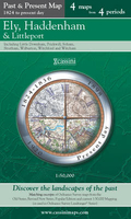
Ely, Haddenham And Littleport Past And Present
of the present-day Landranger extract shown in the fourth panel.* Old Series: the first detailed survey mapping dating from the first half of the 19th century, in black and white and with relief shown by hachuring.* Revised New Series from 1880s/1900s, with some colouring and a mixture of hachuring and contour lines.* Popular Edition from the inter-war years, with contour lines and colouring to indicate woodlands, parks, etc.In this title the three panels present the mapping from 1836, 1899-1901 and 1920. National Grid lines are shown on all four panels for easy comparison across the four time periods. Historical notes, details of the original maps used and web-links for local history societies and other sources of information are also provided. *PLEASE NOTE:** Reproductions from
the Ordnance Survey’s historical series are also available as maps of a wider area, with each title corresponding in its coverage to a present day Landranger map. Please see Great Britain: Cassini Historical Reproductions of Ordnance Survey One-Inch Maps series.* Stanfords can also print on request mapping from all the series *centring the map on a location of your choice.* For more information please click on the link below.
This page now acts as a permanent archive for this product. Add more information using the comments box below to ensure it can still be found by future generations.
Use our search facility to see if it is available from an alternative contributor.
- Availability: Out Of Stock
- Supplier: Stanfords
- SKU: 9781847361073
Product Description
Ely, Haddenham & Littleport in the Cassini Past & Present map series which covers town & cities of England & Wales & offers a unique way of tracing their history & expansion by showing four different periods of their development using Ordnance Survey mapping from the mid-19th century, the late 19th century, the 1920s & the present day. Coverage
Includes:: Little Downham, Prickwill, Soham, Stretham, Wilburton, Witchford & Witcham. Each Past & Present map consists of four panels, all centred on a city or a town & covering exactly the same 15km x 15km area. Three of the panels reproduce Ordnance Survey’s historical editions: the Old Series, the Revised New Series & the Popular Edition, enlarged from their original inch-to-the-mile to match the 1:50, 000 scale of the present-day Landranger extract shown in the fourth panel.* Old Series: the first detailed survey mapping dating from the first half of the 19th century, in black & white & with relief shown by hachuring.* Revised New Series from 1880s/1900s, with some colouring & a mixture of hachuring & contour lines.* Popular Edition from the inter-war years, with contour lines & colouring to indicate woodlands, parks, etc. In this title the three panels present the mapping from 1836, 1899-1901 & 1920. National Grid lines are shown on all four panels for easy comparison across the four time periods. Historical notes, details of the original maps used & web-links for local history societies & other sources of information are also provided. *PLEASE NOTE:** Reproductions from the Ordnance Survey’s historical series are also available as maps of a wider area, with each title corresponding in its coverage to a present day Landranger map. Please see Great Britain: Cassini Historical Reproductions of Ordnance Survey One-Inch Maps series.* Stanfords can also print on request mapping from all the series *centring the map on a location of your choice.* For more information please click on the link below.
Reviews/Comments
Add New
Intelligent Comparison
Price History
Vouchers
Do you know a voucher code for this product or supplier? Add it to Insights for others to use.


 United Kingdom
 France
 Germany
 Netherlands
 Sweden
 USA
USA
 Italy
Italy
 Spain
Spain


 Denmark