More From Contributor

£10.99
Ecuador on a large map at 1:800, 000 from Freytag & Berndt with bold relief shading & colouring providing good representation of the country’s topography. A large inset shows the Galapagos at the same scale. In addition to the relief shading, graphics show salt marshes, swamps & deserts, with spot heights & names of various mountain ranges, etc. Where appropriate, peak names indicate active volcanoes. National parks & other protected areas are prominently highlighted. Road network

Includes::
selected local tracks, shows locations of fuel supplies & border crossings, & gives driving distances on main routes. The course of the Pan American Highway is prominently highlighted as a tourist route. Railway lines are included & domestic airports are marked. The map also shows internal administrative boundaries with names of the provinces, as well as oil wells & pipelines. Various places of interest are prominently highlighted by icons. Latitude & longitude lines are drawn at intervals of 1°. The index is on the reverse. Multilingual legend

Includes::
English.A large inset covers the Galapagos at 1:800, 000, clearly showing the island’s volcanic structures, naming various bays, canals, etc., & highlighting places of interest, etc. Place names, especially on the map of mainland Ecuador, are shown in larger print size than usually found on similar maps.


...
Archived Product
£11.99
Seasoned travelers Julian Smith & Jean Brown lead travelers to unique, off-the-beaten-path adventures in Ecuador, from riding the train through the steep switchbacks of the famous Nariz del Diablo (Devil's Nose) to enjoying some of the best diving in the world off of the Galpagos Islands. Smith & Brown include several trip strategies that cater to the diverse interests of travelers, such as a Culture & History Tour & Outdoor Adventure Tour. Complete with information on exploring the colonial architecture of Quito's Old Town & climbing volcanoes in Sangay National Park, Moon Ecuador gives travelers the tools they need to create a more personal & memorable experience. ...
Archived Product
£7.99
With spectacular colonial architecture, dramatic landscapes & unique wildlife Ecuador is one of the most popular tourist destinations in South America. However rising activism & controversy over the impact of oil companies in the Jungle mean that this is a nation with an uncertain future. About this series: Given the turbulent history of many Central American & Latin American countries, travellers need as much information as they can get in order make the most of a visit. These illustrated titles offer up-to-date coverage of the main historical, economic, political, social & the environmental issues affecting a country. Published by the Latin America Bureau, an independent research group working to broaden public understanding of issues of human rights & social & economic justice in Latin America & the Caribbean. ...
Archived Product
£9.99
Ecuador at 1:660, 000 an indexed, double-sided map from ITMB printed on light, waterproof & tear-resistant synthetic paper. The map has altitude coluring to show the topography, plus street plans of Quito & Guayaquil, & an enlargement of the Quito region with Otavalo & several of the country’s volcanoes including Cotopaxi & Cayambe. The map is double-sided, dividing the country north/south with a good overlap between the sides. Relief is shown by altitude tinting & spot heights for peaks & volcanoes. Glaciers, swamp areas, national parks & reserves are marked. Road information indicates paved & unpaved secondary roads &

Includes::
season roads & selected tracks. Intermediate driving distances shown on main routes & locations of petrol stations are marked. Railway lines are included; local airports & in more remote areas landing strips are marked. The map also shows internal administrative boundaries with names of the provinces. Symbols highlight various places of interest including active/inactive volcanoes, thermal springs, national parks & nature reserves, bird watching sites, beaches, diving sites, etc. Latitude & longitude lines are drawn at 1° intervals. Each side has a separate index. Two insets provide clear street plans of Quito’s most visited areas: the Old Town & the Mariscal district. Both show public transport routes & various places of interest & facilities. A small, more basic street plan shows Guayaquil. Also provided is an enlargement of the Quito region extending north to Otavalo & Ibarra, & south to Latacunga. The region’s national parks & its active volcanoes, including Cotopaxi & Cayambe are highlighted.

...
Archived Product
£21.99
Including Amazonian rainforests, Andean peaks, coastal lowlands, & the Galapagos Islands, Ecuador`s geography is notably diverse. So too are its history, culture, & politics, all of which are examined from many different perspectives in ” The Ecuador Reader”. This rich anthology covers the years prior to the arrival of the Spanish in the early 1500s to the present, addressing colonialism, independence, the nation`s integration into the world economy, & its tumultuous twentieth century. Interspersed among forty-eight written selections are more than three dozen images. The voices & creations of Ecuadorian politicians, writers, artists, scholars, activists, & journalists fill the Reader, from Velasco Ibarra, the nation`s ultimate populist & five-time President, to Pancho Jaime, a political satirist; from Julio Jaramillo, a popular twentieth-century singer to anonymous indigenous women artists who produced ceramics in the 1500s; from the poems of Afro-Ecuadorians, to the fiction of vanguardist Pablo Palacio, to a recipe for traditional Quiteno-style shrimp. The Reader

Includes::
an interview with Nina Pacari, the first indigenous woman elected to Ecuador`s national assembly, & a reflection on how to balance tourism with the protection of the Galapagos Islands` magnificent ecosystem. Complementing selections by Ecuadorians, many never before published in English, are samples of some of the best writing on Ecuador by outsiders, including an account of how an indigenous group with non-Inca origins came to see themselves as definitively Incan, an exploration of the fascination with the Andes from the 1700s to the present, chronicles of the less-than-exemplary behaviour of U.S. corporations in Ecuador, an examination of Ecuadorians` overseas migration, & a look at the controversy surrounding the selection of the first black Miss Ecuador.

...
Archived Product
£16.99
Topographic survey of Sweden at 1:50, 000, the Terrängkartan, from the Lantmäteriet, covering most of the country in 244 double-sided maps. Please note: the mountainous regions of central & northern Sweden are not covered by this series but presented in a separate “ Fjällkartan
- Mountain Map” series also listed on our website. Each 1:50, 000 topographic survey map covers an area of 37.5 x 40km. The maps have contours at 5 metre intervals, plus relief shading & graphics for rocky outcrops & boulders. Further graphics and/or colouring show different types of land use or vegetation (forests, arable l&, orchards, marshes, peat bogs, etc). An unusual feature of this survey is the colouring indicating buildings below or above two storeys high & “leisure/holiday homes”. The maps indicate privately maintained roads & include all other information expected of topographic survey at this scale. The maps have a 1-km UTM grid, plus latitude & longitude lines 5’ intervals. Map legend

Includes::
English. For coverage of the country’s most visited hiking areas in central & northern Sweden please see Lantmäteriet’s Mountain Map series, listed separately on our website.


...
Archived Product
£13.99
This map of Ed Amal Kopmannebro in 1:50, 000 is part of a series of topographic maps from Norstedts Kartforlaget which


...
Archived Product
£8.99
In 1962, when Walter Cousins sleeps with his British au pair, Diane Burroughs, he can have no sense of the magnitude of his error: this brief affair sets in motion a tragedy of epic proportions, upending Sophocles`s immortal tale of fate, free will, & forbidden desire. At the centre is Ed King, an infant given up for adoption who becomes one of the world`s most powerful men. But beneath the gripping story of Ed`s seemingly inexorable rise to fame & fortune is a dark & unsettling destiny, one that approaches with ever-increasing suspense as the novel reaches its shattering conclusion. ...
Archived Product
£16.99
Sverigeserien is an outdoor map series consisting of 116 sheets with coverage of southern & central Sweden & the northern coastline. The map is suitable for outdoor activities such as hiking, excursions, trail running, hunting, fishing, riding, cycling, mountain biking, paddling, skating & much more. Every sheet covers an area of 45x 68km. These topographical maps in scale 1:50 000 contain all the information needed for outdoor activities: Terrain information, hiking trails, illuminated tracks, camping, shelters, golf courses, leisure baths, historical remains, roads in different categories, railway lines & much more. Easy to read topography with contour lines, vertical interval 5 m. Sverigeserien is a high-quality map series & is durable for frequent use! Updated content with map data from Lantmäteriet (National Land Survey of Sweden) & printed on Polyart which is water & tear resistant. This means that the map can be folded repeatedly without breaking & can withstand the challenging weather in Sweden during both winter & summer. Legend is in Swedish, English & German. ...
Archived Product
£7.99
In the world of surfing there are legends, & then there`s Eddie Aikau. In 1970s Hawaii, a decade before bumper stickers & T-shirts bearing the phrase ` Eddie would go` began popping up throughout the surfing world. Eddie Aikau was proving what it meant to be a `waterman`. As a fearless & gifted surfer, he rode the biggest waves in the world; as the first & most famous Waimea Bay lifeguard on the North Shore, he saved hundreds of lives from its treacherous waters; & as a proud Hawaiian, he was at the forefront of the renaissance of Polynesian culture. ` Eddie would go`, they said, & he did, whatever the weather, whatever the danger. For ten years he was the king of big wave surfing. Then in 1978, with his personal life in turmoil, Eddie joined the Hokule`a expedition, an attempt to recreate the ancient oceanic voyages between Hawaii & Tahiti. The journey was to go horribly wrong. Hours after the expedition left Hawaii, the fragile canoe ran into trouble. The crew were in mortal danger. To save his friends, Eddie was to make the ultimate sacrifice. ...
Archived Product

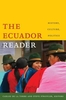
Ecuador: A Climbing Guide

Ecuador is about as perfect a climbing destination as any in the world. Besides having two climbing seasons - June to August and December to February - Ecuador offers an established local climbing community, plenty of equipment shops and available supplies, easy physical access to its peaks, and a relatively low-cost and hassle-free climbing experience. For climbers seeking ideal, high-altitude practice after learning to snow and ice climb in the Rockies and Alps, this is the place. This is a straightforward guide to twenty of the country`s major peaks, including the volcanic Big 10. Well-illustrated, this guide also provides you with advice on preparations, local transportation, supplies, climbing resources, and health tips. Covers routes on twenty mountains, half of them more
than 5, 000 meters (16, 405 feet), illustrated with 25 photographs, 17 maps, and 24 topos, includes background on Ecuador`s history and geology.
RIP - This product is no longer available on our network. It was last seen on 25.09.2019

This page now acts as a permanent archive for this product. Add more information using the comments box below to ensure it can still be found by future generations.

Use our search facility to see if it is available from an alternative contributor.
  • Availability: Out Of Stock
  • Supplier: Stanfords
  • SKU: 9780898867299
Availability: In Stock
£12.99

Product Description

Ecuador is about as perfect a climbing destination as any in the world. Besides having two climbing seasons
- June to August & December to February
- Ecuador offers an established local climbing community, plenty of equipment shops & available supplies, easy physical access to its peaks, & a relatively low-cost & hassle-free climbing experience. For climbers seeking ideal, high-altitude practice after learning to snow & ice climb in the Rockies & Alps, this is the place. This is a straightforward guide to twenty of the country`s major peaks, including the volcanic Big 10. Well-illustrated, this guide also provides you with advice on preparations, local transportation, supplies, climbing resources, & health tips. Covers routes on twenty mountains, half of them more than 5, 000 meters (16, 405 feet), illustrated with 25 photographs, 17 maps, & 24 topos,

Includes::
background on Ecuador`s history & geology.

Reviews/Comments

Add New

Intelligent Comparison

Oooops!
We couldn't find anything!
Perhaps this product's unique.... Or perhaps we are still looking for comparisons!
Click to bump this page and we'll hurry up.

Price History

Vouchers

No voucher codes found.
Do you know a voucher code for this product or supplier? Add it to Insights for others to use.

Facebook

Jargon Buster

Ecuador - A country in South America next to the Pacific Ocean
Ice - Frozen water, the solid state of water.
August - The third season of the year after summer, before winter.
Physical - Used to describe strength or visual properties of an item
History - Anything that happens in the past. An acedemic subject.
World - A physical grouping, commonly used to describe earth and everything associated with ti
Ice - Frozen water, Ice is cold to the touch and forms when water reaches 0 degrees centigrade.
Learning - Educating and growing in intelligence.
Equipment - A product or good that is tactile.
Snow - Water and vapour in clouds that falls in a white crystal form leaving a white layer.
Altitude - Something that can be quite high in relation to sea or ground level.
Experience - To gain further knowledge by practising.
Ideal - Something that satisfies a perfect criteria.

Supplier Information

Stanfords
Stanfords was established in 1853 and opened their iconic Covent Garden flagship store in 1901. They have become the top retailer of maps, travel books and accessories in the UK and arguably offer the largest selection of maps and travel books worldwide. Famous names such as Captain Robert Falcon Scott, Ranulph Fiennes and Michael Palin have purchased from Stanfords. They now have a shop in Bristol and both stores together with other venues operate a calendar of events including talks, book signings and exhibitions. As a specialist map retailer, the map selection is comprehensive and includes road maps, street maps and walking maps from worldwide destinations, as well as a selection of world atlases and wall maps. Books include travel guides and travel literature. Stanfords also stock globes, from miniatures made of blue marble to magnificent floor-standing globes. The website features a selection of interesting articles on travel topics.
Page Updated: 2023-11-12 20:15:36

Community Generated Product Tags

Oh No! The productWIKI community hasn't generated any tags for this product yet!
Menu