More From Contributor
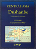
£14.99
Durness, Cape Wrath, Kinlochbervie & Rhiconich area on a detailed topographic & GPS compatible map No. 446, waterproof version, from the Ordnance Survey’s 1:25, 000 Explorer series.MOBILE DOWNLOADS: this title & all the other OS Explorer maps include a code for downloading after purchase the digital version onto your smartphone or tablet for viewing on the OS smartphone app.OS EXPLORER SERIES: to see the list of all the titles in the OS Explorer series, both paper & waterproof versions, please click on the series link. The Explorer series, Ordnance Survey’s most detailed maps recommended for anyone enjoying outdoor activities, provides topographic coverage of Great Britain at 1:25, 000 on GPS compatible maps with hiking trails, cycling routes & extensive tourist information. Each printed map is available either on paper or as a waterproof & tear-resistant OS Active Map, as indicated in its title. Britain’s National Parks & other areas of particular tourist interest are presented on often double-sided OL (Outdoor Leisure) maps, whilst most standard format Explorers cover an area of 30 x 20km (approx. 19 x 12 miles). All three versions (paper, waterproof & digital) are the same & provide plenty of recreational & tourist information, indicating the traditional public right of way paths (except in Scotland where different laws apply), including bridleways & byways. National Trails & other long-distance paths are marked, as well as permissive footpaths or bridleways & on-road or traffic-free cycle routes with, where appropriate, their National/ Regional Cycle Network numbers. Boundaries of access land are clearly marked. A wide range of symbols provides additional tourist information, highlighting camping & caravanning sites, information offices & visitors’ centres, parking & picnicking places, country pubs, sport & recreational facilities including cycle hire locations & mountain biking trails, historic buildings & museums, etc. Exceptionally clear presentation of the landscape is provided by contours at 5m or in the uplands at 10m intervals, with additional spot heights plus colouring and/or graphics for different types of woodlands, orchards, heath, marshl&, scree or boulders, & other topographic features. For GPS users the maps have British National Grid lines at 1km intervals, with latitude & longitude given by margin ticks at 1`. Clearly laid out map legend

Includes::
French & German translations for the tourist information symbols.

...
Archived Product
£8.99
Durness, Cape Wrath, Kinlochbervie & Rhiconich area on a detailed topographic & GPS compatible map No. 446, paper version, from the Ordnance Survey’s 1:25, 000 Explorer series. MOBILE DOWNLOADS: this title & all the other OS Explorer maps include a code for downloading after purchase the digital version onto your smartphone or tablet for viewing on the OS smartphone app.OS EXPLORER SERIES: to see the list of all the titles in the OS Explorer series, both paper & waterproof versions, please click on the series link. The Explorer series, Ordnance Survey’s most detailed maps recommended for anyone enjoying outdoor activities, provides topographic coverage of Great Britain at 1:25, 000 on GPS compatible maps with hiking trails, cycling routes & extensive tourist information. Each printed map is available either on paper or as a waterproof & tear-resistant OS Active Map, as indicated in its title. Britain’s National Parks & other areas of particular tourist interest are presented on often double-sided OL (Outdoor Leisure) maps, whilst most standard format Explorers cover an area of 30 x 20km (approx. 19 x 12 miles). All three versions (paper, waterproof & digital) are the same & provide plenty of recreational & tourist information, indicating the traditional public right of way paths (except in Scotland where different laws apply), including bridleways & byways. National Trails & other long-distance paths are marked, as well as permissive footpaths or bridleways & on-road or traffic-free cycle routes with, where appropriate, their National/ Regional Cycle Network numbers. Boundaries of access land are clearly marked. A wide range of symbols provides additional tourist information, highlighting camping & caravanning sites, information offices & visitors’ centres, parking & picnicking places, country pubs, sport & recreational facilities including cycle hire locations & mountain biking trails, historic buildings & museums, etc. Exceptionally clear presentation of the landscape is provided by contours at 5m or in the uplands at 10m intervals, with additional spot heights plus colouring and/or graphics for different types of woodlands, orchards, heath, marshl&, scree or boulders, & other topographic features. For GPS users the maps have British National Grid lines at 1km intervals, with latitude & longitude given by margin ticks at 1`. Clearly laid out map legend

Includes::
French & German translations for the tourist information symbols.

...
Archived Product
£11.19
Laminated waterproof edition of a detailed topographic map of Durness & Cape Wrath from the Ordnance Survey Explorer series, covering Kinlochbervie & Rhiconich. Edition A1; Publication date December 2007 About this series: These highly detailed maps show all the administrative boundaries, settlements as small as isolated farms, the road network down to unfenced roads & country tracks, & field boundaries (hedges & drystone walls) which make navigation across the countryside much easier. Steep gradients on roads are indicated. Various landmarks, e.g. powerlines, archaeological sites, windmills, churches & lighthouses are shown & additional graphics indicate natural terrain features such as cliffs, scree, mud & vegetation variations. The contour interval is 5 metres in the lower parts of the country & 10 metres in the uplands, & spot heights are marked. Each map covers an area of 30 x 20km (i.e. approx. 19 x 12 miles), with some double-sided maps covering more, as indicated in the individual descriptions. The maps are fully GPS compatible, with the National Grid shown at 1km intervals & latitude & longitude indicated by margin ticks at 1'. The Explorer series has replaced the earlier, green-cover Pathfinder maps. The Explorer series is now complete & covers all of Engl&, Wales & Scotl&. Some sheets for popular areas like the National Parks are still branded as Outdoor Leisure (OL) maps, but are now included in this series as the cartography is the same as that in the Explorer Maps. The Explorer maps offer a substantial improvement on the Pathfinder series, with greater use of colour, larger area per map, & stronger emphasis on information for ramblers & tourists. This series is ideal for walking & other outdoor pursuits & each map shows a large amount of information for ramblers & tourists. Public rights of way are shown (except in Scotland), together with other routes with public access: National Trails & Recreational Paths, permitted paths & bridleways, & selected cycle routes. Open access land created under the Countryside & Rights of Way Act 2000 is marked. Tourist information

Includes::
caravan & camp sites, Park & Ride locations, recreation/leisure/sport centres, museums, historic buildings, English Heritage & National Trust sites, rural pubs, etc. The map legend is in English only, except for the tourist information content which is also in French & German.

...
Archived Product
£9.99
Durrësi Prefecture at 1:85, 000 in a series of handy size, waterproof & tear-resistant, contoured & GPS compatible road maps from the Tirana-based publishers Vektor. Landscape is presented by altitude colouring & contours lines at 100m intervals, with spot heights & a few more names of topographic features than found on Vektor’s 200K road maps of the country. National parks & nature reserves are prominently highlighted. The prefecture maps appear to show the same small local dirt roads as in the 200K series, but given the increase in scale do so with greater clarity & also provide more detailed GPS coordinates (latitude & longitude lines are drawn at 5’ intervals), useful when travelling across the more remote parts of the country. Railway lines are included & local airports are marked. Symbols highlight campsites, beaches, archaeological & historical sites, caves, etc. The maps also show subdivisions of prefectures & names of the communes, & indicate administrative status of towns. Map legend

Includes::
English. Please note: border crossings are prominently marked but beyond topographic colouring no road or other information is provided outside the country’s borders.

...
Archived Product
£8.50
Dushanbe region at 1:500, 000 in a series of detailed, contoured maps of the mountains of Central Asia derived from the Soviet era topographic survey but with transliterated place names & an English language map legend. Maps in this series provide coverage of the Tien Shan & Pamir Mountains, with the whole of Kyrgyzstan, northern Tajikistan, plus the adjoining regions of Uzbekistan (including Tashkent & Samarkand), southern Kazakhstan (with Almaty) & the Sinkiang Province of China. The maps have contours at 100m intervals, enhanced by altitude colouring & relief shading, with plenty of spot heights & names of various mountain chains, peaks, valleys, etc. Additional colouring and/or graphics indicate glaciers, cliffs, rock boulders, sands, ridges & dunes, mud & salt flats, different types of vegetation, etc. The maps show all the information expected of topographic mapping at this scale, including detailed presentation of local roads & tracks, railways, aerodromes, isolated settlements, national & internal administrative borders, etc. Latitude & longitude grid is drawn at 20’ & 30’ respectively. Map legend is in English. The series was prepared in mid-2000s when all the place names have been transliterated from the original Russian mapping & given, where possible, modern local names for larger towns. Each map provides a guide to the transliteration, as well as English & German glossary for the abbreviations. To see the list of titles in this series please click on the series link. ...
Archived Product
£8.99
Dusseldorf on a topographic map at 1:200, 000 from the Bundesamt für Kartographie und Geodäsie, Germany’s federal mapping agency. The map covers an area of Approx. 100 x 90km. This map is belongs to a series of 58 topographic maps from Bundesamt für Kartographie und Geodäsie, the federal cartographic agency of Germany responsible for topographic mapping at 1:200, 000 & maps at smaller scales (the more detailed topographic & leisure maps are prepared & published by the survey organizations of the individual states). Cartography is from the 200K topographic survey & the maps have very elegant, modern look whilst retaining the traditional German presentation of names of smaller towns & villages in italics. Contours are at 12, 5m intervals, enhanced by relief shading, with colouring for woodlands, moors, marches, vineyards & hop plantations. Waterways & rivers are also described in detail, with currents, waterfalls, dams, & jetties clearly marked. Road network, graded into five types, highlights in colour national & regional roads; no driving distances are marked Railway network is also shown in detail, with stations, goods only lines, etc. The maps show administrative boundaries of states & counties, & have a UTM grid plus margin ticks for latitude & longitude at 2’ intervals. Map legend is in German only. PLEASE NOTE: maps in this series provide an excellent presentation of the areas covered by them, with plenty of place names & detailed representation of the road network, & will appeal to anyone who likes quality cartography, but they are not necessarily the best option for holiday & business travel. To see other titles in this series please click on the series link. ...
Archived Product
£8.99
Falk, one of Germany`s leading publishers of street plans, produce their town plans in two different formats. Falk Extra plans are folded in a standard way, where the whole map can be opened to view the entire area it covers. For larger cities, the same mapping is also published with a special folding system designed to show only a small section of the map at one time. The whole map can be opened but it will be cut in several places. Many find these street plans very user-friendly & easier to handle than conventional maps. The plans, which cover towns with their outer suburbs, indicate main landmarks & public buildings & show all the public transport facilities, one way streets & car parks. Plans of lager cities include a separate map of the town centre at a more detailed scale & a diagram of the underground & the suburban rail network. The plans also show the postal divisions & have an extensive street index which, where appropriate, shows individual postal codes for each street. Map legend

Includes::
English. Falk Extra plans also include on the reverse a road map of the surrounding area.

...
Archived Product
£6.50
BKB Verlag’s guide to Dusseldorf is especially designed for business & short trips, aiming to show you the best of the city in just 3 days. Pocket-sized & printed with full-colour photos, the guide is organised into 4 sections, one for each day & a final chapter on ‘services’. Each chapter offers a good mix of places to visit, art, culture, pubs, restaurants & shopping, & is arranged like a diary, so that the sights are described in the order of a potential itinerary that maximises your day. Small maps show the recommended routes within the chapters; they are basic, & would be better used as a general overview of the area. The final section consists of over 20 pages of listings & descriptions of cafes, restaurants, local culture, hotels, museums, nightlife, shopping & more. ...
Archived Product
£9.99
Unusual, very attractive street plan of Düsseldorf from Bollmann, offering a bird’s-eye view of the city with every building drawn to scale with full architectural detail, from street arcades to rooftops & inner courtyards. The plan, drawn in 2009, covers central Düsseldorf from the main railway station across the Rhine to the Oberkassel area & is annotated with small icons of various businesses which sponsored its production. On the reverse is a conventional street plan of the city with its outer suburbs, including part of Neuss. Street index, in a separate booklet, covers both plans &

Includes::
brief descriptions of the main monuments & places of interest, plus lists of local facilities & various shops & other businesses. All the text is in German only.

...
Archived Product
£16.99
Kenya, 2007. Odidi Oganda, running for his life, is gunned down in the streets of Nairobi. His sister, Ajany, & their father bring his body back home, to a crumbling colonial house in northern Kenya. But the peace they seek is hard to find: the murder has stirred deeply buried memories of colonial violence, of the killing-sprees of the Mau Mau uprising, & the shocking political assassination of Tom Mboya in 1969. When a young Englishman appears, searching for his missing father, another story, of love, or at least a connection, begins. This is a spellbinding state of the nation novel about Kenya, showing how the violence of the past informs the violence & disorder of the present. Yvonne Adhiambo Owuor`s memorable characters; Ajany`s mother, deranged with grief & past violations, the Trader, embodying the timeless nomadic traders of Sudan, & Odidi himself, who transcended his past, came to success, & then a tragic end, are enchanting. Owuor reveals to us a new Kenya, a Kenya of bloodshed but also of modernity, suffused with a spirit world only half-remembered. This is a country where the characters listen so acutely for what is not said, & for the voices from the distant & recent past. ...
Archived Product

Dushanbe

Dushanbe street plan from the locally based S.U.E. Map Factory providing both coverage of the whole city and a more detailed plan of its centre, plus information on selected hotels and other facilities, all in English.On one side is a street plan showing the whole city at 1:18, 000. On the reverse the city centre is shown in greater detail at 1:7, 000. Both plans indicate by symbols various facilities and institutions, with the city centre plan also highlighting selected hotels and restaurants. The map includes adverts for various hotels, shops, etc. All the information is in English.
RIP - This product is no longer available on our network. It was last seen on 25.09.2019

This page now acts as a permanent archive for this product. Add more information using the comments box below to ensure it can still be found by future generations.

Use our search facility to see if it is available from an alternative contributor.
  • Availability: Out Of Stock
  • Supplier: Stanfords
  • SKU: X000002
Availability: In Stock
£16.95

Product Description

Dushanbe street plan from the locally based S.U.E. Map Factory providing both coverage of the whole city & a more detailed plan of its centre, plus information on selected hotels & other facilities, all in English. On one side is a street plan showing the whole city at 1:18, 000. On the reverse the city centre is shown in greater detail at 1:7, 000. Both plans indicate by symbols various facilities & institutions, with the city centre plan also highlighting selected hotels & restaurants. The map

Includes::
adverts for various hotels, shops, etc. All the information is in English.

Reviews/Comments

Add New

Intelligent Comparison

Oooops!
We couldn't find anything!
Perhaps this product's unique.... Or perhaps we are still looking for comparisons!
Click to bump this page and we'll hurry up.

Price History

Vouchers

No voucher codes found.
Do you know a voucher code for this product or supplier? Add it to Insights for others to use.

Facebook

Jargon Buster

Supplier Information

Stanfords
Stanfords was established in 1853 and opened their iconic Covent Garden flagship store in 1901. They have become the top retailer of maps, travel books and accessories in the UK and arguably offer the largest selection of maps and travel books worldwide. Famous names such as Captain Robert Falcon Scott, Ranulph Fiennes and Michael Palin have purchased from Stanfords. They now have a shop in Bristol and both stores together with other venues operate a calendar of events including talks, book signings and exhibitions. As a specialist map retailer, the map selection is comprehensive and includes road maps, street maps and walking maps from worldwide destinations, as well as a selection of world atlases and wall maps. Books include travel guides and travel literature. Stanfords also stock globes, from miniatures made of blue marble to magnificent floor-standing globes. The website features a selection of interesting articles on travel topics.
Page Updated: 2023-11-12 20:15:36

Community Generated Product Tags

Oh No! The productWIKI community hasn't generated any tags for this product yet!
Menu