
 United Kingdom
 France
 Germany
 Netherlands
 Sweden
 USA
USA
 Italy
Italy
 Spain
Spain
More From Contributor

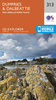


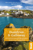
Dumfries & Galloway Walks
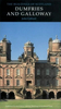
Dumfries and Galloway form the south-west of Scotland, a broad wedge of land jutting out into the Irish Sea between the Solway Firth and the Firth of Clyde. The area is also part of Scotland's border country a peaceful, unspoilt region that possesses a mild climate, a great variety of scenery and a rich historic legacy. The mountains of Dumfries and Galloway offer plenty of remote and challenging walking, with over 40 peaks that exceed 2000 feet. Also featured are clifftop walks around the Mull of Galloway and Rascarrel Bay, a route around the Solway Marshes, and Gretna Green destination for romantic elopements for 200 years.
Product Description
Reviews/Comments
Add New
Vouchers
No voucher codes found.
Do you know a voucher code for this product or supplier? Add it to Insights for others to use.
Do you know a voucher code for this product or supplier? Add it to Insights for others to use.
 Denmark