
 United Kingdom
 France
 Germany
 Netherlands
 Sweden
 USA
USA
 Italy
Italy
 Spain
Spain
More From Contributor


Dubai
Street map of Dubai at 1:15, 000 covering the city from Al Safa Park to the International Airport and from the Al Jaddaf Development to Port Rashid (without the Maritime City). Four insets show the Dubai Coastal Projects at 1:200, 000, the Al Sufouh / Dubai Marina at 1:40, 000, an overview of the Dubai / Abu Dhabi region at 1:970, 000, and a map of the Dubai Light Metro system.Detail includes souks and markets, notable buildings, public buildings, shopping malls, car parks, one-way streets, bus and Light Metro stations, mosques, monuments, museums, theatres, sites of interest, hotels, consulates, post offices, police stations, hospitals. Railways and pedestrian areas and staircases are also indicated alongside land use, e.g. parks, cemeteries, industrial areas,
attractions, etc.The map is indexed for communities, the main streets, and the Dubai Addressing System.
attractions, etc.The map is indexed for communities, the main streets, and the Dubai Addressing System.
Product Description
Reviews/Comments
Add New
Intelligent Comparison
Archived Product
Dubai Stanfords
£4.99
Archived Product
Dubai Stanfords
£8.50
Archived Product
Dubai Stanfords
£11.19
Archived Product
Dubai Stanfords
£6.99
Archived Product
Dubai Stanfords
£4.99
Archived Product
Dubai Stanfords
£9.99
Archived Product
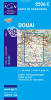
Douai Stanfords
£11.50
Archived Product

Dunai Stanfords
£9.99
Vouchers
No voucher codes found.
Do you know a voucher code for this product or supplier? Add it to Insights for others to use.
Do you know a voucher code for this product or supplier? Add it to Insights for others to use.
 Denmark