
 United Kingdom
 France
 Germany
 Netherlands
 Sweden
 USA
USA
 Italy
Italy
 Spain
Spain
More From Contributor


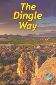
Dingle Way
Dingle Way, a 179-km /111 mile circular trail around the Dingle peninsula in an A5, spiral bound, waterproof guide from Rucksack Readers with contoured mapping at 1:115, 000, detailed route descriptions and general information.The 63-page guide provides both general advice on when to go, in which direction to tackle the route, availability of accommodation, etc, and notes on the area’s history and culture, geology and scenery, habitat and wildlife and the nearby Blasket Islands. Detailed route descriptions, arranged in daily stages, are preceded by a summary of each section of the route giving distance, terrain, grade and availability of food and drink.The route is presented on four maps placed at the end of the guide. The maps provide somewhat generalized presentation of
the topography, with altitude colouring and peaks in the interior of the Dingle Peninsula. Variants of the Dingle Way are marked, as well as a path across the interior linking the coastal stages of the route. The maps also highlight campsites, youth hostels, nature sites, etc. No geographical coordinates for GPS users are provided. The publishers themselves recommend that their guide is used in conjunction with more detailed, contoured and GPS compatible maps from the OSI, the Ordnance Survey of Ireland.For other titles in this series please click on the series link.
the topography, with altitude colouring and peaks in the interior of the Dingle Peninsula. Variants of the Dingle Way are marked, as well as a path across the interior linking the coastal stages of the route. The maps also highlight campsites, youth hostels, nature sites, etc. No geographical coordinates for GPS users are provided. The publishers themselves recommend that their guide is used in conjunction with more detailed, contoured and GPS compatible maps from the OSI, the Ordnance Survey of Ireland.For other titles in this series please click on the series link.

Product Description
Reviews/Comments
Add New
Intelligent Comparison
Archived Product

Dales Way Stanfords
£10.99
Archived Product
Dales Way Stanfords
£12.95
Archived Product
Dales Way Stanfords
£14.95
Archived Product
Dales Way Stanfords
£11.99
Vouchers
No voucher codes found.
Do you know a voucher code for this product or supplier? Add it to Insights for others to use.
Do you know a voucher code for this product or supplier? Add it to Insights for others to use.
 Denmark