More From Contributor
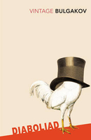
£9.99
Dho, sheet no. 2983-13, in the topographic survey of Nepal at 1:50, 000 published by the Nepali Government in the late 1990s & early 2000s & produced from remote sensing data by Finnish cartographers as part of that country’s international aid program. The maps cover 15’ x 15’ quadrangles.IMPORTANT – PLEASE NOTE BEFORE ORDERING: AVAILABILITY: although, theoretically at least, still in print, these maps are very difficult to get locally in Nepal and/or from various suppliers elsewhere specializing in obtaining such maps. DELIVERIES MAY TAKE SEVERAL WEEKS OR EVEN MONTHS.PROBLEMS WITH PLACE NAMES: reports from previous users indicate that transliteration of place names differs from that used widely not only on other maps & in guide books but also on the ground itself, in road signs & in the tourist & trekking industry in general. Whilst most names are similar enough to be easily recognizable, e.g. Namche Bajar for Namche Bazar or Lantan for Langtang, we have been told of confusion & difficulties arising from different spellings appearing on these maps.TREKKING ROUTES & TOURIST INFORMATION: whilst the maps show foot trails & mark locations of temples, etc, they carry no specific trekking information. Major trekking routes & places of interest are not highlighted. There is no marking for base camps & other tourist facilities. Map specifications: Contours are at 40m intervals, with graphics and/or coloring to show various features of the terrain (glaciers with moraines & crevasses, quarries, gravel or clay pits, etc.) & vegetation (forests, bush, grass, orchards & plantations, etc). Additional comments such as “open mixed forest mainly bajh & pine” annotate many area. The maps have numerous spot heights, but relatively few peaks are named. Areas outside the country’s borders are left blank. Settlements in remote areas are indicated by markings for individual buildings & the placing of names does not always make it clear which group of buildings they refer to. Road network distinguishes between major & minor foot trails. Symbols mark features such as temples, schools & hospitals, police stations, etc. Also shown are the country’s administrative divisions. The maps have a 1-km UTM grid, plus latitude & longitude lines at intervals of 5’. Map legend & all the text is in English. Coverage: the whole country is now covered, with the north at 1:50, 000, plus central & southern Nepal at 1:25, 000. The two series are complementary, do not overlap & use the same grid & numbering system (apart from the Lumbini Zone, where a different grid & numbering are used). For areas not shown on our grid & titles not listed here, please contact us by e-mail, but please do bear in mind the problems with availability & the likely very long delivery time. ...
Archived Product
£6.99
The Dhofar region of southern Oman on a road map at 1:600, 000 from Hupe Verlag with GPS coordinates for 32 locations, plus on the reverse side an enlargement of the region’s coastal area, plus a street map of Salalah. On one side the Dhofar region is shown at 1:600, 000 with coverage extending from the coast to the border with Saudi Arabia. Landscape is shown by altitude colouring with spot heights, wadis & names of main topographic features. Presentation of the road network indicates gravel roads & 4WD tracks, most with driving distances. The map shows various places of interest & locations of oil fields. 32 locations in the region, including viewpoints, oasis, historic buildings as well as camps or restaurants, are cross-reference to a table listing their GPS waypoints. Latitude & longitude lines are drawn at 30’ intervals. On the reverse, the coastal area between Rakhyut & the Tomb of Saleh bin Hud north-east of Sadah is presented in greater detail at 1:305, 000. The reverse side also

Includes::
a street plan of Salalah, showing main roads & naming neighbourhoods & selected smaller streets. The plan indicates locations of hotels, restaurants & various places of interest. All place names are in the Latin alphabet only &, where appropriate including the map legend, in English

...
Archived Product
£17.99
Dhortopatan Hunting Reserve west of the Dhaulagiri Massif presented by Nepa Maps at 1:150, 000. The map covers the region from Beni & the Dhaulagiri peaks westwards to Musikot (Khalanga) & highlights routes across & around the park, including from Dhorpatan to Dunai across the Phalgune Pass or via Hukam. Also marked is a route to the Dhaulagiri Base Camp & other local trails. Contours are at 80 m intervals. The index lists places, peaks, passes & lakes. Margin ticks show latitude & longitude at intervals of 5’. On the inside of the map cover are stage-by-stage distances & timings of the Dhorpatan Circuit & the Banglung to Dunai trek. Titles in this Nepa Maps series have cartography is based on the country’s topographic survey, with contours usually at 40m or 50m intervals, enhanced by relief shading, colouring & graphics to show various features of the terrain, including glaciers, forested or cultivated areas, etc. Numerous peaks, with additional spot heights, plus names of glaciers & mountain ranges are prominently shown. The network of rivers, streams & lakes is shown in great detail, with many smaller rivers & lakes named. Overprint highlights main trekking routes & numerous local trails, with symbols indicating various places of interest & tourist facilities. Most maps are indexed & include additional information such as route profiles, glossaries, etc. All the information is in English & heights are given in metres. To see other titles in this series please click in the series link. ...
Archived Product
£9.99
Upper Langtang Valley, sheet no. 2885-15, in the topographic survey of Nepal at 1:50, 000 published by the Nepali Government in the late 1990s & early 2000s & produced from remote sensing data by Finnish cartographers as part of that country’s international aid program. The maps cover 15’ x 15’ quadrangles.IMPORTANT – PLEASE NOTE BEFORE ORDERING: AVAILABILITY: although, theoretically at least, still in print, these maps are very difficult to get locally in Nepal and/or from various suppliers elsewhere specializing in obtaining such maps. DELIVERIES MAY TAKE SEVERAL WEEKS OR EVEN MONTHS.PROBLEMS WITH PLACE NAMES: reports from previous users indicate that transliteration of place names differs from that used widely not only on other maps & in guide books but also on the ground itself, in road signs & in the tourist & trekking industry in general. Whilst most names are similar enough to be easily recognizable, e.g. Namche Bajar for Namche Bazar or Lantan for Langtang, we have been told of confusion & difficulties arising from different spellings appearing on these maps.TREKKING ROUTES & TOURIST INFORMATION: whilst the maps show foot trails & mark locations of temples, etc, they carry no specific trekking information. Major trekking routes & places of interest are not highlighted. There is no marking for base camps & other tourist facilities. Map specifications: Contours are at 40m intervals, with graphics and/or coloring to show various features of the terrain (glaciers with moraines & crevasses, quarries, gravel or clay pits, etc.) & vegetation (forests, bush, grass, orchards & plantations, etc). Additional comments such as “open mixed forest mainly bajh & pine” annotate many area. The maps have numerous spot heights, but relatively few peaks are named. Areas outside the country’s borders are left blank. Settlements in remote areas are indicated by markings for individual buildings & the placing of names does not always make it clear which group of buildings they refer to. Road network distinguishes between major & minor foot trails. Symbols mark features such as temples, schools & hospitals, police stations, etc. Also shown are the country’s administrative divisions. The maps have a 1-km UTM grid, plus latitude & longitude lines at intervals of 5’. Map legend & all the text is in English. Coverage: the whole country is now covered, with the north at 1:50, 000, plus central & southern Nepal at 1:25, 000. The two series are complementary, do not overlap & use the same grid & numbering system (apart from the Lumbini Zone, where a different grid & numbering are used). For areas not shown on our grid & titles not listed here, please contact us by e-mail, but please do bear in mind the problems with availability & the likely very long delivery time. ...
Archived Product
£5.99
Learn all about the traditions of Dia de los Muertos with this second book in the br&-new board book series Celebrate the World, which highlights special occasions & holidays across the globe. At the end of October each year, it`s time to celebrate an ancient tradition: Dia de los Muertos! With vibrant illustrations by Golden Globe-winning Mexican illustrator Jorge Gutierrez, this festive board book teaches that Dia de los Muertos honors ancestors & loved ones who have passed. From sugar skulls to papel picado, this is a holiday that truly commemorates the cycle of life. ...
Archived Product
£5.50
Primary Evacuation Route – The quickest & easiest way to the assembly/muster station or survival craft Photoluminescent Vinyl
-
...
Archived Product
£7.99
In the South of France, Paul West has a license to thrill. He has just received an offer he can`t refuse: two weeks in the sun, all expenses paid, with a beautiful blonde called Gloria Monday. But it soon becomes obvious that M, as Gloria likes to be known, is not really interested in holidaying with Paul. She has bigger fish to fry. Meanwhile Paul`s best friend Elodie is getting married, & Paul is asked to do the catering. Cooking for the French is a risky assignment at the best of times, but Paul assures Elodie that nothing can go wrong. Or can it? When Paul discovers that M`s real target is France`s biggest fish of all
- the new President
- & that he`s coming to Elodie`s wedding, he realises that the merde is about to hit the fan...

...
Archived Product
£20.00
' This book uncovers the inner workings of one of the most powerful companies in the world: how it came to exert a poisonous, secretive influence on public life in Britain, how it used its huge power to bully, intimidate & cover up, & how its exposure has changed the way we look at our politicians, our police service & our press.' Rupert Murdoch's newspapers had been hacking phones, blagging information & casually destroying people's lives for years, but it was only after a trivial report about Prince William's knee in 2005 that detectives stumbled on a criminal conspiracy. A five-year cover-up then concealed & muddied the truth. Dial M for Murdoch gives the first connected account of the extraordinary lengths to which the Murdochs' News Corporation went to put the problem in a box (in James Murdoch's words), how its efforts to maintain & extend its power were aided by its political & police friends, & how it was finally exposed. The book is full of details which have never been disclosed before in public, including the smears & threats against politicians, journalists & lawyers. It reveals the existence of brave insiders who pointed those pursuing the investigation towards pieces of secret information that cracked open the case. By contrast, many of the main players in the book are unsavoury, but by the end of it you have a clear idea of what they did. Seeing the story whole, as it is presented here for the first time, allows the character of the organisation which it portrays to emerge unmistakeably. You will hardly believe it. ...
Archived Product
£7.99
` Diamonds for everyone.` That`s what fifteen-year-old Patson Moyo hears when his family arrives in the Marange diamond fields, leaving his previous life, school & friends behind with hopes for a better life. Soon Patson is working in the mines along with four friends in the Gwejana Syndicate
- teen diamond miners, secretly pooling their profits & hoping to find the priceless stone that will change everything. But when the government`s soldiers come to Marange, Patson`s world is shattered. Set against the backdrop of President Mugabe`s brutal regime in Zimbabwe, this is the story of a young man who succumbs to greed, but finds his way out through a transformative journey to South Africa in search of his missing sister, in search of freedom, & in search of himself.
...
Archived Product
£7.99
Emily Tempest has been away from the outback for a long time
- uni, travel, dead-end jobs finding trouble all over the world.
...
Archived Product

Diaboliad

The five, irreverent, satirical and imaginative stories contained in ”Diaboliad” caused an uproar upon the book`s first publication in 1925. Full of invention, they display Bulgakov`s breathtaking stylistic range, moving at dizzying speed from grotesque satire to science fiction, from the plainest realism to the most madcap fantasy. ”Diaboliad” is a wonderful introduction to literature`s most uncategorisable and subversive genius.
RIP - This product is no longer available on our network. It was last seen on 25.09.2019

This page now acts as a permanent archive for this product. Add more information using the comments box below to ensure it can still be found by future generations.

Use our search facility to see if it is available from an alternative contributor.
  • External links may include paid for promotion
  • Availability: Out Of Stock
  • Supplier: Stanfords
  • SKU: 9780099529552
Availability: In Stock
£8.99

Product Description

The five, irreverent, satirical & imaginative stories contained in ” Diaboliad” caused an uproar upon the book`s first publication in 1925. Full of invention, they display Bulgakov`s breathtaking stylistic range, moving at dizzying speed from grotesque satire to science fiction, from the plainest realism to the most madcap fantasy. ” Diaboliad” is a wonderful introduction to literature`s most uncategorisable & subversive genius.

Reviews/Comments

Add New

Intelligent Comparison

Oooops!
We couldn't find anything!
Perhaps this product's unique.... Or perhaps we are still looking for comparisons!
Click to bump this page and we'll hurry up.

Price History

Vouchers

No voucher codes found.
Do you know a voucher code for this product or supplier? Add it to Insights for others to use.

Facebook

Jargon Buster

speed - A measurement of how fast an object travels between two points
Wonderful - Another word for describing something that is extremely good, marvellous.

Supplier Information

Stanfords
Stanfords was established in 1853 and opened their iconic Covent Garden flagship store in 1901. They have become the top retailer of maps, travel books and accessories in the UK and arguably offer the largest selection of maps and travel books worldwide. Famous names such as Captain Robert Falcon Scott, Ranulph Fiennes and Michael Palin have purchased from Stanfords. They now have a shop in Bristol and both stores together with other venues operate a calendar of events including talks, book signings and exhibitions. As a specialist map retailer, the map selection is comprehensive and includes road maps, street maps and walking maps from worldwide destinations, as well as a selection of world atlases and wall maps. Books include travel guides and travel literature. Stanfords also stock globes, from miniatures made of blue marble to magnificent floor-standing globes. The website features a selection of interesting articles on travel topics.
Page Updated: 2023-11-12 20:15:36

Community Generated Product Tags

Oh No! The productWIKI community hasn't generated any tags for this product yet!
Menu