
 United Kingdom
 France
 Germany
 Netherlands
 Sweden
 USA
USA
 Italy
Italy
 Spain
Spain
More From Contributor


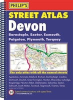
Devon Philip`s Street Atlas
The only atlas with all the named streets in Devon. Updated edition for 2017 with new business parks and estates added. From Philip`s, the UK`s leading publisher of county street atlases. Street maps show car parks, schools, hospitals and many other places of interest. Practical route-planning section showing all A and B roads. BARNSTAPLE, EXETER, EXMOUTH, PAIGNTON, PLYMOUTH, TORQUAY, Appledore, Axminster, Bideford, Brixham, Buckfastleigh, Crediton, Dartmouth, Dawlish, Great Torrington, Honiton, Ilfracombe, Ivybridge, Kingsbridge, Newton Abbot, Okehampton, Salcombe, Seaton, Sidmouth, South Molton, Tavistock, Teignmouth, Tiverton, Totnes This fully updated Philip`s street atlas of Devon gives comprehensive and detailed coverage of the region in a convenient
spiral-bound format. The route planner shows all the A and B roads, and can be used when driving to get close to the destination before turning to the relevant large-scale street map. The street maps show every named road, street and lane very clearly, with major roads picked out in colour. The maps are at a standard scale of 3.5 inches to 1 mile. Exeter and Plymouth city centres are shown at 7 inches to 1 mile.Other information on the maps includes postcode boundaries, car parks, railway and bus stations, post offices, schools, colleges, hospitals, police and fire stations, places of worship, leisure centres, footpaths and bridleways, camping and caravan sites, golf courses, and many other places of interest. The comprehensive index lists street names and postcodes, plus
schools, hospitals, railway stations, shopping centres and other such features picked out in red, with other places of interest shown in blue. Philip`s Street Atlas Devon is suitable for both business and leisure use.

Product Description
Reviews/Comments
Add New
Vouchers
No voucher codes found.
Do you know a voucher code for this product or supplier? Add it to Insights for others to use.
Do you know a voucher code for this product or supplier? Add it to Insights for others to use.
 Denmark