More From Contributor

£11.19
Laminated waterproof edition of a detailed topographic map of Derby from the Ordnance Survey Explorer series, covering Uttoxeter, Ashbourne & Cheadle. Edition A1 with minor changes; Publication date February 2008 About this series: These highly detailed maps show all the administrative boundaries, settlements as small as isolated farms, the road network down to unfenced roads & country tracks, & field boundaries (hedges & drystone walls) which make navigation across the countryside much easier. Steep gradients on roads are indicated. Various landmarks, e.g. powerlines, archaeological sites, windmills, churches & lighthouses are shown & additional graphics indicate natural terrain features such as cliffs, scree, mud & vegetation variations. The contour interval is 5 metres in the lower parts of the country & 10 metres in the uplands, & spot heights are marked. Each map covers an area of 30 x 20km (i.e. approx. 19 x 12 miles), with some double-sided maps covering more, as indicated in the individual descriptions. The maps are fully GPS compatible, with the National Grid shown at 1km intervals & latitude & longitude indicated by margin ticks at 1'. The Explorer series has replaced the earlier, green-cover Pathfinder maps. The Explorer series is now complete & covers all of Engl&, Wales & Scotl&. Some sheets for popular areas like the National Parks are still branded as Outdoor Leisure (OL) maps, but are now included in this series as the cartography is the same as that in the Explorer Maps. The Explorer maps offer a substantial improvement on the Pathfinder series, with greater use of colour, larger area per map, & stronger emphasis on information for ramblers & tourists. This series is ideal for walking & other outdoor pursuits & each map shows a large amount of information for ramblers & tourists. Public rights of way are shown (except in Scotland), together with other routes with public access: National Trails & Recreational Paths, permitted paths & bridleways, & selected cycle routes. Open access land created under the Countryside & Rights of Way Act 2000 is marked. Tourist information

Includes::
caravan & camp sites, Park & Ride locations, recreation/leisure/sport centres, museums, historic buildings, English Heritage & National Trust sites, rural pubs, etc. The map legend is in English only, except for the tourist information content which is also in French & German.

...
Archived Product
£9.99
Derby in the Cassini Past & Present map series which covers town & cities of England & Wales & offers a unique way of tracing their history & expansion by showing four different periods of their development using Ordnance Survey mapping from the mid-19th century, the late 19th century, the 1920s & the present day. Coverage

Includes::
Allestree, Castle Donington, Chaddesden, Little Eaton, Melbourne, Mickleover, Spondon, Repton & Willington. Each Past & Present map consists of four panels, all centred on a city or a town & covering exactly the same 15km x 15km area. Three of the panels reproduce Ordnance Survey’s historical editions: the Old Series, the Revised New Series & the Popular Edition, enlarged from their original inch-to-the-mile to match the 1:50, 000 scale of the present-day Landranger extract shown in the fourth panel.* Old Series: the first detailed survey mapping dating from the first half of the 19th century, in black & white & with relief shown by hachuring.* Revised New Series from 1880s/1900s, with some colouring & a mixture of hachuring & contour lines.* Popular Edition from the inter-war years, with contour lines & colouring to indicate woodlands, parks, etc. In this title the three panels present the mapping from 1836, 1899-1901 & 1920. National Grid lines are shown on all four panels for easy comparison across the four time periods. Historical notes, details of the original maps used & web-links for local history societies & other sources of information are also provided. *PLEASE NOTE:** Reproductions from the Ordnance Survey’s historical series are also available as maps of a wider area, with each title corresponding in its coverage to a present day Landranger map. Please see Great Britain: Cassini Historical Reproductions of Ordnance Survey One-Inch Maps series.* Stanfords can also print on request mapping from all the series *centring the map on a location of your choice.* For more information please click on the link below.

...
Archived Product
£3.50
Derby South in 1899 in a fascinating series of reproductions of old Ordnance Survey plans in the Alan Godfrey Editions, ideal for anyone interested in the history of their neighbourhood or family. The map covers the southern part of Derby, stretching from Macklin Street & East Street southward to Stanhope Street, & from Wood`s Lane eastward to Dickinson Street & Deadman`s Bridge. Features include the Midland Railway with Midland Station, the Locomotive Works, & part of the Carriage & Wagon Works; West Junction, London Road Junction, Masson Works, Gas Works, Derby Canal, Atlas Foundry, Royal Infirmary, tramways, St James church, Midland Hotel, St Andrew`s church, Holy Trinity church, Litchurch Ward, Arboretum, Rose Hill, Temple House, New Normanton Mill, Lead Works, Wilderslowe House, Castlefields Mills, etc. On the reverse are 1891 street directory entries for Abbey Street, London Road, Midland Road, Normanton Road, Osmaston Road, Park Street & Rose Hill Street. About the Alan Godfrey Editions of the 25” OS Series: Selected towns in Great Britain & Ireland are covered by maps showing the extent of urban development in the last decades of the 19th & early 20th century. The plans have been taken from the Ordnance Survey mapping & reprinted at about 15 inches to one mile (1:4, 340). On the reverse most maps have historical notes & many also include extracts from contemporary directories. Most maps cover about one mile (1.6kms) north/south, one & a half miles (2.4kms) across; adjoining sheets can be combined to provide wider coverage.FOR MORE INFORMATION & A COMPLETE LIST OF ALL AVAILABLE TITLES PLEASE CLICK ON THE SERIES LINK. ...
Archived Product
£35.00
This is the essential guide to the architecture of Pevsner`s ”county of contrasts, ” home to an amazingly diverse assortment of landmarks. Among Derbyshire`s many distinguished country houses are Haddon Hall & Hardwick Hall. 17th-century highlights include the adventurous architecture of Bolsover Castle & the Baroque splendors of Chatsworth, while the dazzling Neoclassical interiors of Kedleston Hall are the summit of the county`s many Georgian achievements. Numerous spa towns, pioneering industrial settlements, & parish churches from Anglo-Saxon to modern are also included. The settings range from the Trent valley to the sublime landscape of the Peak District, making Derbyshire one of England`s most visually arresting counties. ...
Archived Product
£5.95
Derbyshire in a series of colourful reproductions of attractive county maps by John Speede from about 1610-1611, printed on thick art paper & ideal for framing. Each title, 58 x 45cm / approx. 23” x 18”, is decorated with additional notes, drawings, coats of arms, street plans, etc. Little drawings are used to show locations of towns, larger villages, hills & woodlands or parks. Rivers & lakes are also drawn, as are boundaries of the administrative subdivisions with the names of the Hundreds. Surrounding the county are decorative panels filled with additional information which differs from title to title: street plans, coats of arms of notable local families, geographical features, notes about local history, etc. ...
Archived Product
£12.00
Tom Windsor`s Derbyshire & Peak District Mountain Bike Guide

Includes::
29 easily accessible, original & legal

...
Archived Product
£2.95
Derbyshire 1610 Replica Map by the Old Map Company is a reproduction of the map created for the famous atlas of the period by the master map maker John Speede Esq. The Old Map Company has recreated the antique maps of British counties, European cities & World countries originally crafted by master map maker John Speede Esq. whose work had accuracy & quality not surpassed for centuries. Each map is treated & presented on specially crafted paper then h&-treated giving it texture & an aged appearance before being beautifully engraved & detailed. ...
Archived Product
£160.00
A Modern Map Of Derbyshire, Drawn From The Latest Surveys.. ., an original antique map by J. Ellis, published in London 1765-1768. A copperplate engraving, original o/l colour. Map size 19.5 x 25 cm, overall mounted size 34.5 x 40.5 cm. An attractive map of the county complete with the major roads. Borough towns are shown with stars identifying the number of members returned to parliament & Places where Fairs are kept have a Line under the Name thus. The county's mines are also delineated. Ellis (d.1796) was a prolific English engraver of the late eighteenth century who joined with William Palmer to produce a set of English county maps, published in Ellis' New English Atlas, in 1765. The maps were later used in Ellis' English Atlas; or a Complete Cartography of England & Wales published in 1766, & reprinted in 1768
- this map comes from the 1768 edition. Ellis engraved some of the maps himself, while others were engraved by Louis de la Rochette, Palmer & W. Fowler. The maps themselves were closely based on Kitchin's maps from Dodsley's England Illustrated. Ellis' atlases were very popular, being often reprinted, as the maps are clearly & distinctively engraved with decorative title cartouches. Antique maps from various original publishers are presented on the Stanford
...
Archived Product
£75.00
Derbyshire, an original antique map by G. Cole / J. Roper published in London, 1810-1843. Copperplate, coloured. Map size 17 x 23 cm, overall mounted size 32.5 x 38.5 cm. This detailed map of Derbyshire is from Dugdale's England & Wales Delineated. The map was drawn by G. Cole & engraved by John Roper for publication first in The Beauties Of England & Wales, issued in parts, from c.1804. Such was the success of the publication that the maps were re-used in other publications, as here. The maps show accurate geographical detail, including the turnpike, mail coach & principal roads, sites of Roman & other historical remains, as well as the seats of the nobility & the gentry, & market towns with their distances from London. The maps also show the division of the counties into hundreds or wapontakes. They are representative of the functional nineteenth-century approach to cartography, yet are not unattractive. Antique maps from various original publishers are presented on the Stanford ...
Archived Product
£15.99
The county of Derbyshire has a great diversity of beautiful landscapes. Photographer Richard Beresford has captured the county`s essence in this collection of stunning images. From timeless villages to heather-clad moors, from the majestic vistas of Kinder Scout to the dramatic gritstone cliffs at Stanage Edge, this book has it covered. For its proud inhabitants, long-term visitors & even casual tourists, Derbyshire in Photographs is a must. Scan through these photographs & you`ll quickly see why this county has such enduring appeal. ...
Archived Product

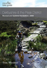
Derbyshire & The Peak District - A Dog Walker`s Guide

On a fine day there is nothing quite so enjoyable for dog owners than getting out into the countryside with their pet for a leisurely walk. Once you get off your home patch, though, it is hard to know where you can walk safely with your dog and which pubs and cafes will welcome you both.Here is a collection of 20 walks, varying in length between 2 and 5.75 miles, in the beautiful countryside of Derbyshire and the Peak District. The Walks have been designed with maximum off-lead time and minimum exposure to roads. There are walks over rolling hills and wide open countryside with wonderful views; through ancient woodland; delightful parkland and beautiful valleys; beside tranquil rivers and impressive reservoirs; and around picturesque villages and historic buildings.
RIP - This product is no longer available on our network. It was last seen on 25.09.2019

This page now acts as a permanent archive for this product. Add more information using the comments box below to ensure it can still be found by future generations.

Use our search facility to see if it is available from an alternative contributor.
  • External links may include paid for promotion
  • Availability: Out Of Stock
  • Supplier: Stanfords
  • SKU: 9781846742897
Availability: In Stock
£7.95

Product Description

On a fine day there is nothing quite so enjoyable for dog owners than getting out into the countryside with their pet for a leisurely walk. Once you get off your home patch, though, it is hard to know where you can walk safely with your dog & which pubs & cafes will welcome you both. Here is a collection of 20 walks, varying in length between 2 & 5.75 miles, in the beautiful countryside of Derbyshire & the Peak District. The Walks have been designed with maximum off-lead time & minimum exposure to roads. There are walks over rolling hills & wide open countryside with wonderful views; through ancient woodland; delightful parkland & beautiful valleys; beside tranquil rivers & impressive reservoirs; & around picturesque villages & historic buildings.

Reviews/Comments

Add New

Intelligent Comparison

Oooops!
We couldn't find anything!
Perhaps this product's unique.... Or perhaps we are still looking for comparisons!
Click to bump this page and we'll hurry up.

Price History

Vouchers

No voucher codes found.
Do you know a voucher code for this product or supplier? Add it to Insights for others to use.

Facebook

Jargon Buster

Day - The time it takes a planet or other space objects to complete one rotation.
Wide - Something with a large width.
Home - A place of permanent residence for families.
Wonderful - Another word for describing something that is extremely good, marvellous.

Supplier Information

Stanfords
Stanfords was established in 1853 and opened their iconic Covent Garden flagship store in 1901. They have become the top retailer of maps, travel books and accessories in the UK and arguably offer the largest selection of maps and travel books worldwide. Famous names such as Captain Robert Falcon Scott, Ranulph Fiennes and Michael Palin have purchased from Stanfords. They now have a shop in Bristol and both stores together with other venues operate a calendar of events including talks, book signings and exhibitions. As a specialist map retailer, the map selection is comprehensive and includes road maps, street maps and walking maps from worldwide destinations, as well as a selection of world atlases and wall maps. Books include travel guides and travel literature. Stanfords also stock globes, from miniatures made of blue marble to magnificent floor-standing globes. The website features a selection of interesting articles on travel topics.
Page Updated: 2023-11-12 20:15:36

Community Generated Product Tags

Oh No! The productWIKI community hasn't generated any tags for this product yet!
Menu