
 United Kingdom
 France
 Germany
 Netherlands
 Sweden
 USA
USA
 Italy
Italy
 Spain
Spain
More From Contributor


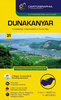


Danube Bend Cycle Atlas & Guide
The Danube Bend, one of Hungary’s most popular tourist destinations, in an A5 spiral-bound cycling atlas from the Budapest-based Frigoria with contoured, GPS compatible mapping at 1:50, 000 highlighting cycle and mountain bike routes, rental and maintenance shops, accommodation options, etc, plus a guide to the area which includes English. Coverage extends from Esztergom to Budapest, including the local section of the EuroVelo Danube Cycle Route.The maps have contours at 10m intervals, spot heights and colouring to indicate woodlands. The overprint shows whether the route is on a bike lane, a separate cycle path, a dirt road, a woodland trail, etc. Steep gradients are shown by additional markings and cycling distances are indicated. Where appropriate, the routes are
cross-referenced to the guide section. The mapping also shows local hiking paths indicating their waymarking signage. Symbols show hotels, motels, pensions, tourist or youth hostels, campsites, bike hire and/or repair shops, tourist information offices, interesting natural or historic sites, etc. Railway lines are shown with stations and bus terminals are marked. The maps have latitude and longitude lines at intervals of 2’. Central Esztergom, Vác, Veroce and Szentendre also covered by street plans.The tri-lingual guide section provides general information about the area including access on routes from Budapest, descriptions and route profiles of 15 cycle and 10 mountain bike tours, plus descriptions of local places of interest which include dates of special events and
useful contact details.Map legend and all the text include English.

Product Description
Reviews/Comments
Add New
Vouchers
No voucher codes found.
Do you know a voucher code for this product or supplier? Add it to Insights for others to use.
Do you know a voucher code for this product or supplier? Add it to Insights for others to use.
 Denmark