More From Contributor
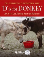
£10.99
Dublin in the Blue Guides series focuses primarily on cultural tourism for the visitor who wishes to understand more of what they might see &, as such, the title provides thorough & objective reference information covering art, history & architecture. The guide features illustrations aimed to inform rather than just decorate, such as maps, diagrams, floor plans, architectural details & photographs. Cross referenced indexing means information is accessible & layout navigable. Selective listings of restaurants & accommodation are chosen in the belief that good, practical recommendations will contribute to the enjoyment of good art & culture. ...
Archived Product
£14.95
The Dalmatian Coast of Croatia & Montenegro on a set of three double-sided, detailed & GPS compatible maps at 1:100, 000 from Kompass. Combined coverage of the three maps extends from Rijeka to the Albanian border. The maps have contours at 40m intervals, enhanced by relief shading & spot heights. Road network

Includes::
unsurfaced country roads & cart tracks, & indicates locations of petrol stations. Railway lines are shown with stations & ferry routes are marked. An overprint highlights a selection of waymarked hiking trails. Picturesque towns & villages are highlighted & symbols mark various places of interest, including selected hotels, campsites & mountain huts, viewpoints, cultural & archaeological sites, etc. Also shown are harbours, marinas, restricted anchorage sites & locations of nautical fuel suppliers. The legend, conveniently placed on each side of the map,

Includes::
English.PLEASE NOTE: to see the individual maps from this set please click on the series link. For convenience, we have also listed with this series Kompass map of Istria at 1:75, 000 (No. 238) which has the publishers’ traditional cartography, markedly different from the other three maps (Nos. 2901 – 2903).


...
Archived Product
£6.50
ADAC, Germany's equivalent of the British Automobile Association publishes an extensive series of street plans which provide detailed high-quality mapping of all the major towns & cities, including their outer suburbs. The plans name all the individual streets & indicate all the main landmarks & public buildings. All public transport facilities are shown: buses, trams, underground & overland rail lines. One way streets & car parks are indicated. Plans of larger cities include an enlargement for the city centre. The plans also show the administrative & postal divisions & have an extensive street index which, where appropriate, shows individual postal codes for each street. On the reverse, each plan has a road map at 1:100, 000, covering a very wide area around the city. Map legend

Includes::
English.

...
Archived Product
£3.99
Explore Dusseldorf with the help of this genuinely pocket-sized map. Small in size yet big on detail, this compact, dependable map will ensure you don't miss a thing.

Includes::
2 popout maps
- a street map of central Dusseldorf & a detailed street by street plan of the heart of the city Additional maps of the Messe & Esprit Arena, Medienhafen & the metro are also included Ingenious, self-folding map is small enough to fit in your pocket yet offers extensive coverage of the city in an easy-to-use format Thorough street index is also featured & cross-referenced to the map so you can easily find your destination Key places of interest are listed offering you advice on the best things to see


...
Archived Product
£17.95
Imray’s series of charts of the coastal waters of the Caribbean are comprehensive & easy-to-use sailing charts published on rip-proof, waterproof paper- ideal to be used on small tables or in cockpits. They show detailed coastline & depth information, & are constantly corrected to reflect latest information. Designed primarily for yachtsmen, they are comprehensive without being unnecessarily cluttered. This chart is a low-scale passage chart of the southern Carribean Sea & Venezuelan coast, from Curacao to Trinidad. Each chart contains insets showing local harbours annotated with symbols indicating what facilities can be found there (marinas, mooring & berth facilities, fuel, water, chandlers, etc.). Charts are fully updated to the latest printing date, & often include further corrections on a separate sheet. Subsequent corrections can be found on the Imray website. On this chart, depths are shown in fathoms & feet, with different sea colouring indicating areas with depths below one, between one & five, & over five fathoms. Positions referring to WGS84 Datum, such as most GPS readings, can be plotted directly onto this chart. Base cartography uses contours, several levels of colour shading, & spot measurements to indicate depth relative to Lowest Astronomical Tide, including distinct colour highlighting for tidally-covered l&. A large number of hatchings & markings are used to indicate coast types, salt flats, marshl&, reefs, etc. Compliant IALA ‘ System Region B’ buoys are clearly marked, & indications of other navigational aides such as light floats are given where possible. Lighthouses are clearly marked with arcs of visibility. A complex & comprehensive system of symbols is used to indicate all types of submerged obstructions, including wrecks, rocks, pipelines & cables, with depths where known. Flood tides, eddies races, ebb tide streams & other current information is given. A wide range of symbols indicate onshore features, anchorages, harbour details & other points of note. Danger areas, restricted areas & traffic zones are all shown. ...
Archived Product
£25.00
On the basis of 1, 400 oral histories from the men who were there, bestselling author & World War II historian Stephen E. Ambrose reveals for the first time anywhere that the intricate plan for the invasion of France in June 1944 had to be abandoned before the first shot was fired. The true story of D-Day, as Ambrose relates it, is about the citizen soldiers
- junior officers & enlisted men
- taking the initiative to act on their own to break through Hitler`s Atlantic Wall when they realised that nothing was as they had been told it would be. D-DAY is the brilliant, no holds barred, telling of the battles of Omaha & Utah beaches. Ambrose relives the epic victory of democracy on the most important day of the twentieth century.

...
Archived Product
£8.99
Antony Beevor's D-Day: D-Day & the Battle for Normandy is the closest you will ever get to war
- the taste, the smell, the noise
...
Archived Product
£9.99
D-Day & the Battle for Normandy Traveller`s Guide from the Massachusetts-based publishers Interlink Books, grouping the region into seven sightseeing routes. Each route is presented as a detailed description of the fighting in 1944, with particular stress placed on the contemporary eyewitness accounts. The seven routes cover: the Pegasus Bridge, the ‘ All-Americans’ & the ‘ Screaming Eagles’ landings, Utah Brach to Cherbourg, Omaha Beach to Caen, Sword Beach to Caen, Gold Beach to Bluecoat, plus June Beach to Falaise. The guide

Includes::
many “ Eyewitness” panels with soldiers’ comments & is illustrated with contemporary photos. The introductory section provides contact details for local D-Day related museums & tourist offices.

...
Archived Product
£12.99
6 June 1944 is one of the most memorable dates of the Second World War. It marked the beginning of the end of the conflict as Allied forces invaded Normandy & fought their way into Nazi-occupied Europe. Operation Overlord, as the invasion was codenamed, was an incredible feat that proved to be a turning point which would eventually result in the defeat of Nazi Germany. Around 150, 000 soldiers landed on the beaches of Normandy on the first day in the largest amphibious operation in history, & within a month more than 1 million men had been put ashore. As memory becomes history, first-hand accounts of this incredible moment become more & more precious. In D-Day Diary, historian Carol Harris collects together remarkable tales of bravery, survival & sacrifice from what was one of the war`s most dramatic & pivotal episodes. ...
Archived Product
£40.00
Published in partnership with the National Archives, D-Day Documents is a commemorative collection of previously unpublished documents marking the 70th anniversary of the Normandy landings. This unprecedented book contains not only 21st Army Group intelligence reports on ` Omaha` Beach, RAF Photographic Reconnaissance prints & the ship`s log of HMS Warspite but various other important official documents covering different aspects of Operations Neptune & Overlord. Crucially, this single volume brings together for the first time the war diary entries of all Anglo-Canadian `spear-head` units & regiments who landed in France on 6 June 1944. A unique publication, which celebrates one of the most momentous days in modern military history, D-Day Documents will fascinate anyone with an interest in the Second World War, as well as offering an invaluable primary source for military historians. ...
Archived Product

D Is For Donkey

This beautifully illustrated anthology contains stories of many donkeys - the majority of whom have been taken into care by The Donkey Sanctuary at its various sanctuaries throughout Europe, as well as some who have been cared for by their teams who work overseas. Each letter of the alphabet is covered and in each there are two parts - the first part is about donkeys whose name begins with that letter and the second concerns donkey facts, people and places. We learn about Naughty Face, the donkey who started it all and his companion Angelina; the children who have benefited from the work of The Elisabeth Svendsen Trust for Children & Donkeys, and lots of little known facts - such as that a zeedonk is the offspring of a male zebra and female donkey. This delightful compilation will
appeal to everyone who loves donkeys.
RIP - This product is no longer available on our network. It was last seen on 25.09.2019

This page now acts as a permanent archive for this product. Add more information using the comments box below to ensure it can still be found by future generations.

Use our search facility to see if it is available from an alternative contributor.
  • Availability: Out Of Stock
  • Supplier: Stanfords
  • SKU: 9781905693399
Availability: In Stock
£20.00

Product Description

This beautifully illustrated anthology contains stories of many donkeys
- the majority of whom have been taken into care by The Donkey Sanctuary at its various sanctuaries throughout Europe, as well as some who have been cared for by their teams who work overseas. Each letter of the alphabet is covered & in each there are two parts
- the first part is about donkeys whose name begins with that letter & the second concerns donkey facts, people & places. We learn about Naughty Face, the donkey who started it all & his companion Angelina; the children who have benefited from the work of The Elisabeth Svendsen Trust for Children & Donkeys, & lots of little known facts
- such as that a zeedonk is the offspring of a male zebra & female donkey. This delightful compilation will appeal to everyone who loves donkeys.

Reviews/Comments

Add New

Intelligent Comparison

Oooops!
We couldn't find anything!
Perhaps this product's unique.... Or perhaps we are still looking for comparisons!
Click to bump this page and we'll hurry up.

Price History

Vouchers

No voucher codes found.
Do you know a voucher code for this product or supplier? Add it to Insights for others to use.

Facebook

Jargon Buster

Children - A young life form within the early stages of physical development,

Supplier Information

Stanfords
Stanfords was established in 1853 and opened their iconic Covent Garden flagship store in 1901. They have become the top retailer of maps, travel books and accessories in the UK and arguably offer the largest selection of maps and travel books worldwide. Famous names such as Captain Robert Falcon Scott, Ranulph Fiennes and Michael Palin have purchased from Stanfords. They now have a shop in Bristol and both stores together with other venues operate a calendar of events including talks, book signings and exhibitions. As a specialist map retailer, the map selection is comprehensive and includes road maps, street maps and walking maps from worldwide destinations, as well as a selection of world atlases and wall maps. Books include travel guides and travel literature. Stanfords also stock globes, from miniatures made of blue marble to magnificent floor-standing globes. The website features a selection of interesting articles on travel topics.
Page Updated: 2023-11-12 20:15:36

Community Generated Product Tags

Oh No! The productWIKI community hasn't generated any tags for this product yet!
Menu