
 United Kingdom
 France
 Germany
 Netherlands
 Sweden
 USA
USA
 Italy
Italy
 Spain
Spain
More From Contributor


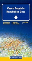
Czech Republic
Czech Republic on a double-sided road map at 1:275, 000 from Kümmerly + Frey, highlighting the country’s picturesque towns and other places of interest, with extensive index included in a separate booklet attached to the map cover.The map divides the country east/west, with a good overlap between the sides and provides excellent coverage of the bordering regions of Germany and Poland with their numerous national/natural parks, including Krknose/Karkonosze and the rest of the Sudeten Mountains. Topography is shown by subtle relief shading, with names of mountain ranges. National/natural parks are prominently highlighted. Also marked are the country’s restricted entry areas.Road network indicates motorway services, driving distances on main routes and connecting secondary roads,
gradient markings, seasonal closures, etc. Railway lines are shown with stations. Towns and villages worth visiting are prominently highlighted and symbols mark other places of interest including campsites, youth hostels, cultural sites, remarkable landscape features, etc. Latitude and longitude lines are drawn at 10’ intervals. The index is in a separate booklet attached to the map cover and lists towns and villages with their postcodes. Map legend includes English.
gradient markings, seasonal closures, etc. Railway lines are shown with stations. Towns and villages worth visiting are prominently highlighted and symbols mark other places of interest including campsites, youth hostels, cultural sites, remarkable landscape features, etc. Latitude and longitude lines are drawn at 10’ intervals. The index is in a separate booklet attached to the map cover and lists towns and villages with their postcodes. Map legend includes English.

Product Description
Reviews/Comments
Add New
Vouchers
No voucher codes found.
Do you know a voucher code for this product or supplier? Add it to Insights for others to use.
Do you know a voucher code for this product or supplier? Add it to Insights for others to use.
 Denmark