
 United Kingdom
 France
 Germany
 Netherlands
 Sweden
 USA
USA
 Italy
Italy
 Spain
Spain
More From Contributor


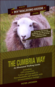
Cumbria Way
Cumbria Way, a 112km / 70 mile long-distance footpaths across the Lake District, described in great detail in a pocket size guide from 2QT Publishing, with sketch maps, GPS waypoints, lists of facilities on or near each stage, colour photos, etc.The guide describes the route, usually walked from south to north between Ulverston on Morecambe Bay and Carlisle, in small segments – many under 1km, all accompanied with GPS waypoints. Brightly coloured special panels are used to highlight important information and along the whole route colour photos are used to aid orienteering. Each section of the route is presented on a very basic sketch map (which the publishers stress is not intended to be used for navigating) plus a route profile. For larger towns street plans are provided.Each
section also has a list of places with a summary of the walk and a chart showing what facilities can be found in these locations (hotels, B&Bs, youth hostels, campsites, cafés/pubs, banks, bus or train access, etc). No accommodation details are given in the guide itself but a list of them can be downloaded from the publishers’ website. The guide also provides more general advice about the Cumbria Way, contact details for public transports, etc.
section also has a list of places with a summary of the walk and a chart showing what facilities can be found in these locations (hotels, B&Bs, youth hostels, campsites, cafés/pubs, banks, bus or train access, etc). No accommodation details are given in the guide itself but a list of them can be downloaded from the publishers’ website. The guide also provides more general advice about the Cumbria Way, contact details for public transports, etc.

Product Description
Reviews/Comments
Add New
Vouchers
No voucher codes found.
Do you know a voucher code for this product or supplier? Add it to Insights for others to use.
Do you know a voucher code for this product or supplier? Add it to Insights for others to use.
 Denmark