
 United Kingdom
 France
 Germany
 Netherlands
 Sweden
 USA
USA
 Italy
Italy
 Spain
Spain
More From Contributor
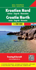


Croatia Reise Know-How
Croatia on an indexed, double-sided map from Reise Know-How, printed on light, waterproof and tear-resistant synthetic paper. The country is shown on three panels designed to provide convenient coverage of its most visited part, the Adriatic Coast. The map, part of the publishers’ highly acclaimed World Mapping Project, presents the coastal regions of Croatia at 1:300, 000 spread across both sides of the sheet, with a good overlap and the mapping tilted so that the coastline stretches horizontally. The inland part of Croatia is added as an inset at 1:700, 000 – please see the coverage image.Light altitude colouring with names of mountain ranges, peaks, etc, shows the topography; national parks and protected areas are highlighted. Road network, clearly visible against the
background, includes local roads and selected tracks, and indicates routes closed to motorized traffic. Driving distances are marked on many smaller roads. Railway lines are shown with stations; ferry links along the Adriatic indicate approximate passage timings. Locations of particular interest are highlighted and symbols mark various other places of interest. Latitude and longitude lines are drawn at 15’ (300K) and 1° (700K) intervals. Map legend includes English.
background, includes local roads and selected tracks, and indicates routes closed to motorized traffic. Driving distances are marked on many smaller roads. Railway lines are shown with stations; ferry links along the Adriatic indicate approximate passage timings. Locations of particular interest are highlighted and symbols mark various other places of interest. Latitude and longitude lines are drawn at 15’ (300K) and 1° (700K) intervals. Map legend includes English.
Product Description
Reviews/Comments
Add New
Vouchers
No voucher codes found.
Do you know a voucher code for this product or supplier? Add it to Insights for others to use.
Do you know a voucher code for this product or supplier? Add it to Insights for others to use.
 Denmark