More From Contributor
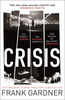
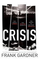
£11.99
Crimson Publishing’s ` Best of Britain` series encompasses a range of guides covering Britain’s regions, exploring some of the best places to eat, find organic & local produce, as well as things to do in wet weather, places to stay & local legends, festivals & pubs. The guides are particularly child-friendly, with a range of activities for those visiting with children. Extensive introductory sections cover factual information about the region, with details of when to go, getting there & around, accommodation, food & drink, festivals & annual events, travelling with children, activities, organised holidays & courses & further practical tourist guidance. A background section also offers insights into the area’s history, geography & geology, wildlife & habitats, culture & local heroes. The main guide section of each title is organised geographically by region, with a list of ‘unmissable highlights’ in the region opening each chapter, so readers can see the main highlights at a glance. ‘ What to see & do’ sections are arranged under ‘fair weather’ & ‘wet weather’, to allow visitors the flexibility to plan their trip accordingly. Each guide in the series incorporates a number of themed maps such as recommended restaurants & gastro-pubs, things to do with children & historical experiences. ‘ Photo Essays’ – a series of colour photographs documenting the region’s highlights – are also included, exploring the local landscape, countryside & where appropriate, coastline. ...
Archived Product
£9.95
Imray's 2000-series small format UK charts are comprehensive & easy-to-use sailing charts for popular British waters. Published as small (A2) sheets on rip-proof, waterproof paper, they are ideal to be used on small tables or in cockpits. They show detailed coastline & depth information, & are constantly corrected to reflect latest information. Designed primarily for yachtsmen, they are comprehensive without being unnecessarily cluttered. Approved for use with Yeoman plotters, Imray 2000 series charts include Yeoman reference points, & are based on the WGS84 datum for GPS compatibility. They are also approved for small craft use by the MCA. Charts are fully updated to the latest printing date, & often include further corrections on a separate sheet. Subsequent corrections can be found on the Imray website. Base cartography uses contours, several levels of colour shading, & spot measurements to indicate depth relative to Lowest Astronomical Tide, including distinct colour highlighting for tidally-covered l&. A large number of hatchings & markings are used to indicate coast types, salt flats, marshl&, reefs, etc. Compliant IALA ' System A' buoys are clearly marked, & indications of other navigational aides such as light floats are given where possible. Lighthouses are clearly marked with arcs of visibility. A complex & comprehensive system of symbols is used to indicate all types of submerged obstructions, including wrecks, rocks, pipelines & cables, with depths where known. Flood tides, eddies races, ebb tide streams & other current information is given. A wide range of symbols indicate onshore features, anchorages, harbour details & other points of note. Danger areas, restricted areas & traffic zones are all shown. ...
Archived Product
£180.00
Cripplegate Ward With It's Divisions Into Parishes.. ., an original antique map by B. Cole, published in London 1756. A copperplate engraving, coloured. Map size 23.5 x 36 cm, overall mounted size 38 x 51 cm. An attractive plan of the area around Moorgate & London Wall Street. At the head of the page is a view of the St Luke's Hospital for Lunatic's (sic). This map originally appeared in Maitland's History Of London, which was sponsored by the aldermen of the city. Accordingly the coat of arms of John Blachford, alderman of Cripplegate appear on this plan with a dedication in the lower margin. Important buildings are shown pictorially. Adams, London Illustrated, 38. Antique maps from various original publishers are presented on the Stanford ...
Archived Product
£11.50
One of the titles in the topographic survey of the coastal part of French Guiana, published as an extension of IGN’s survey of France to its overseas departments. Contours are at 5m intervals & the maps indicate 13 different types of vegetation & land use, including rain forest, brushwood, savanna, high & low mangrove, rice fields, orchards & plantations, etc. The extent of changes in the coastline in the recent decades is indicated. The maps have a UTM grid & latitude/longitude lines at intervals of 5’. Map legend

Includes::
English.

...
Archived Product
£7.99
Introducing Luke Carlton
- ex-Special Boat Service commando, & now under contract to MI6 for some of its most dangerous missions.
...
Archived Product
£32.50
After purchasing his first motorcycle--a Harley-Davidson--in 2004, John Gussenhoven almost immediately planned an epic cross-country road trip, the kind that many dream about but few actually make. Crisscrossing America is a photographic journal of his two-year, two-leg journey crisscrossing the United States--from Mt. Vernon, Washington, to Naples, Florida, & from San Diego, California, to Eastport, Maine. In this truly unique celebration of the United States, breathtaking aerial photographs by Jim Wark accompany the many ground-level photographs of small towns, roadside oddities, & beautiful scenery taken by Gussenhoven as he discovered America one mile at a time. ...
Archived Product
£17.95
This entirely new translation of Critique of Pure Reason is the most accurate & informative English translation ever produced of this epochal philosophical text. Though its simple & direct style will make it suitable for all new readers of Kant, the translation displays an unprecedented philosophical & textual sophistication that will enlighten Kant scholars as well. This translation recreates as far as possible a text with the same interpretative nuances & richness as the original. The extensive editorial apparatus

Includes::
informative annotation, detailed glossaries, an index, & a large-scale general introduction in which two of the world`s preeminent Kant scholars provide both a succinct summary of the structure & argument of the Critique & a detailed account of its long & complex genesis.

...
Archived Product
£5.99
The Michelin National road map of Croatia at 1:750, 00 scale is ideal for route planning. The map gives comprehensive coverage of national road networks showing all major motorways, dual carriageways, national & regional main roads & some single-lane roads; also shows unsurfaced roads. Distances between major locations are marked along roads, with total distance & several intermediate distances shown. A quick-reference chart of distances & driving times between major locations is also included. The map also

Includes::
a grid-referenced index of principal place names. Clear, easy-to read cartography shows roads in reds, yellows & white with black outlines. Major topography is indicated with relief shading. Woodland & forest is marked with green shading. Built-up urban areas are clearly marked in yellow. Airports, ferries & motorails are also marked. National & administrative divisions are marked. Also

Includes::
a quick reference panel giving national driving regulations, including speed limits, equipment requirements (e.g. bulb kits, warning triangles) & seatbelt rules. Town plans & regional enlargements:- Zagreb at 1:10, 000 scale- Dubrovnik at 1:5, 000 scale


...
Archived Product
£11.99
Croatia in the Countries & Regions series from Lonely Planet, market-leading comprehensive guides aimed at independent travellers & serving a large range of international destinations. Frank & informal in style, the guides explore an extensive range of sights, activities, accommodation, restaurants & nightlife & are designed for practical use while travelling on the road. Written & researched by a team of experts, each book is independent in its recommendations & suggestions, often offering individual takes on individual destinations. Widely recognised for their reliability, each Lonely Planet country & region guide has the same layout. Introductory sections profile the destination with individual chapters on particular highlights, getting started, (including when to go) itineraries, history, culture, arts, food & drink & the environment. Each guide is organised geographically by region, with individual sections detailing an extensive range of sights, places of interest, attractions, restaurants, nightlife, accommodation & any local activities. The guides have detailed explanations of historical context where relevant. There is also practical guidance on ...
Archived Product

Crisis

Introducing Luke Carlton - ex-Special Boat Service commando, and now under contract to MI6 for some of its most dangerous missions. Sent into the steaming Colombian jungle to investigate the murder of a British intelligence officer, Luke finds himself caught up in the coils of a plot that has terrifying international dimensions. Hunted down, captured, tortured and on the run from one of South America`s most powerful and ruthless drugs cartels and its psychotic leader thirsting for revenge, Luke is in a life-or-death race against time to prevent a disaster on a truly terrifying scale: London is the target, the weapon is diabolical and the means of delivery is ingenious. Drawing on his years of experience reporting on security matters, CRISIS is Frank Gardner`s debut novel. Combining
insider knowledge, up-to-the-minute hardware, fly on the wall insights with heart-in-mouth excitement, CRISIS boasts an irresistible, visceral frisson of authenticity: smart, fast-paced and furiously entertaining, here is a thriller for the 21st century.
RIP - This product is no longer available on our network. It was last seen on 25.09.2019

This page now acts as a permanent archive for this product. Add more information using the comments box below to ensure it can still be found by future generations.

Use our search facility to see if it is available from an alternative contributor.
  • External links may include paid for promotion
  • Availability: Out Of Stock
  • Supplier: Stanfords
  • SKU: 9780593075784
Availability: In Stock
£12.99

Product Description

Introducing Luke Carlton
- ex-Special Boat Service commando, & now under contract to MI6 for some of its most dangerous missions. Sent into the steaming Colombian jungle to investigate the murder of a British intelligence officer, Luke finds himself caught up in the coils of a plot that has terrifying international

Dimensions. Hunted down, captured, tortured & on the run from one of South America`s most powerful & ruthless drugs cartels & its psychotic leader thirsting for revenge, Luke is in a life-or-death race against time to prevent a disaster on a truly terrifying scale: London is the target, the weapon is diabolical & the means of delivery is ingenious. Drawing on his years of experience reporting on security matters, CRISIS is Frank Gardner`s debut novel. Combining insider knowledge, up-to-the-minute hardware, fly on the wall insights with heart-in-mouth excitement, CRISIS boasts an irresistible, visceral frisson of authenticity: smart, fast-paced & furiously entertaining, here is a thriller for the 21st century.

Reviews/Comments

Add New

Intelligent Comparison

Oooops!
We couldn't find anything!
Perhaps this product's unique.... Or perhaps we are still looking for comparisons!
Click to bump this page and we'll hurry up.

Price History

Vouchers

No voucher codes found.
Do you know a voucher code for this product or supplier? Add it to Insights for others to use.

Facebook

Jargon Buster

Minute - A measurement of time, 60 seconds is equal to one minute
Weapon - Any object that is used for malicious intent
delivery - The method by which something is delivered from one location to another
Wall - A physical barrier between two areas
Heart - An organ that pumps blood around the body. Usually related to love.
Experience - To gain further knowledge by practising.
Dimensions - The shapes and angles of something or a situation.

Supplier Information

Stanfords
Stanfords was established in 1853 and opened their iconic Covent Garden flagship store in 1901. They have become the top retailer of maps, travel books and accessories in the UK and arguably offer the largest selection of maps and travel books worldwide. Famous names such as Captain Robert Falcon Scott, Ranulph Fiennes and Michael Palin have purchased from Stanfords. They now have a shop in Bristol and both stores together with other venues operate a calendar of events including talks, book signings and exhibitions. As a specialist map retailer, the map selection is comprehensive and includes road maps, street maps and walking maps from worldwide destinations, as well as a selection of world atlases and wall maps. Books include travel guides and travel literature. Stanfords also stock globes, from miniatures made of blue marble to magnificent floor-standing globes. The website features a selection of interesting articles on travel topics.
Page Updated: 2023-11-12 20:15:36

Community Generated Product Tags

Oh No! The productWIKI community hasn't generated any tags for this product yet!
Menu