
 United Kingdom
 France
 Germany
 Netherlands
 Sweden
 USA
USA
 Italy
Italy
 Spain
Spain
More From Contributor


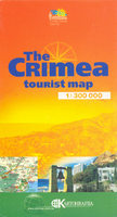
Crimea
Crimea at 1:300, 000 on an English language map from Kartografija in Kiev with extensive tourist information including an enlargement for the southern coast, street plans of city centres in the region’s main towns and descriptions of numerous places of interest.All place names are shown transliterated into Latin alphabet. Topography is indicated by spot heights with colouring and graphics showing forested areas, vineyards and orchards, etc. National Parks and other protected areas are marked. Road network includes unsurfaced roads and local tracks and shows locations of petrol stations and car service centres. Railways lines indicate stations and ferry routes also shown. Interesting towns are highlighted and symbols mark places of interest, campsites, etc. The map has latitude and
longitude lines drawn at intervals of 30’. An enlargement presents part of the southern coast around Yalta and Alupka in greater detail. Map legend is in English, French and German.The whole of the reverse side is covered by additional tourist information, all in English, providing extensive notes on the region’s protected areas, cultural heritage, and descriptions of places of interest. Also provided are street plans of city centres in Alushta, Feodosiya, Kerch, Sevastopol, Simferopol, Yalta, and Yevpatoriya, highlighting places of interest, various services, tourist accommodation, etc, each with a list of the sights.IMPORTANT - PLEASE NOTE BEFORE ORDERING: supplies of all titles published in the Ukraine are irregular and we cannot guarantee a firm delivery time. When
a title is out of stock, it may be advisable to choose an alternative publication.

Product Description
Reviews/Comments
Add New
Vouchers
No voucher codes found.
Do you know a voucher code for this product or supplier? Add it to Insights for others to use.
Do you know a voucher code for this product or supplier? Add it to Insights for others to use.
 Denmark