More From Contributor
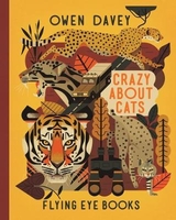
£8.99
Crawley & Horsham area of Sussex & Surrey on a detailed topographic & GPS compatible map OL34, paper version, from the Ordnance Survey’s 1:25, 000 Explorer series. Coverage extends from Cranleigh & Crawley in the north to Hickstead & Bedham, &

Includes::
Billinghurst, Nymans, part of the High Weald Area of Outstanding Natural Beauty, the Low Weald, the Sussex Border Path, the Downs Link, etc.MOBILE DOWNLOADS: this title & all the other OS Explorer maps include a code for downloading after purchase the digital version onto your smartphone or tablet for viewing on the OS smartphone app.OS EXPLORER SERIES: to see the list of all the titles in the OS Explorer series, both paper & waterproof versions, please click on the series link. The Explorer series, Ordnance Survey’s most detailed maps recommended for anyone enjoying outdoor activities, provides topographic coverage of Great Britain at 1:25, 000 on GPS compatible maps with hiking trails, cycling routes & extensive tourist information. Each printed map is available either on paper or as a waterproof & tear-resistant OS Active Map, as indicated in its title. Britain’s National Parks & other areas of particular tourist interest are presented on often double-sided OL (Outdoor Leisure) maps, whilst most standard format Explorers cover an area of 30 x 20km (approx. 19 x 12 miles). All three versions (paper, waterproof & digital) are the same & provide plenty of recreational & tourist information, indicating the traditional public right of way paths (except in Scotland where different laws apply), including bridleways & byways. National Trails & other long-distance paths are marked, as well as permissive footpaths or bridleways & on-road or traffic-free cycle routes with, where appropriate, their National/ Regional Cycle Network numbers. Boundaries of access land are clearly marked. A wide range of symbols provides additional tourist information, highlighting camping & caravanning sites, information offices & visitors’ centres, parking & picnicking places, country pubs, sport & recreational facilities including cycle hire locations & mountain biking trails, historic buildings & museums, etc. Exceptionally clear presentation of the landscape is provided by contours at 5m or in the uplands at 10m intervals, with additional spot heights plus colouring and/or graphics for different types of woodlands, orchards, heath, marshl&, scree or boulders, & other topographic features. For GPS users the maps have British National Grid lines at 1km intervals, with latitude & longitude given by margin ticks at 1`. Clearly laid out map legend

Includes::
French & German translations for the tourist information symbols.


...
Archived Product
£11.19
Laminated waterproof edition of a detailed topographic map from the Ordnance Survey Explorer series, covering Cranleigh & Horsham. Edition B2: Publication date April 2009 About this series: These highly detailed maps show all the administrative boundaries, settlements as small as isolated farms, the road network down to unfenced roads & country tracks, & field boundaries (hedges & drystone walls) which make navigation across the countryside much easier. Steep gradients on roads are indicated. Various landmarks, e.g. powerlines, archaeological sites, windmills, churches & lighthouses are shown & additional graphics indicate natural terrain features such as cliffs, scree, mud & vegetation variations. The contour interval is 5 metres in the lower parts of the country & 10 metres in the uplands, & spot heights are marked. Each map covers an area of 30 x 20km (i.e. approx. 19 x 12 miles), with some double-sided maps covering more, as indicated in the individual descriptions. The maps are fully GPS compatible, with the National Grid shown at 1km intervals & latitude & longitude indicated by margin ticks at 1'. The Explorer series has replaced the earlier, green-cover Pathfinder maps. The Explorer series is now complete & covers all of Engl&, Wales & Scotl&. Some sheets for popular areas like the National Parks are still branded as Outdoor Leisure (OL) maps, but are now included in this series as the cartography is the same as that in the Explorer Maps. The Explorer maps offer a substantial improvement on the Pathfinder series, with greater use of colour, larger area per map, & stronger emphasis on information for ramblers & tourists. This series is ideal for walking & other outdoor pursuits & each map shows a large amount of information for ramblers & tourists. Public rights of way are shown (except in Scotland), together with other routes with public access: National Trails & Recreational Paths, permitted paths & bridleways, & selected cycle routes. Open access land created under the Countryside & Rights of Way Act 2000 is marked. Tourist information

Includes::
caravan & camp sites, Park & Ride locations, recreation/leisure/sport centres, museums, historic buildings, English Heritage & National Trust sites, rural pubs, etc. The map legend is in English only, except for the tourist information content which is also in French & German.

...
Archived Product
£4.50
Crawley Street Atlas at 1:15, 840 / 4 to a mile, in an indexed, glove box size paperback format, with national grid referencing. Street atlas covers Crawley, East Grinstead, Horley, Horsham, Gatwick Airport, Billinghurst, Broadbridge Heath, Forest Row, Copthorne, Crawley Down, Smallfield & Southwater. Motorways, A roads, B roads, dual carriageways, one way streets, pedestrianized/restricted access roads & car parks are shown. The run of street numbers on A & B roads is also indicated. Tracks & footpaths are mapped, as are selected cycleways, railways, stations, level crossings & rail bridges. Colour coding distinguishes land use, e.g. shopping centre, educational establishment or industrial building. Post offices, churches, tourist information centres & emergency services are located, as are public toilets with & without disabled access. Post town & postcode boundaries are demarcated & the atlas is indexed by street name & places of particular interest. Current edition of this atlas
- 2007
...
Archived Product
£4.95
Crawley, East Grinstead, Horley & Horsham Street Atlas from the Geographers` A-Z Map Company in a paperback format slightly smaller than A5. Map scale is 1:15, 840 (4” to a mile). Coverage

Includes::
Gatwick Airport, Billinghurst, Broadbridge Heath, Forest Row, Copthorne, Crawley Down, Smallfield & Southwater. Current edition of this title was published in 2012. To see other titles in this series of A-Z street atlases of towns & cities please click on the series link. A-Z also publish a series of County Street Atlases, for a list of titles in that series please search for SI00000917.A-Z street atlases present motorways plus A & B roads highlighted by colouring & shown with route numbers. One way or restricted access streets & car parks are marked, as are in more recently published titles locations of speed cameras. Also shown are selected cycleway routes. Where appropriate, A & B roads are annotated with selected house numbers for easier identification of addresses. Railway lines are shown with stations & level crossings. Colouring indicates different types of buildings: educational, hospitals & healthcare, industrial, leisure & recreational, shopping centres & markets, public buildings, & places of interest. Symbols mark locations of facilities usually indicated on street mapping: post offices, emergency services, public toilets, etc. Also marked are postcode & local authority boundaries. Each page has the lines & coordinates of the British National Grid. The indexes list streets, places & areas, hospitals, industrial estates, blocks of flats on housing estates, railway stations, & selected places o interest; the latter are printed in contrasting colouring to make them easier to find.

...
Archived Product
£3.50
Crayford in 1907 in a fascinating series of reproductions of old Ordnance Survey plans in the Alan Godfrey Editions, ideal for anyone interested in the history of their neighbourhood or family. Crayford has an ancient history, the Battle of Creganford having been fought here between the Britons & the Jutes in 457 AD. This detailed map covers most of the town & shows it to have a strong industrial base, but with several large houses in ample grounds scattered around the outskirts. The Dartford Loop railway line crosses the south-eastern corner of the map, including Crayford station. The Dover Road or Watling Street crosses the map east-west, running through the town & with a tramway. Industrial features include a tannery, two silk & calico printing works, the West Kent Gas Works, the Swaislands Block Printing Works, & most noticeably the Crayford Works, where Vickers produced armaments, aeroplanes & cars; a motor track is shown for testing the Wolseley Siddeley cars. Vickers later built an estate for their workers at Barnes Cray, which was still a hamlet in 1907. Other features include Whitehill, St Paulinius church, Manor House, Iron Mill Lane, Bigs Hill Wood, Hall Place Mill (a printing works), Halcot, Martens Grove, Oakwood, May Place, River Cray. On the reverse is a Crayford Directory which

Includes::
street entries for High Street, London Road, Maxim Road, Old Road, Station Road. About the Alan Godfrey Editions of the 25” OS Series: Selected towns in Great Britain & Ireland are covered by maps showing the extent of urban development in the last decades of the 19th & early 20th century. The plans have been taken from the Ordnance Survey mapping & reprinted at about 15 inches to one mile (1:4, 340). On the reverse most maps have historical notes & many also include extracts from contemporary directories. Most maps cover about one mile (1.6kms) north/south, one & a half miles (2.4kms) across; adjoining sheets can be combined to provide wider coverage.FOR MORE INFORMATION & A COMPLETE LIST OF ALL AVAILABLE TITLES PLEASE CLICK ON THE SERIES LINK.

...
Archived Product
£9.99
Moving from Singapore to California was a breath of fresh air for Angie. With the curiosity & spunk of an animal let loose in the wild, she began to explore her surroundings on her bicycle. The idea struck her: Why not cycle across America? & why not film a documentary to chronicle the adventure? She would eventually complete the Northwestern-central route in under 40 days. 4, 000 miles at a pace of 100 miles a day. Angie`s story of cycling across the third largest continent in the world is a story of peaks & troughs (both literal & metaphorical), overcoming physical, mental & emotional obstacles, & busting old beliefs. It is also a celebration of friendships forged with the people she met on her journey. Angie`s account of her crazy dream, from conception to actualization, will resonate with anyone who has ever dreamed big. ...
Archived Product
£12.99
Set in the aftermath of a harrowing plane crash, this is the true story of one young boy`s fight for survival in nature`s most treacherous conditions. Eleven-year-old Norman Ollestad was a gifted skier. After winning the 1979 Southern California Slalom Skiing Championship, his father chartered a small plane to fly Norman home, so that his son could collect his trophy & train with his team. Moments later the Cessna, engulfed in a blizzard, crashed into the San Gabriel Mountains & was left suspended at 8, 000 feet. Norman`s father, his coach & his hero, was dead. Climbing out of the wreckage, young Norman begins a gruelling descent, thousands of feet down an icy mountain. Blinded by heavy snow & faced with a raging wind & below-freezing temperatures, he attempts to guide his father`s injured girlfriend to safety. Kept alive by sheer will, Norman summons everything his father taught him about determination & courage to save his own life. Powerful, inspiring & utterly compelling, this is a unique & unforgettable memoir. ...
Archived Product
£8.99
On June 25, 1876, 611 men of the United States 7th Cavalry rode towards the banks of the Little Bighorn where three thousand Indians stood waiting for battle. The lives of two great war leaders would soon become forever linked: Crazy Horse, leader of the Oglala Sioux, & General George Armstrong Custer. This masterly dual biography tells the epic story of the lives of these two men: both were fighters of legendary daring, both became honoured leaders in their societies when still astonishingly young, & both died when close to the supreme political heights. Yet they
- like the nations they represented
- were as different as day & night. Custer had won his spurs in the American Civil War; his watchword was ` To promotion
- or death!` & his restless ambition characterized a white nation in search of expansion & progress. Crazy Horse fought for a nomadic way of life fast yielding before the buffalo-hunters & the incursions of the white man. The Great Plains of North America provided the stage
- & the prize.


...
Archived Product
£7.99
The acclaimed international bestseller soon to be a MAJOR MOTION PICTURE starring Constance Wu, Henry Golding, Michelle Yeoh & Gemma Chan! When Rachel Chu agrees to spend the summer in Singapore with her boyfriend, Nicholas Young, she envisions a humble family home & time with the man she might one day marry. What she doesn`t know is that Nick`s family home happens to look like a palace, that she`ll ride in more private planes than cars & that she is about to encounter the strangest, craziest group of people in existence. Uproarious, addictive, & filled with jaw-dropping opulence, Crazy Rich Asians is an insider`s look at the Asian jet set; a perfect depiction of the clash between old money & new money
- & a fabulous novel about what it means to be young, in love, & gloriously, crazily rich.
...
Archived Product

Crazy About Cats

Did you know that the fishing cat has partially webbed paws for catching fish? Or that pumas can leap over 15 feet into trees? There are roughly 38 species of cats today, each one superbly adapted to their environment - whether that be in the rainforest or the desert.
RIP - This product is no longer available on our network. It was last seen on 25.09.2019

This page now acts as a permanent archive for this product. Add more information using the comments box below to ensure it can still be found by future generations.

Use our search facility to see if it is available from an alternative contributor.
  • External links may include paid for promotion
  • Availability: Out Of Stock
  • Supplier: Stanfords
  • SKU: 9781911171164
Availability: In Stock
£12.99

Product Description

Did you know that the fishing cat has partially webbed paws for catching fish? Or that pumas can leap over 15 feet into trees? There are roughly 38 species of cats today, each one superbly adapted to their environment
- whether that be in the rainforest or the desert.

Reviews/Comments

Add New

Intelligent Comparison

Oooops!
We couldn't find anything!
Perhaps this product's unique.... Or perhaps we are still looking for comparisons!
Click to bump this page and we'll hurry up.

Price History

Vouchers

No voucher codes found.
Do you know a voucher code for this product or supplier? Add it to Insights for others to use.

Facebook

Jargon Buster

Fish - A creature that lives in water. A fish uses gills to breath unlike mammals
Environment - The conditions and surrounding area.

Supplier Information

Stanfords
Stanfords was established in 1853 and opened their iconic Covent Garden flagship store in 1901. They have become the top retailer of maps, travel books and accessories in the UK and arguably offer the largest selection of maps and travel books worldwide. Famous names such as Captain Robert Falcon Scott, Ranulph Fiennes and Michael Palin have purchased from Stanfords. They now have a shop in Bristol and both stores together with other venues operate a calendar of events including talks, book signings and exhibitions. As a specialist map retailer, the map selection is comprehensive and includes road maps, street maps and walking maps from worldwide destinations, as well as a selection of world atlases and wall maps. Books include travel guides and travel literature. Stanfords also stock globes, from miniatures made of blue marble to magnificent floor-standing globes. The website features a selection of interesting articles on travel topics.
Page Updated: 2023-11-12 20:15:36

Community Generated Product Tags

Oh No! The productWIKI community hasn't generated any tags for this product yet!
Menu