More From Contributor
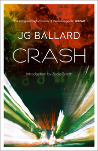
£8.99
The worst cookbook ever, packed with truly bizarre & utterly disgusting recipes from all over the world Ever since humankind produced its first foodie, the culinary world has dished up some staggering confections which could best be described as `acquired tastes`: dishes such as Virgin Boy Eggs (eggs soaked in the urine of prepubescent boys); live octopus, which clutches at the diner`s tongue & throat as it is swallowed; & Beard Beer, made from the yeast found in facial hair. In northern Greenl&, the Inuit are fond of cramming as many as 500 dead auks (small sea birds) into an old seal skin which they place under a large rock until the birds have fermented into what has rightly been described as a `sticky, pungent, toxic, cheesy gloop`. Kiviak, as it is called, is eaten by biting off the birds` heads & sucking out the juices. The mighty Roman Empire was built on such delicacies as larks` tongues, stuffed thrush, boiled flamingo & grilled cow`s womb, while the Tudors loved nothing more than a roast cockenthrice: the head & upper body of a pig carefully stitched onto the lower body & legs of a turkey. Today, for those with an adventurous mindset & a robust life insurance policy, there is no shortage of nauseating local delicacies to enjoy. In China, not only is tuna eyeball on the menu, but also yak penis (served whole). In Vietnam, one can enjoy the still-beating heart of a freshly-killed snake; in Icel&, raw puffin heart. In the Philippines, there is duck embryo to be had
- like a Kinder Surprise.. .only containing a dead foetus instead of a toy. In Sardinia, they like nothing more than a nice bit of maggot-infested cheese; & the favourite tipple of Korean foodies is Ttongsul, a wine made from the fermented faeces of a child. Bon appetit!
...
Archived Product
£7.99
You won`t know whether to laugh or cry at these spectacularly bad attempts at taxidermy, brought to you courtesy of the hit website crappytaxidermy.com. The site`s plethora of bad taxidermy examples
- including a squirrel riding a rattlesnake like a cowboy, & various anatomically imaginative renderings of all creatures great & small
- have proved hugely popular. Here the very best of the worst stuffed animals are brought together in one full-colour volume; with additional features including a DIY ` Stuff Your Own Mouse` lesson, & an author`s introduction to the craze for getting stuffed.

...
Archived Product
£10.00
' Our national genius is knocking things down.' Jim White, Daily Telegraph From inner city poverty to self-satisfied middle Engl&, from the dull & the lifeless to the ugly & the depressing, Dan Kieran & Sam Jordison are back with a brand new list of towns
- & this time it's personal. Inspired by the success of the contentious survey, published in the Idler & in book form in Boxtree's smash hit Crap Towns, residents of the original 50 towns, along with plenty of new towns will have their say in Crap Towns II: To Hull & Back on why Britain isn't just the place of warm beer, cosy bed & breakfasts & amiable old gits that some travel books would have us believe. This brand new list of 50 towns will include new entries, non-movers & a new number one based on the public's reaction to the burnt out cars, shell suits, cheap shoe shops & housing estates patrolled by rabid dogs & feral kids that scar the face of this glorious kingdom. Are the disgruntled residents of Hull right to consider their town the worst place to live in the country? Crap Towns II will find out.
...
Archived Product
£10.00
The genuinely rough guide to Britain is back. Ten years after it first lifted the concrete slab in the garden of Engl&, Crap Towns returns to dish the dirt on the latest planning disasters, urban blight & posh blighters disfiguring our nation. ` My friends & I once spent an evening in Thetford. Some people threw a cucumber at us.` ` Southampton: the only place in the UK I`ve ever seen someone get on a bus & nonchalantly spark up a crack pipe.` ` Bacup long claimed to have the shortest street in Britain
- Elgin Street
- but recently lost the title to Ebeneezer Place, an even shorter street in Wick, to the fury of locals, who complained that the Scottish rival was only `a corner`.`

...
Archived Product
£11.50
Topographic survey of France at 1:25, 000 in IGN`s excellent TOP25 / Série Bleue series. All the maps are GPS compatible, with a 1km UTM grid plus latitude & longitude lines at 5’ intervals. Contours are at 5m intervals except for mountainous areas where the maps have contours at 10m intervals, vividly enhanced by hill shading & graphics for rocky terrain. Colouring with graphics indicates different types of vegetation or land use (deciduous or coniferous forests, moors, orchards, vineyards, etc). PLEASE NOTE: coverage of France at this scale is currently being revised – the format & the presentation of each title are indicated by the letters at the end of its Sheet Reference number (e.g. 0416ET, 3531ETR, 1923SB, etc.)MAPS WITH FULL TOURIST OVERPRINT & AN ENGLISH MAP LEGEND: all TOP25 maps & the SB editions of Série Bleue have an overprint highlighting waymarked walking trails including long-distance GR routes &, where appropriate, ski routes. Symbols indicate campsites, gîtes d’etape, refuges, equestrian centres & other recreational facilities or sites, tourist information centres, cultural heritage, etc. Towns & locations of particular interest are highlighted.- ET or OT = single-sided TOP25 map covering approx. 29x 21 km / 18x 13 miles.- ETR or OTR = waterproof & tear resistant TOP25 map covering the same area as the corresponding ET or OT number, but double-sided, printed on a smaller size sheet with a good overlap between the sides.- SB = Série Bleue map with full tourist overprint; these maps, first introduced in summer 2014, each cover approx. 29x 24km / 18x 15 miles.SÉRIE BLEUE maps with numbers ending in E (Est) or O (Ouest): most editions now indicate the GR routes, but do not show any other tourist information. Map legend is in French only. Each map covers approx. 14x 20km / 9x 12 miles. ...
Archived Product
£16.99
From the people behind the UK`s leading sailing magazine for cruisers comes Crash Test Boat, a dramatic documentation of controlled sailing disasters which has the potential to save the lives of each & every seaman who buys it. Crash Test Boat is unique in its field, with no other title on the market aimed at explicitly revealing at first hand what happens when a boat encounters a major disaster. On the spot reporting with action photographs show what happens when typical family boats fall victim to eight different types of sailing disaster. How quickly does a cabin fill with water when the hull is holed? How do you control a gas leak or fire on board? What should you do first when dealing with a dismasting or a capsize through 360 degrees? By providing cruising & racing yachtsmen with vivid accounts of such extreme events, Crash Test Boat equips the reader with vital knowledge on what to do if disaster strikes &, ultimately, gives everyone on board a greater chance of survival if the boat is overcome. It is a fascinating, enlightening & instructive read. Each chapter opener is accompanied by a scannable QR code that takes the reader directly to the live-action You Tube footage of the relevant crash test, with informative & engaging commentary throughout from the Crash Test Team. ...
Archived Product
£9.99
Map No. 244, Crater Lake National Park in Oregon, in an extensive series of GPS compatible, contoured hiking maps of USA’s national & state parks or forests & other popular recreational areas. Cartography based on the national topographic survey, with additional tourist information. The maps, with most titles now printed on light, waterproof & tear-resistant plastic paper, highlight walking trails along with campsites & other accommodation, picnic sites, areas for various recreational pursuits such as horse riding or skiing, drinking water sources, & many other facilities of interest to the outdoor enthusiast. Cartography is based on information from the USGS (United States Geological Survey
- the country’s national survey organization), revised by the National Geographic Maps in cooperation with the National Park Service, USDA Forest Service, etc. Topography is excellently presented by contours (interval varies according to scale), enhanced by relief shading & colouring/graphics for wood cover, glaciers, etc. All heights are given in feet. The maps have a UTM grid plus latitude & longitude margin ticks & GPS waypoints for selected important locations. Each map is double-sided to give either maximum coverage of the chosen area or additional enlargements of its important sections. Accompanying notes provide useful information on relevant regulations, safety precautions, contact addresses, etc.* *IMPORTANT
- PLEASE NOTE: the series is very extensive, ranging in scale from 1:400, 000 for the vast national parks of Alaska to 1:25, 000 for local map in several states. We recommend, therefore, viewing the series by state rather than the whole list.*

...
Archived Product
£3.50
Craven Arms & Stokesay in 1902 in a fascinating series of reproductions of old Ordnance Survey plans in the Alan Godfrey Editions, ideal for anyone interested in the history of their neighbourhood or family. The map is double-sided, the main map covers the little town of Craven Arms, famous as a major market centre. Coverage extends north to Newington, east to Halford, south to Newton & the Stokesay Castle Hotel, & west to Albion Terrace & beyond into open country. On the back is a large section of sheet 70.08 which extends coverage south to the much older Stokesay with its Castle, St John the Baptist`s church, Stokesay Bridge. Extracts from an early directory, listing inhabitants of Stokesay & Craven Arms, are also included. About the Alan Godfrey Editions of the 25” OS Series: Selected towns in Great Britain & Ireland are covered by maps showing the extent of urban development in the last decades of the 19th & early 20th century. The plans have been taken from the Ordnance Survey mapping & reprinted at about 15 inches to one mile (1:4, 340). On the reverse most maps have historical notes & many also include extracts from contemporary directories. Most maps cover about one mile (1.6kms) north/south, one & a half miles (2.4kms) across; adjoining sheets can be combined to provide wider coverage.FOR MORE INFORMATION & A COMPLETE LIST OF ALL AVAILABLE TITLES PLEASE CLICK ON THE SERIES LINK. ...
Archived Product
£6.39
A detailed topographic map from the Ordnance Survey Explorer series, covering Cranleigh & Horsham. Edition B2; Publocation date April 2009 About this series: These highly detailed maps show all the administrative boundaries, settlements as small as isolated farms, the road network down to unfenced roads & country tracks, & field boundaries (hedges & drystone walls) which make navigation across the countryside much easier. Steep gradients on roads are indicated. Various landmarks, e.g. powerlines, archaeological sites, windmills, churches & lighthouses are shown & additional graphics indicate natural terrain features such as cliffs, scree, mud & vegetation variations. The contour interval is 5 metres in the lower parts of the country & 10 metres in the uplands, & spot heights are marked. Each map covers an area of 30 x 20km (i.e. approx. 19 x 12 miles), with some double-sided maps covering more, as indicated in the individual descriptions. The maps are fully GPS compatible, with the National Grid shown at 1km intervals & latitude & longitude indicated by margin ticks at 1'. The Explorer series has replaced the earlier, green-cover Pathfinder maps. The Explorer series is now complete & covers all of Engl&, Wales & Scotl&. Some sheets for popular areas like the National Parks are still branded as Outdoor Leisure (OL) maps, but are now included in this series as the cartography is the same as that in the Explorer Maps. The Explorer maps offer a substantial improvement on the Pathfinder series, with greater use of colour, larger area per map, & stronger emphasis on information for ramblers & tourists. This series is ideal for walking & other outdoor pursuits & each map shows a large amount of information for ramblers & tourists. Public rights of way are shown (except in Scotland), together with other routes with public access: National Trails & Recreational Paths, permitted paths & bridleways, & selected cycle routes. Open access land created under the Countryside & Rights of Way Act 2000 is marked. Tourist information

Includes::
caravan & camp sites, Park & Ride locations, recreation/leisure/sport centres, museums, historic buildings, English Heritage & National Trust sites, rural pubs, etc. The map legend is in English only, except for the tourist information content which is also in French & German.

...
Archived Product
£14.99
Crawley & Horsham area of Sussex & Surrey on a detailed topographic & GPS compatible map OL34, waterproof version, from the Ordnance Survey’s 1:25, 000 Explorer series. Coverage extends from Cranleigh & Crawley in the north to Hickstead & Bedham, &

Includes::
Billinghurst, Nymans, part of the High Weald Area of Outstanding Natural Beauty, the Low Weald, the Sussex Border Path, the Downs Link, etc. MOBILE DOWNLOADS: this title & all the other OS Explorer maps include a code for downloading after purchase the digital version onto your smartphone or tablet for viewing on the OS smartphone app.OS EXPLORER SERIES: to see the list of all the titles in the OS Explorer series, both paper & waterproof versions, please click on the series link. The Explorer series, Ordnance Survey’s most detailed maps recommended for anyone enjoying outdoor activities, provides topographic coverage of Great Britain at 1:25, 000 on GPS compatible maps with hiking trails, cycling routes & extensive tourist information. Each printed map is available either on paper or as a waterproof & tear-resistant OS Active Map, as indicated in its title. Britain’s National Parks & other areas of particular tourist interest are presented on often double-sided OL (Outdoor Leisure) maps, whilst most standard format Explorers cover an area of 30 x 20km (approx. 19 x 12 miles). All three versions (paper, waterproof & digital) are the same & provide plenty of recreational & tourist information, indicating the traditional public right of way paths (except in Scotland where different laws apply), including bridleways & byways. National Trails & other long-distance paths are marked, as well as permissive footpaths or bridleways & on-road or traffic-free cycle routes with, where appropriate, their National/ Regional Cycle Network numbers. Boundaries of access land are clearly marked. A wide range of symbols provides additional tourist information, highlighting camping & caravanning sites, information offices & visitors’ centres, parking & picnicking places, country pubs, sport & recreational facilities including cycle hire locations & mountain biking trails, historic buildings & museums, etc. Exceptionally clear presentation of the landscape is provided by contours at 5m or in the uplands at 10m intervals, with additional spot heights plus colouring and/or graphics for different types of woodlands, orchards, heath, marshl&, scree or boulders, & other topographic features. For GPS users the maps have British National Grid lines at 1km intervals, with latitude & longitude given by margin ticks at 1`. Clearly laid out map legend

Includes::
French & German translations for the tourist information symbols.


...
Archived Product

Crash

The definitive cult, post-modern novel - a shocking blend of violence, transgression and eroticism - reissued with a new introduction from Zadie Smith. When Ballard, our narrator, smashes his car into another and watches a man die in front of him, he finds himself drawn with increasing intensity to the mangled impacts of car crashes. Robert Vaughan, a former TV scientist turned nightmare angel of the expressway, has gathered around him a collection of alienated crash victims and experiments with a series of auto-erotic atrocities, each more sinister than the last. But Vaughan craves the ultimate crash - a head-on collision of blood, semen, engine coolant and iconic celebrity. First published in 1973 `Crash` remains one of the most shocking novels of the twentieth century and was
made into an equally controversial film by David Cronenberg. This edition is part of a new commemorative series of Ballard`s works, featuring introductions from a number of his admirers (including Robert Macfarlane, Martin Amis, James Lever and Ali Smith) and brand-new cover designs from the artist Stanley Donwood.
RIP - This product is no longer available on our network. It was last seen on 25.09.2019

This page now acts as a permanent archive for this product. Add more information using the comments box below to ensure it can still be found by future generations.

Use our search facility to see if it is available from an alternative contributor.
  • External links may include paid for promotion
  • Availability: Out Of Stock
  • Supplier: Stanfords
  • SKU: 9780007287024
Availability: In Stock
£8.99

Product Description

The definitive cult, post-modern novel
- a shocking blend of violence, transgression & eroticism
- reissued with a new introduction from Zadie Smith. When Ballard, our narrator, smashes his car into another & watches a man die in front of him, he finds himself drawn with increasing intensity to the mangled impacts of car crashes. Robert Vaughan, a former TV scientist turned nightmare angel of the expressway, has gathered around him a collection of alienated crash victims & experiments with a series of auto-erotic atrocities, each more sinister than the last. But Vaughan craves the ultimate crash
- a head-on collision of blood, semen, engine coolant & iconic celebrity. First published in 1973 ` Crash` remains one of the most shocking novels of the twentieth century & was made into an equally controversial film by David Cronenberg. This edition is part of a new commemorative series of Ballard`s works, featuring introductions from a number of his admirers (including Robert Macfarlane, Martin Amis, James Lever & Ali Smith) & br&-new cover designs from the artist Stanley Donwood.

Reviews/Comments

Add New

Intelligent Comparison

Oooops!
We couldn't find anything!
Perhaps this product's unique.... Or perhaps we are still looking for comparisons!
Click to bump this page and we'll hurry up.

Price History

Vouchers

No voucher codes found.
Do you know a voucher code for this product or supplier? Add it to Insights for others to use.

Facebook

Jargon Buster

TV - A shortened term for television
Engine - A machine designed to convert fuel into motion
Car - A machine used for transport which runs on roads
Blood - A red liquid that circulates around the body for all the bodies needs.
Blend - To mix or combine together substances.
Head - The upper part of a body typically separated by the neck.

Supplier Information

Stanfords
Stanfords was established in 1853 and opened their iconic Covent Garden flagship store in 1901. They have become the top retailer of maps, travel books and accessories in the UK and arguably offer the largest selection of maps and travel books worldwide. Famous names such as Captain Robert Falcon Scott, Ranulph Fiennes and Michael Palin have purchased from Stanfords. They now have a shop in Bristol and both stores together with other venues operate a calendar of events including talks, book signings and exhibitions. As a specialist map retailer, the map selection is comprehensive and includes road maps, street maps and walking maps from worldwide destinations, as well as a selection of world atlases and wall maps. Books include travel guides and travel literature. Stanfords also stock globes, from miniatures made of blue marble to magnificent floor-standing globes. The website features a selection of interesting articles on travel topics.
Page Updated: 2023-11-12 20:15:36

Community Generated Product Tags

Oh No! The productWIKI community hasn't generated any tags for this product yet!
Menu