
 United Kingdom
 France
 Germany
 Netherlands
 Sweden
 USA
USA
 Italy
Italy
 Spain
Spain
More From Contributor


Craghead 1895
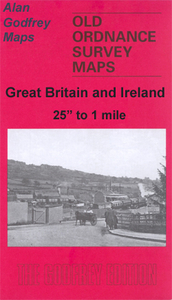
Craghead in 1895 in a fascinating series of reproductions of old Ordnance Survey plans in the Alan Godfrey Editions, ideal for anyone interested in the history of their neighbourhood or family. The map is double-sided to give maximum coverage. The main map covers the village itself, including Craghead Colliery with George Pit and William Pit, and Holmside Colliery with Oswald Pit and Thomas Pit. The Craghead Wagonway is included. The map then extends a mile east into countryside as far as Broomy Holm and includes the Black House pub (today the Charlaw Inn). On the reverse a section of adjacent sheet 12.14 extends coverage west to Windmill Hill, today the setting for two massive wind turbines. There is a short directory of Holmside Parish, and Tom Oliphant`s notes about the village`s
links with the engineer William Hedley; also that Hilary Clinton`s grandfather, Jonathan Rodham, was born there in Wagtail Cottages.About the Alan Godfrey Editions of the 25” OS Series:Selected towns in Great Britain and Ireland are covered by maps showing the extent of urban development in the last decades of the 19th and early 20th century. The plans have been taken from the Ordnance Survey mapping and reprinted at about 15 inches to one mile (1:4, 340). On the reverse most maps have historical notes and many also include extracts from contemporary directories. Most maps cover about one mile (1.6kms) north/south, one and a half miles (2.4kms) across; adjoining sheets can be combined to provide wider coverage.FOR MORE INFORMATION AND A COMPLETE LIST OF ALL AVAILABLE TITLES PLEASE
CLICK ON THE SERIES LINK.

Product Description
Reviews/Comments
Add New
Vouchers
No voucher codes found.
Do you know a voucher code for this product or supplier? Add it to Insights for others to use.
Do you know a voucher code for this product or supplier? Add it to Insights for others to use.
 Denmark