More From Contributor

£10.99
At a few minutes past seven on the evening of Thursday, November 14 1940, the historic industrial city of Coventry was subjected to the longest, most devastating air raid England had yet experienced. Only after eleven hours of continual bombardment by the German Luftwaffe could its people emerge from their half-sunk Anderson shelters & their cellars, from under their stairs or kitchen tables, to venture up into their wounded city. That long night of destruction marked a critical moment in the Second World War. It heralded a new kind of air warfare, one which abandoned the pursuit of immediate military goals & instead focused on obliterating all aspects of city life. It also provided the push America needed to join Britain in the war. But while the Coventry raid was furiously condemned publicly, such effective enemy tactics provided Britain`s politicians & military establishment with a `blueprint for obliteration`, to be adapted & turned against Germany. A merciless four-year war of attrition had begun. In this important work of history, Frederick Taylor draws upon numerous sources, including eye witness interviews from the archives of the BBC which are published here for the first time, to reveal the true repercussions of the bombing of Coventry in 1940. He teases out the truth behind the persistent rumors & conspiracy theories that Winston Churchill knew the raid was coming, assesses this significant turning point in modern warfare, looks at how it affected England`s status in the war, & considers finally whether this attack really could provide justification for the horror of Dresden, 1945. ...
Archived Product
£8.99
From P.D. James, one of the masters of British crime fiction, comes the debut novel that introduced Scotland Yard detective Adam Dalgliesh. Set in the peaceful English countryside, Cover Her Face is a classic murder mystery. St Cedd`s Church fete has been held in the grounds of Martingale manor house for generations. As if organising stalls, as well as presiding over luncheon, the bishop & the tea tent, were not enough for Mrs Eleanor Maxie on that mellow July afternoon, she also has to contend with the news of her son`s sudden engagement to the new parlour maid, Sally Jupp. On the following morning Martingale & the village are shocked by the discovery of Sally`s body. Investigating the violent death at the manor house, Detective Chief Inspector Adam Dalgliesh becomes embroiled in the complicated passions beneath the calm surface of English country life. In Cover Her Face, award-winning P.D. James (author of Death Comes to Pemberley, The Murder Room & Children of Men) plots a complex story of family secrets & suspicion. Meet the dark & brooding Dalgliesh
- a gentleman, a poet, & a gifted detective-and read the novel that launched P.D. James` career as the world`s pre-eminent crime writer.
...
Archived Product
£12.99
The Coversafe Secret Waist Wallet from Pacsafe is a thin wallet you easily hide under your shirt, to keep your money, valuables & small documents safe whilst travelling. It is comfortable to wear thanks to a soft outer lining & adjustable elasticated belt. It features a main large pocket with zip opening & in addition secured with a push button. Ideal for your travels. ...
Archived Product
£17.50
Pacsafe's Coversafe Travel Waist Wallet is for those times when you can never be too careful- it's a high-security waist wallet with a slashproof belt, tamperproof zippers & hidden buckle to ensure maximum safety of your valuables. It
Includes::- Slashproof adjustable belt
- Concealed slim line release buckle
- Tamperproof zipper security flap
- Removable ziplock water-resistant pouch- Comfortable breathable backing
- Moisture proof liner


...
Archived Product
£17.99
Topographic survey of Portugal at 1:50, 000 from the Instituto Geográfico do Exército, the country’s military survey organisation. The maps have contours at 20m intervals & in addition to the standard features shown on topographic mapping at this scale also indicate various types of terrain or vegetation (s&, terraces, rocks, woodlands, vineyards, etc). Each sheet covers an area of 32 x 20km (20 x 12.5 miles approx). The maps have a 1-km UTM grid plus latitude & longitude coordinates for the map corners. Map legend & a glossary of terms used on the maps include English.EDITION DATES: most titles in this series date from 1990s or later. To see all the titles in this series please click on the series link. ...
Archived Product
£17.99
Topographic survey of Portugal at 1:100, 000 from the Instituto Geográfico Português, the country’s civilian survey organisation. The maps have contours at 50m intervals & in addition to the standard features shown on topographic mapping at this scale also indicate various types of vegetation (vineyards, olive groves, etc). Each sheet covers an area of 64 x 40km (40 x 25 miles approx). The maps have latitude & longitude margin ticks at 1’ intervals, plus show UTM coordinates for the map corners. Map legend is in Portuguese only.PLEASE NOTE
- EDITION DATES: some sheets at this scale date back to the 1950s or 1960s. For more recent editions please see IGP’s 1:25, 000 series where each 50K map is divided into four quarters. To see all the titles in the 1:100, 000 series please click on the series link.
...
Archived Product
£9.99
Map No. 788, George Washington & Jefferson National Forests: Covington
- Alleghany Highlands, VA/WV, in an extensive series
...
Archived Product
£8.99
Cow is the story of a Spanish agricultural labourer, Ambrosio, who goes to Switzerland as a Gastarbeiter. He is bound for Innenwald, a village in the Swiss highlands, & the novel begins as he is about to spend a summer working for Farmer Knuchel. It ends in the abattoir of the neighbouring city, at the end of the seven hard years of labour that have destroyed him. There he sees Blosch, the once magnificent lead cow on Knuchel`s farm, now a sad, condemned creature in the abattoir. Cow was acclaimed as a contemporary classic on first publication. Now more than ever it must be read as a book of archaic power about man, his work & his food &, most importantly, as a damning indictment of the relationship between man & the animal world. ...
Archived Product
£6.39
A detailed topographic map of Cowal East from the Ordnance Survey Explorer series, covering Dunoon & Inveraray. Edition A1; Publication date January 2007 About this series: These highly detailed maps show all the administrative boundaries, settlements as small as isolated farms, the road network down to unfenced roads & country tracks, & field boundaries (hedges & drystone walls) which make navigation across the countryside much easier. Steep gradients on roads are indicated. Various landmarks, e.g. powerlines, archaeological sites, windmills, churches & lighthouses are shown & additional graphics indicate natural terrain features such as cliffs, scree, mud & vegetation variations. The contour interval is 5 metres in the lower parts of the country & 10 metres in the uplands, & spot heights are marked. Each map covers an area of 30 x 20km (i.e. approx. 19 x 12 miles), with some double-sided maps covering more, as indicated in the individual descriptions. The maps are fully GPS compatible, with the National Grid shown at 1km intervals & latitude & longitude indicated by margin ticks at 1'. The Explorer series has replaced the earlier, green-cover Pathfinder maps. The Explorer series is now complete & covers all of Engl&, Wales & Scotl&. Some sheets for popular areas like the National Parks are still branded as Outdoor Leisure (OL) maps, but are now included in this series as the cartography is the same as that in the Explorer Maps. The Explorer maps offer a substantial improvement on the Pathfinder series, with greater use of colour, larger area per map, & stronger emphasis on information for ramblers & tourists. This series is ideal for walking & other outdoor pursuits & each map shows a large amount of information for ramblers & tourists. Public rights of way are shown (except in Scotland), together with other routes with public access: National Trails & Recreational Paths, permitted paths & bridleways, & selected cycle routes. Open access land created under the Countryside & Rights of Way Act 2000 is marked. Tourist information

Includes::
caravan & camp sites, Park & Ride locations, recreation/leisure/sport centres, museums, historic buildings, English Heritage & National Trust sites, rural pubs, etc. The map legend is in English only, except for the tourist information content which is also in French & German.

...
Archived Product
£14.99
Cowal East area of central Scotland on a detailed topographic & GPS compatible map OL37, waterproof version, from the Ordnance Survey’s 1:25, 000 Explorer series. Coverage

Includes::
a section of the Loch Lomond & The Trossachs National Park with parts of the Queen Elizabeth Forest Park & the Argyll Forest Park, Dunoon, Inveraray, Loch Long, Loch Eck, Loch Fyne, the Cowal Way, etc.MOBILE DOWNLOADS: this title & all the other OS Explorer maps include a code for downloading after purchase the digital version onto your smartphone or tablet for viewing on the OS smartphone app.OS EXPLORER SERIES: to see the list of all the titles in the OS Explorer series, both paper & waterproof versions, please click on the series link. The Explorer series, Ordnance Survey’s most detailed maps recommended for anyone enjoying outdoor activities, provides topographic coverage of Great Britain at 1:25, 000 on GPS compatible maps with hiking trails, cycling routes & extensive tourist information. Each printed map is available either on paper or as a waterproof & tear-resistant OS Active Map, as indicated in its title. Britain’s National Parks & other areas of particular tourist interest are presented on often double-sided OL (Outdoor Leisure) maps, whilst most standard format Explorers cover an area of 30 x 20km (approx. 19 x 12 miles). All three versions (paper, waterproof & digital) are the same & provide plenty of recreational & tourist information, indicating the traditional public right of way paths (except in Scotland where different laws apply), including bridleways & byways. National Trails & other long-distance paths are marked, as well as permissive footpaths or bridleways & on-road or traffic-free cycle routes with, where appropriate, their National/ Regional Cycle Network numbers. Boundaries of access land are clearly marked. A wide range of symbols provides additional tourist information, highlighting camping & caravanning sites, information offices & visitors’ centres, parking & picnicking places, country pubs, sport & recreational facilities including cycle hire locations & mountain biking trails, historic buildings & museums, etc. Exceptionally clear presentation of the landscape is provided by contours at 5m or in the uplands at 10m intervals, with additional spot heights plus colouring and/or graphics for different types of woodlands, orchards, heath, marshl&, scree or boulders, & other topographic features. For GPS users the maps have British National Grid lines at 1km intervals, with latitude & longitude given by margin ticks at 1`. Clearly laid out map legend

Includes::
French & German translations for the tourist information symbols.


...
Archived Product

Covilha

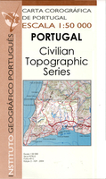
Topographic survey of Portugal at 1:50, 000 from the Instituto Geográfico Português, the country’s civilian survey organisation. The maps have contours at 25m intervals and in addition to the standard features shown on topographic mapping at this scale also indicate various types of vegetation (vineyards, olive groves, etc). Each sheet covers an area of 32 x 20km (20 x 12.5miles approx). The maps have latitude and longitude margin ticks at 1’ intervals and UTM coordinates for the map corners – each sheet also shows conversion details from BBLx (Bessel-Bonnie system, Datum Lisbon) to UTM. Map legend is in Portuguese only.EDITION DATES: most titles in this series have now been updated in the 1990s or later.To see all the titles in this series please click on the series link.
RIP - This product is no longer available on our network. It was last seen on 25.09.2019

This page now acts as a permanent archive for this product. Add more information using the comments box below to ensure it can still be found by future generations.

Use our search facility to see if it is available from an alternative contributor.
  • Availability: Out Of Stock
  • Supplier: Stanfords
  • SKU: XL00000028419
Availability: In Stock
£17.99

Product Description

Topographic survey of Portugal at 1:50, 000 from the Instituto Geográfico Português, the country’s civilian survey organisation. The maps have contours at 25m intervals & in addition to the standard features shown on topographic mapping at this scale also indicate various types of vegetation (vineyards, olive groves, etc). Each sheet covers an area of 32 x 20km (20 x 12.5miles approx). The maps have latitude & longitude margin ticks at 1’ intervals & UTM coordinates for the map corners – each sheet also shows conversion details from BBLx (Bessel-Bonnie system, Datum Lisbon) to UTM. Map legend is in Portuguese only.EDITION DATES: most titles in this series have now been updated in the 1990s or later. To see all the titles in this series please click on the series link.

Reviews/Comments

Add New

Intelligent Comparison

Oooops!
We couldn't find anything!
Perhaps this product's unique.... Or perhaps we are still looking for comparisons!
Click to bump this page and we'll hurry up.

Price History

Vouchers

No voucher codes found.
Do you know a voucher code for this product or supplier? Add it to Insights for others to use.

Facebook

Jargon Buster

Lisbon - The capital city of Portugal

Supplier Information

Stanfords
Stanfords was established in 1853 and opened their iconic Covent Garden flagship store in 1901. They have become the top retailer of maps, travel books and accessories in the UK and arguably offer the largest selection of maps and travel books worldwide. Famous names such as Captain Robert Falcon Scott, Ranulph Fiennes and Michael Palin have purchased from Stanfords. They now have a shop in Bristol and both stores together with other venues operate a calendar of events including talks, book signings and exhibitions. As a specialist map retailer, the map selection is comprehensive and includes road maps, street maps and walking maps from worldwide destinations, as well as a selection of world atlases and wall maps. Books include travel guides and travel literature. Stanfords also stock globes, from miniatures made of blue marble to magnificent floor-standing globes. The website features a selection of interesting articles on travel topics.
Page Updated: 2023-11-12 20:15:36

Community Generated Product Tags

Oh No! The productWIKI community hasn't generated any tags for this product yet!
Menu