
 United Kingdom
 France
 Germany
 Netherlands
 Sweden
 USA
USA
 Italy
Italy
 Spain
Spain
More From Contributor


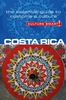

Costa Rica
Costa Rica at 1:500, 000 from Mapas NaTurismo with very clear presentation of the country’s topography, a street plan of San José, plus enlargements of the Central Valley and three national parks: Tortuguero, Volcán Arenal and Volcán PoásOn one side is a road map of the whole country. Excellent use of relief shading and altitude colouring gives an almost 3-D presentation of the terrain. National parks and other protected areas are clearly marked. Additional graphics indicate mangroves and yolillal palm tree swamps.Road network includes seasonal tracks and indicates driving distances on main and many local routes, plus locations of fuel supplies. Border crossings from the neighbouring countries give their opening times. Symbols mark locations with tourist accommodation, beaches,
surfing and diving sites, hot springs, etc. Latitude and longitude lines are drawn at 10’ intervals. The map is indexed and its legend includes English.The reverse side has a street plan of San José at 1:12, 500 highlighting locations of several hotels and places of interest, plus four more detailed enlargements: * The environs of San José and the adjoining parts of the Cordillera Central at 1:75, 000* Parque Nacional Tortuguero at 1:100, 000* Parque Nacional Volcán Arenal st 1:50, 000* Parque Nacional Volcán Poás at 1:50, 000
surfing and diving sites, hot springs, etc. Latitude and longitude lines are drawn at 10’ intervals. The map is indexed and its legend includes English.The reverse side has a street plan of San José at 1:12, 500 highlighting locations of several hotels and places of interest, plus four more detailed enlargements: * The environs of San José and the adjoining parts of the Cordillera Central at 1:75, 000* Parque Nacional Tortuguero at 1:100, 000* Parque Nacional Volcán Arenal st 1:50, 000* Parque Nacional Volcán Poás at 1:50, 000

Product Description
Reviews/Comments
Add New
Vouchers
No voucher codes found.
Do you know a voucher code for this product or supplier? Add it to Insights for others to use.
Do you know a voucher code for this product or supplier? Add it to Insights for others to use.
 Denmark