
 United Kingdom
 France
 Germany
 Netherlands
 Sweden
 USA
USA
 Italy
Italy
 Spain
Spain
More From Contributor


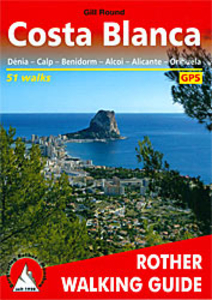
Costa Blanca
The Rother Walking Guide to Costa Blanca introduces 51 particularly interesting routes like walks onto Montgó, the Sierra de Aitana, Sierra de Bèrnia, Sierra Helada and Sierra de Orihuela and a selection of treks to explore and enjoy the cultural history and reveal culinary delights of this region. Every walk contains a fact-file of all the important information, a detailed walk description, a small map (at 1:50, 000 or 1:75, 000) showing the line of the route and an easy-to-read height profile. There are also two overview maps (at 1:50, 000 and 1:75, 000 scales) for general planning; the 85 colour photos give you an excellent insight into the landscape characteristics of all the walks.This guide provides a reliable companion for unforgettable days in spectacular natural
environments - for short trips near to large holiday resorts, as well as more challenging summit ascents in the remote mountain countryside of Alicante province. The selection ranges from leisurely strolls along the coast, to pleasantly cool rambles along rivers and gorges, to mountain walks with stunning views. The guide features 17 walks in Northern Costa Blanca, 18 inland from Benidorm, 9 between Alicante and Alcoi, 5 inland from Alicante and 2 in southern Costa Blanca.The book details how to download the GPS data for the routes featured in the guide.About this series:Rother Walking Guides were first published in 1920- since then Bergverlag Rother have continued to produce these comprehensive guides to “the finest valley and mountain walks”.Each book has a detailed description
of walks, small walking maps and many tips on combining the walks, places of interest, accommodation and public transport; the guides are all in full colour with varying scales and types of cartography - the walks themselves vary from day-long hikes to mountain and valley walks, with varying levels of ease and difficulty indicated.Small enough to fit in your pocket, comprehensive enough to take you everywhere; the books are printed in paperback but with a polytex-laminated cover, making them extremely durable too.

Product Description
Reviews/Comments
Add New
Intelligent Comparison
Archived Product
Costa Blanca Stanfords
£4.99
Archived Product
Costa Brava Stanfords
£12.95
Archived Product

Top 10 Costa Blanca Stanfords
£8.99
Archived Product
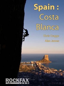
Costa Blanca RockFax Stanfords
£29.95
Archived Product
Costa Rica Stanfords
£9.95
Archived Product
Costa Rica Stanfords
£12.79
Archived Product
Costa Rica Stanfords
£8.99
Archived Product
Mont Blanc Stanfords
£10.50
Vouchers
No voucher codes found.
Do you know a voucher code for this product or supplier? Add it to Insights for others to use.
Do you know a voucher code for this product or supplier? Add it to Insights for others to use.
 Denmark