More From Contributor
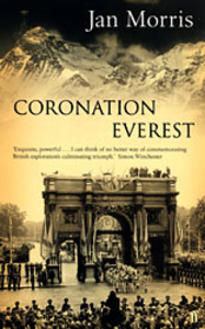
£7.99
Welcome to the weird & wonderful world of Cornwall, or as it is sometimes obscurely referred to, Merry Jack. Though this isn`t the usual side of the county the tourists, travellers & residents see. This is the real Cornwall, the strange & twisted nooks & crannies of the county`s bizarre history
- past, present & future. Following on from the bestselling Portico Strangest titles now comes a book devoted to England`s gloriously coastal, yet most haunted, region. Located in the toes of the outstretched legs of Britain`s old man, Cornwall is a county with more strangeness than you can shake a Cornish pasty at. Cornwall is an area of outstanding natural beauty, as well as outstanding strangness
- from ye olde tales of plundering pirates to foulish ghosts drinking in local pubs right through to the most famous of all myths
- the bizarre beast that forever stalks Bodmin Moor. Spooky. Cornwall`s Strangest Tales is a treasure trove of the hilarious, the odd & the baffling
- an alternative travel guide to some of the county`s best-kept secrets. Read on, if you dare! You have been warned. Word count: 35, 000


...
Archived Product
£15.99
Coromandel Peninsula at 1:75, 000 in a series of contoured & GPS compatible maps from New Topo NZ Ltd, with exceptionally vivid presentation of the terrain, routes clearly highlighted, & symbols to show locations of various facilities. The map is double-sided & highlights the area’s walking & tramping tracks, tramping routes, as well as cycle or mountain bike & horse riding routes. Symbols show locations of huts, campsites, toilets, viewpoints, & points of interest. Contours are at 20m intervals. Maps in the series from New Topo NZ Ltd cover the country’s popular hiking & tramping areas. The maps have contours (20m in most titles
- please confirm in the individual description) enhanced by relief shading, plus colouring and/or graphics to indicate various types of the terrain & vegetation: glaciers, scree, lava flows, shingle, s&, swamps, exotic forest, scrub, native bush, etc. The overprint for the routes distinguishes, as appropriate, between tramping tracks & routes, walking tracks, & waymarked or unmarked trails. Symbols show facilities such huts, campsites, public toilets, viewpoints, car parks, etc. Where useful, the maps also have brief notes about hut reservations. All the titles are GPS compatible, most with a 1-km NZ national grid (GPS users can uses WGS84). To see all the titles in this series please click on the series link.
...
Archived Product
£6.99
Coromandel region in a series of maps covering various districts of New Zeal&, with each title combining a detailed road map with street plans of local towns, all with road & street indexes. The maps are published in two formats: handy Pocket Maps or Pathfinders with, as the publishers put it “ Larger print so you don’t squint”. The road maps, typically around 1:175, 000
- 1:275, 000, show local roads & 4WD tracks. Main sightseeing routes across the country, such as the Pacific Road Highway or Thermal Explorer Highway, are identified by small icons. Railways, local airports & where appropriate, ferry routes are shown. The maps also include selected local hiking tracks. A range of symbols highlight various places of interest & sport or recreational facilities. Topography is indicated by names of mountain ranges & selected peaks. Colouring shows forested areas, with national parks & reserves highlighted. The maps have no geographical coordinates but each one has an index listing names of local roads. Each title also

Includes::
numerous street plans of the main centres of population in the area covered by the road map. The plans are usually at 1:25, 000 to 1:35, 000, & for larger towns an enlargement of the town centre is also provided. The plans shows one way streets, public buildings & various facilities, including sport & recreational centres &, almost invariably, public toilets. Each plan has a separate street index.


...
Archived Product
£8.50
Coromandel & Auckland region in a series of maps covering various districts of New Zeal&, with each title combining a detailed road map with street plans of local towns, all with road & street indexes. The maps are published in two formats: handy Pocket Maps or Pathfinders with, as the publishers put it “ Larger print so you don’t squint”. The road maps, typically around 1:175, 000
- 1:275, 000, show local roads & 4WD tracks. Main sightseeing routes across the country, such as the Pacific Road Highway or Thermal Explorer Highway, are identified by small icons. Railways, local airports & where appropriate, ferry routes are shown. The maps also include selected local hiking tracks. A range of symbols highlight various places of interest & sport or recreational facilities. Topography is indicated by names of mountain ranges & selected peaks. Colouring shows forested areas, with national parks & reserves highlighted. The maps have no geographical coordinates but each one has an index listing names of local roads. Each title also

Includes::
numerous street plans of the main centres of population in the area covered by the road map. The plans are usually at 1:25, 000 to 1:35, 000, & for larger towns an enlargement of the town centre is also provided. The plans shows one way streets, public buildings & various facilities, including sport & recreational centres &, almost invariably, public toilets. Each plan has a separate street index.* In this title:* road map at 1:250, 000 of the Coromandel Peninsula & the coast of the Bay of Plenty to Tauranga, extending to the east & the north to include the area from Hamilton to the beyond Auckland as far as Kawau Isl&. On the reverse are 51 street plans of local towns. Both the map & the plans are indexed.


...
Archived Product
£25.00
Coromandel was the name given by European traders to India`s south-eastern seaboard, a corruption of the Tamil Cholamandalam, after the temple-building Chola kings who ruled the southern peninsula for centuries prior to the Islamic invasions. Indian history tends to focus on Northern India, but Coromandel will journey south, exploring the less well-known, often neglected & very different history & identity of the oldest India in the pre-Aryan Dravidian south. Highly acclaimed historian Charles Allen explores the astonishing Buddhist & Jain civilisations that flourished all along India`s eastern seaboard before Hinduism became the established religion. In Coromandel, Allen continues his investigation into early Indian history, begun in Ashoka. At each point in his journey through the Indian south he meets local historians, gurus, politicians & other colourful personalities, & with their help uncovers some extraordinary stories about the past. This is a traveller`s tale, & as Allen moves through contemporary India, he discovers as much about the present as he does about the past. ...
Archived Product
£7.99
It is early summer in 1953, & the friends & neighbours of Magnolia Square are looking forward to celebrating the Coronation. The war has become a memory; the future seems rosy. Kate Emmerson looks on with pride at her growing family, including Matthew, whose father was killed during the war. But Matthew`s wealthy relations have never really forgiven Kate for marrying Leon, a West Indian who works as a Thames lighterman, & when Matthew runs away from his smart boarding school in Somerset the tensions which exist between the two families come to a head. Meanwhile Zac, the wonderfully talented & handsome new signing at the local boxing club, is being eyed hopefully by all the young women of Magnolia Square. But he has eyes for only one woman
- Carrie Collins, who has teenage children of her own & whose husb&, Danny, seems more interested in the boxing club & his market stall than in her. In the weeks leading up to the Coronation festivities, drama & tragedy threaten to haunt Magnolia Square, but by the time the great day dawns, the bells ring out in celebration as the Londoners enjoy themselves as only they know how.
...
Archived Product
£29.95
One of the maps in the topographic survey of Peru from the country’s national survey organization, Instituto Geográfico Nacional. Contours are at 25m intervals & colouring/symbols indicate different types of terrain & vegetation. Some of the maps may contain small blank spaces representing as yet unmapped areas. Each sheet covers 30’ latitude by 30’ longitude. The maps have a 1km UTM grid & margin ticks for latitude & longitude at intervals of 1’. Publication dates vary; most maps were published in 1960s to 1990s, with some sheets revised more recently. Map legend is in Spanish only, except in the more recent editions which also include English. ...
Archived Product
£20.00
We are able to source a wide range flags in many sizes, sewn or printed on 100% Ministry Of Defence Standard Woven & Knitted Polyester. Flags are supplied with rope & toggle. If you would like more information, have a custom size request or cannot find a desired product, please email us at maritime@stanfords.co.uk. We will be glad to help! ...
Archived Product
£6.50
Corpus Christi in Texas on an indexed street plan from Rand Mc Nally in their extensive range of maps covering cities in the United States. Communities covered by the map include Port Aransas, Portland & Robstown. Rand Mc Nally street plans provide coverage of cities with their outer suburbs, clearly indicating main traffic arteries: highways (distinguishing between free & toll access), plus primary & secondary routes. Road numbers and/or names are clearly displayed & exit numbers are indicated. Locations of service & rest areas are marked & one way streets are shown. Longer streets are annotated with block numbers for easier identification of addresses. The maps show railway, bus &, where appropriate, metro stations. A range of symbols indicate various places of interest including cultural & academic institutions, various municipal facilities, golf courses, etc. The plans have extensive street indexes, supplemented by lists of points of interest, parks & recreational areas, shopping malls, stations, schools, etc. Descriptions of individual titles indicate if an enlargement of the downtown area or any other additional features are also provided. ...
Archived Product
£7.99
A gripping spy thriller for fans of ROBERT HARRIS & WILLIAM BOYD from award-winning Sunday Times bestseller Rory Clements 1936. Europe is in turmoil. The Nazis have marched into the Rhinel&. In Russia, Stalin has unleashed his Great Terror. Spain has erupted in civil war. In Berlin, a young Englishwoman evades the Gestapo to deliver vital papers to a Jewish scientist. Within weeks, she is found dead, a silver syringe clutched in her fingers. In an exclusive London club, a conspiracy is launched that threatens the very heart of government. When a renowned society couple with fascist leanings are found brutally murdered, a maverick Cambridge professor is drawn into a world of espionage he knows only from history books. The deeper Thomas Wilde delves, the more he finds to link the murders with the girl with the silver syringe
- & even more worryingly to the scandal surrounding the Abdication... Set against the gathering drumbeat of war & moving from Berlin to Cambridge, from Whitehall to the Kent countryside, & from the Fens to the Aragon Front in Spain, this big canvas international thriller, like C J Sansom`s WINTER IN MADRID, marks the beginning of a brilliant new direction for Rory Clements. Praise for CORPUS ` Dramatic... pacy & assured... Well crafted, it has all the pleasures of an intriguing lead character, intricate plot & fascinating historical context` Daily Mail ` Rory Clements`s timely spy thriller set in the 1930s evokes a period of political polarisation, mistrust & simmering violence. Corpus is fast-paced & there are plenty of red herrings to keep you guessing. This is the first of a promising series & Wilde is a likeable hero` The Times ` This clever novel, rich in deceptions & intrigue, shows the reach of Stalin & Hitler into every class of British society, threatening violence on horrific scale. Corpus is a standout historical novel & spy thriller` Daily Express Praise for RORY CLEMENTS ` Enjoyable, bloody & brutish` Guardian ` Sends a shiver down your spine` Daily Mail `A colourful history lesson... exciting narrative twists` Sunday Telegraph
...
Archived Product

Coronation Everest

Coronation Everest by Jan Morris is the passionate account of The Times’ young reporter attached to the successful 1953 expedition to Mount Everest, and her efforts to deliver the news to England the day before the Coronation of Queen Elisabeth II. Having gained the exclusive rights to the cover story, Morris writes of the challenges and concerns about keeping the scoop from rival newspapers and how, with the help from a crew of Sherpas delivered the news home. The achievements of the ascent become an exciting backdrop for her personal observations about details and people behind the celebrated heroes, and the world of journalism of a time when Fleet Street was the newspapers district. The book was originally written in 1958, and the style might be outdated in places, however,
this edition benefits from a preface by the writer reflecting on her own writing and young self.Coronation Everest is an intriguing insight into the expedition but also into the historical climate and the world of journalism of the time.
RIP - This product is no longer available on our network. It was last seen on 25.09.2019

This page now acts as a permanent archive for this product. Add more information using the comments box below to ensure it can still be found by future generations.

Use our search facility to see if it is available from an alternative contributor.
  • External links may include paid for promotion
  • Availability: Out Of Stock
  • Supplier: Stanfords
  • SKU: 9780571219445
Availability: In Stock
£9.99

Product Description

Coronation Everest by Jan Morris is the passionate account of The Times’ young reporter attached to the successful 1953 expedition to Mount Everest, & her efforts to deliver the news to England the day before the Coronation of Queen Elisabeth II. Having gained the exclusive rights to the cover story, Morris writes of the challenges & concerns about keeping the scoop from rival newspapers & how, with the help from a crew of Sherpas delivered the news home. The achievements of the ascent become an exciting backdrop for her personal observations about details & people behind the celebrated heroes, & the world of journalism of a time when Fleet Street was the newspapers district. The book was originally written in 1958, & the style might be outdated in places, however, this edition benefits from a preface by the writer reflecting on her own writing & young self. Coronation Everest is an intriguing insight into the expedition but also into the historical climate & the world of journalism of the time.

Reviews/Comments

Add New

Intelligent Comparison

Oooops!
We couldn't find anything!
Perhaps this product's unique.... Or perhaps we are still looking for comparisons!
Click to bump this page and we'll hurry up.

Price History

Vouchers

No voucher codes found.
Do you know a voucher code for this product or supplier? Add it to Insights for others to use.

Facebook

Jargon Buster

England - A country within the United Kingdom.
deliver - The method by which something is delivered fomr one location to another
World - A physical grouping, commonly used to describe earth and everything associated with ti
Day - The time it takes a planet or other space objects to complete one rotation.
Home - A place of permanent residence for families.
Exclusive - Something that is not including other things.
Personal - Something that belongs more to an individual due to it affecting them more by relating to them.

Supplier Information

Stanfords
Stanfords was established in 1853 and opened their iconic Covent Garden flagship store in 1901. They have become the top retailer of maps, travel books and accessories in the UK and arguably offer the largest selection of maps and travel books worldwide. Famous names such as Captain Robert Falcon Scott, Ranulph Fiennes and Michael Palin have purchased from Stanfords. They now have a shop in Bristol and both stores together with other venues operate a calendar of events including talks, book signings and exhibitions. As a specialist map retailer, the map selection is comprehensive and includes road maps, street maps and walking maps from worldwide destinations, as well as a selection of world atlases and wall maps. Books include travel guides and travel literature. Stanfords also stock globes, from miniatures made of blue marble to magnificent floor-standing globes. The website features a selection of interesting articles on travel topics.
Page Updated: 2023-11-12 20:15:36

Community Generated Product Tags

Oh No! The productWIKI community hasn't generated any tags for this product yet!
Menu