More From Contributor

£7.99
Cork & South West Ireland in the Pocket Guide series from Insight provides detailed commentary on a collection of itinerary based trips in a handy pocket format. Each guide has an historical & cultural introduction, profiling the growth of the region or city. There is also a large selection of localised & pedestrian friendly tour itineraries designed to take in the major sites, as well as a chapter on excursions to other destinations within easy reach. Further sections detail leisure activities including shopping, eating out, nightlife, festivals & local events with accompanying addresses & contact details where relevant. There is also practical guidance on transport, local services, language & accommodation. Each guide also has a large selection of colour photographs & a pull-out pocket map giving an overview of the region. ...
Archived Product
£8.25
Map No. 80, Cork Central in the Discovery series from the OSI, the Ordnance Survey of Irel&, which presents the country on detailed topographic maps at 1:50, 000, with additional overprint highlighting campsites & caravan parks, youth hostels, etc. The maps have contours at 10m intervals, with plenty of spot heights & additional altitude colouring. Graphics indicate different types of woodlands. An overprint highlights waymarked or unmarked walking trails as well as cycle routes. National or forest parks & nature reserves are marked & a range of symbols provide tourist information: campsites, caravan parks, youth hostels (An ...
Archived Product
£8.25
Map No. 86, Cork Central in the Discovery series from the OSI, the Ordnance Survey of Irel&, which presents the country on detailed topographic maps at 1:50, 000, with additional overprint highlighting campsites & caravan parks, youth hostels, etc. The maps have contours at 10m intervals, with plenty of spot heights & additional altitude colouring. Graphics indicate different types of woodlands. An overprint highlights waymarked or unmarked walking trails as well as cycle routes. National or forest parks & nature reserves are marked & a range of symbols provide tourist information: campsites, caravan parks, youth hostels (An ...
Archived Product
£8.25
Map No. 80, Cork Central in the Discovery series from the OSI, the Ordnance Survey of Irel&, which presents the country on detailed topographic maps at 1:50, 000, with additional overprint highlighting campsites & caravan parks, youth hostels, etc. Current 4th edition of this map was published in January 2013. Maps in the Discovery series have contours at 10m intervals, with plenty of spot heights & additional altitude colouring. Graphics indicate different types of woodlands. An overprint highlights waymarked or unmarked walking trails as well as cycle routes. National or forest parks & nature reserves are marked & a range of symbols provide tourist information: campsites, caravan parks, youth hostels (An Óige & independent), tourist offices, parking & picnic places, & viewpoints. Golf courses indicate the number of holes. The maps also highlight antiquities & historical sites such as megalithic tombs, standing stones, battlefields, etc. Road network grades third class roads according to their widths &

Includes::
local tracks. Railways are shown with stations & the maps include other details expected of topographic mapping at this scale. Where appropriate, place names are given in both Irish & English. Each map covers an area of 40 x 30km (25 x 19 miles approximately) & has a 1km ITM (Irish Transverse Mercator) grid, plus latitude & longitude margin ticks at 1` intervals. Map legend is in Irish & English. To see the list of all the titles in this series please click on the series link.

...
Archived Product
£8.25
Map No. 85, Cork Central-West in the Discovery series from the OSI, the Ordnance Survey of Irel&, which presents the country on detailed topographic maps at 1:50, 000, with additional overprint highlighting campsites & caravan parks, youth hostels, etc. The maps have contours at 10m intervals, with plenty of spot heights & additional altitude colouring. Graphics indicate different types of woodlands. An overprint highlights waymarked or unmarked walking trails as well as cycle routes. National or forest parks & nature reserves are marked & a range of symbols provide tourist information: campsites, caravan parks, youth hostels (An ...
Archived Product
£12.50
County Cork at 1:100, 000 in a series of double-sided, GPS-compatible maps from Xploreit Maps, with contours, altitude colouring, hiking trails & cycling routes, & printed on light, waterproof & tear-resistant plastic paper. Topography is shown by altitude colouring with contours (interval varies) & plenty of names of geographical features. Road network

Includes::
local secondary roads & tracks & gives driving distances on main routes. Scenic routes are highlighted. Railway lines are shown with station; local airports, harbours/marinas, & passenger ferry connections are also marked. An overprint highlights local waymarked hiking paths, long-distance walking trails & cycle routes. A wide range of symbols indicate various places of interest; antiquities, leisure facilities, museums & heritage sites, tourist information centres, campsites & caravan parks, etc. Each map is indexed & has latitude & longitude lines at intervals of 5’ & 10’ respectively, plus in the margin Irish national grid.

...
Archived Product
£8.25
Map No. 86, Cork Central in the Discovery series from the OSI, the Ordnance Survey of Irel&, which presents the country on detailed topographic maps at 1:50, 000, with additional overprint highlighting campsites & caravan parks, youth hostels, etc. Current 4th edition of this map was published in October 2015. Maps in the Discovery series have contours at 10m intervals, with plenty of spot heights & additional altitude colouring. Graphics indicate different types of woodlands. An overprint highlights waymarked or unmarked walking trails as well as cycle routes. National or forest parks & nature reserves are marked & a range of symbols provide tourist information: campsites, caravan parks, youth hostels (An Óige & independent), tourist offices, parking & picnic places, & viewpoints. Golf courses indicate the number of holes. The maps also highlight antiquities & historical sites such as megalithic tombs, standing stones, battlefields, etc. Road network grades third class roads according to their widths &

Includes::
local tracks. Railways are shown with stations & the maps include other details expected of topographic mapping at this scale. Where appropriate, place names are given in both Irish & English. Each map covers an area of 40 x 30km (25 x 19 miles approximately) & has a 1km ITM (Irish Transverse Mercator) grid, plus latitude & longitude margin ticks at 1` intervals. Map legend is in Irish & English. To see the list of all the titles in this series please click on the series link.

...
Archived Product
£8.25
Map No. 89, Cork South-Central in the Discovery series from the OSI, the Ordnance Survey of Irel&, which presents the country on detailed topographic maps at 1:50, 000, with additional overprint highlighting campsites & caravan parks, youth hostels, etc. Current 4th edition of this map was published in December 2012. Maps in the Discovery series have contours at 10m intervals, with plenty of spot heights & additional altitude colouring. Graphics indicate different types of woodlands. An overprint highlights waymarked or unmarked walking trails as well as cycle routes. National or forest parks & nature reserves are marked & a range of symbols provide tourist information: campsites, caravan parks, youth hostels (An Óige & independent), tourist offices, parking & picnic places, & viewpoints. Golf courses indicate the number of holes. The maps also highlight antiquities & historical sites such as megalithic tombs, standing stones, battlefields, etc. Road network grades third class roads according to their widths &

Includes::
local tracks. Railways are shown with stations & the maps include other details expected of topographic mapping at this scale. Where appropriate, place names are given in both Irish & English. Each map covers an area of 40 x 30km (25 x 19 miles approximately) & has a 1km ITM (Irish Transverse Mercator) grid, plus latitude & longitude margin ticks at 1` intervals. Map legend is in Irish & English. To see the list of all the titles in this series please click on the series link.

...
Archived Product
£8.25
Map No. 81, Cork East
- Waterford South-West in the Discovery series from the OSI, the Ordnance Survey of Irel&, which presents
...
Archived Product
£110.00
Stick pins in the places you’ve been or plan your future travels on this 25 cm diameter cork globe with a clear & simple world map. Pinpoint cities & tick-off countries as you journey around the planet. Mounted on a stainless steel base & supplied with pins. ...
Archived Product

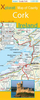
Cork City Spot Guide SUPERCEDED

This is the savvy city breakers' pocket guide to seeing and doing more in the friendly city built on seven hills - with a fun-seeking and cost-conscious slant. It features practical accommodation, restaurant and nightlife listings to suit varied budgets and tastes. Imaginative suggestions reveal the city's hidden gems. Compact format quickly locates the top must-see and do attractions.The guide is perfect for pleasure-seeking city breakers wanting to quickly pinpoint the city's most entertaining highlights and decide what to see and do in a limited time. With clear maps to enable fast orientation and full-colour illustrated pages to pinpoint the very best in shopping, sightseeing, eating and drinking - plus great ideas for low-budget entertainment too.
RIP - This product is no longer available on our network. It was last seen on 25.09.2019

This page now acts as a permanent archive for this product. Add more information using the comments box below to ensure it can still be found by future generations.

Use our search facility to see if it is available from an alternative contributor.
  • Availability: Out Of Stock
  • Supplier: Stanfords
  • SKU: 9781848480438
Availability: In Stock
£6.99

Product Description

This is the savvy city breakers' pocket guide to seeing & doing more in the friendly city built on seven hills
- with a fun-seeking & cost-conscious slant. It features practical accommodation, restaurant & nightlife listings to suit varied budgets & tastes. Imaginative suggestions reveal the city's hidden gems. Compact format quickly locates the top must-see & do attractions. The guide is perfect for pleasure-seeking city breakers wanting to quickly pinpoint the city's most entertaining highlights & decide what to see & do in a limited time. With clear maps to enable fast orientation & full-colour illustrated pages to pinpoint the very best in shopping, sightseeing, eating & drinking
- plus great ideas for low-budget entertainment too.

Reviews/Comments

Add New

Intelligent Comparison

Oooops!
We couldn't find anything!
Perhaps this product's unique.... Or perhaps we are still looking for comparisons!
Click to bump this page and we'll hurry up.

Price History

Vouchers

No voucher codes found.
Do you know a voucher code for this product or supplier? Add it to Insights for others to use.

Facebook

Jargon Buster

Cork - A county in Ireland
Cork - A natural product from the Cork Oak tree
compact - Carefuly designed to ensure an item has a minimal physical size
Fun - Something that provides amusement or enterainment
Entertainment - Something that provides amusement
Colour - The categorised spectrum of light visable to humans
Compact - something that has a lot combined within a small space.
Accommodation - A room in which someone can live in, for example in a hotel
Practical - Weather a task is easy to carry out and realistically succeed.
Pocket - A bag shaped insert in clothing used to carry items

Supplier Information

Stanfords
Stanfords was established in 1853 and opened their iconic Covent Garden flagship store in 1901. They have become the top retailer of maps, travel books and accessories in the UK and arguably offer the largest selection of maps and travel books worldwide. Famous names such as Captain Robert Falcon Scott, Ranulph Fiennes and Michael Palin have purchased from Stanfords. They now have a shop in Bristol and both stores together with other venues operate a calendar of events including talks, book signings and exhibitions. As a specialist map retailer, the map selection is comprehensive and includes road maps, street maps and walking maps from worldwide destinations, as well as a selection of world atlases and wall maps. Books include travel guides and travel literature. Stanfords also stock globes, from miniatures made of blue marble to magnificent floor-standing globes. The website features a selection of interesting articles on travel topics.
Page Updated: 2023-11-12 20:15:36

Community Generated Product Tags

Oh No! The productWIKI community hasn't generated any tags for this product yet!
Menu