
 United Kingdom
 France
 Germany
 Netherlands
 Sweden
 USA
USA
 Italy
Italy
 Spain
Spain
More From Contributor


Corfu F&B
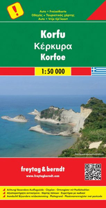
Large, contoured map of Corfu, showing the long-distance hiking trail along the whole length of the island and highlighting various places of interest, with brief descriptions in an accompanying booklet which also provides a street plan of Kerkyra.Relief is portrayed by contours with hill-shading and spot heights Road network shows minor roads and selected cart tracks. Symbols highlight various landmarks, and places of interest, including locations described in the booklet.The map also highlights the course of the “Corfu Trail”, a long-distance footpath which crisscrosses the northern part of the island and runs to its southern tip mainly along the western coast. The map has a UTM grid and latitude and longitude margin ticks at 2’ intervals.Included as an inset are maps of
Paxos with Antipaxos, and the three small islands north of Corfu: Mathraki, Othoni and Erikoussa. Another inset shows Corfu and all these islands indicating ferry connections to mainland Greece and the Albanian port of Sarande. All place names, including those of geographical features and places of interest such as churches, etc., are shown in both Roman and Greek alphabets.A separate booklet attached to the map cover has an index listing all the localities with their postcodes, and brief descriptions of main places of interest, all highlighted on the map. Also included is a street plan of Kerkyra town. Multilingual map legend and the notes include English.
Paxos with Antipaxos, and the three small islands north of Corfu: Mathraki, Othoni and Erikoussa. Another inset shows Corfu and all these islands indicating ferry connections to mainland Greece and the Albanian port of Sarande. All place names, including those of geographical features and places of interest such as churches, etc., are shown in both Roman and Greek alphabets.A separate booklet attached to the map cover has an index listing all the localities with their postcodes, and brief descriptions of main places of interest, all highlighted on the map. Also included is a street plan of Kerkyra town. Multilingual map legend and the notes include English.

Product Description
Reviews/Comments
Add New
Intelligent Comparison
Archived Product
Corfu Stanfords
£4.99
Archived Product
Corfu Stanfords
£5.00
Archived Product
Corfu Stanfords
£12.99
Archived Product

Corfu Stanfords
£6.99
Archived Product

Peru F&B Stanfords
£10.99
Vouchers
No voucher codes found.
Do you know a voucher code for this product or supplier? Add it to Insights for others to use.
Do you know a voucher code for this product or supplier? Add it to Insights for others to use.
 Denmark