More From Contributor

£5.99
Fresh from saving the universe, Compton & Bryan are whisked off to the future to become trainee Time Crime Agents. But when a notorious criminal mastermind escapes from a maximum security prison & kidnaps Bryan, Compton must race against time to save his best friend
- & the world
- from evil...using only a slimy sandwich.

...
Archived Product
£9.99
In cool, precise prose, & with an unerring sense of the absurd, the four novellas of ” Compulsory Happiness” create a picture of everyday life in a grotesque police state, expressing terror & hope, fear & solidarity, the humorous triviality of the ordinary, & the painful search for an ideal.” Norman Manea`s four novellas, written during the later Ceausescu years, offer a comparable contrast to other Eastern European dissident writing. Instead of the energetic irony, the ebullient absurdism, the sharp-eyed wit, we find a dreamy disconnection, a voice that shock has lowered, an air of sweetness driven mad.”--Richard Eder, ” Los Angeles Times” Mr. Manea`s voice is radically new, & we are blessedly awakened & alerted by the demand his fiction makes on our understanding.”--Lore Segal, ” New York Times Book Review” ...
Archived Product
£16.99
` The book stands comparison with A.L. Morton`s ` People`s History` & G.D.H. Cole`s ` Common People`. But it is more than just this. It is in a real sense a history for our own times.` John Foster, Emeritus Professor, University of the West of Scotland ` This book is ideal for its purpose. I only wish it had been available in the decades when I was teaching trade union courses.` Jim Fryth, Labour History Review ` At last a readable & accessible general history of the labour movement.. . Highly recommended.` Manchester TUC Newsletter --A revised, updated & expanded edition of this classic feminist account of British labour history-- Critical & iconoclastic, Comrade or Brother? traces the history of the British Labour Movement from its beginnings at the onset of industrialisation through its development within a capitalist society, up to the end of the twentieth-century. Written by a leading activist in the labour movement, the book redresses the balance in much labour history writing. It examines the place of women & the influence of racism & sexism as well as providing a critical analysis of the rival ideologies which played a role in the uneven development of the labour movement. ...
Archived Product
£5.99
Murcia & the Valencia region at 1:400, 000 in a series of indexed touring maps of Spain from Michelin with street plans of main cities. Topography is indicated by bold relief shading with spot heights & colouring for forested areas. Detailed road information, characteristic of Michelin ...
Archived Product
£9.99
Fortore commune in the mountains along the north-eastern corner of Campania on a detailed, countered map at 1:50, 000 from Ed. Abies, with notes about the area & other tourist information. The map is centered on the villages of Molinara, Montefalcone di Valforte & Foiano di Valfortre, with the town of Benevento in its south-western corner. Contours at 25m intervals, with relief shading & colouring for different types of woodlands, present the topography. The map shows local country roads & tracks without specifically highlighting any waymarked hiking routes. Overprint indicates agritourismo farm accommodation, caravan parks, outlets for local products & picnic sites. The map has no geographical coordinates. On the reverse are notes of the area & other tourist information including dates of local religious festivals. Map legends & all the text include English. ...
Archived Product
£10.99
Topographic survey of Catalonia at 1:50, 000 from the Institut Cartogràfic de Catalunya, with vivid presentation of the terrain & an overprint for long-distance GR hiking trails. The series provides an excellent alternative to the much smaller sheets in the civilian or military surveys produced for the whole of Spain. The Catalan 50K series has not only a much larger area per sheet (each map covers one comarca, an administrative division of a province) than the maps from the national surveys, but also has more colourful, elegant & clear cartography with contours at 20m intervals, hill shading & fine graphics to portray the relief, vegetation types & landmarks. Most maps also have more tourist-related information, with an overprint highlighting long-distance GR trails & the Via Verde routes. Mountain refuges are marked & a range symbols indicate various places of interest including historical monuments, sport & recreational facilities, etc. Four different types of interesting locations are highlighted: picturesque towns or villages, individual isolated building or monuments, natural sites, & hydrographic features such as waterfalls. The maps have a 5km UTM grid, with latitude & longitude values shown for the map corners. Map legend is in Catalan only. To see other titles in this series please click on the series link. ...
Archived Product
£13.99
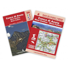
Conca di Aosta
- Mont Emilius
- Mont Fallere, map No. 4, in a series of detailed, GPS compatible hiking maps of the Italian

...
Archived Product
£18.95
At once polemical, insightful & thought-provoking, ” Conceiving God” is essential reading for all those interested in the origins of religious thought, & the respective roles of science & religion in contemporary society. Building on the insights & discoveries of his two earlier books, ” The Mind in the Cave” & ” Inside the Neolithic Mind”, cognitive archaeologist David Lewis-Williams explores how science developed within the cocoon of religion & then shows how the natural functioning of the human brain creates experiences that can lead to belief in the supernatural realm. ...
Archived Product
£17.99
Topographic mapping from Mexico’s national survey agency, Instituto Nacional de Estadística, Geografía e Informática. The maps have contours at 20m intervals with relief shading & indicate various types of terrain & vegetation, e.g. dense vegetation, cultivated areas, swamps, sand dunes, salt pans, etc. UTM grid is at 10km intervals, with latitude & longitude shown by margin ticks at intervals of 5`. Map legend is in Spanish only. To see the other titles in this series please click on the series link. ...
Archived Product
£25.00
Andy Rouse has gained a reputation for getting up close & personal with his subjects -ranging from lions & elephants in Africa to penguins in Antarctica, & taking in a whole host of African, European & North American wildlife on the way. In Concepts of Nature the author brings together some of his most memorable images from a genre-defining portfolio spanning four continents. Split into three parts, Concepts of Nature begins with ` Visions`, in which Rouse presents the photographs, many published here for the fist time, which he feels were the landmarks in his career & in his development from a one `big shot` specialist to an artist who can capture the whole story of a species & its environment. In ` Expression` he then discusses & illustrates the ideas & techniques that have enabled him to create a series of themed portfolios devoted to a single species or ecosystem -such as those he made in South Georgia & Antarctica. Finally, in ` Inspiration` Rouse turns to the work of other wildlife photographers who have inspired & influenced him. There is also an appendix giving technical details of the individual photographs. For aspiring wildlife photographers, this book will itself be an inspiration, showing just what can be achieved with skill, patience & an extraordinary eye for the telling & dramatic shot. But it will also be treasured by the host of wildlife enthusiasts who admire Andy Rouse`s pictures, attend his lectures or watch his television programmes. ...
Archived Product

Conakry IGN Map

One of the titles in a series of topographic maps covering much of north-west Africa, produced as part of the IMW* project in 1960’s. Each map covers an area spanning 6° in longitude and 4° in latitude. There is some variation in colouring and the depiction of terrain, but hill-shading, spot heights and contours are used to show the general relief. Additional graphics show features such as dunes, rock outcrops, cliffs, sand areas, escarpments, marshes, seasonal lakes and watercourses, and areas liable to flooding. Bathymetric contours are also included.Communications detail includes roads, major trails and railways, although there is some inconsistency in colouring and the extent of classification, e.g. not all maps distinguish seasonal roads. On most maps intermediate
road distances are indicated on main routes. Symbols show airports, mosques, mines, oil and gas fields, lighthouses, ruins and significant isolated buildings. Administrative boundaries are marked and latitude and longitude lines are drawn at 1° intervals, with further margin ticks at 1’ intervals. The map legend is in French only on some sheets, and in English and French on others.*The International Map of the World was a project conceived in the early 20th century to compile a world map series at 1:1, 000, 000 through the efforts of participating nations. The value of the program has declined since 1970 and the IMW is no longer regarded as an active international series.
RIP - This product is no longer available on our network. It was last seen on 25.09.2019

This page now acts as a permanent archive for this product. Add more information using the comments box below to ensure it can still be found by future generations.

Use our search facility to see if it is available from an alternative contributor.
  • Availability: Out Of Stock
  • Supplier: Stanfords
  • SKU: XL00000009393
Availability: In Stock
£11.99

Product Description

One of the titles in a series of topographic maps covering much of north-west Africa, produced as part of the IMW* project in 1960’s. Each map covers an area spanning 6° in longitude & 4° in latitude. There is some variation in colouring & the depiction of terrain, but hill-shading, spot heights & contours are used to show the general relief. Additional graphics show features such as dunes, rock outcrops, cliffs, sand areas, escarpments, marshes, seasonal lakes & watercourses, & areas liable to flooding. Bathymetric contours are also included. Communications detail

Includes::
roads, major trails & railways, although there is some inconsistency in colouring & the extent of classification, e.g. not all maps distinguish seasonal roads. On most maps intermediate road distances are indicated on main routes. Symbols show airports, mosques, mines, oil & gas fields, lighthouses, ruins & significant isolated buildings. Administrative boundaries are marked & latitude & longitude lines are drawn at 1° intervals, with further margin ticks at 1’ intervals. The map legend is in French only on some sheets, & in English & French on others.* The International Map of the World was a project conceived in the early 20th century to compile a world map series at 1:1, 000, 000 through the efforts of participating nations. The value of the program has declined since 1970 & the IMW is no longer regarded as an active international series.

Reviews/Comments

Add New

Intelligent Comparison

Oooops!
We couldn't find anything!
Perhaps this product's unique.... Or perhaps we are still looking for comparisons!
Click to bump this page and we'll hurry up.

Price History

Vouchers

No voucher codes found.
Do you know a voucher code for this product or supplier? Add it to Insights for others to use.

Facebook

Jargon Buster

Oil - A hydrophobic liquid with high carbon and hydrogen content. Has many variations including; cooking oils, petrochemical oils, essential oils.
Graphics - A general term for visual aspects of an item/display
Railways - A set of tracks that have been laid for the purpose of trains to travel up and down them
World - A physical grouping, commonly used to describe earth and everything associated with ti
Road - a manmade lane or a path that is used to speed up travel.

Supplier Information

Stanfords
Stanfords was established in 1853 and opened their iconic Covent Garden flagship store in 1901. They have become the top retailer of maps, travel books and accessories in the UK and arguably offer the largest selection of maps and travel books worldwide. Famous names such as Captain Robert Falcon Scott, Ranulph Fiennes and Michael Palin have purchased from Stanfords. They now have a shop in Bristol and both stores together with other venues operate a calendar of events including talks, book signings and exhibitions. As a specialist map retailer, the map selection is comprehensive and includes road maps, street maps and walking maps from worldwide destinations, as well as a selection of world atlases and wall maps. Books include travel guides and travel literature. Stanfords also stock globes, from miniatures made of blue marble to magnificent floor-standing globes. The website features a selection of interesting articles on travel topics.
Page Updated: 2023-11-12 20:15:36

Community Generated Product Tags

Oh No! The productWIKI community hasn't generated any tags for this product yet!
Menu