More From Contributor
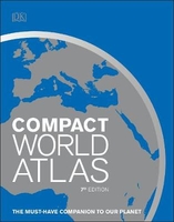
£10.99
Como on an indexed street plan at 1:10, 000 from Litografia Artistica Cartografica, with a detailed enlargement of the city’s historic centre at 1:7, 500. 35 monuments including historic buildings & churches, cultural or educational institutions, & important municipal buildings or facilities are numbered & listed next to the plan. Litografia Artistica Cartografica (LAC) are Italy’s leading publishers of street plans with an extensive range of titles. Where appropriate, the plans include an enlargement showing the historic centre in greater detail. On each plan monuments including historic buildings & churches, archaeological sites, cultural or educational institutions, & important municipal buildings or facilities are numbered & listed next to the plan. Unless indicated to the contrary in the individual description, one way streets are not marked. Street index is on the reverse. ...
Archived Product
£7.95
Como & Lecco Provinces in a series of handy size road maps from Litografia Artistica Cartografica (LAC) with more minor local roads & tracks than can be found on most regional maps. The series is gradually being changed to a new style of digitally derived cartography, so presentation of adjoining titles may vary. All the maps have hill shading to represent the general relief with spot heights for selected peaks, & show a few more local roads & rough tracks than the other road map series. Intermediate road distances are indicated. Regional, provincial & communal borders are marked, & railways, funiculars, airports, sea ferry links & campsites are shown. The legend is in Italian only. The new, digitally produced editions are indexed & have enhanced, more finely drawn cartography: the hill-shading is less bold, motorway service areas are marked, natural parks are highlighted & an expanded range of symbols indicates various landmarks & sites, e.g. antiquities, churches, etc. Two styles of the new cartography are produced, differing only in the colour of the predominant background shading: grey or yellow/green. Some of the new editions include geographical coordinates for the map corners. The index of localities is on the reverse. This title is still produced in the traditional cartographic style. ...
Archived Product
£12.99
Map No. 1374, Como, in the topographic survey of Switzerland at 1:25, 000 from Bundesamt für Landestopographie (swisstopo), covering the whole country on 247 small format sheets, with special larger maps published for popular regions including some titles now available in hiking versions. Highly regarded for their superb use of graphic relief & hill shading, the maps give an almost 3-D picture of Switzerland`s mountainous terrain. Contours are at 10 m intervals, with 20m intervals in the mountainous areas. All the maps have a 1-km grid for Swiss national coordinates (datum CH 1903). * Small format sheets (Nos. 1011
- 1374)* Map legend in the language of the area covered by the map. Additional margin ticks show latitude & longitude in steps of 2`. The area covered by each map is 17 x 12 km (11 x 7 miles approx). * Special larger sheets (Nos. from 2501 onwards) – STANDARD editions:* No map legend is included but a separate leaflet can be provided instead. The area covered by each map is 25 x 17 km (15 x 11 miles approx).* Special larger sheets (Nos. from 2501 onwards) – HIKING editions:* An overprint highlights hiking, mountain & alpine paths, including regional & national long-distance trails. The maps also show bus routes with bus stops, plus inns in remote locations. The area covered by each map is 25 x 17 km (15 x 11 miles approx).
...
Archived Product
£12.99
Como, map No. 297, in the standard topographic survey of Switzerland at 1:50, 000 from Swisstopo, i.e. without the special overprint highlighting walking trails, local bus stops, etc, presented in Swisstopo’s hiking editions of the 50K survey. The map covers mainly the Italian side of the border, with only a small part of Switzerland shown on it. Highly regarded for their superb use of graphic relief & hill shading, the maps give an almost 3-D picture of Switzerland`s mountainous terrain. Contours are at 20m intervals. All the maps have a 1-km grid with the Swiss national coordinates. This standard version of the 50K survey covers the whole country on 78 small format sheets, with special larger format maps published for several popular tourist destinations. Small format sheets cover an area of 35 x 24 km (21 x 15 miles approx) & have map legend in the language of the area covered by the map. The special larger sheets cover 50 x 35 km (31 x 22 miles approx) & have no map legend, but a separate leaflet can be provided instead.PLEASE NOTE: the hiking editions of the 1:50, 000 Swisstopo survey are listed on our website in a separate series. ...
Archived Product
£12.99
Map No. 1311, Comologno, in the topographic survey of Switzerland at 1:25, 000 from Bundesamt für Landestopographie (swisstopo), covering the whole country on 247 small format sheets, with special larger maps published for popular regions including some titles now available in hiking versions. Highly regarded for their superb use of graphic relief & hill shading, the maps give an almost 3-D picture of Switzerland`s mountainous terrain. Contours are at 10 m intervals, with 20m intervals in the mountainous areas. All the maps have a 1-km grid for Swiss national coordinates (datum CH 1903). * Small format sheets (Nos. 1011
- 1374)* Map legend in the language of the area covered by the map. Additional margin ticks show latitude & longitude in steps of 2`. The area covered by each map is 17 x 12 km (11 x 7 miles approx). * Special larger sheets (Nos. from 2501 onwards) – STANDARD editions:* No map legend is included but a separate leaflet can be provided instead. The area covered by each map is 25 x 17 km (15 x 11 miles approx).* Special larger sheets (Nos. from 2501 onwards) – HIKING editions:* An overprint highlights hiking, mountain & alpine paths, including regional & national long-distance trails. The maps also show bus routes with bus stops, plus inns in remote locations. The area covered by each map is 25 x 17 km (15 x 11 miles approx).
...
Archived Product
£30.00
This is a reference book on the history of Britain from 55 BC to the present day. Drawing on academic research, the top scholars in the subject present over 4000 entries which reflect the interdisciplinary nature of this immense & fascinating subject. It contains both essay-length articles & short, quick-reference entries which cover economic, social, medical, cultural, scientific, & feminist aspects of history as well as the political, constitutional, & military. This book is intended for students, teachers, & academics in all aspects of history & allied subjects (including politics, economics & law) & public & institutional libriaries. ...
Archived Product
£16.99
Over one thousand castles were built in the century following the Norman Conquest. Most were constructed in the wake of the Conquest itself by the Norman lords & their allies as they took possession of their lands. These conquerors in a nosteile land numbered only a few thousand & their castle became symbols of subjugation & bastions of paranoia. Nevertheless, contrary to the popular perception, medieval castles were more often lived in than fought over. A castle was a fortified feudal residence, a symbol of a lord`s power & authority & the instrument of regional domination: administrative, judicial & military. Very few castles remain unaltered from when they were first built & none fits neatly into any particular category. Many have succumbed to the ravages of siege warfare, abandonment & despoliation, especially in the aftermath of the English Civil War. Some have been entirely rebuilt & most have been remodelled many times, according to the current military, domestic & architectural fashion. For several there is evidence of continuous occupation from the twelfth century to the present day. Stephen Friar has an encyclopedic knowledge of all aspects of castles as well as the ability to place issues within a historical context & explain them succinctly & clearly for the non-specialist. From quadrangular castles to shell keeps, garderobes & gargoyles to tournaments, & anarchy to zig-zag moulding, this detailed A to Z reference book, with its lavish illustrations, index of castles & lists of addresses & further reading, is essential for anyone interested in medieval castles. ...
Archived Product
£16.99
Even in this predominantly secular age, Britain`s cathedrals remain potent symbols of religious continuity. Their purpose was to reveal God`s majesty, to declare the supremacy of the Church & the devotion of the men who built them. They were intended, literally, to be awesome. Similarly, our medieval abbeys, most of them sad remnants of a glorious past, serve to remind us of the dedication of those who aspired to the monastic ideal. No two cathedrals or abbeys are alike in their conception, location, construction or history, & it is this that gives them their limitless appeal. This comprehensive volume contains over 1, 450 entries arranged alphabetically, together with lists of useful addresses & further reading, & is richly illustrated with color & black & white photographs, plans & drawings. A wealth of subjects including architecture, liturgy, history & monasticism are covered in detail & assist in placing research in a wider historical context. Newcomers to the study of abbeys & cathedrals as well as experienced researchers will find Stephen Friar`s companion essential reading. ...
Archived Product
£16.99
This is a comprehensive, fully illustrated A-Z guide to churches dating from the post Roman period to the present day. Subjects covered include architecture, fittings & furnishings, decorative & allegorical features, stained glass, heraldry, traditions & customs, ecclesiastical history, & the role of the church in its community. Alphabetical entries consist of main entries from which cross-references lead on to a larger number of secondary entries. The companions illustrated throughout & include suggestions for reading & a list of useful addresses. Stephen Friar is a writer & historian. His previous books include ” The Companion to Heraldry”, ” The Companion to Local History”, ” The Companion to Cathedrals & Abbeys” & ” The Companion to Castles”, all published by The History Press. ...
Archived Product
£8.99
The ” Yellow Jersey Companion to the Tour de France” might just tell you everything you`ve ever wanted to know about the world`s greatest sporting event. We won`t just give you the name of every stage winner; every mountain & the first to top them; the age of each overall winner; a complete list of all the stage finishes since the race began
- we`ll tell you all the unknown stories too. We`ll tell you about the rider forced to crawl along the finish line in search of his glass eye; the exhausted man who hitched a ride on the back of a donkey; the Tour star denied his yellow jersey hours after he`d won it, & the journeyman competitor who never got to wear his because someone drove away with it. On our alphabetical ride through the Tour`s one-hundred-year history we`ll share with you the inside stories of the great stars
- Jacques Anquetil, Fausto Coppi, Bernard Hinault, Miguel Indurain, Eddy Merckx, Greg Le Mond, & Lance Armstrong to name a few; we`ll outline the arcane & so often cruel rules that have helped make this race into the sporting world`s most gruelling spectacle & we`ll even reveal the answer to a question that has troubled many Tour junkies over the years
- who really was the first maillot jaune. A work of unparalleled reference & a joy to read, ” The Yellow Jersey Companion to the Tour de France” is a literary gift from cycling heaven.


...
Archived Product

Compact World Atlas

Now in its 7th Edition, Compact World Atlas provides a fascinating insight into the world in which we live. Featuring DK`s outstanding cartography and design, this fully revised edition has been updated to reflect recent geopolitical changes, such as the new nation of South Sudan, the annexation of Crimea, the Inuit place names in Canada and the populations of Chinese towns.With 65 clear, easy-to-read maps, this atlas combines improved visual landscape modelling with key roads, railways, rivers and settlements. Learn more about each of the world`s 196 nations, with an accompanying factfile which provides an insight into even the most remote of countries.With figures and insights, from both the political world to the physical world, Compact World Atlas is a necessary staple to
any bookshelf.
RIP - This product is no longer available on our network. It was last seen on 25.09.2019

This page now acts as a permanent archive for this product. Add more information using the comments box below to ensure it can still be found by future generations.

Use our search facility to see if it is available from an alternative contributor.
  • External links may include paid for promotion
  • Availability: Out Of Stock
  • Supplier: Stanfords
  • SKU: 9780241317648
Availability: In Stock
£9.99

Product Description

Now in its 7th Edition, Compact World Atlas provides a fascinating insight into the world in which we live. Featuring DK`s outstanding cartography & design, this fully revised edition has been updated to reflect recent geopolitical changes, such as the new nation of South Sudan, the annexation of Crimea, the Inuit place names in Canada & the populations of Chinese towns. With 65 clear, easy-to-read maps, this atlas combines enhanced visual landscape modelling with key roads, railways, rivers & settlements. Learn more about each of the world`s 196 nations, with an accompanying factfile which provides an insight into even the most remote of countries. With figures & insights, from both the political world to the physical world, Compact World Atlas is a necessary staple to any bookshelf.

Reviews/Comments

Add New

Intelligent Comparison

Oooops!
We couldn't find anything!
Perhaps this product's unique.... Or perhaps we are still looking for comparisons!
Click to bump this page and we'll hurry up.

Price History

Vouchers

No voucher codes found.
Do you know a voucher code for this product or supplier? Add it to Insights for others to use.

Facebook

Jargon Buster

compact - Carefuly designed to ensure an item has a minimal physical size
Key - A physical or virtual device or code used for opening something
Physical - Used to describe strength or visual properties of an item
Railways - A set of tracks that have been laid for the purpose of trains to travel up and down them
World - A physical grouping, commonly used to describe earth and everything associated with ti
Compact - something that has a lot combined within a small space.
Design - A drawing or styles that shows the look and functionality of something before its made.

Supplier Information

Stanfords
Stanfords was established in 1853 and opened their iconic Covent Garden flagship store in 1901. They have become the top retailer of maps, travel books and accessories in the UK and arguably offer the largest selection of maps and travel books worldwide. Famous names such as Captain Robert Falcon Scott, Ranulph Fiennes and Michael Palin have purchased from Stanfords. They now have a shop in Bristol and both stores together with other venues operate a calendar of events including talks, book signings and exhibitions. As a specialist map retailer, the map selection is comprehensive and includes road maps, street maps and walking maps from worldwide destinations, as well as a selection of world atlases and wall maps. Books include travel guides and travel literature. Stanfords also stock globes, from miniatures made of blue marble to magnificent floor-standing globes. The website features a selection of interesting articles on travel topics.
Page Updated: 2023-11-12 20:15:36

Community Generated Product Tags

Oh No! The productWIKI community hasn't generated any tags for this product yet!
Menu