
 United Kingdom
 France
 Germany
 Netherlands
 Sweden
 USA
USA
 Italy
Italy
 Spain
Spain
More From Contributor


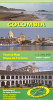
Colombia
Colombia at 1:1, 500, 000 on an indexed double-sided map from Mapas NaTurismo with very clear presentation of the country’s topography, an overview map of Bogotá, plus a street plan of central Cartagena. The map divides the country between its more populated western part with the Andes and the lowlands east of the Andes, with Bogotá and Medellin shown on both sides. Isla de San Andrés and Isla de Providencia are shown as insets at 1:100, 000.Excellent use of relief shading and altitude colouring gives an almost 3-D presentation of the terrain. National parks and other protected areas are clearly marked. Additional graphics indicate swamps and salt pans, mangroves, and coffee or tobacco plantations.Road network includes seasonal tracks and indicates driving distances on main and
many local routes, plus locations of fuel supplies. Local airports are also marked. Symbols mark locations with tourist accommodation, beaches, surfing and diving sites, hot springs, etc. Latitude and longitude lines are drawn at 30’ intervals. The map is indexed and its legend includes English. Also provided is an overview plan of Bogotá at 1:50, 000 showing main traffic routes including access to the international airport and indicating districts with tourist accommodation. A more detailed street plan at 1:20, 000 shows the historic part of Cartagena.
many local routes, plus locations of fuel supplies. Local airports are also marked. Symbols mark locations with tourist accommodation, beaches, surfing and diving sites, hot springs, etc. Latitude and longitude lines are drawn at 30’ intervals. The map is indexed and its legend includes English. Also provided is an overview plan of Bogotá at 1:50, 000 showing main traffic routes including access to the international airport and indicating districts with tourist accommodation. A more detailed street plan at 1:20, 000 shows the historic part of Cartagena.

Product Description
Reviews/Comments
Add New
Vouchers
No voucher codes found.
Do you know a voucher code for this product or supplier? Add it to Insights for others to use.
Do you know a voucher code for this product or supplier? Add it to Insights for others to use.
 Denmark