
 United Kingdom
 France
 Germany
 Netherlands
 Sweden
 USA
USA
 Italy
Italy
 Spain
Spain
More From Contributor


Colchester
Map No. 168, Colchester, in the Ordnance Survey Landranger series at 1:50, 000 including Burnham-on-Crouch, Hullbridge, South Woodham Ferrers, Cock Clarks, Maylandsea, Southminster, Tillingham, Bradwell on Sea, Maldon, Tollesbury, Great Totham, Tiptree, Witham, Kelvedon, Silver End, Layer de la Haye, Marks Tey, Coggeshall, Earls Colne, Halstead, Wivenhoe, West Mersea, Brightlingsea, Clacton-on-Sea, St Osyth, Little Clacton, Great Bentley, Weeley, Great Oackley, Elmstead Market, Wix, Manningtree, Ardleigh, West Bergholt and Great Horkesley, with Mersea Island, estuaries of the Blackwater and the Colne and a part of the E2 European Long-distance path along the Stour Valley. Editon C2; Revised for selected changes 2006; Copyright date: 2006 This title is
also available on our website in a waterproof and tear-resistant version.Maps in this series are only published folded. Stanfords can also print flat versions of Ordnance Survey maps through the OS Select system, centring the map on a location of your choice and with a picture provided by you on the cover. For more information please click on the link at the bottom of this description.About Ordnance Survey
also available on our website in a waterproof and tear-resistant version.Maps in this series are only published folded. Stanfords can also print flat versions of Ordnance Survey maps through the OS Select system, centring the map on a location of your choice and with a picture provided by you on the cover. For more information please click on the link at the bottom of this description.About Ordnance Survey
Product Description
Reviews/Comments
Add New
Intelligent Comparison
Archived Product
Colchester Stanfords
£3.99
Archived Product
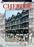
Chester Stanfords
£5.00
Archived Product

Colchester 1896 Stanfords
£3.50
Archived Product
Colchester 1805 Stanfords
£7.99
Archived Product

Colchester 1898 Stanfords
£9.99
Archived Product

Worcester Stanfords
£29.99
Archived Product
Colesberg Stanfords
£29.99
Vouchers
No voucher codes found.
Do you know a voucher code for this product or supplier? Add it to Insights for others to use.
Do you know a voucher code for this product or supplier? Add it to Insights for others to use.
 Denmark