More From Contributor
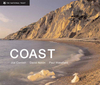
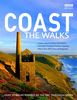
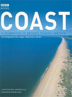
£2.95
Coalbrookdale & Lightmoor in 1901 in a fascinating series of reproductions of old Ordnance Survey plans in the Alan Godfrey Editions, ideal for anyone interested in the history of their neighbourhood or family. Selected towns in Great Britain & Ireland are covered by maps showing the extent of urban development in the last decades of the 19th & early 20th century. In this title: the map covers the area from the Iron Works eastward to Lightmoor & Roughpark, & northward to Dawley Parva & Stoneyhill. The map will be essential for all interested in industrial archaeology &

Includes::
Cherrytree Hill Brick Works, Shutfield Brick Works & Lightmoor Brick Works, with the tramway between them, also the GWR Wellington & Severn Jct railway, Lightmoor Junction, the disused Lightmoor & Dawley Parva collieries. On the reverse are contemporary directories for Dawley Parva & Coalbrookdale. About the Alan Godfrey Editions of the 25

...
Archived Product
£3.50
Coalbrookdale & Lightmoor in 1901 in a fascinating series of reproductions of old Ordnance Survey plans in the Alan Godfrey Editions, ideal for anyone interested in the history of their neighbourhood or family. Tthe map covers the area from the Iron Works eastward to Lightmoor & Roughpark, & northward to Dawley Parva & Stoneyhill. The map will be essential for all interested in industrial archaeology &

Includes::
Cherrytree Hill Brick Works, Shutfield Brick Works & Lightmoor Brick Works, with the tramway between them, also the GWR Wellington & Severn Jct railway, Lightmoor Junction, the disused Lightmoor & Dawley Parva collieries. On the reverse are contemporary directories for Dawley Parva & Coalbrookdale. About the Alan Godfrey Editions of the 25” OS Series: Selected towns in Great Britain & Ireland are covered by maps showing the extent of urban development in the last decades of the 19th & early 20th century. The plans have been taken from the Ordnance Survey mapping & reprinted at about 15 inches to one mile (1:4, 340). On the reverse most maps have historical notes & many also include extracts from contemporary directories. Most maps cover about one mile (1.6kms) north/south, one & a half miles (2.4kms) across; adjoining sheets can be combined to provide wider coverage.FOR MORE INFORMATION & A COMPLETE LIST OF ALL AVAILABLE TITLES PLEASE CLICK ON THE SERIES LINK.

...
Archived Product
£3.50
Coalville in 1901 in a fascinating series of reproductions of old Ordnance Survey plans in the Alan Godfrey Editions, ideal for anyone interested in the history of their neighbourhood or family. The map covers much of the small industrial town of Coalville, stretching from Gutteridge Street eastward to Broom Leys & Constable Lane. Features include Midland Railway with Coalville station, LNWR Charnwood Forest Branch with station, Whitwick Colliery & Whitwick Colliery Railway, Railway Wagon Works, Elastic Web Factory, iron works, cattle market, The Park, Christ Church, part of Snibston Colliery Railway, Colliery Farm, brick & terra cotta works, Glebe Farm, Broom Leys, Whitwickwaste Farm, etc. On the reverse is an 1891 directory of Coalville, plus an extract from a 1916 timetable for the Leicester-Burton line. About the Alan Godfrey Editions of the 25” OS Series: Selected towns in Great Britain & Ireland are covered by maps showing the extent of urban development in the last decades of the 19th & early 20th century. The plans have been taken from the Ordnance Survey mapping & reprinted at about 15 inches to one mile (1:4, 340). On the reverse most maps have historical notes & many also include extracts from contemporary directories. Most maps cover about one mile (1.6kms) north/south, one & a half miles (2.4kms) across; adjoining sheets can be combined to provide wider coverage.FOR MORE INFORMATION & A COMPLETE LIST OF ALL AVAILABLE TITLES PLEASE CLICK ON THE SERIES LINK. ...
Archived Product
£12.99
This first volume of Coarse Angling in Northern France with Phil Pembroke covers 176 excellent angling locations including Paris. Vendee, Aube. Yonne, Marne, Somme, Loire, Cher & Indre. If angling is your thing, then the numerous possibilities listed here will have you spoilt for choice when you’re planning your weekend break across the Channel. With a French angling licence being all that’s needed to fish in public rivers & lakes, Phil Pembroke takes you through all your initial bases. From the River Somme, to the beautiful Loire Valley, to the historic chateaux a mere hours drive south west of Paris…this volume is aimed at visitors from the UK who will appreciate the list of smaller scale, privately-managed carp fisheries providing all-inclusive angling holiday packages. Containing numerous black-&-white sketched maps, this volume has a particular focus on the area to the south & east of Paris, thought to contain some of the best carp fishing sites in France – notably the large reservoirs of the River Seine basin, less than four hours drive from Calais. For those with restricted mobility, the book directs users towards appropriate facilities that include pontoon-fishing platforms with easy car access, highlighting their location in each chapter. Fishing schools are also listed in detail for most areas, as well as night fishing zones for the increasing numbers of visitors who wish to avail themselves of angling opportunities outside of traditional hours. Finally, this book might save your life: given the increased dangers of electrocution resulting from longer & lighter fishing poles, this guide highlights the importance of caution whenever visitors see the EDF danger signs warning of the proximity of overhead power lines. ...
Archived Product
£9.99
A stunning glimpse of some of Britain`s finest coastline, from the granite columns of the Giant`s Causeway on the Northern ...
Archived Product
£8.99
Coast & Castles Cycle Route North at 1:100, 000 in a series of cycling maps from Sustrans, the charity behind developing UK’s National Cycle Network. The map covers route No. 1 between Edinburgh & Aberdeen, with alternative variants between Edinburgh & Dundee. Many day ride suggestions are marked, as well as a spur from Banchory to Ballater along the Deeside Way. The map is printed on light, waterproof & tear-resistant synthetic paper. Each title in the Sustrans series of cycling maps covers either a single route, presented in sections on separate strip maps, or a wider area with the main cycling route (s) prominently highlighted but other recommendations for cyclists also marked. The area covered each map is shown on our website on its individual “coverage” image. The route has markers indicating steep gradients, controlled access, distances & possible danger points. Route profiles indicate riding surface & the density of traffic (main road, minor road & traffic-free) &, where appropriate, street plans show the course of the route across towns & cities. On maps covering a wider area around the main National Cycle Route suggestions of possible day ride excursions are also marked. A range of symbols highlight various facilities & places of interest, including tourist information centres, youth hostels, cafes & pubs, grocery shops, cycle shops & hire, historical & natural sites, etc. For access by rail, the rail network is shown with stations &, where appropriate, metro stations are also marked. Topography is shows by altitude colouring. Unless specifically indicated in the individual description, the maps do not show British National Grid lines for GPS. Each title also contains contact addresses for various useful organizations, etc. Many titles are printed on light, waterproof & tear-resistant synthetic paper. ...
Archived Product
£8.99
Coast & Castles Cycle Route South at 1:100, 000 in a series of cycling maps from Sustrans, the charity behind developing UK’s National Cycle Network. The map covers route No. 1 between Newcastle & Edinburgh via Galashields, with an alternative route No. 76 after Berwick-upon-Tweed via Dunbar. Many day ride suggestions are marked, as well as other national routes in the area. The map is printed on light, waterproof & tear-resistant synthetic paper. Each title in the Sustrans series of cycling maps covers either a single route, presented in sections on separate strip maps, or a wider area with the main cycling route (s) prominently highlighted but other recommendations for cyclists also marked. The area covered each map is shown on our website on its individual “coverage” image. The route has markers indicating steep gradients, controlled access, distances & possible danger points. Route profiles indicate riding surface & the density of traffic (main road, minor road & traffic-free) &, where appropriate, street plans show the course of the route across towns & cities. On maps covering a wider area around the main National Cycle Route suggestions of possible day ride excursions are also marked. A range of symbols highlight various facilities & places of interest, including tourist information centres, youth hostels, cafes & pubs, grocery shops, cycle shops & hire, historical & natural sites, etc. For access by rail, the rail network is shown with stations &, where appropriate, metro stations are also marked. Topography is shows by altitude colouring. Unless specifically indicated in the individual description, the maps do not show British National Grid lines for GPS. Each title also contains contact addresses for various useful organizations, etc. Many titles are printed on light, waterproof & tear-resistant synthetic paper. ...
Archived Product
£12.99
Coast is a definitive narrative of Nicholas Crane’s journey of discovery around the edges of Britain & Ireland & the culmination of five years presenting the BBC’s successful series. On a journey of exploration, Crane describes how we discovered & embraced our coastline
- the key to our island identity. From the shining cliffs that the dinosaurs would have seen to the modern estuaries teeming with wildlife, from Stone Age fishermen, via smugglers` caves, to modern day surfers & sandcastle builders – everyone who has lived, worked & played on Britain & Ireland’s coastline forms part of its evolving tale. A fusion of history, geography, adventure & biography, Coast explains why the edge of our little earth means so much to us.
...
Archived Product
£20.00
The first book of Coast took us on a sweeping clockwise tour of Britain`s marine borderlands, where one type of distinctive landscape gives way to the next. In this companion volume we criss-cross the UK & Irel&, looking at our relationship with different regions of our coast. Each chapter looks at a certain stretch of coastline, how areas within that stretch are related, & what that says about our l&, our history & our way of life. For example, Chalk to Chalk takes us from Dover to the Isle of Wight & even across the channel, where the substance of the land itself has shaped how we live there. Holyhead to Liverpool mark the boundaries of The Inventive Coast, a hotbed of maritime innovation & industrial progress. Our military history is explored in The Explosive Coast, which takes us from Carlisle to Arran. We learn how the coast created one of the world`s greatest cities, London, along The Capital Coast, & The Emerald Coast is a celebration of Ireland`s dramatic eastern edge. Many other varied themes & regions are explored in this fascinating guide to our coast. Fully illustrated with glorious photgraphs, there`s much to discover where the UK & Ireland meet the sea. ...
Archived Product
£16.99
Accompanying BBC2`s BAFTA award-winning television series, ” Coast: The Walks” will inspire you to explore the best that the coastline of the British Isles has to offer. With more than 50 fantastic walks around Great Britain & Irel&, this practical guidebook features a variety of town & rural routes that are designed to suit both experienced walkers & those who fancy nothing more taxing than an afternoon stroll. Whether you crave the rugged beauty of Antrim & Skye, the seaside fun of Brighton & Great Yarmouth, the majestic cliffs of the Cornish & Pembrokeshire peninsulas, or the history of our great coastal cities, such as Aberdeen, Belfast, Dublin, Hull, Liverpool & Plymouth, ” Coast: The Walks”

Includes::
all these places, & many more besides. As well as offering invaluable advice that will enable you to plan your day out, & tried-&-tested instructions to guide you on your way, the book helpfully highlights points of interest along the route: historic sites & buildings, topographical features, & wildlife to watch out far as you go
- each illustrated with a colour photograph. Equally at home in the car or on the bookshelf, ” Coast: The Walks” will encourage you to get out there & make the most of our wonderfully diverse & endlessly fascinating 10, 000 miles of coastline.


...
Archived Product

Coast

Accompanying the 13-part BBC2 series, Coast is both a superbly illustrated celebration of the UK’s coastal areas and a practical guide to all that they have to offer. Christopher Somerville takes you on an impressive tour of the outer limits of Great Britain and Northern Ireland. The first part of the book is divided into the 12 coastal regions as featured in the programme, with lavish photography, clear maps and evocative essays. The second part is a region-by-region reference of places, people, activities, natural history, historic events and fascinating facts - all clearly laid out to help you plan you own adventure. From the dramatic cliffs of Eastbourne’s Beachy Head to the spare beauty of the Norfolk salt marshes; from the storm-wracked Cape Wrath at the edge of the
Scottish Highlands to the peaceful wooded creeks of Cornwall’s Helford River. With fascinating and beautifully illustrated guide to the 9000-mile coastline of Britain and Northern Ireland, this book will be the centre of everyone’s attention.
RIP - This product is no longer available on our network. It was last seen on 25.09.2019

This page now acts as a permanent archive for this product. Add more information using the comments box below to ensure it can still be found by future generations.

Use our search facility to see if it is available from an alternative contributor.
  • External links may include paid for promotion
  • Availability: Out Of Stock
  • Supplier: Stanfords
  • SKU: 9780563522799
Availability: In Stock
£17.99

Product Description

Accompanying the 13-part BBC2 series, Coast is both a superbly illustrated celebration of the UK’s coastal areas & a practical guide to all that they have to offer. Christopher Somerville takes you on an impressive tour of the outer limits of Great Britain & Northern Irel&. The first part of the book is divided into the 12 coastal regions as featured in the programme, with lavish photography, clear maps & evocative essays. The second part is a region-by-region reference of places, people, activities, natural history, historic events & fascinating facts
- all clearly laid out to help you plan you own adventure. From the dramatic cliffs of Eastbourne’s Beachy Head to the spare beauty of the Norfolk salt marshes; from the storm-wracked Cape Wrath at the edge of the Scottish Highlands to the peaceful wooded creeks of Cornwall’s Helford River. With fascinating & beautifully illustrated guide to the 9000-mile coastline of Britain & Northern Irel&, this book will be the centre of everyone’s attention.

Reviews/Comments

Add New

Intelligent Comparison

Oooops!
We couldn't find anything!
Perhaps this product's unique.... Or perhaps we are still looking for comparisons!
Click to bump this page and we'll hurry up.

Price History

Vouchers

No voucher codes found.
Do you know a voucher code for this product or supplier? Add it to Insights for others to use.

Facebook

Jargon Buster

UK - United Kingdom - An island nation in Europe
History - Anything that happens in the past. An acedemic subject.
edge - Enhanced data rates for GSM evolution also known as enhanced GPRS. A mobile phone technology with improved data transmission rates.
edge - The point at which two surfaces meet
Natural - not manmade
Adventure - an undertaking of an exciting challenge or experience.
Practical - Weather a task is easy to carry out and realistically succeed.
Head - The upper part of a body typically separated by the neck.
Reference - To prove evidence with a back up source.

Supplier Information

Stanfords
Stanfords was established in 1853 and opened their iconic Covent Garden flagship store in 1901. They have become the top retailer of maps, travel books and accessories in the UK and arguably offer the largest selection of maps and travel books worldwide. Famous names such as Captain Robert Falcon Scott, Ranulph Fiennes and Michael Palin have purchased from Stanfords. They now have a shop in Bristol and both stores together with other venues operate a calendar of events including talks, book signings and exhibitions. As a specialist map retailer, the map selection is comprehensive and includes road maps, street maps and walking maps from worldwide destinations, as well as a selection of world atlases and wall maps. Books include travel guides and travel literature. Stanfords also stock globes, from miniatures made of blue marble to magnificent floor-standing globes. The website features a selection of interesting articles on travel topics.
Page Updated: 2023-11-12 20:15:36

Community Generated Product Tags

Oh No! The productWIKI community hasn't generated any tags for this product yet!
Menu