More From Contributor

£6.50
Cleveland
- Cuyahoga County in Ohio on an indexed street plan from Rand Mc Nally in their extensive range of maps covering cities
...
Archived Product
£10.99
The Cleveland Way, a 177km / 110 mile long National Trail from Helmsley around the North York Moors National Park to Filey, presented by Rucksack Readers in handy A5 size, spiral-bound, waterproof guide with mapping at 1:120, 000. The 64-page guide provides general advice on when to go, availability of accommodation, etc, &

Includes::
notes on local heritage, geology, habitats & wildlife. Detailed route descriptions, arranged in daily stages, are preceded by a summary of each section of the route giving distance, terrain, grade & availability of food & drink. The guide is illustrated with numerous colour photos. The route is highlighted on five fold-out map panels at 1:120, 000. The maps have altitude colouring to show the topography & also indicate various facilities & places of interest. No geographical coordinates for GPS users are provided. The publishers themselves recommend that their guide is used in conjunction with more detailed, contoured & GPS compatible maps from Harvey Map Services or the Ordnance Survey. To see other titles in this series please click on the series link.

...
Archived Product
£10.36
The Cleveland Way National Trail offers a fine walk around the North York Moors National Park, enjoying scenery that


...
Archived Product
£12.99
The Cleveland Way, a 175-km/108 mile route around the Yorkshire Moors between Helmsley & Filey, in a series of walking guides to the National Trails in England & Wales with colour extracts from the Ordnance Survey's Explorer series at 1:25, 000 showing points along the route cross-referenced to the text. The maps also indicate nearby places of interest & various facilities including campsites & caravan parks, youth hostels, water points, pubs, information or visitor centres, etc. Also shown are alternative sections of the route & stretches designated as bridleways or suitable for cycling. The guides are illustrated throughout with colour photos & include an introductory section on the path & the surrounding landscape, plus a chapter of useful information including access to various locations along the route by public transport, a list of tourist information offices & principal overnight stopping places, a bibliography, etc. ...
Archived Product
£11.99
All-in-one, practical guide to walking Cleveland Way National Trail, in the beautiful, wild countryside of the North York Moors National Park in northern Engl&. The 110-mile route runs from Helmsley near Thirsk around the western edge of the park to reach the coast at Saltburn-by-the-Sea. It then continues along the eastern edge of the park south down the coast through Whitby, Robin Hood`s Bay & Scarborough to finish in Filey. Combining moorland & coast there`s wonderful scenic variety to this walk, with crumbling castles & idyllic fishing villages to explore. The guide
Includes:: * 48 large-scale walking maps
- at just under 1:20, 000
- showing route times, places to stay, places to eat, points of interest, & 8 town plans. * 10 colour stage maps to help plan your walk, including hills & descents, & two colour overview maps. * Places to stay with reviews
- campsites, bunkhouses, hostels, B& Bs, pubs & hotels. * Places to eat with reviews
- cafes, teashops, pubs, takeaways, restaurants. * What to see from the path
- history, culture, natural history. * Comprehensive public transport information
- for all access points on the Cleveland Way. * Flora & fauna
- four page full colour flower guide, plus an illustrated section on local wildlife. * Itineraries for all walkers
- whether walking the route in its entirety over two weeks or sampling the highlights on day walks & short breaks. * Green hiking
- understanding the local environment & minimizing our impact on it. * GPS waypoints
- also downloadable from the Trailblazer website page.


...
Archived Product
£13.95
Cleveland Way, established over 40 years ago as Britain’s second National Trail, presented at 1:40, 000 on a GPS compatible, light, waterproof & tear-resistant map from Harvey Map Services. The 170km/109 miles route which starts in Helmsley, crosses the North York Moors National Park & sweeps southwards along the coast to Filey, is covered on five overlapping panels. Maps in the Harvey’s series covering Great Britain’s national trails & other long-distance footpaths are printed on light, waterproof & tear-resistant synthetic paper & cover the routes at 1:40, 000 or 1:60, 000. Topography is shown by contours at 15m intervals, with additional spot heights plus colouring and/or graphics to provide a very detailed picture of the terrain (boulder fields, scree, crags, etc) & vegetation / land use (pastures, moorl&, woodlands, etc). In Scotland peaks & hills classified as Munros, Corbetts & Donalds are marked. The overprint for the long-distance trail shows sections on local or main roads (highlighting danger points), on tracks, & on footpaths, indicating intermittent or not visible paths. The maps also show other right of way paths, including permissive paths & bridleways. Symbols indicate various facilities & accommodation options (including campsites & youth hostels), pubs & refreshments, food shops, banks, information points, etc, both along the route itself & in the nearby locations. All maps are GPS compatible, with the British National Grid overprinted on each panel. The maps also include useful contact details & general advice. To see other titles in this series please click on the series link. ...
Archived Product
£14.99
The Cleveland Way, a 175-km/108 mile route around the Yorkshire Moors between Helmsley & Filey, in a series of walking guides to the National Trails in England & Wales with colour extracts from the Ordnance Survey`s Explorer series at 1:25, 000 showing points along the route cross-referenced to the text. The maps also indicate nearby places of interest & various facilities including campsites & caravan parks, youth hostels, water points, pubs, information or visitor centres, etc. Also shown are alternative sections of the route & stretches designated as bridleways or suitable for cycling. The guides are illustrated throughout with colour photos & include an introductory section on the path & the surrounding landscape, plus a chapter of useful information including access to various locations along the route by public transport, a list of tourist information offices & principal overnight stopping places, a bibliography, etc. To see other titles in the Aurum Press series of guides to the national trails & other long-distance footpaths, please click on the series link. ...
Archived Product
£7.99
Do you find yourself willing away the minutes
- & sometimes hours
- on your journey to work? With Clever Commuter you can claim

...
Archived Product
£8.99
Stella was a clever girl, everyone thought so. Living with her mother & rather unsatisfactory stepfather in suburban respectability she reads voraciously, smokes until her voice is hoarse & dreams of a less ordinary life. When she meets Val, he seems to her to embody everything she longs for
- glamour, ideas, excitement & the thrill of the unknown. But these things come at a price & one that Stella despite all her cleverness doesn`t realise until it is too late.
...
Archived Product
£8.99
As a teacher in an inner-city school, Lucy Crehan was exasperated with ever-changing government policy claiming to be based on lessons from `top-performing` education systems. She resolved to find out what was really going on in the classrooms of countries whose teenagers ranked top in the world in reading, maths & science. Cleverlands documents Crehan`s journey around the world, weaving together her experiences with research on policy, history, psychology & culture to offer extensive new insights into what we can learn from these countries. ...
Archived Product

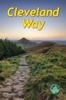
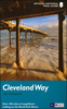
Cleveland Way And Yorkshire Wolds Way

The Cleveland Way National Trail offers a fine 110 mile walk around the North York Moors National Park, enjoying scenery that includes the open heather moorlands, gentle dales, interesting towns and villages, and dramatic cliff coastline. The Tabular Hills Walk is a 50 mile Regional Trail between Scalby Mills, near Scarborough and Hemsley, far inland. Walkers can pick up the Cleveland Way at the market town of Hemsley and continue along this route back to Filey. The Yorkshire Wolds Way, one of the quietest of Britain`s National Trails, wanders through gentle, cultivated and sparsely populated countryside. The route is usually walked from south to north for 80 miles from Hessle, near Hull on the Humber Estuary to Filey. The three routes can be joined to create an easy circular
route of over 250 miles (400km) of walking. The guidebook includes a 1:25, 000 scale OS map booklet of the Cleveland Way.
RIP - This product is no longer available on our network. It was last seen on 25.09.2019

This page now acts as a permanent archive for this product. Add more information using the comments box below to ensure it can still be found by future generations.

Use our search facility to see if it is available from an alternative contributor.
  • Availability: Out Of Stock
  • Supplier: Stanfords
  • SKU: 9781852848231
Availability: In Stock
£16.95

Product Description

The Cleveland Way National Trail offers a fine 110 mile walk around the North York Moors National Park, enjoying scenery that

Includes::
the open heather moorlands, gentle dales, interesting towns & villages, & dramatic cliff coastline. The Tabular Hills Walk is a 50 mile Regional Trail between Scalby Mills, near Scarborough & Hemsley, far inl&. Walkers can pick up the Cleveland Way at the market town of Hemsley & continue along this route back to Filey. The Yorkshire Wolds Way, one of the quietest of Britain`s National Trails, wanders through gentle, cultivated & sparsely populated countryside. The route is usually walked from south to north for 80 miles from Hessle, near Hull on the Humber Estuary to Filey. The three routes can be joined to create an easy circular route of over 250 miles (400km) of walking. The guidebook

Includes::
a 1:25, 000 scale OS map booklet of the Cleveland Way.

Reviews/Comments

Add New

Intelligent Comparison

Oooops!
We couldn't find anything!
Perhaps this product's unique.... Or perhaps we are still looking for comparisons!
Click to bump this page and we'll hurry up.

Price History

Vouchers

No voucher codes found.
Do you know a voucher code for this product or supplier? Add it to Insights for others to use.

Facebook

Jargon Buster

Regional - An adjective to describe a set geographic area.

Supplier Information

Stanfords
Stanfords was established in 1853 and opened their iconic Covent Garden flagship store in 1901. They have become the top retailer of maps, travel books and accessories in the UK and arguably offer the largest selection of maps and travel books worldwide. Famous names such as Captain Robert Falcon Scott, Ranulph Fiennes and Michael Palin have purchased from Stanfords. They now have a shop in Bristol and both stores together with other venues operate a calendar of events including talks, book signings and exhibitions. As a specialist map retailer, the map selection is comprehensive and includes road maps, street maps and walking maps from worldwide destinations, as well as a selection of world atlases and wall maps. Books include travel guides and travel literature. Stanfords also stock globes, from miniatures made of blue marble to magnificent floor-standing globes. The website features a selection of interesting articles on travel topics.
Page Updated: 2023-11-12 20:15:36

Community Generated Product Tags

Oh No! The productWIKI community hasn't generated any tags for this product yet!
Menu