More From Contributor

£3.50
Chingford Green in 1914 in a fascinating series of reproductions of old Ordnance Survey plans in the Alan Godfrey Editions, ideal for anyone interested in the history of their neighbourhood or family. The map is centred on Chingford Green & covers an area stretching from Low Street eastward to Chingford station & Gordon Road, & from Pole Hill southward to Endlebury Road & Simmons Lane. Features include The Green, Chingford Goods Yard (former station), Station Road, Park Hill, Kingshead Hill, Mansfield Hill, Warren Road, St Peter & St Paul`s church. On the reverse is a directory for Chingford in 1895. About the Alan Godfrey Editions of the 25” OS Series: Selected towns in Great Britain & Ireland are covered by maps showing the extent of urban development in the last decades of the 19th & early 20th century. The plans have been taken from the Ordnance Survey mapping & reprinted at about 15 inches to one mile (1:4, 340). On the reverse most maps have historical notes & many also include extracts from contemporary directories. Most maps cover about one mile (1.6kms) north/south, one & a half miles (2.4kms) across; adjoining sheets can be combined to provide wider coverage.FOR MORE INFORMATION & A COMPLETE LIST OF ALL AVAILABLE TITLES PLEASE CLICK ON THE SERIES LINK. ...
Archived Product
£3.50
Chingford Hatch in 1914 in a fascinating series of reproductions of old Ordnance Survey plans in the Alan Godfrey Editions, ideal for anyone interested in the history of their neighbourhood or family. This detailed map covers Chingford Hatch together with Chingford Mount, an area being developed in 1914. Coverage stretches from Bateman Road northward to the Old Church & eastward to Chingford Hatch. Features include the Chingford Branch railway (but no stations), St Edmunds church (the original one), tramway, St Peter & St Paul`s church (the ` Old Church`), Chingford Mount Cemetery, Suffield Hatch, Isolation Hospital, Higham Farm, part of Highams Park, Larks Hall Farm, Cherrydown Farm, Normanshire Farm, Nightingale Hall etc. On the reverse is commercial directory for Chingford. About the Alan Godfrey Editions of the 25” OS Series: Selected towns in Great Britain & Ireland are covered by maps showing the extent of urban development in the last decades of the 19th & early 20th century. The plans have been taken from the Ordnance Survey mapping & reprinted at about 15 inches to one mile (1:4, 340). On the reverse most maps have historical notes & many also include extracts from contemporary directories. Most maps cover about one mile (1.6kms) north/south, one & a half miles (2.4kms) across; adjoining sheets can be combined to provide wider coverage.FOR MORE INFORMATION & A COMPLETE LIST OF ALL AVAILABLE TITLES PLEASE CLICK ON THE SERIES LINK. ...
Archived Product
£7.95
Chingford`s geological make-up & topography formed natural barriers to the 19th century development which transformed nearby Walthamstow & Tottenham. Consequently, Chingford remained an inward-looking, self -contained entity until well into the 20th century, Developers reached it at last & made it an upmarket residential area guarded by Epping Forest. Barbara Ray`s book tells the story of this gradual transformation with the aid of numerous illustrations, many published for the first time. ...
Archived Product
£18.99
If you`re hungry for good food but short on time you`ll love Ching`s quick & easy Chinese recipes. The bestselling author is the master of fresh flavours & simple ingredients & her collection of all-time favourites & exciting new dishes are a delight to cook & share. Why order a take-away when you can deliver your own in minutes? With her bestselling cookbook, Chinese Food Made Easy, Ching quickly established herself as the new voice of Chinese cooking with her simple & delicious recipes. Ching`s brand new cookbook is packed with quick & easy recipes that you can make in 30 minutes or less. Bursting with flavour, deliciously healthy & nearly always made with everyday supermarket ingredients, her new collection of authentic Chinese recipes is destined to become another kitchen classic. Ching`s recipes are as varied as they are exciting & are a wonderful balance of all-time favourites, such as Sweet & Sour Pork, Chicken & Cashew Nut Stir-fry & Hot & Sour Soup, & exciting new authentic dishes such as Exploding River Prawns, Hunan-style Hot Pink Pepper Chicken & Chongqing Beef. For more special days when you have a little more time on your hands there is an Easy Entertaining section complete with menu suggestions & time-saving tips. ...
Archived Product
£12.99
Topographic survey of France at 1:25, 000 in IGN`s excellent TOP25 / Série Bleue series. All the maps are GPS compatible, with a 1km UTM grid plus latitude & longitude lines at 5’ intervals. Contours are at 5m intervals except for mountainous areas where the maps have contours at 10m intervals, vividly enhanced by hill shading & graphics for rocky terrain. Colouring with graphics indicates different types of vegetation or land use (deciduous or coniferous forests, moors, orchards, vineyards, etc). PLEASE NOTE: coverage of France at this scale is currently being revised – the format & the presentation of each title are indicated by the letters at the end of its Sheet Reference number (e.g. 0416ET, 3531ETR, 1923SB, etc.)MAPS WITH FULL TOURIST OVERPRINT & AN ENGLISH MAP LEGEND: all TOP25 maps & the SB editions of Série Bleue have an overprint highlighting waymarked walking trails including long-distance GR routes &, where appropriate, ski routes. Symbols indicate campsites, gîtes d’etape, refuges, equestrian centres & other recreational facilities or sites, tourist information centres, cultural heritage, etc. Towns & locations of particular interest are highlighted.- ET or OT = single-sided TOP25 map covering approx. 29x 21 km / 18x 13 miles.- ETR or OTR = waterproof & tear resistant TOP25 map covering the same area as the corresponding ET or OT number, but double-sided, printed on a smaller size sheet with a good overlap between the sides.- SB = Série Bleue map with full tourist overprint; these maps, first introduced in summer 2014, each cover approx. 29x 24km / 18x 15 miles.SÉRIE BLEUE maps with numbers ending in E (Est) or O (Ouest): most editions now indicate the GR routes, but do not show any other tourist information. Map legend is in French only. Each map covers approx. 14x 20km / 9x 12 miles. ...
Archived Product
£10.99
Chios at 1:50, 000 on a large GPS compatible map from Freytag & Berndt with brief descriptions of places of interest highlighted on the map, plus a street plan of Chios town. Coverage

Includes::
the nearby islands of Inousses & Passas. Topography of the island is shown by bold relief shading, enhanced by contours at 40m intervals. All place names are given in both Greek & Latin alphabet. Road network

Includes::
small local roads & selected cart tracks, showing driving distances on main & secondary routes. Ferry connections are marked. The island’s best sights are prominently highlighted & provided with brief multilingual descriptions in a booklet attached to the map cover. Various other places of interest are marked & named on the map, including numerous beaches & churches/monasteries. The map has a UTM grid, plus latitude & longitude margin ticks. The index, placed in the booklet, provides GPS waypoints for all the locations listed in it. Multilingual map legend

Includes::
English. Also provided is a street plan of Chios town. Street names are in the Latin alphabet only.


...
Archived Product
£9.99
Chios on a light, waterproof & tear-resistant, contoured & GPS compatible map at 1:60, 000 from Terrain Editions, with on the reverse a large street plan of Chios town at 1:4, 000 annotated with various facilities, descriptions of three specially selected hiking trails, plus general information about the isl&. Coverage

Includes::
the nearby island of Inousses (Inousa). Contour interval is 100m. All place names are shown in both Greek & Latin alphabet. Map legend & all the text include English. Maps of the Greek islands from Terrain Editions have topography well presented by contours at 20m intervals (unless indicated differently in the map`s individual description), enhanced by spot heights, subtle relief shading & additional altitude colouring. Road network is very clearly graded according to width & the type of surface, distinguishing between good & rough dirt roads. Distances are marked on most small local roads, as well as locations of petrol stations and/or tyre repair workshops; scenic routes are highlighted. Each map also shows which ports are served by ferry services. Hiking paths are graded as main or narrow trails. National parks & other protected areas are marked & a wide range of symbols indicate various places of interest & recreational facilities, with main sights clearly highlighted. Most titles distinguish between sandy & pebble beaches; some also indicate beaches with natural shade and/or the type of sea bed. The maps have a UTM grid, plus latitude & longitude margin ticks. The reverse side of each title is covered by general information about the isl&, illustrated with colour photos. Many titles also include brief descriptions of recommended hiking trails and/or a street plan of the island’s main town, with colouring clearly showing various tourist facilities. To see the other titles in this series please click on the series link.

...
Archived Product
£9.95
Chios with Oinousses & Psara in the Mc Gilchrist’s Greek Islands series focuses primarily on cultural tourism for the visitor who wishes to understand more about the art, history & architecture of the islands. The series contains no photographs, but has specially drawn maps for each island (66 in total) & site plans for every major site (57 in total), together with thoroughly comprehensive textual information. Each guide also recommends a small number of places to stay & eat selected for their simplicity & unpretentiousness. ...
Archived Product
£1.99
Chios claims Homer as its native son. In this booklet Jill Dudley describes the ancient site north of the port of Chios where the author of the Iliad & the Odyssey taught & sang his epic poems. She visits the temples of pagan gods who divinely intervened in the Trojan War, & describes how Helen of Troy was worshipped as a goddess in the northwest of the isl&. It is as the back cover of the booklet says: all you need to know about the island`s myths, legends & its gods. ...
Archived Product
£6.39
A detailed topographic map of Chippenham & Bradford-on-Avon from the Ordnance Survey Explorer series, covering Trowbridge & Melksham. Edition A2 with minor changes; Publication date April 2011 About this series: These highly detailed maps show all the administrative boundaries, settlements as small as isolated farms, the road network down to unfenced roads & country tracks, & field boundaries (hedges & drystone walls) which make navigation across the countryside much easier. Steep gradients on roads are indicated. Various landmarks, e.g. powerlines, archaeological sites, windmills, churches & lighthouses are shown & additional graphics indicate natural terrain features such as cliffs, scree, mud & vegetation variations. The contour interval is 5 metres in the lower parts of the country & 10 metres in the uplands, & spot heights are marked. Each map covers an area of 30 x 20km (i.e. approx. 19 x 12 miles), with some double-sided maps covering more, as indicated in the individual descriptions. The maps are fully GPS compatible, with the National Grid shown at 1km intervals & latitude & longitude indicated by margin ticks at 1'. The Explorer series has replaced the earlier, green-cover Pathfinder maps. The Explorer series is now complete & covers all of Engl&, Wales & Scotl&. Some sheets for popular areas like the National Parks are still branded as Outdoor Leisure (OL) maps, but are now included in this series as the cartography is the same as that in the Explorer Maps. The Explorer maps offer a substantial improvement on the Pathfinder series, with greater use of colour, larger area per map, & stronger emphasis on information for ramblers & tourists. This series is ideal for walking & other outdoor pursuits & each map shows a large amount of information for ramblers & tourists. Public rights of way are shown (except in Scotland), together with other routes with public access: National Trails & Recreational Paths, permitted paths & bridleways, & selected cycle routes. Open access land created under the Countryside & Rights of Way Act 2000 is marked. Tourist information

Includes::
caravan & camp sites, Park & Ride locations, recreation/leisure/sport centres, museums, historic buildings, English Heritage & National Trust sites, rural pubs, etc. The map legend is in English only, except for the tourist information content which is also in French & German.

...
Archived Product

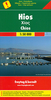
Chios - Psara - Inouses Anavasi 10.31

Chios with Oinousses on a light, waterproof and tear-resistant, contoured and GPS compatible map at 1:60, 000 published by Anavasi, with the nearby island of Psara shown on the reverse at 1:40, 000. Plus street maps of the town on Chios and of the historic Kampos area near the island’s airport.Landscape is vividly presented by contours at 20m intervals with hill shading and spot heights. The map indicates dirt roads in poor condition, with distances on most routes plus locations of petrol stations. Country paths distinguish between wide and well defined or narrow and/or poorly defined routes. 11 recommended hiking trails are prominently highlighted and cross-referenced to brief descriptions. Symbols highlight various facilities and places of interest including hostels, campsites,
restaurants, beaches, historical remains, etc. Five most interesting sites are also cross-referenced to descriptions. All place names are in both Greek and Latin alphabets. The map has a 1km UTM grid plus latitude/longitude margin ticks and crosshairs at 1’. On the reverse the islands of Psara and Antipsara are shown at 1:40, 000 with place names in Greek only. The reverse side also includes street maps of Chios Town and of the historic Kampos area, both annotated with facilities and/or places of interest. Map legend and the text include English.To see which other Greek islands are covered by maps from Anavasi, please click on the series link.
RIP - This product is no longer available on our network. It was last seen on 25.09.2019

This page now acts as a permanent archive for this product. Add more information using the comments box below to ensure it can still be found by future generations.

Use our search facility to see if it is available from an alternative contributor.
  • Availability: Out Of Stock
  • Supplier: Stanfords
  • SKU: 9789608195301
Availability: In Stock
£6.99

Product Description

Chios with Oinousses on a light, waterproof & tear-resistant, contoured & GPS compatible map at 1:60, 000 published by Anavasi, with the nearby island of Psara shown on the reverse at 1:40, 000. Plus street maps of the town on Chios & of the historic Kampos area near the island’s airport. Landscape is vividly presented by contours at 20m intervals with hill shading & spot heights. The map indicates dirt roads in poor condition, with distances on most routes plus locations of petrol stations. Country paths distinguish between wide & well defined or narrow and/or poorly defined routes. 11 recommended hiking trails are prominently highlighted & cross-referenced to brief descriptions. Symbols highlight various facilities & places of interest including hostels, campsites, restaurants, beaches, historical remains, etc. Five most interesting sites are also cross-referenced to descriptions. All place names are in both Greek & Latin alphabets. The map has a 1km UTM grid plus latitude/longitude margin ticks & crosshairs at 1’. On the reverse the islands of Psara & Antipsara are shown at 1:40, 000 with place names in Greek only. The reverse side also

Includes::
street maps of Chios Town & of the historic Kampos area, both annotated with facilities and/or places of interest. Map legend & the text include English. To see which other Greek islands are covered by maps from Anavasi, please click on the series link.

Reviews/Comments

Add New

Intelligent Comparison

Oooops!
We couldn't find anything!
Perhaps this product's unique.... Or perhaps we are still looking for comparisons!
Click to bump this page and we'll hurry up.

Price History

Vouchers

No voucher codes found.
Do you know a voucher code for this product or supplier? Add it to Insights for others to use.

Facebook

Jargon Buster

GPS - Global Positioning System - Global position using satellites
Hiking - An outdoor activity envolving walking in nature
Waterproof - Resistant to water, usualy specified by depth in metres
Condition - The quality of a product or service.
Resistant - Something that can repel against something.
Wide - Something with a large width.

Supplier Information

Stanfords
Stanfords was established in 1853 and opened their iconic Covent Garden flagship store in 1901. They have become the top retailer of maps, travel books and accessories in the UK and arguably offer the largest selection of maps and travel books worldwide. Famous names such as Captain Robert Falcon Scott, Ranulph Fiennes and Michael Palin have purchased from Stanfords. They now have a shop in Bristol and both stores together with other venues operate a calendar of events including talks, book signings and exhibitions. As a specialist map retailer, the map selection is comprehensive and includes road maps, street maps and walking maps from worldwide destinations, as well as a selection of world atlases and wall maps. Books include travel guides and travel literature. Stanfords also stock globes, from miniatures made of blue marble to magnificent floor-standing globes. The website features a selection of interesting articles on travel topics.
Page Updated: 2023-11-12 20:15:36

Community Generated Product Tags

Oh No! The productWIKI community hasn't generated any tags for this product yet!
Menu