
 United Kingdom
 France
 Germany
 Netherlands
 Sweden
 USA
USA
 Italy
Italy
 Spain
Spain
More From Contributor


China
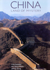
China at 1:6, 000, 000 on an indexed map from the Kathmandu based Nepa Maps, showing the country’s administrative provinces in different colours and highlighting provincial capitals. The map provides a useful overview of main road and rail connections in the western half of the country. In eastern China, large number of place names makes road and rail routes more difficult to see.Topographic information is again better presented in the western part, with rivers, numerous lakes, names of mountain chains, peaks, etc. All places names are shown only in Latin alphabet, some presented with alternative Tibetan versions.The map has latitude and longitude lines at intervals of 5°. The index includes lists of lakes and rivers.

Product Description
Reviews/Comments
Add New
Vouchers
No voucher codes found.
Do you know a voucher code for this product or supplier? Add it to Insights for others to use.
Do you know a voucher code for this product or supplier? Add it to Insights for others to use.
 Denmark