More From Contributor
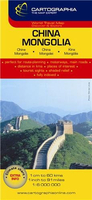
£16.99
One of the most far-reaching events since the Second World War is the re-emergence of China as a world power, & its present government`s willingness to open up the country to the rest of the world. This comprehensive cultural history ranges from prehistoric times to the present
- from the disunity of Pre-Imperial China to the renaissance of the Sung & Tang dynasties, from the Mongol conquest to Tiananmen Square & the 1989 student revolt. By placing the modern country in historical perspective this brilliant study reveals how many continuities there are within the oldest of all civilizations.
...
Archived Product
£20.00
One of the oldest civilizations in the world, China`s heritage dates back more than six millennia.” China: A Visual Adventure” profiles the colour & variety of its provinces, offering a series of contrasts
- new & old, rich & poor, bustling & calm
- to define the modern culture of this enduring nation. Leading readers on an incredible tour of the country`s various regions, ” China: A Visual Adventure” is at once a treasure trove of beautiful images & a wealth of historical & contemporary facts of one of the twenty-first century`s most important industrial powers.

...
Archived Product
£6.95
China in the Culture Smart range of pocket-sized guide books; providing detailed information on local customs, culture, etiquette & manners & ensuring that visitors are prepared for a diverse range of social environments. The series covers an extensive number of countries worldwide & are designed both for those working & living abroad, as well as for visitors who do not want to offend, either intentionally or inadvertently. Their aim is to prevent readers from making embarrassing mistakes & feel confident in unfamiliar situations, while preparing them before arrival on what to expect & how to behave. Each guide is arranged thematically, with dedicated individual chapters on land & people, values & attitudes, customs & traditions, making friends, people at home, ‘time-out’, travelling & communicating. There is also a separate chapter for business travelers, with important information on subjects such as business culture, meetings & making appointments. A Further Reading section also offers a list of recommended other history, travel literature & language titles available on the country. ...
Archived Product
£7.99
For thousands of years, the Chinese believed that they had created a perfect social system. Dynasties came & went, but the essence of being Chinese remained more or less unchanged until the twentieth century. Following invasion by the Japanese, civil war, & revolution, in 1949 Mao Zedong & the Communists took power. China was largely closed off from the rest of the world, undergoing almost constant revolution at an often terrible price. After Mao s death in 1976 the country opened its doors to the West & introduced a nascent market economy, called socialism with Chinese characteristics. China became the workshop of the world. Low wages & a low yuan boosted exports & created jobs for millions. ...
Archived Product
£9.95
The Freytag & Bernt China & Mongolia map is a clear general-purpose indexed road map at 1:4, 000, 000 scale, ideal for planning & touring. The national road networks of motorways & primary roads are shown clearly, with under-construction section marked, & selected provincial & minor roads are marked including some unsurfaced tracks. Intermediate driving distances are shown alongside the routes. The Great Wall of China is also shown. Administrative & international boundaries are clearly marked, & administrative area names are shown. Some detail on topography is shown with relief shading, & spot heights for high peaks & passes in metres. No contours are given. Natural features such as rivers & lakes, swamps & glaciers are indicated, & National Parks are marked. Symbols indicate UNESCO World Heritage sites, airports & ports, selected tourism & leisure facilities such as ski resorts & spas, & other selected points of interest. The multi-lingual legend

Includes::
English, & the map is indexed for major place names with a very clear, easy-to-read index. Latitude/ Longitude grid lines (WGS84 datum) are drawn at 4

...
Archived Product
£10.99
China on a double-sided map at 1:3, 000, 000 from Freytag & Berndt, with a separate booklet attached to the map cover containing an index & street plans of central Beijing, Lhasa, Shanghai, Hong Kong, Taipei, Ulaanbaatar & Kathmandu. Coverage

Includes::
the whole of Mongolia, the Koreas, Nepal & Bhutan, also northern Burma with Mandalay, Indian Himalaya with Delhi, etc. Place names are in the Latin alphabet (except for larger towns within Russia, also shown in the Cyrillic). Topography of the whole region is well presented, particularly in Tibet & Xingjian, by relief shading & spot heights, with plenty of names of mountain ranges, peaks, deserts, etc. Road network gives distances on main routes. Railway lines are included & local airports are marked; the map also shows shipping routes. Also shown are internal administrative boundaries & names of the provinces. A range of small icons highlight various places of interest. Latitude & longitude lines are drawn at 1º intervals. The index, in a separate booklet attached to the map cover is arranged by country. Multilingual map legend

Includes::
English.


...
Archived Product
£14.95
China in the Odyssey Guides series; aimed at travellers particularly interested in the culture & history of their destination; the guides focus on the atmosphere, customs, & distinctive character of a country, region or city. As the only English language publisher based in China, Odyssey Guides specialize in Asian destinations, relying on the expertise of local writers. This gives readers more of an insider ...
Archived Product
£35.00
Born two years before the invention of daguerreotype & the birth of photography, Thomson first travelled to Asia in 1862 where he set up a professional photographic studio. The local culture & the people of Asia fascinated him, & in 1868 he made his second trip, this time settling in Hong Kong. Between 1868 & 1872, Thomson made extensive trips to Guangdong, Fujian, Beijing, China`s northeast & down the Yangtse River, covering nearly 5000 miles. This exhibition catalogue is drawn from his time in these regions. These were the early days of photography when negatives were made on glass plates that had to be coated with emulsion before the exposure was made. A huge amount of cumbersome equipment had to be carried from place to place & with perseverance, great energy & stamina, Thomson managed to take a wide variety of images & themes, including landscapes, people, & architecture, domestic & street scenes. As a foreigner, his ability to gain access to photograph women is also remarkable. In China, Thomson excelled as a photographer in quality, depth & breadth, & in artistic sensibility. ...
Archived Product
£2.95
China 1626 Replica Map by the Old Map Company is a reproduction of the map created for the famous atlas of the period by the master map maker John Speede Esq. The Old Map Company has recreated the antique maps of British counties, European cities & World countries originally crafted by master map maker John Speede Esq. whose work had accuracy & quality not surpassed for centuries. Each map is treated & presented on specially crafted paper then h&-treated giving it texture & an aged appearance before being beautifully engraved & detailed. ...
Archived Product
£25.00
This is a spectacular & lavish portrait of China, the world's oldest civilization
- past, present & future. You can take an incredible
...
Archived Product

China - Mongolia

Detailed (but sometimes crowded) road map of China & Mongolia with hill shading, coloring and selected spot heights. A separate inset covers the Hainan Dao Island in China.Six different types of roads plus tracks are indicated with intermediate driving distances on main roads. Also marked are international and disputed boundaries, administrative boundaries, airports and ports, two kinds of railways, cease-fire lines, military demarcation lines and the Great Wall of China.Geographical information include national parks, interesting natural features, thermal springs, salt and intermittent lakes, marshes and swamps. Plus a series of symbols shows tourist points of interest, Buddhist temples and monasteries, mosques and Pagodas.Longitude and latitude lines are drawn at 3°
intervals and the legend is in English, German, French and Hungarian.Printed on paper with an extensive index of place names on the reverse.
RIP - This product is no longer available on our network. It was last seen on 25.09.2019

This page now acts as a permanent archive for this product. Add more information using the comments box below to ensure it can still be found by future generations.

Use our search facility to see if it is available from an alternative contributor.
  • External links may include paid for promotion
  • Availability: Out Of Stock
  • Supplier: Stanfords
  • SKU: 9789633525050
Availability: In Stock
£8.50

Product Description

Detailed (but sometimes crowded) road map of China & Mongolia with hill shading, coloring & selected spot heights. A separate inset covers the Hainan Dao Island in China. Six different types of roads plus tracks are indicated with intermediate driving distances on main roads. Also marked are international & disputed boundaries, administrative boundaries, airports & ports, two kinds of railways, cease-fire lines, military demarcation lines & the Great Wall of China. Geographical information include national parks, interesting natural features, thermal springs, salt & intermittent lakes, marshes & swamps. Plus a series of symbols shows tourist points of interest, Buddhist temples & monasteries, mosques & Pagodas. Longitude & latitude lines are drawn at 3° intervals & the legend is in English, German, French & Hungarian. Printed on paper with an extensive index of place names on the reverse.

Reviews/Comments

Add New

Price History

Vouchers

No voucher codes found.
Do you know a voucher code for this product or supplier? Add it to Insights for others to use.

Facebook

Jargon Buster

Paper - A thin sheet mainly used for writing. Available in a variety of colours. Made mainly from wood pulp.
Wall - A physical barrier between two areas
Railways - A set of tracks that have been laid for the purpose of trains to travel up and down them
Natural - not manmade
Fire - the release of energy through heat and light.
Road - a manmade lane or a path that is used to speed up travel.

Supplier Information

Stanfords
Stanfords was established in 1853 and opened their iconic Covent Garden flagship store in 1901. They have become the top retailer of maps, travel books and accessories in the UK and arguably offer the largest selection of maps and travel books worldwide. Famous names such as Captain Robert Falcon Scott, Ranulph Fiennes and Michael Palin have purchased from Stanfords. They now have a shop in Bristol and both stores together with other venues operate a calendar of events including talks, book signings and exhibitions. As a specialist map retailer, the map selection is comprehensive and includes road maps, street maps and walking maps from worldwide destinations, as well as a selection of world atlases and wall maps. Books include travel guides and travel literature. Stanfords also stock globes, from miniatures made of blue marble to magnificent floor-standing globes. The website features a selection of interesting articles on travel topics.
Page Updated: 2023-11-12 20:15:36

Community Generated Product Tags

Oh No! The productWIKI community hasn't generated any tags for this product yet!
Menu