More From Contributor

£12.00
Jim Rubery’s Cicerone guide to Historic Walks in Cheshire explores some of the walking possibilities in one of the north-west’s most historic & popular counties. The guide

Includes::
walks through charming villages, famous stately homes, fascinating museums & through Chester itself, one of England’s most celebrated cities. The walking terrain varies from the wild, upland landscape of the Peak District to the riverside pastures & meadows of the Cheshire countryside. The guide is organized into 20 circular walks which explore every corner of the county & which range from canal-side strolls to rambles through wilder landscapes. Many of the routes are full of historic interest, combining landscape with architecture & natural beauty with history. Each walk has an information box providing details on total distances, start & finish points & the relevant map. Detailed route descriptions are accompanied by Ordnance Survey extracts mapping the route as well as colour photographs illustrating some of the main highlights of the region.

...
Archived Product
£14.99
Philip`s Street Atlas Cheshire gives detailed coverage of the county in a convenient spiral-bound format. The route planner shows all the A & B roads, & can be used when driving to get close to the destination before turning to the relevant large-scale street map. The street maps show every named road, street & lane very clearly, with major roads picked out in colour. The maps are at a standard scale of 3.5 inches to 1 mile. In addition, Chester city centre is shown at 7 inches to 1 mile. Other information on the maps

Includes::
postcode boundaries, car parks, railway & bus stations, post offices, schools, colleges, hospitals, police & fire stations, places of worship, leisure centres, footpaths & bridleways, camping & caravan sites, golf courses, & many other places of interest. Also included are fixed single & multiple speed-camera locations, with corresponding speed limits. The comprehensive index lists street names & postcodes, plus schools, hospitals, railway stations, shopping centres & other such features picked out in red, with other places of interest shown in blue. Philip`s Street Atlas Cheshire is suitable for both business & leisure use.

...
Archived Product
£11.95
Cheshire Ring & South Pennine Ring Pearson`s Canal Companion from Wayzgoose, showing over 165 miles of canal network including sections of the Ashton Canal, Bridgewater Canal, Calder & Hebble Navigation, Huddersfield Canals, Macclesfield Canal, Rochdale Canal, Peak Forest Canal, & Trent & Mersey Canal. Current edition of this title was published in May 2013. Pearson’s Canal Companions have for over 30 year now been presenting Britain’s network of inland waterways on handy size, informative guides which combine practical information with interesting descriptions & facts about the surrounding countryside. The routes are shown in sections on maps at approx. 2” to 1 mile, & are annotated with locks, towpaths & nearby facilities. Rather than providing a more technical picture of each waterway (depth, clearance, etc), these guides are indeed true “companions” with the accompanying descriptions full of interesting historical or literary references, little know facts, etc. Where appropriate the maps are also accompanied by recommendations for eating & drinking, shopping, things to do, & public transport connections. Each guide also

Includes::
a boating directory with hire bases, boatyards, ferries, etc. Please note: Pearson’s Canal Companions sometimes indicate facilities and/or places of interest without showing detailed road access to them; it’s perhaps advisable to use these charming companions with proper road maps of the surrounding countryside.

...
Archived Product
£11.99
Cheshire in the Pathfinder Guides series, produced in association with Ordnance Survey & published by Crimson; comprising a range of walking guides to popular British destinations. Each Pathfinder guide

Includes::
28 varied walks ranging from easy strolls to exhilarating hikes & is accompanied by 1:25, 000 Ordnance Survey mapping with marked, colour-coded routes. Introductory sections profile the county or region covered, with recommendations on the best time to visit & a brief explanation of GPS. An

...
Archived Product
£6.95
How many times do parents say If only my children were interested in walking? This beautifully-produced book of walks is aimed specifically at parents & children. Each walk

Includes::
easy-to-follow directions (for mums & dads) with instructions on where to point out interesting things that will fascinate young walkers
- everything from fir cones to wild flowers, church spires to squirrels. Some routes are suitable for pushchairs & these are clearly identified. All are on well-maintained paths that are easily negotiated by little people. Clear, concise, yet thorough directions are given, along with listings of toilets & baby changing facilities where available. The features a text of interest to children &

Includes::
unique 'check-lists' for each walk, for the child to tick off landmarks & objects encountered on the way. An Index Chart shows at a glance which walks are suitable for pushchairs, wet weather, which have a cafe or place of interest along route, & so forth, so that a perfect day out is planned in seconds.


...
Archived Product
£12.99
This brand new title in Bradt`s acclaimed UK regional Slow series is the only full guide to Cheshire, a county known for its abundance of black-&-white timbered buildings & which was put firmly on the map in the 1980s thanks to then-resident stars Posh & Becks. Cheshire is a county that confounds expectations, from the Cheshire Plain to the hills & moors of the Pennines & Peak District in the east & surprisingly dramatic sandstone ridges in the west, not to mention the Wirral Peninsula, flanked by the major estuaries of the Rivers Mersey & Dee flowing into the Irish Sea. Home to premier league footballers it may be, but it is also a largely rural landscape & an area of farm shops, forests & falconries; meres, marinas & marshes. There is industrial & scientific heritage, too, ranging from Bronze-Age mining sites to the internationally important astronomical observatory & mighty Lovell Telescope at Jodrell Bank. With this new Bradt guide, discover all of this & more: the county town of Chester with its fascinating Roman history, unique double-decker medieval shopping arcades & the most complete city walls in Britain; ruins of ancient castles; & reminders of the salt & silk industries that have been so important in the past. For a truly slow experience, Cheshire also offers a network of canals, perfect for waterside strolls or pootling along in a narrowboat, while Bradt`s Slow Cheshire details information for walkers & cyclists, too. Also included in this guide are gardens & parks, grand stately homes & structural legacies of the past (such as Port Sunlight), engaging museums, attractions & events. Local food & drink is covered, along with all types of accommodation, from farm stays & self-catering cottages to guesthouses & hotels. ...
Archived Product
£25.00
Chesire Pevsner Architectural Guide Pevsner Architectural Guide, in a series of publications begun with the express aim of providing up-to-date guides to the most significant buildings in every part of the country, suitable for both general reader & specialist. Each volume provides an introductory overview of the architecture of the area, followed by a descriptive gazetteer arranged alphabetically by place. Whilst cathedrals & their furnishings, great country houses & their parks form the grand set pieces, the books demonstrate the enjoyable diversity of architecture in the British Isles in accounts of rural churches & farmsteads, Victorian public buildings & industrial monuments. A continuing programme of publication keeps the series up-to-date with new information on older buildings & recent architecture while maintaining the tradition of Pevsner's own succinct accounts. Each book has over 100 photographs, mostly specially commissioned, numerous maps & plans, a glossary & indexes. ...
Archived Product
£4.95
Chesire Ring map (running through Macclesfield, Kidsgrove, Middlewich, Preston Brook, Sale, Manchester & Ashton-under-Lyne) by GEOproject shows details of navigation & facilities available to the boat user with details of boatyard & boat trip operators, as well as useful snippets of visitor information for places of interest not far from the water ...
Archived Product
£3.50
Cheslyn Hay in 1882 in a fascinating series of reproductions of old Ordnance Survey plans in the Alan Godfrey Editions, ideal for anyone interested in the history of their neighbourhood or family. About the Alan Godfrey Editions of the 25” OS Series: Selected towns in Great Britain & Ireland are covered by maps showing the extent of urban development in the last decades of the 19th & early 20th century. The plans have been taken from the Ordnance Survey mapping & reprinted at about 15 inches to one mile (1:4, 340). On the reverse most maps have historical notes & many also include extracts from contemporary directories. Most maps cover about one mile (1.6kms) north/south, one & a half miles (2.4kms) across; adjoining sheets can be combined to provide wider coverage.FOR MORE INFORMATION & A COMPLETE LIST OF ALL AVAILABLE TITLES PLEASE CLICK ON THE SERIES LINK. ...
Archived Product
£12.99
` Supreme Quality` chess & draughts board games set with instructions. We enjoy nothing better after dinner than a game of chess or draughts. But beware; due to the challenging nature of the game tempers may run high. The set
Includes:: 1 x Smart green checker board, 32 x round wooden chess/draughts pieces in red & cream with gold relief, 1 x cotton carry bag for the counters, & a full set of instructions-

Material:
Wood/ Cardboard- For playing chess & draughts- Contains a full set of instructions


...
Archived Product

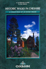
Cheshire Year Round Walks

These 20 circular walks vary in length from 3 1/2 to 7 1/2 miles and are enjoyable all year the round. The author has divided the routes into seasons to show each at its very best. In spring, Macclesfield Forest is dotted with heron`s nests and the woods near Dutton are a sea of bluebells. On a summer`s day you can spot seals near Hilbre Island and enjoy the wonderful views of Cheshire`s Peak District. Autumn brings deep-bronzed beech woods around Alderley Edge and Anderton. To see merlins and pink-footed geese at Parkgate saltmarshes or admire the carpet of snowdrops at Dunham Massey you should visit in winter.All the walks include details of:* How to get to the start * Where to park* Numbered route map and directions* Distance and terrain* Recommended local pubs and cafes * Points of
interest along the way
RIP - This product is no longer available on our network. It was last seen on 25.09.2019

This page now acts as a permanent archive for this product. Add more information using the comments box below to ensure it can still be found by future generations.

Use our search facility to see if it is available from an alternative contributor.
  • External links may include paid for promotion
  • Availability: Out Of Stock
  • Supplier: Stanfords
  • SKU: 9781846743603
Availability: In Stock
£8.95

Product Description

These 20 circular walks vary in length from 3 1/2 to 7 1/2 miles & are enjoyable all year the round. The author has divided the routes into seasons to show each at its very best. In spring, Macclesfield Forest is dotted with heron`s nests & the woods near Dutton are a sea of bluebells. On a summer`s day you can spot seals near Hilbre Island & enjoy the wonderful views of Cheshire`s Peak District. Autumn brings deep-bronzed beech woods around Alderley Edge & Anderton. To see merlins & pink-footed geese at Parkgate saltmarshes or admire the carpet of snowdrops at Dunham Massey you should visit in winter. All the walks include details of:* How to get to the start * Where to park* Numbered route map & directions* Distance & terrain* Recommended local pubs & cafes * Points of interest along the way

Reviews/Comments

Add New

Intelligent Comparison

Oooops!
We couldn't find anything!
Perhaps this product's unique.... Or perhaps we are still looking for comparisons!
Click to bump this page and we'll hurry up.

Price History

Vouchers

No voucher codes found.
Do you know a voucher code for this product or supplier? Add it to Insights for others to use.

Facebook

Jargon Buster

Forest - A area with a high density of trees
Pink - A colour made by combining red and white
Summer - The season between Spring and Autumn. Usually the hottest season of the year
edge - Enhanced data rates for GSM evolution also known as enhanced GPRS. A mobile phone technology with improved data transmission rates.
edge - The point at which two surfaces meet
Day - The time it takes a planet or other space objects to complete one rotation.
Year - The time it takes the planet earth to orbit the sun. This takes around 365.25 days.
Autumn - A season which falls between summer and winter.
Winter - The fourth season of a year that comes between Spring and Autumn
Year - 365 days (366 days in a leap year), the time taken for planet earth to make one full revolution around the sun.
Carpet - A layer of fabric that goes in homes to cover the flooring, can help with insulation.
Wonderful - Another word for describing something that is extremely good, marvellous.

Supplier Information

Stanfords
Stanfords was established in 1853 and opened their iconic Covent Garden flagship store in 1901. They have become the top retailer of maps, travel books and accessories in the UK and arguably offer the largest selection of maps and travel books worldwide. Famous names such as Captain Robert Falcon Scott, Ranulph Fiennes and Michael Palin have purchased from Stanfords. They now have a shop in Bristol and both stores together with other venues operate a calendar of events including talks, book signings and exhibitions. As a specialist map retailer, the map selection is comprehensive and includes road maps, street maps and walking maps from worldwide destinations, as well as a selection of world atlases and wall maps. Books include travel guides and travel literature. Stanfords also stock globes, from miniatures made of blue marble to magnificent floor-standing globes. The website features a selection of interesting articles on travel topics.
Page Updated: 2023-11-12 20:15:36

Community Generated Product Tags

Oh No! The productWIKI community hasn't generated any tags for this product yet!
Menu